
Michelau in Upper Franconia
| coat of arms | Germany map | |
|---|---|---|

|
Coordinates: 50 ° 10 ′ N , 11 ° 7 ′ E |
|
| Basic data | ||
| State : | Bavaria | |
| Administrative region : | Upper Franconia | |
| County : | Lichtenfels | |
| Height : | 266 m above sea level NHN | |
| Area : | 19.36 km 2 | |
| Residents: | 6329 (Dec. 31, 2019) | |
| Population density : | 327 inhabitants per km 2 | |
| Postal code : | 96247 | |
| Primaries : | 09571, 09574 | |
| License plate : | LIF, STE | |
| Community key : | 09 4 78 145 | |
| Community structure: | 4 parts of the community | |
| Address of the municipal administration: |
Rathausplatz 1 96247 Michelau i.OFr. |
|
| Website : | ||
| Mayor : | Dirk Rosenbauer ( CSU ) | |
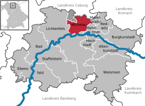
| Location of the community of Michelau i.OFr. in the Lichtenfels district | ||
  |
||

Michelau in Upper Franconia (officially: Michelau i.OFr. , Franconian: Michlaa) is a municipality in the Upper Franconian district of Lichtenfels in the north of the Free State of Bavaria .
geography
Geographical location
Neighboring larger cities are Lichtenfels (about five kilometers), Coburg (about 25 km), Kronach (about 25 km), Kulmbach (about 30 km) and Bamberg (about 45 km).
Community structure
In addition to Michelau, the municipality of Michelau includes the following parts of the municipality:
history
Michelau was first mentioned in a document in 1195. The place arose from a fishing village on the Main, where vineyard piles were made for Main Franconia until the 18th century. Basketry spread in the 18th century, and its products were sold to Holland as early as 1780 , and to Prussia and Russia in 1792 . In 1840 there were 1003 people in Michelau. Around 1900 there were almost 900 basket makers in Michelau whose products were sold all over the world. From 1950 onwards, a number of large companies emerged that form the economic backbone of the municipality (wicker, strollers, metal goods, toys, textiles, car accessories).
Incorporations
On January 1, 1977, the previously independent municipality of Lettenreuth was incorporated. The new Neuensorg community was spun off from the Neuensee community on February 15, 1952 . Neuensee was incorporated on January 1, 1978 together with Schwürbitz.
Population development
In the period from 1988 to 2018, the population increased minimally from 6377 to 6386 by 9 or 0.1%. On December 31, 2000, Michelau had 7,089 inhabitants.
religion
- 49.35% Protestant
- 45.01% Catholic
- 5.64% others
politics
mayor
Mayor has been Helmut Fischer ( CSU ) since April 9, 2006 .
Municipal council
The municipal council has 21 members including the mayor.
(As of: local elections on March 16, 2014 )
coat of arms
A braided and closed black trap on a silver background .
Culture and sights

Museums
Architectural monuments
- The knocker-maker statue in the Neuensee district is reminiscent of the carpet-beating trade that was practiced in the village from 1840 to 1980. The sculpture was created in 1997 by Wolfgang Zwieb and shows Kathi Ritzel, one of the last of the knockers' guild.
traffic
The Michelau (Oberfr) stop is on the Bamberg – Hof railway line .
Personalities
- Ernst Anton Clarus (1776–1848), Protestant clergyman and politician
literature
- Johann Kaspar Bundschuh : Michelau . In: Geographical Statistical-Topographical Lexicon of Franconia . tape 3 : I-Ne . Verlag der Stettinische Buchhandlung, Ulm 1801, DNB 790364301 , OCLC 833753092 , Sp. 594 ( digitized version ).
- Johannes Engel: On the history of the village of Michelau, in particular the Catholic parish , 1930, 44 pp.
- Michelau in Upper Franconia . 3. Edition. - Kissing: WEKA-Verlag, 1983. - 52 pp.
- Herbert Perzel: 800 years of Michelau in Upper Franconia - past and present of a Franconian community , ISSN 0945-0114
- Pleikard Joseph Stumpf : Michelau . In: Bavaria: a geographical-statistical-historical handbook of the kingdom; for the Bavarian people . Second part. Munich 1853, p. 606 ( digitized version ).
Web links
- Entry on the coat of arms of Michelau in Upper Franconia in the database of the House of Bavarian History
- Homepage of the municipal administration Michelau i. OFr.
- Michelau in Upper Franconia: Official statistics of the LfStat (PDF; 1.04 MB)
Individual evidence
- ↑ "Data 2" sheet, Statistical Report A1200C 202041 Population of the municipalities, districts and administrative districts 1st quarter 2020 (population based on the 2011 census) ( help ).
- ↑ Thomas Gunzelmann: The cultural landscape around 1840 . In: Günther Dippold: In the upper Main Valley on the Jura an Rodach and Itz , self-published by Kreissparkasse Lichtenfels, Lichtenfels 1990, p. 75
- ↑ a b Federal Statistical Office (ed.): Historical municipality register for the Federal Republic of Germany. Name, border and key number changes in municipalities, counties and administrative districts from May 27, 1970 to December 31, 1982 . W. Kohlhammer GmbH, Stuttgart / Mainz 1983, ISBN 3-17-003263-1 , p. 695 .
- ^ Wilhelm Volkert (ed.): Handbook of Bavarian offices, communities and courts 1799–1980 . CH Beck, Munich 1983, ISBN 3-406-09669-7 , p. 511 .
- ↑ website Basket Museum

Altenkunstadt | Bad Staffelstein | Burgkunstadt | Ebensfeld | Hochstadt am Main | Lichtenfels | Marktgraitz | Marketers | Michelau in Upper Franconia | Redwitz an der Rodach | Weismain
Unregulated areas: Breitengüßbacher Forst | Neuensorger Forest