Franconian Marienweg

from Wikipedia, the free encyclopedia
Waymarks

The Franconian Marienweg is a 1920 km long long- distance hiking trail through Lower Franconia , Upper Franconia and Middle Franconia . He touches 87 pilgrimage sites in the diocese of Würzburg and the archbishopric of Bamberg . Short sections of the route also run through Baden-Württemberg , Hesse , Thuringia and the Upper Palatinate . Its marking logo is a Mother of God in a red robe with a child in a blue robe on a dark blue background.

It was created in 2002 on the initiative of Josef Treutlein, pastor of St. Josef in the Würzburg district of Grombühl, with a west and an east loop, each starting and finishing in Würzburg. However, according to his own statements, he has not yet committed it completely. The signage is based on older hiking routes that the districts and hiking clubs had already defined and marked.

The long-distance hiking trail was primarily planned by its initiator for pilgrims, church associations and other Christian-oriented hiking groups, but is also generally used as a leisure hiking and cycling trail. It not only touches well-known Franconian pilgrimage sites such as Mariabuchen , Kälberau , Hessenthal and Kreuzberg Monastery , but also wine towns such as Dettelbach and Volkach , a traditional spa ( Bad Kissingen ) and numerous art-historical highlights that can be found in larger cities such as Würzburg and Aschaffenburg on the more remote stages, such as the Tilman-Riemenschneider- Altar in the parish church of St. Magdalena in Münnerstadt .

In 2020 the Marienweg was expanded to include routes in Upper and Middle Franconia ( Archdiocese of Bamberg ). Like the older routes, these also consist of two longer circular hiking trails (starting in Bamberg ): the western Magnificat route (466 km) and the eastern Ave Maria route (593 km).

geography

Routes from Würzburg

The route planner provides for four main sections with individual stages between 2.4 and 51.4 km:

West loop
East loop

Routes from Bamberg

Magnificat Route (466 km in 14 stages)

It first leads down the Main to Zeil (here connection to the east loop of the Würzburger Marienweg), then crosses the Steigerwald in a south-westerly direction (via Ebrach , Schlüsselfeld and Scheinfeld ) and reaches Rothenburg . Then she turns to the east and reaches the city of Fürth via Heilsbronn . Turning north here, it leads west of the Regnitz valley back to Bamberg.

Ave Maria Route (593 km in 26 stages)

It leads first east of the Regnitz valley via Forchheim to Nuremberg . Then it follows the Pegnitz valley upwards and turns after Pegnitz to Gößweinstein . Now that it has crossed Franconian Switzerland in a northerly direction , it reaches Kulmbach and crosses the Franconian Forest . On the way back south, it reaches the Main valley again via Kronach near Lichtenfels . It then reaches Bamberg again via Vierzehnheiligen and Banz Monastery .

Description of the individual milestones

The individual stages (of the Würzburg Marienweg) are:  Map with all coordinates: OSM | WikiMapf1Georeferencing

No. stage Place
district
image Coordinates
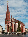
01 Lady Chapel Wurzburg Marienkapelle Würzburg, South-West View 20140107 15.jpg 49 ° 47 '41.2 "  N , 9 ° 55' 46.5"  E
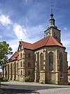
02 Maria Hilf chapel Erlabrunn Erlabrunn Chapel Southeast.jpg 49 ° 51 '49.1 "  N , 9 ° 49' 56.6"  E
03 Maria-Hilf-Chapel (Zellingen) Zellingen 49 ° 54 ′ 2.8 "  N , 9 ° 48 ′ 48"  E
04 Maria in the Green Valley Zellingen
Retzbach
Maria in the green valley-Retzbach.jpg 49 ° 54 '10.2 "  N , 9 ° 49' 47.8"  E
New Chapel Maria at the wine press Sky city Himmelstadt Vineyard Chapel Maria an der Kelter 04.jpg 49 ° 55 '32.2 "  N , 9 ° 49' 1.1"  E
05 Book of Mary Lohr am Main
Sendelbach
Mariabuchen.jpg 49 ° 59 '19.2 "  N , 9 ° 37' 20.4"  E
06 Schoenau Monastery Gemünden am Main
Seifriedsburg
Kloster-Schoenau-1.jpg 50 ° 4 '35.7 "  N , 9 ° 43' 15.3"  E
07 Virgin Mary's birth Fellen
Rengersbrunn
MSP Rengersbrunn 2009Sept 2.JPG 50 ° 7 '4 "  N , 9 ° 32' 53"  E
New Chapel of Mary in the rise Mömbris
Schimborn
Schimborn Chapel Maria im Aufgang.jpg 50 ° 3 '7.6 "  N , 9 ° 12" 7.8 "  E
08 Maria to the rough wind Alzenau
Kälberau
Kälberau Pilgrimage Church.JPG 50 ° 5 ′ 33 "  N , 9 ° 5 ′ 42"  E
09 Visitation of the Virgin Mary ("Sand Church ") Aschaffenburg Sand Church 2.JPG 49 ° 58 '26.4 "  N , 9 ° 9' 2.9"  E
10 Mary in the Sun ( Schmerlenbach Monastery ) Hösbach
Winzenhohl
Schmerlenbach, Klosterkirche-001.jpg 49 ° 59 '10.3 "  N , 9 ° 13' 42.2"  E
11 Hessenthal pilgrimage church Mespelbrunn
Hessenthal
Mespelbrunn Pilgrimage Church Hessenthal.JPG 49 ° 55 '36.8 "  N , 9 ° 17' 2.8"  E
12 Chapel Maria Frieden Aschaffenburg
Obernau
Obernau - Maria Frieden chapel (1) .jpg 49 ° 56 '7.1 "  N , 9 ° 9' 23.4"  E
13 Maria Snow Chapel Röllbach 49 ° 46 ′ 30.8 "  N , 9 ° 14 ′ 56.3"  E
14th Franciscan monastery Engelberg Großheubach Kloster-Engelberg-01.jpg 49 ° 43 '26 "  N , 9 ° 13' 55"  E
15th Relay Madonna Miltenberg St Jakobus Miltenberg.jpg 49 ° 41 '58.4 "  N , 9 ° 15' 6.4"  E
16 Our Lady on the Holderstock Schneeberg Our Lady on the Holderstock.JPG 49 ° 38 ′ 26.2 "  N , 9 ° 14 ′ 48.5"  E
17th Parish Church of the Annunciation Faulbach 49 ° 46 ′ 56.3 "  N , 9 ° 26 ′ 32.6"  E
18th Parish Church of the Birth of Mary Hoechberg Hoechberg Mariae geburt.JPG 49 ° 46 '51.6 "  N , 9 ° 52' 33.6"  E
19th Käppele Wurzburg Kaeppele wuerzburg festungsfoto.jpg 49 ° 47 '3.5 "  N , 9 ° 55' 18.8"  E
20th Schoenstatt Chapel on the Marienhöhe Wurzburg 49 ° 46 '21.3 "  N , 9 ° 58' 20.7"  E
21st Lady Chapel Butthard 49 ° 35  '34.2 " N , 9 ° 52' 47.2"  E
22nd Church of the Holy Virgin Mary Sonderhofen
Bolzhausen
49 ° 35  '36.5 " N , 10 ° 1' 28.5"  E
23 Loreto Chapel Dettelbach
Effeldorf
Church, Effeldorf.JPG 49 ° 47 '48  .3 " N , 10 ° 5' 10.3"  E
24 Maria in the sand Dettelbach Dettelbach Wallfahrtskirche.jpg 49 ° 48 '18.5 "  N , 10 ° 10' 13.7"  E
25th Maria de Rosario Volkach
Dimbach
Church, east, Dimbach.JPG 49 ° 49 '55.4 "  N , 10 ° 15' 23.2"  E
26th Maria in the vineyard Volkach 2014 Maria im Weingarten 01.jpg 49 ° 52 '28.8 "  N , 10 ° 12' 50.3"  E
27 Maria Hilf chapel Dingolshausen
Bischwind
Bischwind Capilla.JPG 49 ° 55 '21.5 "  N , 10 ° 23' 32.3"  E
28 Pilgrimage church Maria Limbach Eltmann
Limbach
Pilgrimage Church Maria Limbach 04.jpg 49 ° 59 '8.9 "  N , 10 ° 37' 3.7"  E
29 Zeiler Käppele Zeil am Main Zeil am Main, mountain chapel 20170304 004.jpg 50 ° 0 ′ 34.5 "  N , 10 ° 36 ′ 7.7"  E
New Marienkirche Koenigsberg in Bavaria Königsberg-Marienkirche-01.jpg 50 ° 4 '55.2 "  N , 10 ° 34' 12.2"  E
30th Knight's Chapel in Hassfurt Hassfurt Knight's Chapel Haßfurt.jpg 50 ° 1 '54.6 "  N , 10 ° 30' 42.1"  E
31 Pilgrimage to Mary of Victory Gädheim
Greßhausen
Church Greßhausen from the west.JPG 50 ° 2 ′ 6 "  N , 10 ° 22 ′ 56.6"  E
32 Kerlach Chapel Stadtlauringen Kerlach Chapel and Way of the Cross Stadtlauringen 04.jpg 50 ° 11 '0.1 "  N , 10 ° 21' 36.4"  E
33 Virgin Mary's birth Bad Königshofen in Grabfeld
Ipthausen
Ipthausen, Pilgrimage Church of the Birth of Mary 002.JPG 50 ° 18 '2.5 "  N , 10 ° 28' 54.4"  E
34 Findelberg Church Hall on the Saale Hall on the Saale-2148.jpg 50 ° 19 '17.9 "  N , 10 ° 21' 26.8"  E
35 Grossenberg Chapel Mellrichstadt 50 ° 25 '32.6 "  N , 10 ° 18" 19.1 "  E
36 Pilgrimage Church of St. Ulrich Bastheim
Braidbach
50 ° 23 '10.6 "  N , 10 ° 11' 18.1"  E
37 Bildhausen Monastery Münnerstadt
Kleinwenkheim
Bildhausen Monastery.JPG 50 ° 16 ′ 37 ″  N , 10 ° 17 ′ 15 ″  E
38 Church of the Assumption Münnerstadt
Fridritt
Fridritt 2011 01.JPG 50 ° 15 ′ 34.5 "  N , 10 ° 15 ′ 14.7"  E
39 Münnerstadt Talk Church Münnerstadt Münnerstadt-1365.jpg 50 ° 13 '10.9 "  N , 10 ° 11' 49.4"  E
40 Terzenbrunn Bad Kissingen
Arnshausen
Terzenbrunn (Arnshausen) - 20140923-164.JPG 50 ° 9 '1.4 "  N , 10 ° 6' 10"  E
41 Lady Chapel Bad Kissingen Bad Kissingen, Kapellenstrasse, Marienkapelle-004.jpg 50 ° 12 ′ 6 ″  N , 10 ° 5 ′ 4 ″  E
42 Virgin Mary's birth Münnerstadt
Windheim
Mary's Birth Windheim Außenansicht.jpg 50 ° 15 '56.3 "  N , 10 ° 6' 35.3"  E
43 Maria-Schnee-Church Niederlauer
Unterebersbach
Niederlauer, Unterebersbach, Catholic parish church Mariae Annunciation, 001.jpg 50 ° 17 '57.1 "  N , 10 ° 8' 2.8"  E
44 Kreuzberg Monastery Bischofsheim an der Rhön
Haselbach in the Rhön
Kreuzberg Monastery.jpg 50 ° 22 '14.5 "  N , 9 ° 58' 31.4"  E
45 Volkersberg Monastery Bad Brueckenau
Volkers
Volkers Monastery, 2.jpg 50 ° 19 '45 "  N , 9 ° 46" 3.5 "  E
46 Maria Ehrenberg Wildflecken
military training area Wildflecken
Maria Ehrenberg Oct. 2010-19.jpg 50 ° 23 '8.8 "  N , 9 ° 48" 38.8 "  E
47 Maria Steinthal Hammelburg Maria Steinthal Chapel (Hammelburg) - 20150508-061.JPG 50 ° 6 '15.1 "  N , 9 ° 53' 5.7"  E
48 Pilgrimage Church of the Visitation of the Virgin Mary Werneck
Eckartshausen
Visitation of the Virgin Mary Eckartshausen 2014 (11) .jpg 50 ° 0 ′ 36.8 "  N , 10 ° 4 ′ 44.3"  E
49 Maria Sondheim Arnstein Arnstein, Catholic Parish and Pilgrimage Church Maria Sondheim, Exterior, 004.jpg 49 ° 58 '24.2 "  N , 9 ° 57' 45.7"  E
50 Augustinian monastery Fährbrück Hausen near Würzburg Fährbrück pilgrimage church 001.jpg 49 ° 55 '4.3 "  N , 10 ° 2' 42.3"  E

literature

  • Treutlein, Josef: Hiking and cycling on the Franconian Marienweg between Main, Saale, Wern, Sinn, Kahl and Tauber, 1: 75,000 hiking and cycling guides, Galli-Verlag, 2011, ISBN 978-3-936990-12-6
  • Martin, Johannes / Treutlein, Josef: Fränkischer Marienweg: Marian pilgrimage sites and places of grace in Lower Franconia, Echter-Verlag, 2004 ISBN 978-3-429-02566-3 (also as an audio book)

Web links

Individual evidence

  1. Bayer. Rundfunk B5 current broadcast f. Bergsteiger on May 31, 2020 at 6:35 a.m. and https://www.br.de/berge/wandern/wandern-fraenkischer-marienweg-spessart-rhoen-hassberge-steigerwald-frankenwald100.html
  2. http://www.fraenkischer-marienweg.de Fränkischer Marienweg - accessed on May 31, 2020