
Dingolshausen
| coat of arms | Germany map | |
|---|---|---|

|
Coordinates: 49 ° 54 ' N , 10 ° 23' E |
|
| Basic data | ||
| State : | Bavaria | |
| Administrative region : | Lower Franconia | |
| County : | Schweinfurt | |
| Management Community : | Gerolzhofen | |
| Height : | 260 m above sea level NHN | |
| Area : | 10.23 km 2 | |
| Residents: | 1325 (Dec. 31, 2019) | |
| Population density : | 129 inhabitants per km 2 | |
| Postal code : | 97497 | |
| Area code : | 09382 | |
| License plate : | SW , GEO | |
| Community key : | 09 6 78 122 | |
| Community structure: | 4 districts | |
| Association administration address: | Brunnengasse 5 97447 Gerolzhofen |
|
| Website : | ||
| First Mayor : | Nicole Weissenseel-Brendler (Christian voter community Bischwind) | |
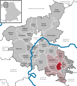
| Location of the municipality of Dingolshausen in the district of Schweinfurt | ||
  |
||

Dingolshausen is a municipality in the Lower Franconian district of Schweinfurt and a member of the Gerolzhofen administrative community .
geography
Dingolshausen is located at the foot of the northern Steigerwald in a depression on the Volkach .
Community structure
There are four officially named municipal parts:
- Bischwind
- Dingolshausen
- Middle mill
- Volkachsmühle
Neighboring communities
Neighboring residents are the middle center Gerolzhofen in the west , the community Michelau im Steigerwald to the east and the community Sulzheim with its district Vögnitz in the northwest and the community Donnersdorf in the northeast. The municipality of Oberschwarzach borders indirectly in the south, separated by a ridge of the unmarked Steigerwald nature park . In between there is only the forest rest .
The nearest regional centers are Schweinfurt (~ 20 km), Bamberg (~ 40 km) and Würzburg (~ 40 km).
history
The community part of Dingolshausen was more important in the high Middle Ages as the seat of a castle and an administrative court. A market took place once a year until 1345.
timeline
- 1165 Dingolshausen was first mentioned in a document
- 1243 the Würzburg bishopric appears as the rulership of the village
- 1312 the village is already a parish (previously a branch of Oberschwarzach)
- 1340 the Ebrach monastery has district rights in the village
- 1345 Relocation of the market from Dingolshausen to Gerolzhofen
- 1407–1536 the Knights of Lichtenstein are resident in the place
- 1427 the lords of the Fuchs von Bimbach family appear with three Sölden estates as fiefdoms
- 1536 the families Heßberg and von Rieneck are resident
- In 1561 the community of Dingolshausen was awarded a coat of arms. It shows a vine with two grapes
- 1597 Prince-Bishop Julius Echter had the church tower rebuilt
- 1631 the Swedes invade Franconia and also Dingolshausen. More than 30 houses were burned as victims of the flames.
- In 1738 a town hall was built next to the church and later a school hall was set up in it
- In 1796 looting and pillage in Dingolshausen again, this time by Napoleonic troops. In addition, payments in kind and in cash must be provided.
- In 1811, as a contribution to the payment of the German war debts, the community forge is sold for 1255 guilders
- 1863 the poor house is built. The cost is 7100 guilders. From 1910 the building was used as a kindergarten and for outpatient nursing
- 1874 the voluntary fire brigade Dingolshausen is founded
- In 1895 lightning struck the steeple and set it on fire.
- In 1903 the first post office was set up in Johann Loos' house
- 1909 Dingolshausen receives a public telephone with a telegraph service
- 1910 the community gets a full-time post office
- 1912 Dingolshausen is connected to the electrical power supply.
- 1914–1918 16 soldiers from Dingolshausen die in the First World War
- 1930 62 of the 95 local households are farming
- 1939–1945 38 Dingolshausers die as soldiers in World War II
- 1945 Dingolshausen is occupied by the American armed forces
- 1954–1957 Dingolshausen is connected to the water supply and sewer system
- 1957–1965 Land consolidation
- 1959 the Gerolzhofen – Michelau road is expanded by the Free State of Bavaria.
- 1969 the volunteer fire brigade gets its first fire engine.
- 1971 Construction of the gym and the adjoining sports center in Dingolshausen
- 1972 New construction of the parish church St. Laurentius
- 1974 Construction of the kindergarten, completion of the gym with sports center, residual sewerage and connection to the sewage treatment plant of the city of Gerolzhofen, closure of the nurses' station
- 1978 Connection to the long-distance water supply Franconia
- 1979 Construction of the fire station
- 1985 New construction of the town hall
- 1986 Five years after the bankruptcy of Hümmer-Bräu, the municipality acquires the company premises. The conversion to the building yard of the community takes place
Incorporations
On May 1, 1978, the previously independent community of Bischwind was incorporated.
politics
Mayoress
Nicole Weissenseel-Brendler (Christian voter group Bischwind) has been at the head of the community since May 1, 2020. She was elected on March 15, 2020 with 65.7% of the vote, the voter turnout was 80.97%. Her predecessor was Lothar Zachmann (Citizens' Block / Free Voting Community) from May 1, 1996 to April 30, 2020, he was no longer running in 2020.
Municipal council
The local elections from 2002 to 2020 led to the following allocation of seats in the local council:
| 2002 | 2008 | 2014 | 2020 | |
|---|---|---|---|---|
| Citizens' bloc / Free voter community | 10 | 10 | 10 | 9 |
| Christian voter group Bischwind | 2 | 2 | 2 | 3 |
| total | 12 | 12 | 12 | 12 |
coat of arms
In 1561 the municipality of Dingolshausen received the coat of arms law.
|
|
Blazon : "In gold, a green vine with two green grapes and two green leaves." |
Partner municipality
-
 Equemauville in France , Normandy , since 1990
Culture and sights
Dingolshausen is the starting point for scenic cycling and hiking tours from the Stollburg to the Zabelstein .
Buildings
- The pilgrimage chapel Maria Helferin is located on a hill on the outskirts of Bischwind
- Catholic Church St. Wendelin in Bischwind
- Catholic Church of St. Laurentius and St. Sebastian in Dingolshausen
Regular events
- The annual Dingolshausen wine festival
- Fun mile , every three years
- Historic wine market in the years when there is no fun mile
- Chapel festival in Bischwind at the end of July and beginning of August
- Parish fair in both suburbs
Architectural monuments
Economy and Infrastructure
In 2017 there were 215 jobs subject to social security contributions in the municipality. Of the resident population, 548 people were in an employment relationship subject to compulsory insurance. This means that the number of out-commuters was 333 more than that of in-commuters. 16 residents were unemployed. In 2016 there were 19 farms.
Viticulture
Viticulture has a long tradition in the municipality. One of the most famous wines is the Köhler . It takes its name from an old corridor that is considered the first vineyard site in the municipality. According to legend, a charcoal burner planted the first vine there on the edge of the Steigerwald .
In the meantime, a rich Steigerwald wine, typical of Keuperboden, is growing on different fields and on around 30 hectares in both parts of the community. Not only the grape varieties are diverse , ranging from the classic Müller-Thurgau , Silvaner and Bacchus varieties to Kerner and Portuguese red wine. In addition to conventional quality wines , the winemakers produce top quality wines from Kabinett and Spätlese to Auslese , which have been awarded numerous bronze and silver medals from the Franconian and German wine awards, and some with the highest award in gold .
education
There is a kindergarten in the Dingolshausen part of the municipality; the local St. Johannis Association is responsible for this. There is a pick-up and delivery service for children from the Bischwind district. Since 2006 there has also been a forest kindergarten in Mahlholz (Gerolzhofen city forest) in neighboring Gerolzhofen . The primary school pupils from the Dingolshausen district visit the branch of the Donnersdorf primary school in the neighboring village of Michelau in the Steigerwald . Children from the Bischwind district attend the Donnersdorf elementary school . From the fifth to sixth grade, secondary school students attend the secondary school in Traustadt , followed by the secondary school in Gerolzhofen. The next secondary school is the state-run Ludwig Derleth secondary school in Gerolzhofen. The next high school is the Franken-Landschulheim Schloss Gaibach , Gerolzhofen branch (only grades 5 to 10). From grade 11, high school students attend the high schools in Gaibach (district of Volkach ), Wiesentheid or Schweinfurt, depending on their choice of subject . In neighboring Gerolzhofen there are also day nurseries and after-school care centers, the Julius-Kardinal-Döpfner -prachförderschule, the adult education center responsible for Dingolshausen , as well as a branch of the Schweinfurt music school.
traffic
State road 2274 runs through Dingolshausen and connects the northern Steigerwald to the middle center of Gerolzhofen. There is a connection to the German federal trunk road network via the Gerolzhofen-Süd junction of federal highway 286 . The A 3 and A 70 motorways can be reached from there without any intersections.
The district of Dingolshausen is connected to the neighboring towns of Gerolzhofen and Michelau in the Steigerwald via the local public transport bus line 9307 of Omnibusverkehr Franken (OVF) , as well as to the regional center of Schweinfurt approx. 20 kilometers away . The public transport connections are, however, optimized for school traffic and certain commuter traffic , but have an unfavorable schedule for travelers. There is no direct public transport connection in both directions between the two districts of Bischwind and Dingolshausen. With a change in Gerolzhofen, one journey per day with a duration of approx. 20 minutes is possible, otherwise the transport takes place with very long detours and takes approx. 4 hours.
There is a connection to the rail network via Schweinfurt main station (~ 20 km) and the train station in Haßfurt (~ 15 km).
A regional, signposted network of cycle paths is largely available in the region around Dingolshausen. In the two suburbs of Dingolshausen and Bischwind, cycling is possible without problems due to the compact settlement areas and the low traffic volume . Existing internal gradients due to the depression are easy to cope with for everyday cyclists. There are direct cycle paths between Dingolshausen and the towns of Gerolzhofen and Michelau, and between Bischwind and Vögnitz .
Communication networks
In the Dingolshausen part of the municipality, VDSL is available with up to 100 Mbit / s, in the Bischwind part of the municipality VDSL is available with up to 250 Mbit / s.
Due to its location in a depression , mobile phone reception is sometimes severely restricted in the center of Dingolshausen. Deutsche Telekom has been operating a transmitter on the edge of the Dingolshausen district since 2020 . In the higher areas of Dingolshausen, the cellular networks from Telefónica and Vodafone are also available at least with UMTS quality.
In Dingolshausen, television reception is partially possible via DVB-T2 (only a selection of public broadcasters) using a roof antenna, satellite and IPTV ; there is no cable television network.
Local supply
It is difficult to buy everyday goods in Dingolshausen. There is only one bakery and two butchers in the Dingolshausen district. The last grocery store closed in the 1990s. The retail trade in neighboring Gerolzhofen largely fills this gap.
Well-known sons and daughters
- Richard Gress (* 1970), documentary filmmaker
Web links
Individual evidence
- ↑ "Data 2" sheet, Statistical Report A1200C 202041 Population of the municipalities, districts and administrative districts 1st quarter 2020 (population based on the 2011 census) ( help ).
- ↑ Dingolshausen community. Administrative community Gerolzhofen, accessed on June 7, 2020 .
- ↑ http://www.bayerische-landesbibliothek-online.de/orte/ortssuche_action.html ? Anzeige=voll&modus=automat&tempus=+20111114/200743&attr=OBJ&val= 1752
- ^ Federal Statistical Office (ed.): Historical municipality directory for the Federal Republic of Germany. Name, border and key number changes in municipalities, counties and administrative districts from May 27, 1970 to December 31, 1982 . W. Kohlhammer GmbH, Stuttgart and Mainz 1983, ISBN 3-17-003263-1 , p. 753 .
- ↑ Mayoral election 2020 , accessed on July 3, 2020
- ↑ 2020 municipal council election , accessed on July 3, 2020
- ^ Entry on the coat of arms of Dingolshausen in the database of the House of Bavarian History
- ↑ http://www.waldkindergarten-gerolzhofen.de/ Website of the Waldkindergarten Gerolzhofen
- ↑ https://www.mainpost.de/regional/schweinfurt/2020-wird-Buergermeister-Lothar-Zachmann-sein-Amt-niederlegen;art769,10354839

Bergrheinfeld | Dingolshausen | Dittelbrunn | Donnersdorf | Euerbach | Frankenwinheim | Geldersheim | Gerolzhofen | Gochsheim | Grafenrheinfeld | Grettstadt | Kolitzheim | Lülsfeld | Michelau im Steigerwald | Niederwerrn | Oberschwarzach | Poppenhausen | Röthlein | Sparing | Swan field | Schwebheim | Sennfeld | Stadtlauringen | Sulzheim | Üchtelhausen | Waigolshausen | Waterless | Werneck | Wipfeld
Unregulated areas in the district of Schweinfurt
Bürgerwald |
Geiersberg |
Hundelshausen |
Nunnery |
Stollbergerforst |
Vollburg |
Wustvieler forest