
Sparing
| coat of arms | Germany map | |
|---|---|---|

|
Coordinates: 50 ° 3 ′ N , 10 ° 19 ′ E |
|
| Basic data | ||
| State : | Bavaria | |
| Administrative region : | Lower Franconia | |
| County : | Schweinfurt | |
| Height : | 218 m above sea level NHN | |
| Area : | 81.03 km 2 | |
| Residents: | 7679 (Dec. 31, 2019) | |
| Population density : | 95 inhabitants per km 2 | |
| Postcodes : | 97453, 97526 | |
| Primaries : | 09721, 09727, 09526 | |
| License plate : | SW , GEO | |
| Community key : | 09 6 78 174 | |
| LOCODE : | DE SHO | |
| Community structure: | 13 districts | |
| Address of the municipal administration: |
Marktplatz 1 97453 Schonungen |
|
| Website : | ||
| Mayor : | Stefan Rottmann ( SPD ) | |
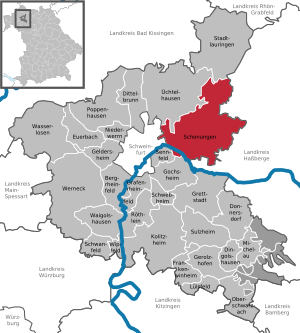
| Location of the community Schonungen in the district of Schweinfurt | ||
  |
||

Schonungen is a municipality in the Lower Franconian district of Schweinfurt . In terms of area, it is the largest and in terms of population (after Werneck and Niederwerrn ) the third largest municipality in the district.
geography
Geographical location

Schonungen is about five kilometers east of Schweinfurt am Main , 219 m above sea level. NN. The old town center spreads out in the valley widening of the Steinach at its confluence with the Main. The new development areas grew up the slopes. Because of the view of the Main Valley and the city, Schonungen became a preferred place to live in the Schweinfurt bacon belt .
The large community covers about a third of the area of the Schweinfurt district belonging to the Schweinfurt Rhön . The highest elevations are the Grainberg (408 m above sea level) and the Siebenkohlplatte (403 m above sea level). The plateau of the Schweinfurt Rhön is cut in the municipality by two deep stream valleys into three parts, on the heights of which there is little profitable agriculture. This is also where the district of Löffelsterz (384 m above sea level) is the highest church village in the district and a 24-hole golf course . The municipality is the Mühlviertel of the district. There are several old mills on the Steinach, which is rich in water, and especially on the Mühlbach . In the Mühlbachtal, the Hausen district is protected by a flood retention basin . In the south-west and west, the district extends across the Main and includes several quarry ponds and the Reichelshof in the Schonunger Bucht (see: Reichelshof ).
Schonungen is in the northeast of the Franconian wine-growing region . The vineyards are located on the steep south-facing slopes against the Main, with a total of three vineyards in the municipality. From the Schweinfurt city limits (from west to east) these are Mainberger Mainleite , Mainberger Schloßberg and Schonunger Kreuzberg . Outside of the Schlossberg, very little wine is grown today.
The Kaltenhof on the plateau between Mainberg and Schonungen belongs to the Benedictine abbey of Münsterschwarzach , in which the non-profit association LEVI e. V. maintains a housing project for the follow-up care and reintegration of people treated with psychiatry .
Community structure
Schonungen is divided into 13 districts:
|
Neighboring communities
Neighboring communities are (starting from the north clockwise): Stadtlauringen , Aidhausen , Riedbach , Haßfurt , Theres , Gädheim , Gochsheim , Sennfeld , Schweinfurt and Üchtelhausen . The second to fifth municipality is located in the Haßberge district . Schweinfurt is independent and all other municipalities are in the district of Schweinfurt .

history
antiquity
During sand extraction work in Schonungen Bay in 1938, a 7 m long dugout canoe was excavated. It was made around 80 AD and was then probably used by Germanic fishermen on the Main until 120 AD . The find was of supraregional importance, as it was the first reliable evidence of the presence of the Teutons in this region.
middle Ages
Places with the ending ungen indicate Thuringian origins. The Thuringians ruled the northern Main Franconia until they were pushed back or overlaid by the Franks from the 6th century onwards.
Schonungen was founded in the 5th century . The name either means that it was a beautiful, stately settlement ( sconi = handsome, beautiful) or the settlement of a clan of Schön (Scono = personal name). (See also: Course of the Altmain )
The first known mention can be found in a document from 1194, with which Emperor Heinrich VI. Confirmed donations. In addition to the Counts of Henneberg, the lords of Lobdeburg , von Thundorf and von Wenkheim , the monasteries Theres , Ebrach and Heidenfeld and the Haug monastery in Würzburg were also wealthy in Schonungen .
Modern times

In 1553, during the Markgräflerkrieg , Schonungen burned down almost completely. 300 years later, the place suffered this fate again: The cause was a flight of sparks on the railway line from Bamberg to Schweinfurt, which had opened a year earlier .
In 1818 the political municipality was established.
Modern
At the end of 2000, the community became known nationwide for the so-called Sattler contaminated site ; This is the name given to the extensive soil pollution with Schweinfurt green , as it was caused by the former paint factory Wilhelm Sattler in the period from 1814 to 1930 . On 24 October 2002, a report by the magazine was monitor the WDR about the Sattler legacy broadcast, the plantations brought nationwide in the headlines. Preparations for the renovation of the affected area began in October 2011, including the demolition of several buildings. Since the causer of the pollution is no longer tangible, the current law owners would be obliged to contribute to the renovation costs up to the amount of the value of their land. After long negotiations, a compromise was found between the property owners and the Free State of Bavaria , which limits the property owners' liability to € 13.33 per square meter.
Incorporations
On July 1, 1975, the previously independent community of Mainberg was incorporated. This happened against the will of the majority of the population, who wanted a connection to the city of Schweinfurt because of the close and historical ties. On May 1, 1978 Abersfeld, Forst, Hausen, Löffelsterz, Marktsteinach, Reichmannshausen and Waldsachsen were added. In addition to the districts, there are also the four hamlets Bayerhof, Kaltenhof, Rednershof and, on the other side of the Main, only accessible via Gochsheim or Sennfeld, Reichelshof in the municipality of Schonungen .
Population development
Inhabitants in today's territory:
|
|
|
Religions

In 1332 Schonungen became a parish through the foundation of the von Wenkheim couple. The old Neumann -style St. George's Church, which was destroyed by the village fire in 1853, was consecrated in 1858 after it was rebuilt. Its pointed Echterturm characterizes the old town center.
1959–1961 the new St. George's Church was built on Hauptstrasse. In addition to these two Catholic churches, the Evangelical Christ Church has existed on Schrotberg since 1954 . The Protestant parish of Schonungen was initially looked after by Schweinfurt St. Johannis until it received its own pastor after the Second World War . In 1953 the vicariate was raised to a parish office.
In the 18th century, with the help of the Lords of Thundorf, individual Jewish families settled there. In 1725 the Jewish community consisted of eight families. The prayer house they built fell victim to the village fire in 1853, but was rebuilt and re-consecrated in 1855/56. The Jewish community had its own teacher. The interior of the synagogue at Bachstrasse 21 was destroyed by SA men in the November pogrom in 1938 ; the building was converted into a car garage and a residential building after 1945. A plaque there commemorates the house of God and the Jewish fellow citizens who were victims of the Shoah .
politics
Municipal council
_Town_Hall_2015_SW.jpg)
The council has 20 members (excluding the mayor).
|
Status: Local elections on March 16, 2014
mayor
On March 11, 2012, Stefan Rottmann (SPD) was elected as the new mayor to succeed Kilian Hartmann (CSU); his term of office began on May 1, 2012. At the age of 25, he became Germany's youngest mayor at the time. He prevailed with three votes ahead of the candidate from the CSU. The very tight election result and the title as “youngest full-time mayor” resulted in national reports. Articles about Rottmann appeared in the days after the election in the Hamburger Abendblatt , in Focus and on Spiegel.de, among others .
In the election on March 15, 2020 , he was confirmed in office for another six years with 82.9% of the vote.
coat of arms
The description of the municipal coat of arms, introduced in 1959, reads: “Split of red and gold; in front three silver tips, behind a red armored black hen standing on a green three-mountain ”.
.svg)
Intercommunal alliance Schweinfurter OberLand
The community is a founding member of the Intercommunal Alliance Schweinfurter OberLand, which also includes the communities Maßbach , Rannungen , Thundorf in Lower Franconia , Üchtelhausen and Stadtlauringen (see also Schweinfurter Rhön ).
Partnerships
The community of Schonungen has a partnership with the French community of Alban in the Tarn department .
Culture and sights
Buildings

- Old St. George's Church. Cultural events are occasionally held there.
- Mainberg Castle
- Kaltenhof
Architectural monuments
museum
Founded by the Schumm family of pharmacists, there has been a pharmacy museum with three rooms on around 50 square meters since 1998. It is publicly accessible by appointment.
Reichelshof

The historic Reichelshof estate is on the left side of the Main and can only be reached via Sennfeld . Today it is home to the Reichelshof nature and environmental garden, a state-approved environmental station in 2004, where children and adults have the opportunity to experience nature and shape their environment.
Recreation

Schonunger Bay
The Schonunger Bucht consists of seven lakes and has a bathing beach. It was mostly created by quarry ponds in the silted up river bed of the Altmain.
Biking and hiking trails
The 600-kilometer Main Cycle Route was the first German long -distance cycle route to be awarded five stars by the General German Bicycle Club (ADFC).
In the municipality area in the Schweinfurt Rhön there is a dense network of hiking trails, especially around the Ottenhäuser Grund. The network of hiking trails leads beyond the municipal area, including to the nearby Ellertshauser lake .
Golf course
Golf course of the Golf Club Schweinfurt in Löffelsterz : 18-hole course, public 6-hole course and public driving range .
Rock lake
One of the most worth seeing places in the Schweinfurt Rhön is isolated in the municipality of Schonungen, almost unknown and neither accessible nor visible. A 2.57 hectare groundwater lake, surrounded on three sides by steep rock walls, approx. 275 m above sea level. NN , in a limestone quarry that was closed in 1998, on the nature reserve Hausener valley slopes on Ottenhäuser Grund, north of Hausen .
Economy and Infrastructure
- The place has all the essential facilities of a small center, e.g. B. Doctors, dentists, pharmacy, schools, post office, banks, games and sports facilities, indoor swimming pool, car repair shop with gas station, hairdressers, retail stores and craft businesses. There are overnight accommodations in the Naturfreundehaus and in two inns
- With the youth environmental station of the Catholic Young Community and the Reichelshof nature adventure garden, there are two state-approved environmental stations on the territory of the community.
- The Protestant parish operates two photovoltaic systems with a total of 14 kWp on the roofs of the Christ Church and the parish hall . There is also a photovoltaic system on the roof of the town hall.
- In the north-eastern part of the municipality between Forst and Waldsachsen, several wind turbines generate electricity: eight with 1.0 MW each , two with 2.5 MW.
traffic
- The place is crossed by the state road St 2447 (Schweinfurt - Eltmann ), from which the state road St 2266 branches off to Hofheim in the center . 2 km to the east there is a connection to the federal highway 303 to Coburg and to the Autobahn 70 Schweinfurt – Bamberg (Maintalautobahn) .
- Since December 2014, Schonungen has been connected to the Bamberg – Schweinfurt – Würzburg railway through a new stop. The old station was shut down in October 1983.
- The place is connected to the public transport network of Stadtwerke Schweinfurt , with bus routes 71 and 72. Omnibusverkehr Franken GmbH (OVF) runs several bus routes (e.g .: 8130, 8156) through Schonungen.
media
The community of Schonungen publishes a community sheet that appears every Friday.
Personalities associated with sparing
- Paulus Klüpfel , former Roman Catholic priest and founder of the Free Land Free Money Federation , was born in Schonungen.
education
The place has a primary school, a secondary school and a support center with a special focus on physical and motor development (school for children and adolescents with physical disabilities) of Lebenshilfe Schweinfurt eV
literature
- Community of Schonungen (Ed.): 800 years of Schonungen 1194–1994 , Schonungen 1993
- Rudolf Metz: Schonungen anno 1986 , Schonungen 1988
- Robert Mantel: 1200 Years Abersfeld 788–1988 , Schonungen 1988
- Joachim Ahlborn / Norbert Kraus: Forest through the ages , Schonungen 1984
- Rita Steger-Frühwacht, 800 years in Hausen. A village in the Schweinfurt Rhön 1194–1994 , Hausen 1994
- Erich Schröder: Spoonsterz on the Schlettach. The village and its people , Spoonsterz 1994
- Erich Schröder: Spoonsterz on the Schlettach in the sphere of influence of the Popponen and Henneberger , Spoonsterz 1993
- Rudolf Metz / Ingrid Wheels: Reichmannshausen. History and events in the lovable Schlettachdorf , Schonungen 1999
- Robert Hofmann: Reichmannshausen and me. Jugenderinnerungen , Schonungen, 2nd edition 1995
Web links
- Community Schonungen
- Waldsachsen district
- Entry on the coat of arms of Schonungen in the database of the House of Bavarian History
- Information on the Jewish history of the place at Alemannia Judaica
- Schonungen: Official statistics of the LfStat
Individual evidence
- ↑ "Data 2" sheet, Statistical Report A1200C 202041 Population of the municipalities, districts and administrative districts 1st quarter 2020 (population based on the 2011 census) ( help ).
- ↑ BayernAtlas: First recording (1808–1864). Retrieved January 2, 2018 .
- ↑ a b Topographic map in the Bavaria Atlas
- ↑ http://www.bayerische-landesbibliothek-online.de/orte/ortssuche_action.html ? Anzeige=voll&modus=automat&tempus=+20111114/222947&attr=OBJ&val= 1769
- ↑ Inter-municipal alliance Schweinfurter Oberland: Schonunger Bucht. Retrieved January 8, 2018 .
- ^ Announcement on the homepage of the Schweinfurt District Office , accessed on October 17, 2011.
- ↑ Report on the website of Bayerischer Rundfunk , accessed on March 15, 2012.
- ↑ administration.bayern.gov (PDF; 421 kB)
- ↑ a b c Federal Statistical Office (ed.): Historical municipality directory for the Federal Republic of Germany. Name, border and key number changes in municipalities, counties and administrative districts from May 27, 1970 to December 31, 1982 . W. Kohlhammer GmbH, Stuttgart and Mainz 1983, ISBN 3-17-003263-1 , p. 753 .
- ↑ Population figures on December 31, 2018. Bavarian State Office for Statistics, accessed on May 24, 2020 .
- ↑ Memorial sites for the victims of National Socialism. A documentation, volume 1. Federal Agency for Civic Education, Bonn 1995, ISBN 3-89331-208-0 , p. 191
- ↑ Relief from him: Stefan Rottmann youngest full-time mayor of Germany ( page no longer available , search in web archives ) Info: The link was automatically marked as defective. Please check the link according to the instructions and then remove this notice. , www.swex.de, March 11, 2012
- ↑ A wafer-thin lead: Stefan Rottmann is the new mayor , Hamburger Abendblatt, accessed on March 15, 2012
- ↑ Germany's youngest mayor is only 25 , article on focus.de, accessed on March 15, 2012
- ↑ Tobias Lill: The three-voices-more-man , article on spiegel.de of March 14th, accessed on March 15th, 2012.
- ↑ Eckart Roloff and Karin Henke-Wendt: Well measured and modest, but versatile and in great demand. (The Small Pharmacy Museum in Schonungen) In: Visit your doctor or pharmacist. A tour through Germany's museums for medicine and pharmacy. Volume 2, Southern Germany. Verlag S. Hirzel, Stuttgart 2015, pp. 146-147, ISBN 978-3-7776-2511-9 .
- ↑ Reichelshof Natural and Environmental Garden. Retrieved March 19, 2017 .
- ↑ n-tv.de: Main-Radweg excellent - five stars from the ADFC. August 27, 2008.
- ↑ Golf Club Schweinfurt. (No longer available online.) Archived from the original on November 15, 2016 ; accessed on November 15, 2016 . Info: The archive link was inserted automatically and has not yet been checked. Please check the original and archive link according to the instructions and then remove this notice.
- ↑ "Habitats". A project by Basalt Actiengesellschaft: Pictures of the lake in the limestone quarry. Retrieved January 9, 2017 .
- ↑ [1] , www.nuus.de, accessed on June 19, 2012
- ↑ Large train station at Schonungen's new train stop , www.schonungen.de, accessed on January 19, 2017

Bergrheinfeld | Dingolshausen | Dittelbrunn | Donnersdorf | Euerbach | Frankenwinheim | Geldersheim | Gerolzhofen | Gochsheim | Grafenrheinfeld | Grettstadt | Kolitzheim | Lülsfeld | Michelau im Steigerwald | Niederwerrn | Oberschwarzach | Poppenhausen | Röthlein | Sparing | Swan field | Schwebheim | Sennfeld | Stadtlauringen | Sulzheim | Üchtelhausen | Waigolshausen | Waterless | Werneck | Wipfeld
Unregulated areas in the district of Schweinfurt
Bürgerwald |
Geiersberg |
Hundelshausen |
Nunnery |
Stollbergerforst |
Vollburg |
Wustvieler forest
Abersfeld | Bayerhof | Forest | Hausen | Kaltenhof | Spoonsterz | Mainberg | Marktsteinach | Rednershof | Reichelshof | Reichmannshausen | Sparing | Waldsachsen