
Rannungen
| coat of arms | Germany map | |
|---|---|---|

|
Coordinates: 50 ° 10 ′ N , 10 ° 12 ′ E |
|
| Basic data | ||
| State : | Bavaria | |
| Administrative region : | Lower Franconia | |
| County : | Bad Kissingen | |
| Management Community : | Maßbach | |
| Height : | 352 m above sea level NHN | |
| Area : | 17.34 km 2 | |
| Residents: | 1133 (Dec. 31, 2019) | |
| Population density : | 65 inhabitants per km 2 | |
| Postal code : | 97517 | |
| Area code : | 09738 | |
| License plate : | KG, BRK, HAB | |
| Community key : | 09 6 72 143 | |
| LOCODE : | DE R9N | |
| Community structure: | 1 district | |
| Address of the municipal administration: |
Hauptstrasse 12 97517 Rannungen |
|
| Website : | ||
| Mayor : | Fridolin Zehner ( CSU ) | |
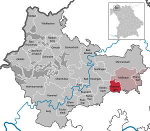
| Location of the municipality of Rannungen in the Bad Kissingen district | ||
  |
||

Rannungen is a municipality in the Lower Franconian district of Bad Kissingen and a member of the Maßbach administrative community . The community belongs to the Main-Rhön region and the Intermunicipal Alliance Schweinfurter OberLand and is 13 km north of Schweinfurt .
geography
Location of the place
The place is on a hill of the Wern-Lauer-Platten ; the Wern rises southwest of the village (towards Pfersdorf ). While the western municipality area is part of the natural area of the Upper Wern Valley, the Birkenrain forest area in the southeast belongs to the Hesselbacher Waldland . The Lauertal joins in the north . Originally, Rannungen is said to have been located a little further south in a depression (today Wiesenstrasse), perhaps because a water-bearing stream (Wern, Leingraben) still ran at this point. Only later were the church, churchyard and aristocratic residence moved to the hill. There they formed the northern end of the village until the second half of the 20th century, while the farms spread out towards the south.
Neighboring places
Neighboring towns are Pfändhausen (municipality of Dittelbrunn ), Pfersdorf (municipality of Poppenhausen ), Rottershausen (municipality of Oerlenbach ), Poppenlauer (municipality of Maßbach ), Maßbach and the Brönnhof (municipality of Üchtelhausen ).

geology
Rannungen lies at an altitude of 352 above sea level in the area of the Wern-Lauer-Platten , which are to be assigned to the Swabian-Franconian layer level country and form the north-western border of the Schweinfurt basin as a range of hills . Only the Triassic layers of the karst limestone and the Keuper are on the surface in the Rehlenens area . There are also ice age loess deposits . Rannungen lies on the watershed between the two rivers Lauer and Wern .
history
The latest prehistoric finds testify that the place has been continuously inhabited since the Neolithic period (settlements or graves of linear ceramic , the Middle Neolithic, the Urnfield period , the Hallstatt period and the later Latène period ). The first documentary mention of Rannungen as "Hrannona" occurs in Carolingian times : In 772, Alwalah , a clergyman of noble origin, bequeathed his property in Rannungen to the Fulda monastery in a deed of donation . Rannungen is one of the oldest known settlements in the area. In the following decades the place appeared frequently in connection with generous donations from Franconian-Thuringian aristocrats around Schweinfurt-Geldersheim-Pfersdorf, so that science speaks of a high-profile “Rehner Tradentenkreis” in this area. The noble family of the Lords von Rannungen (in the vicinity of the Henneberger ) appears in some documents from the 12th century. In their place, however, other noble families such as Herbilstadt will soon take their place . In the Middle Ages, however, the Würzburg monastery also gained more and more influence in the village, so that the majority of the farms, the so-called Würzburg neighbors , are ultimately subordinate to the monastery. The smaller part of the population, the so-called nobles , remained under aristocratic rule until the founding of the Duchy of Franconia-Tuscany and the Kingdom of Bavaria , most recently the Lords of Munster . The old aristocratic seat next to the church bears witness to this.
The residents have always made their living from agriculture. In addition, viticulture was practiced in Rannungen from the Middle Ages to the 18th century ; the “Wengertsweg” (Weinbergsweg) and the terrace walls on the Hesselberg are a reminder of this. Fruit growing was intensified in the second half of the 19th century . With the emergence of large-scale industry in nearby Schweinfurt , the number of factory workers steadily increased in the 20th century.
Place name
The place name is derived from the Germanic word hraban (for raven ) and the suffix -ung or -ing . So Rannungen could be a raven place or - much more likely - a settlement named after a Hraban . The place name is probably associated with the clan of the noble Hrabaning , who appeared as a witness in the deed of donation from Geldersheim / Pfersdorf as early as 763 , because , according to K. Bosl, there were close family ties between the traders of these three villages. Earlier variants of the place name were "Ramnung", "Rammungen", "Ranning" or "Ranningen". Rennenens residents are known as "Ranninger" in the East Franconian dialect. From the 17th century onwards, the place was incorrectly listed as "Raudingen" in old maps, which can be traced back to an error in copying.
Parish

The village has been a parish seat since 1187; at that time a "Hugo" was called a "plebanus" (people priest). For centuries the Rottershausen and Pfändhausen branches (at times also Holzhausen ), as well as the Brönnhof , the Schwarze Pfütze and the Gressertshof belonged to the parish . Rannungen St. Bonifatius is an independent Catholic parish and part of the Lauertal parish community . After belonging to the former deans of Schweinfurt, Münnerstadt and Geldersheim, the parish was assigned to the Kissingen dean's office in the 1970s .
politics
mayor
Fridolin Zehner (CSU / Free Voters Rannungen) has been mayor since May 1, 2002; he was elected for a further six years on March 15, 2020 with 84.2% of the vote.
Municipal council
The local elections on March 15, 2020 resulted in the following filling of the twelve mandates of the municipal council:
| CSU / Free Voters | 7 seats | (54.33%) | |
| Runner Citizen List | 5 seats | (45.67%) |
The distribution of seats remained unchanged as in the 2014 to 2020 term. Another member and chairman of the municipal council is the mayor.
Wind Turbine Controversy
How the community of Rannungen deals with wind power was the subject of an ARD television program from the series “Exklusiv im Erste” which was broadcast on August 1, 2016. Claudia Butter and Achim Reinhardt showed recordings of the wind turbines in Rension, demonstrating citizens as well as excerpts from an interview with the mayor Fridolin Zehner and local council members under the title “The battle for the wind turbines”. The filmmakers clearly criticized the actions of the Rannungen community.
coat of arms
- Blazon : “Split; in front in silver a continuous black bar cross, behind with four points split by red and silver. "
- Coat of arms history: On January 20, 772, Rannungen was mentioned for the first time in a deed of donation by Charlemagne about property in the community. The church patron is the monastery founder Bonifatius . The black “Fulda” cross in the coat of arms reminds of the town's relationship with the Fulda monastery . In the back of the coat of arms is the family coat of arms of the Lords of Herbilstadt , a Franconian aristocratic family who were enfeoffed with the possessions of the Fulda monastery in the village. The family died out in 1608.
The coat of arms was awarded by the government of Lower Franconia on January 20, 1972.
Intercommunal alliance Schweinfurter OberLand
The municipality has been a member of the Intercommunal Alliance Schweinfurter OberLand since 2014, to which the municipalities Schonungen , Üchtelhausen , Stadtlauringen , Thundorf in Lower Franconia and Maßbach also belong (see also Schweinfurt Rhön ).
Culture and sights
Catholic parish church of St. Boniface
Because of Boniface - Patroziniums and the close relationship of the village to Matt Onen is to assume that monks from Fulda soon after the death of the saint built a first church in Rannungen. Rannungen is documented as a parish seat from 1187.

The current parish church of St. Bonifatius dates back to a new building by Julius Echter in 1588/1589. From this construction phase, the tower, which stands on medieval foundation walls, was preserved. Its original, typically Franconian pointed hood (so-called Julius-Echter-Turm ) was replaced by today's Welsche hood after the “baker's fire” (1726) . Prince-Bishop Johann Philipp v. Re-build Greiffenclau in 1716 according to plans by Joseph Greissing . The church was expanded to its current size in 1913 with a transverse building with two window axes. The church has baroque furnishings, in particular the painting in the high altar with the awakening of Lazarus (17th century) and an altar sheet with the martyrdom of St. Laurentius , a loan from St. Kilian's Cathedral in Würzburg. The Romanesque baptismal font and the Renaissance - pulpit with wood inlays appear to have been taken from the previous building. A cycle of paintings from 1913/14 with depictions from the Bonifatius legend is embedded in the stucco ceiling; These paintings in the style of historicism are by Hans Bayerlein ( Bamberg ) and are based heavily on the frescoes destroyed in the war, which Professor Heinrich von Hess created for the Munich Abbey of St. Boniface .
More buildings
- Prince-Bishop's tithe barn : solid natural stone building with stepped gable , the core from the 17th century
- Former upper inn: representative half-timbered building from 1665 (coat of arms of Prince-Bishop Johann Philipp von Schönborn ); Formerly a post office on the Würzburg-Meiningen road
- Marienkapelle : neo-Gothic building from 1878 (architect: Andreas Lohrey ); houses a sandstone sculpture of the Rosary Madonna by the Würzburg sculptor Schuler

- Former castle of the Barons of Münster, single-storey mansard roof building, in the core of the 16th century, with ancillary buildings
Wayside shrines and crosses
In the village and hall there are numerous wayside shrines , altars and high crosses made of sandstone. Particularly noteworthy are:
- Wayside shrine from 1718 with the rare depiction of the conversion of St. Paul (valley path)
- Friedrichsruh (Rannungen) , floor cross
- Rococo processional altar from 1735 with the depiction of the Pietà and Saint Mark in front of the tithe barn
- Rococo shrine from 1716 with a filigree depiction of the fourteen helpers in need (Am Hock)
- Baroque Ölberggruppe , around 1780, made of sandstone, on the south facade of the parish church

Plan dance
In Rannungen every ten years is to Kirchweih a multi-day planning with traditional plan dance instead, which is carried out by a specially established plan association. The process on the "Plua" (village square) is based on a tradition that has been handed down since 1780. The next plan festival is expected to be celebrated in autumn 2020.
Economy and Infrastructure
Jobs and agriculture
In 2017 there were 82 jobs subject to social security contributions in the municipality. Of the resident population, 479 people were in employment subject to compulsory insurance. The number of out-commuters was 397 more than that of in-commuters. Eight residents were unemployed. In 2016 there were 17 farms.
traffic
Rannungen was originally located on an important north-south connection, the Rome pilgrimage route in the Middle Ages (cf. Via Romea ). Coming from Münnerstadt, one reached the village through the Runner valley and left it in the direction of Maigraben / Holzhausen . This ancient path was continued in the original post road Würzburg - Meiningen , which led through Rannungen; In 1665, the prince-bishop had the stately post office (former Upper Inn or Gasthaus Zum Raben) built for travelers. When the Chaussee was re-routed (approx. 1790), the traffic flows coming from the south (Schweinfurt or Geldersheim) were then led past Rannungen over the later Black Puddle to Münnerstadt. This was also retained when building the successor, the B 19 .
Only with the construction of the A 71 (Schweinfurt – Erfurt) did Rannungen move closer to the supra-regional traffic flow. Since the end of the 19th century there has been a direct road connection to Schweinfurt (today's district road). There is public bus transport with connections to the next major cities of Schweinfurt, Bad Kissingen and Münnerstadt.
The nearest train stations are in Rottershausen ( Schweinfurt – Meiningen railway line ) and Schweinfurt . Until 1960, the Rottershausen – Stadtlauringen railway branched off here .
societies
- Musikverein Rannungen
- TSV Rannungen
- Volunteer fire brigade Rannungen
- Kindergarten Association St. Johannes
- Homeowners
- Plan club
education
- Kindergarten "Gückernest" (sponsor: St.-Johannes-Zweigverein) with 49 approved places and 35 supervised children (status: 2018)
Elementary, secondary and secondary schools as well as adult education facilities are located in the immediate vicinity.
Personalities
Honorary citizen

- Ludwig Erhard (1897–1977), Federal Minister of Economics and German Federal Chancellor from 1963–1966. Erhard's father was a native of the race.
- Joseph Schmitt (1859–1922), pastor in Rannungen. In 1913 he added a transverse building to the parish church and had the interior redesigned.
- Leo Erhard (1932–2019), former mayor of the municipality of Rannungen
Sons and daughters of the church
- Michael Erhard (1773–1838), cathedral dean of the cathedral chapter in Würzburg
- Georg Valentin Röder (1776–1848), composer and royal Bavarian court music director in Munich, head of the collegiate and band music in Altötting
- Zita Zehner (1900–1978), politician and member of the Bavarian state parliament from 1946 to 1971
- Rudolf Weigand (1929–1998), Professor of Canon Law in Würzburg, Regens of the seminary
literature
- Karl Bosl : Franconia around 800. Structural analysis of a Franconian royal province. 2nd, expanded edition. Beck, Munich 1969.
- The harvest festival at Rannungen. Feasted on August 3rd, 1817. Giegler, Schweinfurt 1817 (reprinted as a reprint in 2017).
- Karin Genth: Costumes in Lower Franconia. (= Mainfränkische Studien. Volume 26). Wurzburg 1982.
- Peter Genth: When Herrle and Fräle were still young. From the life of farmers and citizens in the eastern Bad Kissingen district. Bad Kissingen 1981.
- Alfred Memmel: Twelve Centuries of Runner History. (772-1972). = Rannungen 772-1972. Vier-Türme-Verlag, Münsterschwarzach 1971.
- Alfred Memmel: 800 years of the parish of Rannungen. Some contributions to their history. Municipality, Rannungen 1988.
- Carl F. Reinhardt: History of the parish village of Rannungen. Franconian company printing house, Würzburg 1903.
- Hans-Peter Schäfer: The development of the road network in the Schweinfurt area up to the middle of the 19th century (= Mainfränkische Studien. Vol. 13, ISSN 1612-4286 ). Historical Association Schweinfurt e. V. u. a., Schweinfurt u. a. 1976 (At the same time: Würzburg, University, dissertation, 1974).
- Rita Wagner: Traces through time. Monuments in Rannungen. M. Pfeifer Publishing House, Aschaffenburg 2013.
Individual evidence
- ↑ "Data 2" sheet, Statistical Report A1200C 202041 Population of the municipalities, districts and administrative districts 1st quarter 2020 (population based on the 2011 census) ( help ).
- ↑ Permanently available on Youtube: https://www.youtube.com/watch?v=wbzQnSEMZAw&t=1195s . Available in the ARD media library until August 3, 2017: Archived copy ( memento of the original from November 29, 2016 in the Internet Archive ) Info: The archive link was inserted automatically and has not yet been checked. Please check the original and archive link according to the instructions and then remove this notice. .
Web links
- Homepage of the community
- Entry on the coat of arms of Rannungen in the database of the House of Bavarian History

Aura on the Saale | Bad Bocklet | Bad Brueckenau | Bad Kissingen | Burkardroth | Elfershausen | Your village | Fuchsstadt | Geroda | Hammelburg | Maßbach | Moths | Münnerstadt | Nüdlingen | Oberleichtersbach | Oberthulba | Oerlenbach | Ramsthal | Rannungen | Riedenberg | Schondra | Sulzthal | Thundorf in Lower Franconia | Wartmannsroth | Wild spots | Zeitlofs
Unregulated areas of
Dreistelzer Forst |
Forst Detter-Süd |
Geiersnest-East |
Geiersnest-West |
Great Auersberg |
Calf Hill |
Motten Forest South |
Neuwirtshauser Forest |
Omerz and Red Mountain |
Römershager Forest North |
Römershager Forest East |
Rossbach Forest |
Waldfensterer forest