
Saarbrücken
| coat of arms | Germany map | |
|---|---|---|

|
Coordinates: 49 ° 14 ' N , 7 ° 0' E |
|
| Basic data | ||
| State : | Saarland | |
| County : | Regional association Saarbrücken | |
| Height : | 230 m above sea level NHN | |
| Area : | 167.09 km 2 | |
| Residents: | 180,374 (Dec. 31, 2019) | |
| Population density : | 1080 inhabitants per km 2 | |
| Postcodes : | 66111-66133 | |
| Primaries : | 0681, 06893, 06897, 06898, 06805, 06881, 06809 | |
| License plate : | SB | |
| Community key : | 10 0 41 100 | |
| LOCODE : | DE SCN | |
| NUTS : | DEC01 | |
| City structure: | 4 districts with 20 districts | |
City administration address : |
Rathausplatz 1 66111 Saarbrücken |
|
| Website : | ||
| Lord Mayor : | Uwe Conradt ( CDU ) | |
| Location of the city of Saarbrücken in the Saarbrücken regional association | ||
  |
||

.JPG)

.JPG)

Saarbrücken ( , in the local Rhine Franconian dialect Saabrigge , ; in the neighboring Moselle Franconian dialect area Saabrekgen, French: Sarrebruck ) is the capital of Saarland .
Today's university town and only major Saarland city is located on the Saar and was created in 1909 from the merger of the three previously independent cities of Saarbrücken (city census 1322), St. Johann a. d. Saar (city elevation 1322) and Malstatt - Burbach (city elevation 1874). Saarbrücken is the center and regiopolis of a metropolitan area that extends beyond the border between Saarland and Lorraine, and in terms of population it is the 42nd largest city in the Federal Republic of Germany .
Saarbrücken is the political, economic and cultural center of Saarland as well as the seat of the Saarbrücken regional association , a special kind of local authority association .
Linguistic
City name
Explanation
In the year 999 the place name was first mentioned in the form of "Sarabruca". Then in 1065 "Sarebrucca" and 1126 "Sarebrugge". The name of the city means exactly what it appears today: a bridge over the Saar. The name goes back to an early high German * Sara-bruggja . In the late 8th century the "j" (Early High German * bruggja <Old High German brugga < Middle High German bridge, brucke < New High German bridge ) disappeared . The word “bridge” can also mean landing bridge , landing stage or pier . A stone bridge over the Saar, the so-called Old Bridge , which connects St. Johanner Markt and Saarbrücker Schlossplatz , was built in 1546/47 under Count Philipp II , after Emperor Charles V had flooded the river at this point for several days could not cross. After the Roman bridge a little further up the river, which fell into disrepair in the early Middle Ages, the Old Bridge was the first Saar bridge on site in centuries.
The underlying river name Saar is a pre-Germanic water name derived from Indo-European * Sarawa . It is composed of the Indo-European root * sor-, * sar- (German: strömen ) with the suffix -ava . The first element of the place name ("Saar") is, according to the rules of Germanic and German word formation, the determining determinant, which more closely delimits the basic word ("Brücke").
The modern city name on "-en" arose from the dative designation * bi of the Sarebrücken (German: near the Saarbrücke). There is a similar development of ending in places in the area that arose from names of bodies of water, field names and place names: e.g. Bliesbrücken (near the Bliesbrücke), Bliesen (on the Blies river ), Differten (near the deep ford of the Bist ), Wadern (on the mudflats of the Wadrill ).
There are now two possibilities to motivate the naming of the place:
- The Germanic-Franconian place name of the originally Roman vicus at the old Saar Bridge migrated down the Saar when the town center was relocated to today's castle or palace cliffs.
- The place got its name from a landing bridge on the Saar, probably in the area of the current Neumarkt.
Explanations of the city name that point to a Celtic origin are considered out of date.
Foreign language terms
In some other languages the word for Saarbrücken is formed according to the sound, in some with the literal translation of the component -brücke. In many languages the name is simply “Saarbrucken”. Some forms that differ from this are more common today, some less.
| language | Surname | Usage |
| French ; Spanish | Sarrebruck | exclusively |
| Luxembourgish | Saarbrécken | exclusively |
| Dutch | Saarbruggen | next to Saarbrücken |
| z. B. English | Saarbrücken | next to Saarbrucken |
Residents
The inhabitants of the city are called "Saarbrücker" (in the Rhine Franconian dialect "Saarbrigga", in the Moselle Franconian dialect "Saarbrekger"), not, as is often assumed, "Saarbrückener". The same applies to the associated adjective; for example it is called “ Saarbrücker Zeitung ” and “ Saarbrücker Zoo ”.
dialect
In terms of linguistic history, between the end of the 17th and the middle of the 19th century, due to the changing political influences, there was a shift from the originally Moselle-Franconian to the Rhine-Franconian dialect used today , finally to a uniform city dialect, the Saarbrigga Platt .
geography

Natural spatial structure
In the area of today's urban area of Saarbrücken, the following natural spatial structure prevails:
Saarbrücken valley widening
The 4 km wide and 10 km long valley widening of the Saar in the Middle Buntsandstein is a climatically favored, asymmetrical basin framed by wooded heights. Through the confluence of numerous side valleys, the Saarbrücken valley widening is connected to the adjacent areas:
- in the north and east with the Saar coal forest and the Saarbrücken-Kirkeler forest
- in the southeast with the open arable plains of the Saar-Blies-Gau and the steep, wooded drop of the Spicherer Heights on the opposite bank of the Güdinger Saar valley
- in the south the Saarbrücken-Forbacher depression
- in the southwest the wooded heights of the Warndt
The broad bottom and the wide flat slopes of the valley are almost entirely covered by the settlement and industrial area of the city of Saarbrücken. The lower valley floor (190 m) is about one km wide and borders in the southwest on a 60 m high steep ascent, which is divided by small dry valleys (Reppersberg and Triller). This steep ascent is dominated by the Winterberg (301 m), an isolated knoll with a roof made of Kordeler sandstone . On the eastern edge of the valley floor, the two similarly constructed peaks of the Halberg (270 m) and the Rabbit Mountain (266 m) rise at the mouth of the Scheidterbach. With the Saarbach (Fechinger Bach), the Scheidterbach has built an extensive alluvial cone into the exit valley funnel. In the south, the Spicherer Heights break off suddenly against the Saar in a 120 m high steep slope with overhanging rocks in the red sandstone. The opposite slope (200–240 m) to the Spicherer Heights, rising slowly to the Saar coal forest in the north, is divided into red sandstone spurs and wide ridges by narrow exits of the two coal valleys and short notch valleys. The ridges support two levels of extensive river terraces. The former winding course of the Saar was straightened by canalization and relocated several times in the wake of road construction work.
The old settlement centers of today's big city Saarbrücken lie on the only slightly raised lower terrace and the neighboring terrace ledge. The settlements first extended over the entire valley floor, then over the surrounding slopes. Newer residential areas found their place on the slopes. The boggy high-tide channels were initially left uninhabited. In the narrow, now canalized bed of the Saar, the high water pressure can cause high water to rise up to 6 m and then flood the city motorway built along the bank in the 1960s. The southeastern part of the valley is occupied by Fettwiesen. The factory facilities of the Burbacher Hütte used to dominate the urban area in the west, that of the Halberger Hütte at the exit of the Scheidterbachtal in the east. The steep heights of the Saartal widening feature parks and forests: Halberg, Rabbitberg, Winterberg and zoo grounds below the Eschberg.
St. Johann forest and Scheidter mountain
Open slabs surrounded by forests or forest-covered ridges and knolls that slope steeply on all sides, and deeply cut, steep-walled valleys are demarcated from the Saar-Blies-Gau to the south . The Scheidterbachtal forms the connection between the Middle Saar Valley in the southwest and the St. Ingbert-Kaiserslauterer Senke in the northeast.
Narrow-bottomed valleys are notched into the red sandstone with walls up to 100 m high. The old traffic route of the Napoleonic Kaiserstraße runs in the densely populated Scheidterbachtal . Aside from that lies the Grumbach valley. The slabs are covered by surfaces made of Kordeler sandstone. Scheidter Berg (340 m) and Eschberg (350 m) are among the forestless islands made of shell sandstone islands. The steep drop of the Eschberg on the edge of the Saarbrücken valley widening is preceded by two smaller peaks. Schwarzenberg (377 m), Bartenberg (359 m) and Gehlenberg (359 m) are advanced on the watershed between Scheidterbach and Saar to the north towards the Neuweiler-Spiesener Höhe and tower above it on steep slopes up to 100 m. On the formerly used as arable land Eschberg, the residential district Eschberg was created in the 1960s. Most of the former orchards on the Scheidter Berg are built over today. The Halberg is made up of beech forest. The Grumbach Valley, rich in forests and meadows, is used for local recreation. The Scheidterbachtal has been redesigned by old settlement centers and extensive industrial facilities.
Saar coal forest
The area with high levels of precipitation is a heavily chambered and relief wooded mountainous area, which is mainly severely cut up by parallel long valleys and criss-crossed by closed settlements. In the northeast this happens through the cross valley of the Blies, in the northwest through the Köllertal . The central Saar valley forms the southern boundary, the southeast is the St. Ingbert-Kaiserslauterer Senke (192 m). The area adjoins the Saarbrücken-Kirkeler Forest and in the north the Prims-Blies hill country. The heights reach an average level of 350 to 400 m. The highest point is the Göttelborner Höhe (444 m) on the main watershed between Saar and Blies. The valleys that drain into the Saar are deepened to 210–250 m and are sharply separated from each other by transverse and longitudinal watersheds. The mountainous region, which extends in a south-west-north-east direction, is 8 km long and 20 km wide. The coal valleys, which are oriented towards the Saar, follow the slow sinking of the main saddle under the red sandstone and tear open the seam-bearing layers. This made historical coal mining possible and the Saar industry could begin here. The settlements are limited by large areas of reforestation made up of beech and coniferous trees.
Coal valleys
In the precipitation-rich core of the Saar coal forest, which is framed by heights and heavily reliefed by parallel valleys, the forest cover is closely interlinked with dense settlements and industrial facilities. The area opens up to the Saarbrücken valley widening in the south, in the northeast it is delimited from the Neunkirchen valley basin by a cross ridge, to the north it is connected to the Prims-Blies hill country by a wide gate.
The two coal valleys of the Sulzbach and Fischbach (240–190 m) are deepened by 100–150 m with narrow bottoms in slate, claystones and fine-grained sandstones of the Saarbrücken strata. In doing so, they expose the coal seams contained therein. Fischbachtal and Sulzbachtal are separated from each other by an elongated ridge (307-360 m) made of sandstone conglomerates. Road traffic from the Saar valley to the northeast is concentrated on the ridge (old Rennweg, today Grühlingstraße). Rail traffic runs through the two side valleys of the Saar. The ridge is connected to the broadly arched to sharp-edged cross bar in the northeast, which forms the main watershed between Saar and Blies. It reaches a height of 403 m with the Hoferkopf and a height of 397 m with the oriel height. The ridge is separated from the Göttelborner Höhe (444 m) by the spacious basins of the origin of the Fischbach. The Fischbach is fed by numerous streams and channels that arise from the Holzer conglomerate. The sweeping slopes of the Sulzbach valley are subdivided by short valley valleys. In the lower reaches of the Sulzbach it cuts a red sandstone block embedded in the coal mountains and forms a wide basin in which the village of Dudweiler is located.
Height dimensions
The lowest point of the urban area is 178.5 m above sea level. NHN at the Luisenthal lock. The 401 m above sea level. NHN's highest point is on the Steinkopf, north of Saarbrücken Airport.
Floors
After the first ice age, the Saar, the Fechinger Bach, the Scheidterbach, the Sulzbach and the Fischbach began to wash out the Saarbrücken valley floor in the soft red sandstone. The tributaries of the Saar brought rubble and sand with them from their catchment area. The Saar itself also moved an immense load of gravel. After the three post-glacial periods, the late Tertiary Saar valley at the site of today's Saarbrücken was widened to 4 km and redesigned several times by water erosion. In the process, the Rabbit Mountain and the Halberg were carved out as protrusions. In the constantly moving valley floor, wide gravel fields were heaped up and relocated. In the drier periods of time, the main course of the Saar dug itself deep into the alluvial gravel bed, creating the river terraces that are still recognizable today in several thrusts.
On the cleared red sandstone floor, sandy gravel pebbles now form the floodplain and the only slightly raised lower terrace, which is over 1 km wide in the center of the Saarbrücken valley widening. The gravel pebbles are 2 to 5 m thick. After the initially wildly shooting water masses had slowed down, the finest mineral particles were deposited and formed floodplain clay, which offered a good starting substrate for the re-emerging flora. With the exception of inconspicuous remains, the sandy gravel soils with the alluvial clay covers of the low terraces and the gravel-rich clay-sand soils of the middle and high terraces are completely covered by buildings. The former floodplain has been covered and changed by the repeated renovation and expansion of the Saar. Both the steep south and west slopes, as well as the gently sloping north and east slopes of the Saarbrücken valley widening are built on like settlements.
In the districts of Malstatt, Burbach and Altenkessel, clayey parabrown soils, loamy fine sand and sandy-silty loam predominate due to the carbon subsoil. In the slopes of St. Johann, Alt-Saarbrücken, St. Arnual, in the Scheidter Valley and on the southern slope of Dudweiler, there are lighter, more permeable soils such as loamy sand and loamy fine sand in the area of the middle red sandstone. The Eschberg is an island-like exception. Here base-rich, clayey-loamy brown limestone soils have developed due to the shell limestone layer. The same soil situation can be found on the Scheidter Berg, the Fechinger Berg, the Güdinger Berg and the Bübinger Berg, in Ensheim, in Eschringen, in Bischmisheim and on the Bübinger slope. A nutrient-rich parabrown earth, which was formed from diluvial and alluvial sediments, can be found in the districts of Fechingen, Brebach and Güdingen.
Vegetation history
Saarbrücken with its humid climate would be an almost closed forest area without human influence outside the Saar flood gulls and the rocky sites. The history of the vegetation after the last ice age is revealed by pollen analysis. The development curve extends from the treeless tundra to the developed high forest. Archaeological finds date back to the first interglacial period (approx. 600,000 to 550,000 BC). In a cave from the Paleolithic period discovered in 1927 near Spichern, there were bones from the hunted as well as processed wood and charcoal remains. The wood comes from spruce (Picea), silver fir (Abies) and pine (Pinus). These wood finds indicate that Saarbrücken had a high proportion of evergreen coniferous wood with Nordic traits at that time.
Around 10,000 BC When the longest and most spatially extensive glaciation (Würm Ice Age, duration 120,000 years) came to an end, there was almost no higher vegetation in the area of what is now Saarbrücken. The landscape showed a tundra-like vegetation with sedge beds, dwarf shrubs, lawn and aquatic plant communities. As the temperature rises, a stunted forest and tree tundra followed with robust pioneer trees such as willow, birch and pine.
During a time when the heights of the neighboring Vosges and the Black Forest peaks were still permanently covered in snow, a loose, light forest with birch, pine and willow and occasional oaks developed in the area of today's Saarbrücken. With increasing warmth, the hazelnut bush quickly found its way and soon formed a dense layer of bushes in the loose forest. The ash settled in nutrient-rich locations. In marshy depressions and on oxbow lakes of the Saar, alder joined the pasture, so that dense swamp forests soon formed.
Around 8000 BC A period with less rain favored the spread of the pine, which lasted until 7000 BC. In the Saarbrücken area became the dominant tree species. With the increase in precipitation as a result of increased Atlantic influence, the proportions of alder, ash, oak, elm, linden and maple increased, the seeds of which were easily and widely spread by wind and forest animals. Instead of the previously predominant pine forests, a deciduous mixed oak forest formed, which is also proven by an archaeological find from Burbach.
During laying work on the Saar, the horn cones of an aurochs from the period 5500-4000 BC were found here. With washed-in shore mud. The Saar sludge contained pollen from oak (18%), linden (24%), birch (19%), pine (27%), alder and hazel (7%) as well as 5% indeterminable residues.
When around 3000 to 2500 BC When the temperature fell slightly and there was higher precipitation, the beech, which was already present in the Tertiary, migrated back into the Saarbrücken mixed forest and gradually conquered most of the forest areas at the expense of ash, elm, linden and maple.
Human influence on the vegetation in today's Saarbrücken can be proven from the beginning of the Young Stone Age (4000 to 1800 BC). With wild herb pollen (goosefoot, mugwort, plantain and dock plants), pollen diagrams indicate increasing shifting cultivation. This is also proven by found stone tools from this time, which were found in large numbers. With the help of these stone tools, people are now increasingly clearing forest areas in the river lowlands of the Saarbrücken valley widening in order to create hiking fields in their place.
Since there was no fertilization or crop rotation of the fields, these were abandoned after the soil had been exhausted and a new cultivation area was created in another cleared area. A wild herb flora first settled on the abandoned arable land, and gradually willow, aspen, birch and hazel. Around 1000 BC The hornbeam penetrated from the east. In the Bronze Age, shifting cultivation continued, as indicated by finds of bronze axes from the Saarbrücken valley location.
With the end of the Bronze Age around 800 BC Chr. The climate cooled down again and the precipitation increased. During this phase, the beech continued to expand in the Saarbrücken area. This phase continues to our days.
Current vegetation
Due to the massive human influence, there is no more natural vegetation to be found in the Saarbrücken urban area. Horticultural cultures determine the cityscape in streets, gardens, parks and green spaces. The development of the closed woodland, in which two thirds of the original forest were cut down through extensive clearing until the late Middle Ages, significantly changed the Saarbrücken vegetation. The areas gained were used as fields, meadows and pastures. Further overexploitation of the forest was largely avoided in Saarbrücken. Apart from the clearing at the Rodenhof (= clearing yard), the St. Johann Forest and the large princely forests of the Saarkohlenwald were largely preserved due to the requirements of the Nassau-Saarbrücken dynasty. To this day, Saarbrücken is surrounded by dense forests with dominant beech vegetation outside of the widening of the Saar valley. Oak and sycamore also thrive here. Hornbeams are more common in frost hollows. A species-rich brook ash forest grows on small stream channels.
With the introduction of targeted forest management planning, the forest around Saarbrücken also changed its appearance. Large-scale plantings with non-native tree species (spruce, Douglas fir, larch), planned field guidance and controlled natural regeneration resulted in similar and age-matched forest parts with high susceptibility to damage. These monocultures have been abandoned in favor of more natural forest management.
As a result of industrialization since the 19th century, the districts of Alt-Saarbrücken, St. Johann, St. Arnual, Malstatt-Burbach, Rodenhof, Jägersfreude and Dudweiler were almost completely built up to the tree line over a period of 150 years. Agricultural use is now only possible in the later incorporated districts of Ensheim, Eschringen, Bischmisheim, Bübingen, Güdingen and Fechingen.
Numerous arable land became building land. With the use of chemical growth substances and pesticides, the mechanization of agriculture and the abandonment of traditional small-scale farming, the yield rose disproportionately, but there was a loss of numerous flowering plants (e.g. cornbeal, chamomile, poppy, cornflower, yellow pea). Regarding the flora of the winter grain fields on limestone soils, plants such as the umbel, the arable rock seed, the hairy flat pea, the umbilicus or the candytuft have completely disappeared since around 1960. Field buttercups, broad seeds, summer devil's eye, Venus crest and cumin seeds have become rare. More robust species such as sickle carrot, clove and corn poppy survive on open paths and arable land. In wet hollows there are complexes of pipe grass meadows with marsh root, caraway-leaved silge and yellow mountain clover. Columbine thrives in shady corners. On shallow, dry slopes, semi-arid lawns with a rich floral flora and orchid species (e.g. helminth orchid, bee garlic, lesser orchid, bumblebee garwort, purple orchid) have formed.
With the designation of a number of useless natural forest cells (e.g. in a larger area in the Steinbachtal between Von der Heydt and Neuhaus), the state forest administration is trying to research how and in what period of time a potential natural vegetation, i.e. a plant cover without human influence, on the largely undisturbed natural forest areas.
climate
The climate in the Saarbrücken region is largely Atlantic. Decisive for this are the constant west drift and the relative proximity to the sea coast, the surface structure and the elevation levels rising to the northeast. Due to the relief, there are differences even in the smallest of spaces. The low-lying Saar valley and its edges are designated as the warmest climatic zone. The annual mean temperature is more than 8 ° C.
The middle Saar valley in its southeast-northwest direction and especially the Saarbrücken valley widening lie in the slipstream of the red sandstone and shell limestone layer that accompanies the Saar valley range on its left bank. To the right of the Saar, the Karbon-Saddle rises behind the river Saar. The valley is between 170 and 200 m above sea level. NN . The height steps in the adjacent high areas on both sides of the Saar reach 350 to 400 m . From the long-term series of measurement data (1951–1970) from the St. Arnual meteorological observation station (191 m above sea level), the annual mean air temperature for the valley zone was 9.6 ° C. In the winter half year it was 4.3 ° C, in the summer half year 14.9 ° C. For the altitude, the measurements by the Ensheim aviation weather station ( 323 m above sea level ) resulted in an annual mean of 8.9 ° C (winter half year 3.6 ° C / summer half year 14.2 ° C). The annual mean of the frost days with a daily minimum temperature of less than ± 0 ° C was recorded as 74 days for the valley and 84 days for the high areas. The mean value of the summer days with a daily maximum temperature higher than 25 ° C was 34 days in the valley zone and 22 days at the top. From June to August it is warmest with an average of 16.9 ° C and from December to February it is coldest with an average of 0.8 ° C.
In the high-altitude currents, the southwest winds predominate, closely followed by wind currents from the northeast. The valley course of the Saar from south-east to north-west and the lee position of the valley along the strata create a significantly changed valley wind flow. The winds from southeast to south prevail here.
The Atlantic rain clouds brought in by the west drift do not give off their precipitation until the Saar coal forest is dammed, so that the central Saar valley is remarkably dry. The long-term mean precipitation value (1951-1970) at the St. Arnual station was 790 mm, well below the value at the Ensheim measuring station with 840 mm, but considerably below the value of Göttelborn with 1140 mm and Kleinblittersdorf with 1047 mm of precipitation. Most of the precipitation falls in August with 80 mm.
In addition to the summarized macroclimatic conditions, the mesoclimatic and terrain climatic conditions are particularly important. In the case of dry high pressure situations in autumn and winter, weather conditions with low air exchange for a whole day or several days with no wind (inversion) are typical, with a stable atmospheric stratification. With increasing altitude, immobile, warmer layers of air lie above the cold air close to the ground. The consequences are occasional frosts, fog formation and the accumulation of harmful exhaust gases and suspended matter in the lower air zone, which affects settlements in the valley and basin areas.
The short-term soil inversions are more common when, on clear, weakly windy nights, pent-up cold air leads to late frosts and heavy dew and fog formation. With strong horizontal air currents (advective weather conditions) from north to east, sufficient air exchange is guaranteed in Saarbrücken city center. The rise of heated city air when the wind is relatively calm, i.e. with vertical air movement (convective weather conditions), creates a suction flow in the air layer close to the ground, which brings cooler fresh air from the less heated outskirts of Saarbrücken.
| Saarbrücken | ||||||||||||||||||||||||||||||||||||||||||||||||
|---|---|---|---|---|---|---|---|---|---|---|---|---|---|---|---|---|---|---|---|---|---|---|---|---|---|---|---|---|---|---|---|---|---|---|---|---|---|---|---|---|---|---|---|---|---|---|---|---|
| Climate diagram | ||||||||||||||||||||||||||||||||||||||||||||||||
| ||||||||||||||||||||||||||||||||||||||||||||||||
|
Monthly average temperatures and precipitation for Saarbrücken
Source: DWD ; wetterkontor.de
|
|||||||||||||||||||||||||||||||||||||||||||||||||||||||||||||||||||||||||||||||||||||||||||||||||||||||||||||||||||||||||||||||||||||||||||||||||||||||||||||||||||||
City structure


The urban area of Saarbrücken is divided into the four urban districts of Mitte, Dudweiler, West and Halberg according to § 1 of the "Statute on the division of the state capital Saarbrücken into districts", whereby the district of Dudweiler has its own district administration. Each district has a district council and a district mayor. The district councils are to be heard on important matters affecting the district. The final decision on a measure is then incumbent on the city council of the entire city of Saarbrücken. The city districts are divided into city districts and these in turn are subdivided into districts . However, the subdivision into districts is for statistical purposes only.
The city districts with their official number and their associated city districts
- 1 Middle: 11 Alt-Saarbrücken - 12 Malstatt - 13 St. Johann - 14 Eschberg - 16 St. Arnual
- 2 West : 21 Gersweiler - 22 Klarenthal - 23 Altenkessel - 24 Burbach
- 3 Dudweiler : 31 Dudweiler - 32 Hunters Joy - 33 Herrensohr - 34 Scheidt
- 4 Halberg: 42 Schafbrücke - 43 Bischmisheim - 44 Ensheim - 45 Brebach-Fechingen - 46 Eschringen - 47 Güdingen - 48 Bübingen
Neighboring communities
- Regional association Saarbrücken
- Saarpfalz district
- France , Moselle department in the Grand Est region
history
Prehistory and early history
A prehistoric settlement is suspected in the core area of St. Johann, but it is covered by today's buildings, so that it is only found by chance. Hunting remains ( aurochs horn cones) from the Paleolithic were found in Burbach. Stone blades and ceramics have been found in St. Johann from the Neolithic Age . A barrow in Brebach-Fechingen and a farmstead in Güdingen with significant remains (e.g. a bronze wheel needle) date from the Middle Bronze Age . Neck and arm rings from the Iron Age were discovered at a burial site in St. Johann .
Antiquity


In the area of old Saarbrücken there was already a settlement of the Mediomatrics in pre-Roman times . On the Sonnenberg there was a Celtic hilltop castle with a princely seat. Upstream from the current city center, in the St. Arnual district and in the area of the wholesale market at the foot of the Halberg , remains of Roman settlements have been found. The place name of the settlement on Halberg, documented on a milestone, was Vicus Saravus ( Saarort ). With this vicus, a settlement center emerged for the first time in what is now Saarbrücken's urban area. Two highways crossed here ( Metz - Mainz , Strasbourg - Trier ).
A Roman settlement on the flood-free terrace in today's St. Johann is suspected, a stick dam in the area of today's Dudweilerstrasse and Gerberstrasse has been proven. The first development of the Vicus Saravus arose in the early imperial period parallel to the course of the Saar. A cemetery of the settlement was inside, one outside of the local development at the foot of the Halberg. The sources of the Schwarzenberg were brought into the settlement with the help of an above and below ground water pipe since the middle of the 2nd century AD. There is evidence of a Merkur temple on the Eschberg and a Mithras sanctuary on the Halberg .
Hypocaust heating and discoveries of medical equipment suggest a certain level of comfort and medical care. The road connection to the other bank of the Saar was originally ensured by a ford, later by a bridge, which was probably usable until the high Middle Ages and the remains of which were blown up in 1863 in the course of the Saar sewer system. Other bridges were located above today's Güdingen and were usable until the 17th century. The previous buildings on the site of today's Gothic collegiate church Sankt Arnual are also of Roman origin. Further finds are suspected in the area of the St. Arnualer Markt and in the former abbey district.
The prosperous Vicus Saravus was completely burned down in the year 275/6 AD during an invasion of the Alemanni . After the reconstruction, the settlement probably fell victim to a German invasion in AD 350, which resulted in the rapid decline of the place.
In late Roman times, to protect against invasions, the construction of a fort ( Saarbrücken Fort ) on an irregular hexagonal ground plan had begun. It formed a bridgehead and included the road and the Saar Bridge. Four corners of the fort, which offered space for a small Roman garrison, were secured by round towers. The presumably associated vicus Saravus fell with the last Germanic storms at the beginning of the fifth century or with the passage of the Huns on their way to Metz. On the left of the Saar, around the collegiate church of Sankt Arnual , there was evidence of a Roman settlement with a larger villa. Further Roman settlements were found throughout the present city.
middle Ages


.JPG)
From around 520 the Franconian population settled next to resident Gallo-Romans . In the ruins of the Roman villa in today's St. Arnual district, the first church was built in the Merovingian times as the burial place of the Metz bishop Arnual . This church was the center of a clerical community in what was then the village of Merkingen, which was later renamed after St. Arnual. The church is said to be a gift from the Merovingian King Theudebert II . From around 830 the Merkingen clergy community developed into a collegiate foundation .
The oldest places mentioned in a document that today belong to the state capital Saarbrücken are Fechingen (777), Eschringen (893), Dudweiler (977) and Malstatt (960).
In the Treaty of Verdun in 843, when the Carolingian Empire was divided, the Saar region became part of the Middle Empire of Emperor Lothar ( Lotharii Regnum ). A castle that was owned by the king was probably built around this time on the Saarfelsen, where Saarbrücken Castle is today .
This castle was in a deed of donation by Emperor Otto III. on April 14, 999 first mentioned as the royal castle "castellum Sarabrucca", which was given to the Metz bishop Adalbero II . King Heinrich IV confirmed in a document dated April 3, 1065 that Saarbrücken Castle had been awarded to the Bishop of Metz, Adalbero III. from Luxembourg .
In the period of 1085/1088 the Saargaugrafen were enfeoffed with the Saarbrücken castle. Since 1118 and 1123 the Saargaugrafen named themselves after the castle " Counts of Saarbrücken ".
On December 1, 1145 Pope Eugene III. in Vetralla called for a second crusade with the first "cruise bull " Quantum praedecessores . After a sermon on this by Bernhard von Clairvaux , the French King Louis VII solemnly declared his participation in the crusade on March 31, 1146 in Vézelay . Ludwig was to receive the supreme command of the crusade, which now more and more volunteers, not only from France, but also from Flanders, England and northern Italy joined. The French contingent of the Second Crusade arrived in St. Arnual in 1147 under the leadership of King Ludwig VII. A Roman bridge made it possible to cross the Saar for a larger army on the way from Metz to Worms. On the first Sunday after Trinity, the monastery of St. Arnual and the Bishop of Trier Albero von Montreuil organized a banquet for the French king and the later Count of Champagne , Henry the Generous , and provided them with travel provisions.
On the orders of Emperor Friedrich I ("Barbarossa") , the Saarbrücken castle was partially destroyed. After 1171 the castle complex was rebuilt and a small settlement was established west of the castle, in which castle men, traders and people seeking protection settled in the vicinity of the castle; the (old) Saarbrücken settlement developed. In 1227 by Simon III. the German Order Coming St. Elisabeth was founded, which received charitable tasks and limited jurisdiction and achieved considerable prestige and influence in the following generations. The chapel, built in the 13th century as an infirmary, is considered to be the oldest still existing medieval building in Saarbrücken.
From around 1250–1270, the old collegiate church of St. Arnual was replaced by a new Gothic building that still exists today. Around this time the Saar crossing was relocated from St. Arnual to today's city center. A ferry connection between Saarbrücken and the neighboring settlement of St. Johann ensured transport from bank to bank. The opening of the Gotthard Pass after 1220 led to an increase in south-north trade, which took an important route via Saarbrücken. A settlement called Hendung near today's Südfriedhof was first mentioned in a document in 1252. However, it fell in the third quarter of the 15th century. Shortly after the naming of Hendung, the settlement of Breitenbach at today's Deutschmühlenweiher was named in 1259. It also fell in desolation after 1452.
After 1261, the construction of the St. Nicholas chapel began on the site of today's castle church . The existence of the village of St. Johann with its Johanneskapelle was first mentioned in 1265. Today's Saarbrücken district of Burbach was first mentioned in a document around 1290.
The new Gothic building of St. Arnual's collegiate church was completed around 1390.
In 1322, Count Johann I von Saarbrücken-Commercy granted Saarbrücken (today's district of Alt-Saarbrücken) and St. Johann city rights in a letter of freedom . The Eschberg settlement was first mentioned in 1393.
In 1353 Saarbrücken fell to the House of Nassau (Walramische Linie), who owned the city and county until the French Revolution and the Congress of Vienna . In 1398, King Wenzel the Lazy granted the right to mint to the Saarbrücken Count Philip I of Nassau-Saarbrücken-Weilburg . The Saarbrücken craftsmen organized themselves into guilds before 1412 . The Saarbrücken Countess Elisabeth von Lothringen pioneered the prose novel in early New High German in the first half of the 15th century . She translated and edited four French courtly novels ( Chanson de geste ) around 1437 : " Herpin ", "Sibille", "Loher and Maller" and " Huge Scheppel ".
In 1459 the castle was re-fortified by Count Johann III. started and the castle chapel was relocated in the following years. From 1462 onwards, the Saarbrücken city court had its own seal. This seal is still part of the Saarbrücken city coat of arms.
From around 1470–1480, the old Nikolauskapelle in Saarbrücken was replaced by today's late Gothic castle church. Probably at the instigation of Emperor Charles V , the construction of today's Old Bridge over the Saar was started by Count Philip II in the years 1546–1548. From this time on, Reformation ideas began to spread in the county of Saarbrücken, starting with the St. Arnual Collegiate Foundation, which was dissolved in 1569.
Reformation and early modern times

.JPG)
.jpg)
.jpg)
In 1574, the county of Nassau-Saarbrücken fell to Count Philip III by inheritance . who introduced the Reformation according to the Lutheran confession . In 1577 the construction of the count's summer house on the castle wall above the Saar began in the castle area. The medieval castle was transformed into a renaissance castle in the years 1602–1617 by the master builder Kempter von Vic . Today's Ludwigsgymnasium was founded in 1604. The Sankt Arnual Abbey had a collegiate school as early as 1223. After the dissolution of the monastery in 1569 and the introduction of the Reformation in 1575, Philip III formed. from Nassau-Saarbrücken it became a Latin school in the 16th century . In 1604, Count Ludwig II of Nassau-Saarbrücken finally founded a high school as an educational center for Nassau-Saarbrücken , which was financed by the income of the St. Arnual Abbey. The first rector was Wilhelm Ursinus . In accordance with the church tradition of the grammar school and its main purpose during the Baroque period, namely to prepare the country’s young pastors and officials for theology or law studies, the teachers and rectors of the grammar school were also Protestant pastors.
The Thirty Years War devastated Saarbrücken terribly. In 1627 there was the first serious war raid in the county. The count's family fled to Metz in 1635. Even further decimated by the outbreak of the plague, only 70 people lived in the destroyed city in 1637.
The French King Louis XIV had Saarbrücken burned down in the Franco-Dutch War in 1677 ; the entire city was destroyed except for eight houses. As part of the French reunification policy , Saarbrücken was annexed to the Kingdom of France shortly after the end of the war in 1680, but returned to the Holy Roman Empire in the Peace of Rijswijk in 1697.
After Wilhelm Heinrich came to power in 1741, the city experienced an unprecedented economic boom, coal mines were nationalized and iron smelters were established. In addition, the baroque residential palace Saarbrücken , built by Friedrich Joachim Stengel, and numerous other buildings were built that transformed Saarbrücken into a closed baroque city with numerous lines of sight and baroque streets. In 1775 the Ludwigskirche was completed, one of the most important baroque buildings in Germany and a symbol of the city of Saarbrücken. The erection of the Saarkranen in 1762 documented the upswing of the Saarbrücken merchants. Under the rule of Prince Ludwig von Nassau-Saarbrücken , the princely residence was further expanded and Ludwigsberg Palace was laid out under the spell of Malstatter.
French Revolution, the rule of Napoleon, transition to the Kingdom of Prussia

.JPG)
.jpg)

In 1792 the city was occupied by French revolutionary troops who looted and occupied the baroque palace. In the ensuing battles with the Prussian federal troops, in whose ranks the Hereditary Prince Heinrich von Nassau-Saarbrücken also served as an officer, the castle caught fire in 1793 and was partially destroyed. Before that, the princely family had already fled to the area on the right bank of the Rhine.
Through the Peace of Campo Formio in 1797 and the Peace Treaty of Lunéville in 1801, Saarbrücken came under the rule of Napoleon Bonaparte to France . As early as 1798, Saarbrücken and the neighboring town of St. Johann were incorporated into the French Département de la Sarre and the city administration (Mairie) was redesigned in 1801 based on the French model. Numerous men from Saarbrücken had to do military service on all battlefields in Europe during the Napoleonic Wars .
After Napoleon Bonaparte had been forced to abdicate, was with the Bourbon Louis XVIII. the first Treaty of Paris concluded on May 31, 1814, according to which France was restricted to the state borders of 1792. Exceptions were the cities of Saarbrücken, Saarlouis and Landau , which were to remain with France.
After Napoleon's return and his final defeat at Waterloo on June 18, 1815, as well as his exile on the island of St. Helena , Saarbrücken was separated from France again in the Second Peace of Paris and handed over to the Kingdom of Prussia . Several petitions from merchants from Saarbrücken and St. Johann and a signature campaign under the leadership of Saarbrücken Mayor Heinrich Böcking , which aimed to join the Saarorte to the Kingdom of Prussia , played a not insignificant role.
When the question of the future state affiliation of the Saar places was discussed in the course of the liberation wars of 1814/15, Böcking was, alongside Philipp Fauth, the most prominent advocate of incorporation into Prussia . Böcking was a member of various delegations, in particular the deputation sent to the Paris Peace Conference in the summer of 1815 . There was very close contact with the Prussian negotiator in the Paris peace negotiations in 1815, Karl August Freiherr von Hardenberg .
On November 30, 1815, the Prussian government officially took possession of Saarbrücken and the rest of the Saar locations through an official ceremony by the Prussian government in the Saarbrücker Ludwigskirche, by the royal Prussian commissioner Mathias Simon on behalf of King Friedrich Wilhelm III.
The Saarbrücken mayor's office was established in the Saarbrücken area with the municipalities of Saarbrücken and St. Johann as well as the rural municipalities of Malstatt , Burbach , Brebach and Rußhütte . In 1816, Saarbrücken became the seat of a district within the Trier administrative district of the Grand Duchy of Lower Rhine province , which became part of the Rhine province in 1822. A mining authority was set up to manage the state coal mines in the area. The Saarbrücken Regional Court was founded in 1835 .
Various civic associations took part in petitions and demonstrations in the context of the revolution of 1848 . Democratically minded officials were reprimanded by the Prussian government. A vigilante group was set up as a preventive measure against French looters or against possible revolts by the dispossessed lower class, which was particularly hard hit by the economic misery of the 1840s. The vigilante group was equipped with weapons and uniforms, the civic daughters sewed a black, red and gold tricolor and embroidered the German double-headed eagle. After the failure of the revolution, the 1848 tradition lived on in part in the shooting society founded in 1848 and still in existence today. According to the statutes of 1848, it was the aim of the association "to receive training through continuous practice - in order, as part of the people's armament, to be useful to the fatherland in times of danger".
Industrial boom
With the construction of the train station in St. Johann in the years 1850–1852 and the connection to the German and French railway network achieved with it, far-reaching economic growth was initiated. In 1856, the Burbach ironworks went into operation, and within a few years it developed into the largest company in the entire area. In 1859 St. Johann was granted the right to form its own city administration, which ended the centuries-old joint administration of Saarbrücken and St. Johann. After 1860 , a Saar harbor was built in the border area between Malstatt and St. Johann, in the area of today's congress hall and the Bürgerpark . With the completion of the Saar-Kohlen Canal in 1866, Saarbrücken was connected to the French waterway network.
Franco-German War
_Anton_von_Werner.jpg)

At the beginning of the Franco-Prussian War , in August 1870, the Battle of Spichern took place directly on the city limits, which was a great loss for both sides . After the declaration of war by the French Emperor Napoleon III. against Prussia on July 19, 1870, the Prussian troops had initially withdrawn from Saarbrücken, so that the French army could take Saarbrücken on August 2nd. The French built extensive and skilful border fortifications on the Spicherer Heights (on French territory). Nevertheless, on August 6, 1870, the German troops attacked and after heavy losses (almost three times as many soldiers fell on the German side than on the French), they were able to conquer the heights. The Germans celebrated the battle with great propaganda effort, although it was not of decisive importance for the outcome of the war. In the town hall of Saarbrücken, today's old town hall , a patriotic memorial was set up with the Saarbrücken town hall cycle Anton von Werner in memory of the war events. Furthermore, the Winterberg Monument was erected.
Saarbrücken in the German Empire
.JPG)
The communities of Malstatt and Burbach united in 1875 and were elevated to the status of town. Rapid population growth began in the city, which is dominated by industrial companies. In 1897 St. Arnual was incorporated into Saarbrücken. Between the years 1897 and 1900, the neo-Gothic St. Johann town hall was built according to plans by Georg von Hauberrisser , which after 1909 became the town hall of Saarbrücken.
By contract of December 5, 1908, the independent cities of Saarbrücken , St. Johann and Malstatt-Burbach were united with effect from April 1, 1909 into one city with the name Saarbrücken . The previous city of Saarbrücken has been called Alt-Saarbrücken since then. The new city of Saarbrücken had around 105,000 inhabitants when it was founded, making it the fifth largest German city on the left bank of the Rhine . At the same time, the city of Saarbrücken left the Saarbrücken district and became an independent city . According to the city archives, it is a rumor that the dispute over the city names to be chosen, Saarbrücken or St. Johann, led to a pistol duel between the mayors. There was such a duel, but already in 1894 and at that time it was not about the name of the new town, but about the location of the district command, i.e. a military authority. How it ended is not clear. The fact is: The district command was in St. Johann on Landwehrplatz and the mayors were confronted with legal consequences because of the duel.
First World War and First Saar Territory Period
During the First World War , Saarbrücken played an important strategic role in supplying the armies at the front. With the exception of a few air strikes, the civilian population was spared the fighting. Nevertheless, people's lives were marked by suffering and hardship. On November 23, 1918, the city was occupied by French troops and placed under French military administration.
After the First World War, in 1920, as a result of the provisions of the Peace Treaty of Versailles, the Saar area and with it the city of Saarbrücken were placed under the administration of the League of Nations . Saarbrücken became the capital of the Saar area and is developing into the economic, political and cultural center of the region. The first Saarbrücken airport was opened in St. Arnual in 1928. During the League of Nations mandate over the Saar area (1920-1935) there was also a domain school in Saarbrücken . Heinrich Rodenstein also taught at this school in Talstrasse for a short time .
National Socialism and World War II
In the referendum established by the Versailles Treaty on January 13, 1935, the majority of the population (90.8%) of the Saar area decided to reintegrate into the German Empire . Numerous citizens were forced to emigrate because immediately after the vote, political and racially motivated persecution by the Nazi system began.
The new "Gautheater (Westmark)" was built in the years 1937 and 1938 according to designs by Paul Otto August Baumgarten in the neoclassical style. Officially, it was the Saarland for the vote in 1935, with the Saarland had opted for annexation to the German Reich, in which case but a large part financed by the city of Saarbrücken "given" by the then Nazi government had. According to the will of the rulers on the border of the German Empire, the building was to serve as a "bulwark" against France.
In the same year the synagogue in St. Johann was burned down during the so-called Reichskristallnacht and there were anti-Semitic excesses of the local SS units .
In 1939 Saarbrücken, which was integrated into the fortifications of the Siegfried Line and was located in the Red Zone, was cleared at the beginning of the Second World War . The population was brought to safety in an evacuation operation in other parts of the German Reich. The city was only allowed to be repopulated in 1940 after the campaign in France ended victoriously . Saarbrücken became the capital of the NSDAP and the seat of the state administration for the Palatinate , Saarland and the annexed Moselle department . The Mayor of Saarbrücken also managed the neighboring French town of Forbach . On October 21 and 22, 1940, the last Saarbrücken Jews were transported to the Gurs internment camp as part of the Wagner-Bürckel campaign (after Gauleiter Josef Bürckel ) . From here, most of them had to make their way to the extermination camps in 1944 .
Apart from artillery fire and fighter-bomber attacks, Saarbrücken suffered a total of 30 bombing raids by the Allied air forces between 1939 and 1940. The first bombing raid on the city took place on the night of July 29-30, 1942.
The Neue Bremm Gestapo camp was established in 1943 . The camp existed until the invasion of the Allied troops in the winter of 1944/45. The prisoners (including those from France, the Soviet Union, Poland and Great Britain) were mostly transported from there to concentration camps . The number of those murdered is estimated at a few hundred, the total of the inmates at around 20,000.
In the course of the war Saarbrücken was badly damaged by bombing raids by the British and American air forces. The heaviest attack took place on the night of October 5-6, 1944, when 325 British bombers dropped over 350,000 incendiary bombs over the city. 361 people were killed and 45,000 were left homeless. Old Saarbrücken was almost completely destroyed. Another evacuation of the city was ordered.
The last air raids on Saarbrücken took place on January 13, 1945, ten years after the Saar referendum, when the British Air Force flew a mission with 274 aircraft, and on January 14/15. March 1945, before American troops marched into the almost deserted Saarbrücken on March 21, 1945. The urban area was 90% destroyed in the center and 60% in the peripheral areas. The main areas of destruction were on both sides of the Saar and the railway line and stretched from the Bismarck Bridge to Malstatt-Burbach. Of the residential buildings, 43% were completely destroyed, 35% were slightly to moderately damaged and only 21% remained undamaged. The latter were in the quarters to the left of the Saar in the direction of St. Arnual, Feldmannstrasse and the Hohen Wacht, and to the right of the Saar on the Rotenbühl .
post war period

On March 21, 1945, US troops captured the so-called "Saarbrücken Fortress" from two sides. In Saarbrücken only about 7,000 inhabitants were counted (from about 130,000 before the war). On July 29, 1945, the city, like the entire Saar area, was placed under French military rule.
In the first months of the occupation by US troops, when the refugee population of Saarbrücken gradually returned, mainly rubble was removed and makeshift security work was carried out on repairable buildings. Only after the establishment of the French military government did the systematic clearing and reconstruction of public buildings and the Saarbrücken churches begin in cooperation with the administrative commission. Because of the considerable extent of the war damage, the French military government appointed the city planner Georges-Henri Pingusson , who, with the “Equipe des Urbanistes de la Sarre”, presented an important reconstruction plan for a modern, car-friendly city complex with wide street openings and huge blocks of flats. The realization of this plan failed, however, because massive expropriation actions with compensation for the previous landowners would have had to be carried out. The entire, almost intact underground infrastructure network of the city should have been given up. In addition, the long-term Pingusson plan was controversial as there was an immediate need for apartments, schools, administrative buildings and churches. The reconstruction of the necessary buildings was carried out with constant compromises. A conglomerate of rebuilt houses and multi-story modern high-rise buildings emerged. But even at the end of the 1950s there were still numerous emergency quarters, war-related vacant lots and rubble plots in the urban area.
During the reconstruction, as in other war-torn cities, some potentially preservable historical buildings and urban structures were demolished. One of the most extensive interventions in the historic Saarbrücken city plan is the construction of the A 620 city motorway . In order to enable the construction of the A 620 through the city center of Saarbrücken along the Saar, the front - younger - castle wall of the Saarbrücken castle was demolished and moved several meters backwards. The old bridge , which had been connected to the front wall until then, had become “too short”, the newly created gap above the new motorway was spanned by a steel pedestrian bridge (popularly known as the “bottleneck”). The historic Oberamtshaus on the castle wall , built by Friedrich Joachim Stengel , was completely demolished, as was the row of houses that closed off Neumarkt on the Saar side. The former rectangular square of the Neumarkt, which until then had a comparable function for old Saarbrücken as the St. Johanner Markt on the opposite side of the Saar, has not been recognizable as such since then and is characterized by the busy Wilhelm-Heinrich-Brücke.
Two years after the end of the Second World War, in 1947, Saarland became an autonomous state with Saarbrücken as its capital. The Saarland University was founded in 1948 with French founded support. It emerged from the Institut d'Études Supérieures de Hombourg , which was initially affiliated to the Nancy Université . On March 8, 1947, the first institute of the Saarland University was inaugurated in Homburg as a branch of the University of Nancy. Saarbrücken had already become a trade fair city with the Saarmesse in 1950 . At the beginning of the 1950s, the city applied for the seat of the European Coal and Steel Community .
In 1955 there was a vote on the Saar Statute , which had been strongly promoted by the government of Prime Minister Johannes Hoffmann . In the Saarland referendum held on October 23, 1955, 30,858 people in what was then the city of Saarbrücken voted for this statute and 48,063 people against. (The national average of the no-sayers was 67.7%; 663,970 people were entitled to vote, which corresponds to approx. 66% of the total population.)
Thereupon the government of Prime Minister Johannes Hoffmann resigned and Saarbrücken and the Saarland were politically and economically in 1957 ("Day X") attached to the Federal Republic of Germany. Saarbrücken thus became the capital of the tenth federal state (West Berlin was not officially a federal state) of the Federal Republic of Germany .
After 1960, Saarbrücken was connected to the German motorway network with the construction of the city motorway, which destroyed numerous buildings in the city.
With the territorial and administrative reform in Saarland in 1974 , Saarbrücken was enlarged with eleven surrounding cities and communities; the population almost doubled to over 200,000 people, the urban area tripled. At the same time, the previously independent city was merged with the Saarbrücken district to form the Saarbrücken city association . This was the first time that a local association of a special kind was created in Germany , which is comparable to a district. Partnerships have been concluded with Nantes, Tbilisi (Georgia) and Cottbus. In 1999 the city of Saarbrücken celebrated the 1000th anniversary of its first documentary mention.
21st century
On April 1, 2004, Saarbrücken's mayor Hajo Hoffmann , who was also convicted of infidelity in the second instance, resigned after he had already been suspended from his post in August 2002. The case made headlines nationwide because he did not initially pay bills for construction work and the construction of the garden himself for the construction of his private house, but these were paid by the urban settlement company.
Since October 2004, Charlotte Britz (SPD) headed the administration as Lord Mayor. During this time, a number of projects were started in the city: the city developed a new urban quarter Eurobahnhof in the immediate city center on the former railway site , in which commercial and cultural facilities were to be decisive, and in 2009 the city center on the river project, which was not uncontroversial among the population, started . The aim is to move the city motorway (A 620) running through the center of the city into a tunnel.
On January 1, 2008, the city association was transformed into the Saarbrücken regional association. Ulf Huppert was appointed acting regional association director. In June 2009, Peter Gillo (SPD) was elected regional association director in a primary election in the second ballot; he took office in August 2009.
Incorporations
Formerly independent municipalities and districts that were incorporated into the city of Saarbrücken:
| year | places |
|---|---|
| 1896 | St. Arnual |
| April 1, 1909 | Association of the cities of Saarbrücken, St. Johann and Malstatt-Burbach |
| January 1, 1960 | Eschberg district of the Scheidt community |
| 1st January 1974 | City of Dudweiler and the communities Altenkessel, Bischmisheim, Brebach- Fechingen (formed on January 1, 1959), Bübingen, Ensheim, Eschringen, Gersweiler, Güdingen, Klarenthal, Schafbrücke (formed in 1960) and Scheidt |
Population development

In 1905 Saarbrücken had more than 25,000 inhabitants. After the unification of the cities of Malstatt-Burbach, Saarbrücken and Sankt Johann, the population of the city exceeded the limit of 100,000 in 1909, making it a major city . By 1974 this number doubled to the historic high of 209,104 through the incorporation of several surrounding cities and municipalities. On December 31, 2006, the official population for Saarbrücken was 177,870 (only main residences ) according to an update by the Saarland statistical office and after comparison with the other state offices . Thus Saarbrücken was a continuously shrinking city from 1992 on. In the meantime, however, the population has been increasing again since 2011; on December 31, 2016 it was 182,447 inhabitants.
religion
Denomination statistics
According to the 2011 census , 43.7% were predominantly Roman Catholic , 26.5% of the population were Protestant and 29.9% were non-denominational or belonged to another religious community. The number of Protestants and Catholics has fallen since then. In December 2019 Saarbrücken had a population share of 36.9% Catholic, 21.5% Protestant Christians and 41.6% no religious affiliation / other religious affiliation / no information.
Christianity
Bishopric boundaries of the Roman Catholic Church
In the Middle Ages, the area of today's city of Saarbrücken belonged partly to the diocese of Metz in Lorraine and partly to the archbishopric of Trier . The border ran between Saarbrücken and St. Johann on the one hand and Malstatt and Burbach on the other. In the wake of the Congress of Vienna, the boundaries of the diocese were redefined according to the boundaries of the new political order. Like the entire Saarland part of the Prussian Rhine Province, Saarbrücken was assigned to the Diocese of Trier. The Palatinate-Bavarian area became the diocese of Speyer; this included B. also Ensheim, which is now a district of Saarbrücken. The diocese boundaries are still today as they were established back then.
Introduction of the Reformation
In 1575, Count Philip III. from Nassau-Saarbrücken introduced the Reformation according to the Lutheran creed. Therefore, today's urban area was predominantly Protestant for many centuries. From the 17th century there was a Reformed parish in addition to the Lutheran parishes.
Association of Protestant Denominations
After the transition to Prussia in 1815, Saarbrücken became part of the later Rhine province . The Lutheran congregations and the Reformed congregation in Saarbrücken had already submitted a request for unification to the French administration in 1802, but this had been rejected by the latter for political reasons. The communities made a second attempt in 1817, months before the official Union decree from Berlin; this union was successful this time and led to the creation of the Saarbrücker Union . Since then, the Protestant parishes have been part of the Evangelical Church in the Rhineland (with the exception of the Ensheim district , which is part of the Evangelical Church of the Palatinate ) - unless they are members of a free church . Within this they belong to the church districts Saar-West and Saar-Ost.
As a reaction to the union between the Lutheran Church and the Reformed tradition , Evangelical Lutheran parishes arose throughout the Kingdom of Prussia, which for theological reasons could not join this union. After persecution by the Prussian state with the approval of the Evangelical-Union Consistory, the Old Lutherans were able to organize themselves as an Evangelical Lutheran (Old Lutheran) Church under strict conditions from 1840 . This is why the Evangelical Lutheran Immanuelsgemeinde has existed in Saarbrücken since 1857. This parish today belongs to the church district of southern Germany of the old confessional independent Evangelical Lutheran Church (SELK) .
Other Christian denominations
In addition to Lutheran and Reformed congregations, there are also free church congregations in Saarbrücken , e.g. B. the Adventists , the Apostolic Congregation , the New Apostolic Church , the Baptists , the Free Evangelical Congregations , the Methodists and the Mennonite Brethren Congregations .
Resurgence of Catholicism
After the wars of reunion of Louis XIV , a Catholic parish was again allowed in Saarbrücken: The first Catholic church service in what is now Saarbrücken since the Reformation was held in an emergency church in St. Johann in 1680. Then the basilica St. Johann was built as a catholic town church with French grants . The first Catholic parish was not legally established in St. Johann until 1803. The church to which all Catholics of today's urban area belonged also stood. Another Catholic church was built in 1885 and the Josefskirche in Malstatt in 1910 . Today the Roman Catholic residents of the city belong to the Saarbrücken deanery of the Trier diocese (apart from the districts of Eschringen and Ensheim, which belong to the Speyer diocese ) and represent the largest denomination with a share of 38.2% (2004) of the total population. In 2006 the German Catholic Day took place in Saarbrücken. The Society of St. Pius X. also maintains a branch in Saarbrücken and a school until 2010.
Other denominations
In addition, there is an old Catholic parish in Saarbrücken that uses the former Reformed Church of Peace on Ludwigsplatz .
Judaism
The settlement of Jews in Saarbrücken was only permitted by Prince Ludwig . At the instigation of the Saarbrücken merchants, who paid a considerable sum to the princely financial administration, all Jews were expelled from the city. Only with the French Revolution did a few Jews settle back in Saarbrücken. In 1860, 18 Jewish families lived in Saarbrücken, in 1877 there were 60, in 1890 there were 90. A total of 550 people of Jewish faith lived in the district. Before the First World War, 1,250 people of Jewish faith lived in Saarbrücken.
The church service was initially held in a prayer room. Only in the years 1889/1890 could a synagogue be built in St. Johann. A Jewish cemetery was established in Saarbrücken as early as 1873.
Islam
There are five mosques in Saarbrücken. In the district of Alt-Saarbrücken, a mosque is managed by the umbrella organization DITIB . The IGDB operates two mosques: The Bosnian Mosque in the St. Johann district and the Bosanski-Kulturni-Centar in the Brebach district. There is also a mosque in the Burbach district, which is run by the Saar Islamic Community. The Masjid Bilal Mosque in the Malstatt district is not under any umbrella organization.
politics
City council

After the local elections on May 26, 2019 , the following distribution resulted for the 63 seats of the Saarbrücken City Council:
| Political party | Share of votes | difference | Seats | difference |
|---|---|---|---|---|
| CDU | 26.0% | −3.4% | 18th | −1 |
| SPD | 25.2% | −5.2% | 17th | −3 |
| Green | 19.9% | + 9.1% | 13th | +6 |
| left | 9.6% | −2.3% | 6th | −2 |
| AfD | 6.9% | + 2.2% | 4th | +1 |
| FDP | 5.3% | +1.2% | 3 | +1 |
| POLITICAL PARTY | 3.5% | + 3.5% | 2 | +2 |
| Others | 3.6% | −5.1% | ||
| Voter turnout: | 54.4% | + 11.3% |
At the beginning of August 2019, city councilor Claudia Kohde-Kilsch , who was elected for the party Die Linke , announced that she was leaving the faction of her party, and a few weeks later she joined the SPD faction. In October 2020, another member of the left left the group and switched to the Greens.
After the local elections in 2019, a Jamaica alliance made up of the CDU, the Greens and the FDP replaced the red-red-green coalition of the SPD, the Left and the Greens, which had been in power since 2009 .
City leaders
Over the centuries, judges were at the head of the cities of Saarbrücken and St. Johann, some of whom were appointed "Meier" and "Heimburgen" by the sovereign. Together with the lay judges, they judged the city. Both cities carried out their official business relatively autonomously, but there was also a common authority. The mayor of Saarbrücken later called himself “Meier”, and that of St. Johann from 1458 “Mayor”, whose offices changed annually from the 17th century. From 1689 there was a senior bailiff in place of the Meiers in Saarbrücken, from 1724 a town and high school council and towards the end of the 18th century a town bailiff. With the French occupation of the city, the municipal constitution was introduced in 1798 . Both cities then formed a political municipality, whose canton in 1800 the places Malstatt and Burbach were added. The Mairie (later mayor's office ) Saarbrücken was created within the canton . It included the cities of Saarbrücken and St. Johann as well as the villages of Malstatt, Burbach, St. Arnual, Brebach, Güdingen, Fechingen, Bischmisheim, Gersweiler and Klarenthal. After the annexation to Prussia, the municipal constitution was initially retained, but in future the mayor was given the title of lord mayor, and from 1819 mayor. The Prussian town order was introduced in Saarbrücken and St. Johann in 1859 . St. Johann had tried in vain to break away from Saarbrücken's mayor since 1820 , which was finally approved in 1862. However, since the cities were so close together, a new merger was attempted from 1905, which was then achieved on April 1, 1909.
City leaders before the union
- Franz-Friedrich von Liebenstein († 1596, tomb in the collegiate church Sankt Arnual ): Hofmeister, Oberamtmann and highest commander of the city and castle Saarbrücken
French municipal administration (1798–1815)
- 1798–1799: Jacob Röchling
- 1799–1800: Ludwig Schmidtborn
- 1800–1804: Phillipp von Mandell
- 1804–1814: Sebastian Bruch
- 1814: Heinrich Böcking - Karl Lauckhard
- 1814–1815: Charles Rupied
Prussian Rhine Province from 1815 until the founding of a city in 1909
- District of Old Saarbrücken , 1815 mayoralty, from 1859 Stadtbürgermeisterei (from 1897 with St. Arnual )
- 1815–1816: Karl Zimmermann
- 1816–1823: Friedrich Köllner
- 1823–1831: Christian Heinrich Quien
- 1832–1838: Heinrich Böcking
- 1838–1841: August Ludwig Reuther
- 1841–1844: Friedrich Haldy
- 1844–1854: Ludwig Wagner
- 1854–1862: August Kromayer
- 1862–1871: Carl Schmidtborn
- 1871–1884: Julius Kiefer
- 1884–1907: Friedrich Wilhelm Feldmann
- District St. Johann , from 1859 Stadtbürgermeisterei (up to 1862 in personal union with Alt-Saarbrücken)
- 1851: Friedrich Bentz
- 1862–1868: Karl Karcher
- 1868–1871: Heinrich Rumschöttel
- 1872–1888: Hermann Falkenhagen
- 1888-1909: Paul Neff
- Malstatt district (with Burbach ), from 1859 state mayor's office (until 1866 in personal union with old Saarbrücken), from 1875 city mayor's office
- 1866–1900: Wilhelm Meyer
- 1900-1909: Paul Schmook
Mayor of the city of Saarbrücken 1909–1957
- 1909–1919: Emil Mangold
- 1919–1920: August Carl Klein (acting)
- 1921–1935: Hans Neikes
- 1935–1937: Ernst Dürrfeld , NSDAP
- 1937–1945: Fritz Schwitzgebel , NSDAP
- 1945: Heinrich Wahlster
- 1945–1946: Emil Peter Heim (Mayor)
- 1946–1949: Franz Maria Singer , center , later CVP (mayor)
- 1949: Johann Heinrich Barth (Mayor)
- 1949–1956: Peter Zimmer , SPS (mayor)
- 1956–1957: Johann Ecken (alderman)
Lord Mayor since 1957
- 1957–1976: Fritz Schuster , DPS , from 1970 CDU
- 1976–1985: Oskar Lafontaine , SPD
- 1985–1991: Hans-Jürgen Koebnick , SPD
- 1991–2004: Hajo Hoffmann , SPD (suspended from August 2002)
- 2002–2004: Kajo Breuer , Greens (acting head of the city administration)
- 2004–2019: Charlotte Britz , SPD
- since October 1, 2019: Uwe Conradt , CDU
mayor
- 2002–2009: Kajo Breuer (Environment Department)
- 2010–2020: Ralf Latz (Finance Department)
- since 2020: Barbara Meyer-Gluche (Finance Department)
coat of arms
As is customary in heraldry , the description of the coat of arms is from the point of view of the bearer of the coat of arms (right-left exchange from the point of view of the beholder):
Saarbrücken coat of arms
.JPG)
.JPG)

Inside a shield border made of black and silver under a split silver shield head - inside on the right a red rose with gold seeds and green sepals, on the left a black mallet and a black iron crossed diagonally, under the ends of the handle a fallen black pliers - in blue a gold-crowned, gold-reinforced and red-tongued silver lion, angled by four silver paw crosses. The city colors are blue and white.
The city of Saarbrücken, which was created in 1909 through the merger of the cities of Saarbrücken, St. Johann and Malstatt-Burbach, received this coat of arms in 1911 from Kaiser Wilhelm II, with the coat of arms depicted as a breastplate of an eagle. It was also known as the "emperor's coat of arms". The coat of arms alone was referred to as the "seal coat of arms". The city of Saarbrücken, which was enlarged in 1974 as a result of the regional reform, also decided to keep the historical coat of arms in a slightly different form.
The coat of arms symbols were taken from the coats of arms of the three earlier cities: the rose comes from the coat of arms of St. Johann, mallets, iron and pliers come from the coat of arms of Malstatt-Burbach and the lion comes from the old Saarbrücken coat of arms.
Coat of arms of the Bübingen district
The coat of arms was approved on October 20, 1966.
Blazon : "Divided seven times by red and gold, topped with a tinned silver tower with black windows and a black gate."
The colors of the place are red-yellow.
The division into eight fields represents the earlier, shared ownership structure in the village by the Lords of Warsberg, Rodborn, Kerpen, Kriechingen, Ettendorf, Nassau-Saarbrücken, Müllenbach and Kurtrier. The tower was mentioned as early as the 11th century.
The coat of arms was designed by August Diesinger-Huber.

Town twinning
-
 Nantes ( France ), since 1965
 -
 Tbilisi ( Georgia ), since 1975. The friendship treaty between the cities was signed on March 22nd.
 -
 Cottbus ( Germany , Brandenburg ), since 1987, then still GDR
 - Saarbrücken belongs to the trinational city network QuattroPole .
In addition, individual districts maintain partnerships:
-
Coucy-le-Château-Auffrique (France) with old boiler
-
Saint-Avold (France) with Dudweiler
-
Schœneck (France) with Klarenthal
In addition, Saarbrücken also maintains a friendship between cities:
Economy and Infrastructure
traffic
Road traffic: connection to the national road network

The following motorways begin in Saarbrücken : the A 6 to the east (to Waidhaus via Kaiserslautern , Mannheim , Heilbronn and Nuremberg ), the A 623 to the northeast (feeder to the A8 in the direction of Pirmasens ) from SB-Dudweiler to the Friedrichsthal motorway triangle and the A to the north 1 (to Heiligenhafen via Trier , Cologne , Dortmund , Münster , Osnabrück , Bremen , Hamburg and Lübeck ), as well as on the Goldenen Bremm (southern city limits) the French A320, a feeder to the A4 towards Paris ( Boulevard périphérique ). Via the A620 to Saarlouis, Saarbrücken is also connected to the A 8 , which connects the cities of Saarlouis and Luxembourg .
The A 620 (Saarbrücken- Saarlouis ) functions between the Saarbrücken-Güdingen (AS 21) and Saarbrücken-Klarenthal (AS 11) junctions as a city motorway for Saarbrücken with eleven junctions in the Saarbrücken urban area. On this section, which cuts through the city along the Saar , there is not only a lot of noise but also flooding , which leads to the extensive collapse of private traffic. As the floods occur regularly, various roads have been set up as flood bypasses; When the A 620 is closed, they will be rededicated to multi-lane thoroughfares with no stopping , although the bus stops located there and in the immediate vicinity will not be served.
In addition, the federal highways B 41 to Bad Kreuznach , B 268 to Lebach - Trier and B 406 via Saarlouis - Dillingen to the Saarland-Luxembourg border town of Perl - Nennig begin in Saarbrücken ; the B 51 towards Stuhr (near Bremen ) begins in the neighboring municipality of Kleinblittersdorf .
Transportation
Rail transport
Infrastructure
There are currently eleven Deutsche Bahn stations and stops in operation in the city's boundaries (there is also a theoretically usable exhibition station), as well as an inner-city route with sixteen stops of the Saarbahn , an international tram-train based on the Karlsruhe model , which also has four of the DB -Stations starts.
Said DB stations are initially the main train station (also: Eurobahnhof Saarbrücken) as the junction of all routes, an international long-distance traffic stop and a hub for regional traffic in the entire region. The station has 17 tracks (14 of which are platform tracks); it is the largest train station in the Saar-Lor-Lux area. It represents the start and end point of six railway lines with passenger traffic, and it is also affected by the Saarbahn's inner-city route.
Also on the railway lines:
- Palatine Ludwig Railway in the direction of Sankt Ingbert , Homburg , Kaiserslautern and Mannheim ; In the city limits are the train stations or stops Saarbrücken Ost (together with the line to Saargemünd), Schafbrücke and Scheidt (Saar) with two directional tracks each (Ostbahnhof with three plus one stub track ), in addition, the VEP sees the construction of two more stops at Rotenbühl and Saarbasar / Zoo.
- Railway line to Sarreguemines via Kleinblittersdorf ; The Ostbahnhof (together with the Palatinate Ludwigsbahn), the Brebach and the Güdingen and Bübingen stops (all two directional tracks ) are located within the city limits; the construction of two additional stops Brebach Süd and Bübingen Nord is planned.
- Nahe Valley Railway to Neunkirchen (Saar) , Sankt Wendel , Idar-Oberstein , Bad Kreuznach and Mainz with the Jägersfreude and Dudweiler stations (both two direction tracks + one freight track)
- Saar line towards Völklingen , Saarlouis and Trier with the Burbach (two directional tracks on a central platform + two goods / passing tracks) and Burbach Mitte (two directional tracks); The construction of two new stops Rockershausen and Malstatt is planned (together with the Forbacher Bahn)
- Fischbachtalbahn to Illingen (Saar) via Quiigart without operating points on the district of Saarbrücken (a Rußhütte stop is, however, specified in the VEP)
- Forbacher Bahn in the direction of Forbach and Metz also without stops on the district, but the construction of the stops Malstatt and Westpark / Wiesenstraße is planned.
In addition, the Rosseltalbahn begins here with the exhibition center, which currently only serves freight traffic. According to VEP, the route may be intended for reactivation by Saarbahn GmbH .
Long-distance transport
With the opening of the high-speed line (Frankfurt -) Saarbrücken - Paris ( LGV Est , planned 320 km / h) , Saarbrücken Hauptbahnhof has been a fully-fledged station in the European high-speed network since December 2007 . In addition to the ICE trains running there to Frankfurt am Main and Paris , ICE trains also run to Dresden via Frankfurt. There are IC connections to Frankfurt, Heidelberg and Stuttgart . EuroCity trains run to Salzburg and Graz .
Regional traffic
Saarbrücken Hauptbahnhof serves as a hub for regional transport. Regional and Regional Express trains run every minute to the surrounding Saarland as well as to France and the rest of Germany. Regional Express trains run via Neunkirchen , Türkismühle , Mainz to Frankfurt am Main, to Koblenz via Saarlouis and Merzig , to Trier via Saarlouis and Merzig, to Metz via Forbach , to Strasbourg via Saargemünd and to Kaiserslautern . There are also regional trains on the Zweibrücken - Pirmasens , Saarlouis - Merzig - Trier, Illingen - Lebach , Neunkirchen - St. Wendel and Neunkirchen - Homburg lines .
| line | description | Train route ( destinations outside Saarbrücken in italics ) | Clock frequency |
|---|---|---|---|
| RE 1 | Southwest Express | Koblenz - Wittlich - Trier - Saarlouis - Völklingen - Saarbrücken - Homburg (Saar) - Kaiserslautern - Neustadt (Weinstrasse) - Mannheim | 60 min (Koblenz – Kaiserslautern) 120 min (Kaiserslautern – Mannheim) |
| RE 3 | vlexx | Saarbrücken Hbf - Neunkirchen - St Wendel - Idar-Oberstein - Mainz - Frankfurt (Main) Hbf | 60 min 120 min (Mainz-Frankfurt) |
| RE 18 | (Metz -) Forbach - Saarbrücken Hbf | 60 min individual trains (Metz-Forbach) |
|
| RE 19 | Saarbrücken Hbf - Sarreguemines - Strasbourg | two pairs of trains per day (Saarbrücken-Saargemünd) 60 min (Saargemünd-Strasbourg) |
|
| RB 68 | Saarbrücken Hbf - Saarbrücken East - St. Ingbert - Zweibrücken - Pirmasens | 60 min | |
| RB 70 | Saar Valley Railway | Merzig - Saarlouis - Burbach Mitte - Burbach - Saarbrücken Hbf - Scheidt - St. Ingbert - Homburg - Kaiserslautern | 60 min |
| RB 71 | Saar Valley Railway | Trier - Merzig - Saarlouis - Burbach Mitte - Burbach - Saarbrücken Hbf - Saarbrücken East - Sheep Bridge - Scheidt - St. Ingbert - Homburg | 60 min |
| RB 72 | Saarbrücken main station - Quiigart - Illingen - Lebach-jabach | 60 min | |
| RB 73 | Saarbrücken Hbf - Hunters Joy - Dudweiler - Neunkirchen - St Wendel - Türkismühle - Neubrücke | 30 min 60 min (St Wendel-Neubrücke) |
|
| RB 76 | Saarbrücken Hbf - Qui Various - Neunkirchen - Bexbach - Homburg | isolated |
In the new transport development plan (VEP) of the state capital, the aim is to set up an S-Bahn, the lines of which are to run every 30/60 minutes on the current regional railway lines, thus relieving the regional trains and ensuring better connections to the surrounding area. In addition, the reactivation of the Rosseltalbahn and a link from Dillingen to Schmelz (closed) to Lebach are being considered. This could create a connection between Nieadltdorf and Homburg without having to change trains, which in the sense of the S-Bahn enables many connection points to the remaining lines. A concept is being planned.
Saarbahn and bus services

The Saarbahn GmbH operates the Saarbahn , a regional rail service to the Karlsruhe model. The vehicles of the Saarbahn have the gauge of the Deutsche Bahn and drive over a ramp on their tracks to the French Sarreguemines . The Saarbrücken tram drove through the city as early as 1890 to 1965 . From 1948 to 1964 this was supplemented by the Saarbrücken trolleybus .
In addition, the city bus company currently offers 104 bus routes in the area of the city of Saarbrücken. In addition, some lines of Saar-Pfalz-Bus GmbH , VVB , NVG and private providers (e.g. Baron Reisen) lead from the city center to the surrounding area.
Bicycle traffic
Saarbrücken is not a very bicycle-friendly city. The share of cycling in the modal split was 4% in 2010, which was one of the lowest in German cities. Despite the relatively compact inner city area, the use of bicycles as an everyday means of transport is in some cases hindered rather than encouraged due to the road design that is primarily geared towards the requirements of private and public motor vehicle traffic (including several one-way streets in the opposite direction that are not passable for bicycle traffic and few bicycle lanes). The location of the university on a site high above the rest of the city is an unfavorable prerequisite for a higher proportion of bicycle traffic. On the other hand, Saarbrücken opened numerous one-way streets within 30 km / h zones for bicycle traffic in the opposite direction as early as the 1990s and was thus a pioneer in this regard, together with Münster and Bremen . This was preceded by the award of the negative rusty spoke prize by the ADFC bicycle club in 1989.
Air travel

With Saarbrücken Airport in the Ensheim district, Saarbrücken has an international airport. It can be reached from the city center with the Saar-Mobil regional bus line R 10, which runs every hour (every two hours on weekends and public holidays) and goes to Blieskastel .
Like many German airports, Saarbrücken Airport is working deficit.
Saar waterway

The lower reaches of the Saar are developed for large shipping from Konz to Saarbrücken. From Saarbrücken to Saargemünd , the river is navigable for smaller ships ( Penischen ). From Sarreguemines connects Saar channel (formerly Sarre channel called) the Saar with the Marne-Rhine canal .
economy
Key data
The unemployment rate in October 2008 was 10.1% for the entire regional association, the debt was 540 million euros on October 1st, 2008.
The number of people commuting to Saarbrücken is around 65,000, with around 10,000 employees coming from France alone every day.
Saarbrücken is the holder of the title Capital of Fair Trade 2015 .
service
Saarbruecken one of the four nationwide own was until the end of 2012 Call Center of HanseNet and one of Heine shipping. With CosmosDirekt , Saarbrücken is home to Germany's largest direct insurer. In addition, Saarbrücken Juris , the legal information system of the Federal Republic of Germany is located. Founded in Saarbrücken, IDS Scheer AG , a software and consulting company that has its business in the area of business process management, is now a branch of Software AG .
As in other cities near the border with France, prostitution is an economic factor in Saarbrücken . Compared to France, more permissive regulations attract clients from the neighboring country. Brothels and similar businesses are settling here , which causes considerable resentment among residents. The authorities are trying to curb prostitution through restricted area ordinances and the development plans.
Industry
The ZF Friedrichshafen AG at the Golden Bremm , a broom-rich ( "golden") valley in the south of the city, made with more than 8000 employees automatic transmission for virtually all European automakers. Another automotive supplier is Hörmann Automotive Saarbrücken GmbH as part of Hörmann Industries .
The European headquarters of the gardening equipment manufacturer MTD is located in the Bübingen district.
The cast works Saarbrücken (formerly Halberg-casting) in Saarbrücken-Brebach finished castings, especially crankcase and crankshaft for the European passenger car and commercial vehicle market. Saint-Gobain cast iron pipe produces pipes and sewer casting products made of cast iron . For example, the sewer system in Ankara (Turkey) comes from here. Both companies emerged from the Halbergerhütte , which was founded in 1756 . The Saarstahl AG produces with about 600 employees at its plant Saarbrücken-Burbach (remains of the former Burbach Smelting ) wire for the European market.

Hager Electro , founded in Saarbrücken-Ensheim in 1955, manufactures and trades electrical fuse boxes, switch cabinets and building system technology. The parent company, the Hager Group , is based in Blieskastel. Schröder Fleischwaren is a large meat product factory in the eastern industrial area. The Leffer company in Saarbrücken- Dudweiler is active in apparatus construction, mechanical engineering, steel construction and gas container construction. A RoRo system for loading oversized components onto ships was built for Leffer on the Saar near the Bürgerpark . Saarbrücker Zeitung Verlag und Druckerei is a large printing company that also prints the Saarbrücker Zeitung . The German headquarters of Wings of Germany AG , licensee of the system catering chain Hooters, is also located in Saarbrücken . One of the most economically and ecologically important large power plants, the Römerbrücke power plant , is located on the outskirts of the city center directly on the Saar.
media
The Saarbrücken Halberg is the seat of the Saarländischer Rundfunk (SR), one of the smallest state broadcasters in Germany with the German Radio Philharmonic Saarbrücken Kaiserslautern . On the premises of the SR, the ZDF also has its state studio for reporting from the Saarland. In addition, the private radio stations Radio Salü (with its main program and Classic Rock Radio ) and Radio Saarbrücken broadcast from the state capital. In addition, the private youth radio bigFM broadcasts a regional program for Saarbrücken and Saarland several hours a day, the rest of the program is taken over from Stuttgart.
As a newspaper appears from the Rheinische Post Media Group , the Saarbrücken newspaper with eleven local editions.
The Axel Springer AG brings since 2005 with the image Saarland a sheet that provides regional coverage. At the same time, she also started publishing a Die Welt Kompakt , which contained a regional section from the Saarland. However, the regional editorial office was closed on September 29, 2006 due to insufficient demand. Since then, only the Rhein-Neckar edition of the newspaper has been available in Saarland.
The L! VE magazine has been functioning as a free city magazine since 1984 . There are other issues such as Lifestyle or Pop-Scene .
Authorities
In addition to the city administration, the Saarbrücken regional association and numerous offices of the state government, the following authorities, among others, are represented in Saarbrücken:
- Saarland Employment Agency,
- German pension insurance Knappschaft-Bahn-See,
- German pension insurance Saarland as the carrier of the statutory pension insurance
- Chamber of Labor of the Saarland ,
- Branch office of the Central Frankfurt am Main Office of the Federal Railroad Assets ,
- Federal Office for freight
- Federal Network Agency with part of the headquarters and a branch office,
- Federal police with several areas in Saarbrücken, which belong to the Federal Police Directorate Koblenz,
- Germany-wide service of the Federal Employment Agency for the allocation of company numbers ,
- Branch office of the Federal Railway Authority ,
- Main Customs Office Saarbrücken,
- Job center in the Saarbrücken regional association,
- State center for political education in Saarland
- Saarland Court of Auditors ,
- Regional Directorate Rhineland-Palatinate / Saarland of the Federal Employment Agency ,
- Social insurance for agriculture, forestry and horticulture (SVLFG), Saarbrücken location,
- Department of the General Customs Directorate and
- Saarbrücken customs office.
Courts and prosecutors
Saarbrücken is the seat of the constitutional court of the Saarland . In addition to the Saarland Higher Regional Court , the city also has a regional court and a district court . The Finance Court of the Saarland , the Regional Labor Court of Saarland , the Social Court for the Saarland as well as a labor and social court are also located in the state capital.
The public prosecutor's office and the general public prosecutor's office in Saarbrücken are also based in Saarbrücken, and their area of responsibility extends to the entire Saarland.
Correctional facility
The Saarbrücken correctional facility is located on Lerchesflurweg.
security
Saarbrücken has a professional fire brigade with two fire stations in the city . The fire station 1 is located in St. Johann, the fire station 2 in the district of Burbach. A total of 180 firefighters and one female firefighter are on duty there. A total of 17 volunteer fire brigades with over 1000 members are spread across the city districts and support the professional fire brigade. There are four volunteer fire brigades available in the city itself (core city guards).
In the city area there are a total of five rescue stations (professional fire brigade, ASB, DRK, MHD) with a total of eight ambulance vehicles (RTW), three emergency doctor vehicles (NEF), a baby ambulance (Baby-NAW) and eight ambulances (KTW). The rescue helicopter Christoph 16 is also stationed at the Saarbrücken Clinic and flies missions throughout the Saarland from there.
Hospitals
There are the following hospitals in the city of Saarbrücken:
- the city-owned Klinikum Saarbrücken gGmbH, which is the second largest hospital in Saarland after the Homburg University Hospital;
- the Evangelical City Hospital Saarbrücken in the St. Johann district, which belongs to the Kreuznacher diakonie ;
- the St. Theresia Hospital in the Rastpfuhl district and the St. Josef Hospital in Dudweiler, both of which belong to the Saarbrücken CTS Caritas organization;
- the psychiatric / geriatric specialist clinic Sonnenberg in the district of Güdingen, which belongs to Saarland-Heilstätten gGmbH.
Education and Research
University, colleges and research institutions

- Saarland University , founded in 1948 by the French military administration
- Saarland University of Fine Arts , founded in 1989 by the Saarland as the successor to the State School for Arts and Crafts founded in 1924 and the School for Arts and Crafts that existed from 1946.
- Saarland University of Technology and Economics , founded in 1971 through the merger of the Higher Business School and the State Engineering School, was given its current name in 1991.
- Franco-German University , founded in 1999, offers courses leading to a double degree
- Saar University of Music , founded in 1947 as a state conservatory. After that, an institute for Catholic church music and an institute for school music were established, which were converted into a State University of Music in 1957 and transferred to Saarland sponsorship in 1971.
- German University for Prevention and Health Management , privately owned university of applied sciences, founded in 2001 as a BSA private professional academy.
- iso Institute for Social Research and Social Economy, largest independent social science research institution in southwest Germany, founded in 1969.
- Leibniz Institute for New Materials (INM), founded in 1987.
- German Research Center for Artificial Intelligence , founded in 1988.
- Max Planck Institute for Computer Science , founded in 1990.
- Max Planck Institute for Software Systems , founded in 2004.
- Intel Visual Computing Institute , founded in 2009.
- Cluster of Excellence Multimodal Computing & Interaction (MMCI), founded in 2007.
- The Saarbrücken Graduate School of Computer Science
- Center for Bioinformatics (CBI).
- Helmholtz Institute for Pharmaceutical Research Saarland (HIPS), founded in 2009
- Helmholtz Center for Information Security , founded in 2019 (emerged from the Center for IT Security, Privacy and Accountability (CISPA), founded 2011).
- Fraunhofer Institute for Non-Destructive Testing (IZFP)
- Korea Institute of Science and Technology , founded in 1996 as a European branch of one of the largest Korean research institutes.
- Office for Austrian Literature and Culture / Robert Musil Research and Austrian Scientific Library Robert Musil , founded in 1970. Austrian focus within German studies at Saarland University.
The state capital Saarbrücken is a corporate sponsoring member of the Max Planck Society .
schools
In addition, as a large city, Saarbrücken has all pre-school and school educational institutions. The secondary schools are as follows:
- Friedrich List School (FLS)
- Günter-Wöhe-Gymnasium for Economics (GWGW)
- Ludwigsgymnasium (LG) (the oldest grammar school in Saarland (founded in 1604 as a Latin school ))
- Marienschule (MaS)
- Gymnasium am Schloss (GaS)
- Willi Graf Schools (one grammar school and one community school )
- Gymnasium am Rotenbühl (GaR)
- German-French high school / Lycée Franco-Allemand ( bilingual encounter school )
- Community school / comprehensive school Rastbachtal
- Community school / comprehensive school Bellevue
- Community school / comprehensive school Sulzbachtal
- Community school / extended secondary school Gersweiler-Klarenthal (also: Katharina-Weißberger-Schule )
- Community school / extended secondary school Güdingen
- Otto Hahn Gymnasium (OHG) / State. Upper secondary school and evening grammar school
- KBBZ-1 KBBZ-2 SPBBZ WWBBZ and other vocational training centers
- Economics Gymnasium Saarbrücken and Saarland College
- Higher vocational school for business informatics , state educational institution with two years of full-time training as a state-certified business informatics specialist
Culture and sights
theatre
- Saarland State Theater Saarbrücken (opera, operetta, musical, drama, ballet)


The state theater building was built in 1937/38. The National Socialist regime donated the venue as a reward for the voting result in 1935, with which the Saarland decided to become part of the German Reich. (see history ) The building served as a bulwark against the capitalist west on the border of the German Empire . In the presence of Hitler and Himmler, the Reich Propaganda Minister Joseph Goebbels opened the theater. The fascist theater ideology did not last long in Saarbrücken. Large parts of the building were destroyed in the war years, but the technology was largely retained and is still part of one of the most technically flexible state theaters in Germany. Despite the ambiguous past, the theater on the banks of the Saar is accepted as a distinctive part of the cityscape. The ensemble has a good reputation.
- Old fire station
- Theater Überzwerg
- Small theater in the town hall
- Theater in the district
- Division4
Orchestra and choirs


- Former municipal orchestra, now Saarbrücken State Orchestra at the Saarland State Theater .
- Deutsche Radio Philharmonie Saarbrücken Kaiserslautern - The orchestra emerged in 2007 from a merger of the Radio Symphony Orchestra Saarbrücken, founded in 1936 andre-establishedafter the Second World War ,with the Radio Orchestra Kaiserslautern of the SWR .
- Evangelical choir community on the Saar , founded in December 1945 (home church: Stiftskirche St. Arnual )
- Saarbrücken Chamber Choir
- Mixed Saarbrücker Damenchor , was founded in September 1992 and consists (as of May 2009) of 50 women who sing about work, love and politics,
- Mixed Saarbrücker Herrenchor , was founded in June 2001 and consists of approx. 30 men (as of May 2009),
- Choir total vocal , since 1995 existing A cappella choir , where about forty men and women sing,
- Intercultural choir ensemble voices diversity , was founded in June 2008. It consists of around 20 women and men (as of May 2009) who sing songs in many languages. The choir is led by Amei Scheib.
- Heartchor , was launched in late summer 2008 as a project by the Denkwerk-Stadt Saarbrücken e. V. founded in cooperation with the Modern School for Music Sulzbach; It consists of 15 women and six men (as of July 2009), most of whom are over 60 years old and sing rock with German lyrics. When performing in public, the choir is accompanied by a three-piece rock band. The choir is directed by Mellika Meskine.
- Dr. Schröders A-cappella-GmbH & Chor KG , emerged in 1990 from a student choir project; Still based at the university, 20-25 men and women of different ages now sing in the repertoire choir.
- Saarbrücken Gospel Choir , under the direction of Wilhelm Otto Deutsch, is mainly dedicated to African gospels. The repertoire also includes American gospels and musicals such as “Godspell”. Other programs: "Missa Gaia", "Sacred Concert" by Duke Ellington or "Hold to his hand", a project with the big band of the Saarland Police Music Corps. The choir has more than 100 members and will celebrate its 25th anniversary in November 2011.
- Vocal ensemble d'accord , founded in 1985, is directed by Ania Konieczny. The choir consists of about 30 men and women and sings secular music from five centuries.
Museums


- Adventure Museum (Saargalerie)
- Medicinal Plant Museum
- Local history museum St. Arnual
- Historical Museum Saar
- District Hall Saarbrücker Schlossplatz (Old Collection)
- Museum of Prehistory and Early History
- Saarland Museum (modern gallery with studio gallery and graphic cabinet, old collection, museum in the castle church)
- Saarländisches Künstlerhaus (Old Collection - until March 2007, State Gallery)
- Sepurkral Museum
- Saarbrücken City Gallery
bridges

At times, the location on the river led to fixed structures connecting both banks instead of boat connections. In total there should be at least 14 bridges over the Saar in the 2010s .
- As early as 1547, the (meanwhile) old bridge called the old bridge was built from stone as an arch bridge . It is designed in the Renaissance style and is a listed building.
- Later bridges often owe their construction to design competitions, such as two structures at the beginning of the 20th century.
- Achterbrücke (built around 1932) a steel railway bridge built over the Saar. Main train connection over the Saar to France in the direction of Forbach and feeder with foot crossing to the Saarbrücken exhibition center.
Memorials and memorials
- Memorial Gestapo Camp Neue Bremm
- Invisible Memorial Square
- Memorial for the fallen of the First World War, Reppersberg
- Memorial for the fallen of the Franco-German War 1870/71 in the Franco-German Garden
- Memorial to the victims of the war of 1870/1871 (Winterbergturm)
- Memorial with a fountain for the Prussian Queen Luise , Altneugasse
Profane buildings


- Baroque
- Saarbrücken Castle , built in the Baroque style under Friedrich Joachim Stengel , postmodern central elevation by Gottfried Böhm
- Aristocratic palaces (especially around the Ludwigskirche )
- St. Johanner Markt with St. Johanner Marktbrunnen
- Old Town Hall Saarbrücken , (Alt-Saarbrücken district)
- Rabbitberg (remains of a pleasure palace)
- Old Saarkran (in Baroque style 1762 by Friedrich Joachim Stengel, 1991 reconstruction according to old plans)
- historicism
- Rathaus St. Johann , (St. Johann district; Architect: Georg von Hauberrisser )
- Halberg Castle (seat of the Saarland Broadcasting Corporation ), built by Edwin Oppler in the years 1877–1880
- State Parliament of Saarland (built by Julius Carl Raschdorff in the years 1865/1866 for the Saarbrücken casino company)
- Bergwerksdirektion 1877–1880, (architect: Martin Gropius based on the Viennese Palais Ferstel ), facade largely preserved in its original form, substantial loss of substance through conversion and integration of the former neighboring shopping center SaarGalerie by ECE project management
- Discount corner (until the Second World War "Hansa corner"), listed corner house, Bahnhofstraße 37 / corner of Dudweilerstraße, rebuilt without a corner bay window that was destroyed in the war
- Modern
- Villa Obenauer (architect: Peter Behrens )
- Ministry of Culture 1952/54 ("Schmales Handtuch", former French Embassy in Saarbrücken , architect: Georges-Henri Pingusson )
Important churches
- Gothic
- Deutschherrenkapelle (13th century), oldest preserved church in the city, today owned by the city of Saarbrücken, which runs a youth welfare facility in the former Teutonic monastery.
- Collegiate Church of St. Arnual (Protestant since the Reformation of 1575), burial place of the Counts of Nassau-Saarbrücken with the tombs of the Counts of Saarbrücken, including the tomb of the important Countess Elisabeth of Lorraine
- Castle Church (former Saarbrücken city church St. Nikolaus , Protestant since the Reformation of 1575), after being profaned, the late Gothic church is owned as a museum by the Saarland Cultural Heritage Foundation , colored glazing by Georg Meistermann
- Baroque
- Ludwigskirche (Protestant), symbol of the city, built 1762–1775 by Friedrich Joachim Stengel
- Basilica St. Johann , (Catholic), built in 1754 by Friedrich Joachim Stengel
- Friedenskirche ( Old Catholic ), built in 1743 as a reformed church by Friedrich Joachim Stengel
- St. Peter (Ensheim) (Catholic), built from 1755 to 1756 with several extensions (1834–1835 and 1907–1909)
- Evangelical Church Güdingen , baroque hall church from 1779 on the site of a chapel from the 9th century, tower from the 14th century
- classicism
- Evangelical Church Bischmisheim (classicist church on an octagonal floor plan, designed in 1824 by Karl Friedrich Schinkel )
- historicism
- St. Jakob (Saarbrücken) , (Catholic), neo-Gothic, patronage from the medieval Saarbrücken castle chapel, built by Arnold Güldenpfennig from 1884–1887 , expansion 1906–1907 according to plans by the architect Moritz Gombert (Saarbrücken), reconstruction after being destroyed by war by Rudolf Krüger and Emil Tiator
- Johanneskirche (Protestant), built from 1894 to 1898 by Heinrich Güth in neo-Gothic style
- St. Josef (Saarbrücken) (Catholic), neo-Gothic, built from 1908 to 1910 by Johann Adam Rüppel
- St. Eligius (Saarbrücken-Burbach) (Catholic), neo-Gothic, built 1868–1870 and 1871–1873 by the Saarlouis master builder Carl Friedrich Müller, reconstruction after destruction by the Trier architect Heinrich Schneider
- Matthäuskirche (Saarbrücken-Burbach) (Protestant), neo-Gothic, built 1892–1898 by Eduard Philipp Arnold , reconstruction after war destruction by Helmut Zieboldt
- Stumm Church ( Brebach-Fechingen ) (Protestant, profane), neo-Romanesque, built between 1880 and 1882 according to a design by the Hanoverian architect Ferdinand Schorbach , builder was Carl Ferdinand von Stumm-Halberg
- Immanuelkirche (Saarbrücken) (Protestant), neo-Romanesque, built in 1902 according to designs by Saarbrücken architect August Rahfeld, reconstruction after being destroyed in the war by Albert Dietz from Saarbrücken
- Herz-Jesu-Kirche (Saarbrücken) (Catholic), neo-Romanesque, built from 1912 to 1914 by Ludwig Becker and Anton Falkowski , reconstruction after war destruction by Fritz Thoma (Trier)
- St. Marien (Dudweiler) (Catholic), neo-Gothic, built from 1864 to 1866 according to plans by Saarlouis architect Carl Friedrich Müller, windows by Jacques Le Chevallier, works of art by Ernst Alt
- Kreuzkirche (Saarbrücken-Herrensohr) , (Protestant), neo-Gothic, built between 1908 and 1909 by Oskar Hossfeld ( Berlin ), several restoration measures due to damage in the mountains, including a. by the architects Windecker and Gorges (Dudweiler)
- St. Johannes Baptista (Altenkessel) (Catholic), neo-Gothic, built by Wilhelm Hector between 1902 and 1903
- Abstraction historicism
- St. Michael (Catholic), built in 1923/1924 by Hans Herkommer in St. Johann
- St. Marien (Catholic) built in the years 1926–1927 in ( Malstatt - Rußhütte ) by Ludwig Becker and Anton Falkowski
- Christ the King Church (Catholic) built in the years 1927–1929 by Carl Colombo in the style of neo-Byzantine and neo-Romanesque abstraction historicism in St. Arnual with rich mosaic decorations
- St. Antonius von Padua (Rastpfuhl) (Catholic), former Franciscan monastery church built by Moritz Gombert in 1929
- St. Laurentius (Eschringen) (Catholic), built 1928–1930 by the Saarbrücken architect Peter Weiß in abstract neo-Romanesque and neo-Baroque forms, reconstruction after war destruction by Albert Boßlet
- St. Elisabeth (Altenkessel) (Catholic), built between 1928 and 1929 by Ludwig Becker and Anton Falkowski in crystalline neo-baroque forms
- Modern
- Parish church Maria Königin (Catholic), built 1954–1959 according to a design by Rudolf Schwarz , window by Wilhelm Buschulte
- St. Albert (Catholic), built in 1954 by Dominikus and Gottfried Böhm
- St. Ursula (Scheidt), (Catholic), built in 1935 by Jakob Quirin, wall painting by Frans Masereel
- Saarbrücken Emergency Church (Protestant), built in Switzerland as a military barrack, gift from the American Lutheran Church in 1946, restoration in 2008
- St. Paulus (Saarbrücken) (Catholic), built from 1959 to 1961 according to the plans of the Trier architect Fritz Thoma as a replacement for an emergency church barrack from the immediate post-war period, the bell tower was demolished in 2006, windows by Boris Kleint
- St. Barbara (Dudweiler) , (Catholic), built 1954–1958 by Heinrich Latz and Anton Laub, church window by Gabriel Loire
- St. Mauritius in Alt-Saarbrücken (Catholic), built by the architects Albert Dietz and Bernhard Grothe in 1956, windows by Boris Kleint ( Gabriel Loire workshop in Chartres ), profaned as a rehearsal room for the University of Music
- St. Helena in Burbach (Catholic), built for the Heilig-Rock-Pilgrimage in 1959, profaned in 2009, destroyed by fire in 2012
- Christ Church on the Rotenbühl (Protestant), built from 1955 to 1959 according to plans by Rudolf Krüger, altar by Albert Schilling , glass windows by Harry MacLean
- St. Augustinus auf dem Eschberg (Catholic), built from 1970 to 1973 according to plans by Albert Dietz, altar cross and baptismal font designed by Egino Weinert , organ designed as a spatial sculpture by the company Ohms from Trier with 24 registers, glass window by Bodo Schramm , rose window of the Marienkapelle by Willi Kurz
- Orthodox Church
- Russian Orthodox Church in St. Michael , Church of the Moscow Patriarchate - Parish of the Holy Great Martyr and Healer Panteleimon in Saarbrücken in the crypt of the Catholic Church of St. Michael


Ludwigskirche (east side) with Ludwigsplatz

Western view
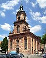
St. John's Basilica

Evangelical Collegiate Church of St. Arnual

Tumba Elisabeth of Lorraine , Collegiate Church of St. Arnual
Portrait of Elisabeth of Lorraine (detail of the tomb in the collegiate church of St. Arnual)

Saarbrücken Castle Church
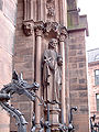
Entrance of the Johanneskirche


.jpg)

Other sights
- Burning mountain in Dudweiler
- Franco-German garden (with park railway )
- Rock paths in St. Arnual
- Saarbrücken public park
- Saarbrücken main cemetery , opened in 1914 as a cemetery of honor and also as a civil cemetery in 1916
- Casemates and underground foundations of the former Saarbrücken Castle under the Schlossplatz
- Mithras sanctuary on Halberg
- Saarbrücken Zoo
- Spicherer heights , right on the city limits with France
- Lulustein in old Saarbrücken
- St. Johanner Market
Regular events
- January / February: Max Ophüls Prize , the largest festival for young German-speaking films
- Shrove Saturday : PreMaBüBa (large carnival party in all halls of the Congress Hall )
- Rose Monday: Carnival procession in Burbach and Ensheim
- March to October: every second Saturday of the month, large flea market on Franz-Josef-Röder-Straße
- Easter: demo party revision in the E-Werk ( Burbach )
- April: PhotoMarathon in the twin cities Saarbrücken, Nantes and Tbilisi
- May: Perspectives
- May / June: Mouvement - music in the 21st century, festival for contemporary music by Saarland Radio
- May / June: Trofeo Karlsberg : The city is a partner of this junior World Cup cycle race, which takes place annually on the weekend after Corpus Christi .
- April / May: May festival in Burbach
- June / July: Cinema in the river ( Cinéfleuve ), interregional film festival
- June: light and flowers in the German-French Garden (DFG)
- Early June to late August: Sundays at the castle
- June / July: Old Town Festival in St. Johann
- July to October Saarbrücken summer music (festival for jazz, chamber music, new music at various locations in the city)
- July / August: Christopher Street Day
- July / August: Nauwieserfest in St. Johann
- August: Saar spectacle
- August: Imagination and Medieval Days in the Franco-German Garden
- End of August: Cultural Mile Festival between the Music Academy and the State Theater
- September: German-French wine market
- September: Festival around the Ludwigskirche
- September: Days of Fine Arts - artists invite you to tour studios, galleries and workshops
- September / October: Oktoberfest in Burbach
- October: Intermarionett (puppet theater festival)
- November: 3rd Thursday in November: Beaujolais Primeur Fest, St. Johann market
- November / December: African Film Days
- 1st Advent weekend: Old Saarbrücken Christmas market around the castle
- November / December: Christmas market on the St. Johann market
Sports and clubs

Soccer
The most famous soccer club in Saarbrücken and Saarland is the current third division club 1. FC Saarbrücken . He played a total of five seasons in the Bundesliga : 1963/64, 1976–1978, 1985/86 and 1992/93, another 19 seasons in the 2nd Bundesliga. The venue for the home games was the Ludwigsparkstadion until December 2015 . Since this has been rebuilt since then, the FCS has been playing its home games in the Völklingen Hermann-Neuberger Stadium as an alternative venue since 2016 . The women's team of 1. FC Saarbrücken has played in the women's first division for the fourth time since the 2009/10 season (after the 1997/98 to 2001/02, 2003/04 and 2007/08 seasons).
The Saarland Football Association (as well as the Saarland Gymnastics Association and many other sports associations in Saarbrücken) are located in the Hermann-Neuberger-Sportschule . This is operated by the state sports association for the Saarland .
Other sport
- The headquarters of the Rhineland-Palatinate / Saarland Olympic training center is also located in Saarbrücken .
- The Saarland Hurricanes (American Football) were founded in 1996 through a merger of the Dillingen Steelhawks and Saarbrücken Wölfe . They played in the 2nd Bundesliga (GFL2) from 1997 to 2000 and from 2008 to 2010, and were promoted to the GFL as champions in 2000 and 2010. The greatest success in the club's history was winning the German championship with the A-youth in 2013.
- The Turnerbund St. Johann from 1847 e. V. Saarbrücken has existed since 1847 and is a multi-branch association with 18 departments. He practices both popular and competitive sports.
- The first BC Bischmisheim plays in the first badminton Bundesliga , where he has already five times (2006-2010) win the German Championship and current vice-champion is.
- The Badminton World Federation maintains one of its three international training centers in Saarbrücken.
- The ATSV Saarbrücken played in the 1980s and early 1990s in the table tennis leagues for women and men and was German team champion several times. Since the promotion in 2009 Saarbrücken is represented again by the men's team of 1. FC Saarbrücken in the German table tennis Bundesliga
- Academic Sports Association Saarbrücken
- ATV Dudweiler
- Alpine Club and Ski Club Saarbrücken
- Baseball & Softball Club River Bandits Saarbrücken e. V.
- Basketball Association Saar e. V.
- Gersweiler-Ottenhausen e. V.
- Black Shadows Saarbrücken (American Football)
- Billiards Union Saar
- Drachenflugclib Saar e. V.
- DJK Dudweiler
- DJK St. Arnual
- DJK 08 Rastpfuhl e. V.
- DLRG OG St. Johann e. V.
- Herzwacht e. V.
- Ju-Jutsu Association V.
- Folsterhöhe judo club
- Judo Club Malstatt Saarbrücken e. V.
- Karate Dojo Saarbrücken
- Herzwacht e. V.
- HSG-Dudweiler
- Ju-Jutsu Association V.
- Folsterhöhe judo club
- Judo Club Malstatt Saarbrücken e. V.
- Canoe hikers Saarbrücken e. V.
- Karate Dojo Saarbrücken
- Carnival and Dance Sports Association Saar 2012 e. V.
- Bone Breaker (hobby football in Bübingen)
- Lacrosse Club Saarlax e. V.
- State Sports Association
- Running community Saarbrücken e. V.
- Running club LT Phoenix Dudweiler e. V.
- LAZ Saarbrücken
- LC 72 old boiler
- Post SV
- Post sports club diving
- Police sports club water sports
- Police sports club - dance sport
- PSV Saarbrücken
- PSV badminton
- Bischmisheim Riding Club
- Riding and Driving Association Dudweiler-Sulzbachtal e. V.
- Saarbrücken racing club
- RV Blitz (cycling)
- Rowing Club Saar (RCS)
- Saarbrücker Fitnessboxclub09 e. V.
- Saarbrücken Canoe Club
- Saarbrücken rowing company UNDINE
- Saarland gymnastics youth
- Saarland-Sportschützen-online
- Saarländischer Tennisbund e. V.
- Saarland Swimming Association V.
- Saarland Chess Association (SSV)
- SV 08 Saarbrücken e. V. (swimming & water polo)
- SV 09 Bübingen
- Swimming club Malstatt-Burbach 1984 e. V.
- Chess Association Sbr. 1970 e. V.
- Saar 05 e. V.
- Saar 05 e. V. Karate
- Saarland Triathlon Union
- Saarwald-Verein OV Saarbrücken
- ShinZenBi martial arts and forms of movement e. V.
- Dudweiler Ski Club
- Sportfreunde 05 Saarbrücken e. V.
- Stade Sarrois Rugby e. V.
- SV 1910 Gersweiler-Ottenhausen e. V.
- SV Saar05 dance sport
- Bootz-Ohlmann dance school
- Diving club Manta Saarbrücken e. V.
- Diving club TSC Saarlorlux e. V.
- Tennis Club Bübingen e. V.
- TV Bischmisheim
- TV Brebach
- TV Fechingen from 1895 e. V.
- TC Blau-Weiß Gersweiler (tennis)
- St. Arnual tennis club
- Rot-Weiß Waldhaus tennis club
- TV Fechingen
- TV 1887 Güdingen
- Gymnastics Federation St. Johann
- TUS 1884 St. Arnual
- TUS men's ear
- Turkish international sports club DOSTLUK e. V. Saarbrücken
- TV soot hut
- TV Altenkessel
- TVS - Turnverein Scheidt eV Volleyball
- UFC Wacker
- Yacht Club Saarbrücken e. V.
Carnival and other clubs
- Mir sin do, Saarbrücker Karnevalsgesellschaft, founded in 1890, and M'r sin nit so, Saarbrücker Karnevalsgesellschaft, founded in 1856 and the Nassauer Großsaarbrücker Karnevalsgesellschaft, founded in 1980.
- The Historical Association for the Saar Region (HV) , founded in 1839, with its headquarters in Saarbrücken, is the oldest and, with around 800 members, the largest scientific history association in the region. It is a non-profit association whose members are interested in the history of the Saarland and the neighboring regions and also research it. At the same time, the HV would like to convey history in a generally understandable manner. His work is characterized by a wide range of activities: publications (magazine for the history of the Saar region and Saar history / s) - conferences - library and collections - various series of lectures - high school diploma award. The AGM exerts socio-political influence on the historical culture of the Saarland. He expresses himself publicly on the regional protection of monuments and other historically related questions of cultural identity.
- The Geography Without Borders association is also the Saarbrücken Geographic Society. He organizes guided tours through Saarbrücken, Saarland, France and Luxembourg ( Saar-Lor-Lux region ) on special topics under expert guidance for interested citizens. The city tours, which not only show the classic sights of the city, but also special features and backgrounds off the beaten track, are supplemented by lectures during the winter months.
- Saarland artist house
Personalities
Honorary citizen
Sons and daughters of the city and other personalities
Famous personalities from Saarbrücken include the former Rhineland-Palatinate Prime Minister Peter Altmeier , the director Max Ophüls , the Federal Interior and Foreign Minister Gerhard Schröder and the singers Sandra and Nicole .
City legend: The stingy baker

The stone grimace of a gargoyle is on the castle wall in Saarbrücken. According to legend, it is said to be the head of a rich, but stingy Saarbrücken baker who abruptly rejected the poor during a terrible famine. He was known for his hard-heartedness. The Saarbrücken countess heard about it, disguised herself as a beggar and was also ruthlessly turned away. Even in bad times, when many Saarbrücken citizens were poor and hungry, he did not give out a piece of bread without payment. According to the legend, he was the only baker far and wide and people were dependent on him. He is said to have said "no bread without money". As a punishment and deterrent, she arranged for the stingy baker's head to be attached to the old bridge as a mask of shame , where she now had to spit the dirty water into the Saar through her wide-open mouth, to the great pleasure of the citizens of Saarbrücken. The baker should be easily recognizable and the "stingy character" should be expressed. Later the grimace was relocated to the castle wall of the Saarbrücken castle.
In the media
Saarbrücken has been the setting and filming location for episodes of the crime series Tatort on ARD since 1970 . In the opinion of the media manager Martin Hoffmann, this has contributed to the Max Ophüls Prize as well as "that Saarbrücken is perceived as a place of modern, young television and film culture". The following investigators were on duty in the Saarbrücken team:
- Dieter Eppler as Peter Liersdahl (1970–1973),
- Manfred Heidmann as Horst Schäfermann (1977–1984),
- Jochen Senf as Max Palu (1988-2005, see Salü Palu ),
- Maximilian Brückner as Franz Kappl and Gregor Weber as Stefan Deininger (2006–2012, see Kappl and Deininger ),
- Devid Striesow as Jens Stellbrink and Elisabeth Brück as Lisa Marx (2013-2019, see Stellbrink and Marx ), as well
- Daniel Sträßer as Adam Schürk and Vladimir Burlakov as Leo Hölzer (since 2020, see Schürk and Hölzer ).
literature
in alphabetical order by authors / editors
- Werner Arend: The Saarbrücker Eisenbahn, its prehistory and a travel report, Volume 4, Dudweiler history workshop, 1996
- Helmut Ballas: Sale of the Eschberger Hof to the City of Saarbrücken, Volume 11, Dudweiler History Workshop, 2010
- Irmgard Christa Becker: Open research questions on Saarbrücken city history in the Saar area period 1920–1935, in: Journal for the history of the Saar area 58 (2010), pp. 103–117.
- Irmgard Christa Becker: The instrumentalization of the Saarbrücken city archives for Saar propaganda 1929–1935, in: Association of archivists (ed.): Das deutsche Archivwesen und der Nationalozialismus, Essen 2007, pp. 396–406.
- Hans Bünte: Small Saarbrücken City History . Verlag Friedrich Pustet, Regensburg 2009, ISBN 978-3-7917-2165-1 .
- Florian Brunner: Underground Saarbrücken - tunnels, bunkers, rock cellars. Insights into the Saarbrücken underground . Geistkirch-Verlag, Saarbrücken 2011, ISBN 978-3-938889-36-7 .
- Florian Brunner: Saarbrücken - Discoveries from above - aerial photographs from 1929 to 2013 show old and new faces of a city . Geistkirch-Verlag, Saarbrücken 2014, ISBN 978-3-938889-03-9 .
- Florian Brunner / Markus Philipp: Searching for traces in Saarbrücken - a journey to the city's visible secrets . Geistkirch-Verlag, Saarbrücken 2015, ISBN 978-3-946036-41-8 .
- Peter Burg: Saarbrücken 1789–1960, From the residential city to the industrial center, (= Saarland Library, 14). Gollenstein, Blieskastel 2000.
- Oranna Dimmig: Garden art in Saarbrücken (exhibition catalog). Wernersche Verlagsgesellschaft , Worms 1999. ISBN 978-3-88462-162-2
- Werner Eckel: Saarbrücken in the air war 1935-1945, Saarbrücken 1985.
- Dieter Gräbner / Stefan Weszkalnys: Citizens, Bridges and Duels. 100 years of the city of Saarbrücken. Pictures, memories and chronicles. Conte Verlag, Saarbrücken 2009, ISBN 978-3-936950-85-4 .
- Michael Jung: "Between arable farming and Fürstenhof. Saarbrücken and St. Johann bourgeoisie in the 18th century." (= Saarland Library, 7), Röhrig, St. Ingbert 1994.ooo
- Erich Keyser (Ed.): City book of Rhineland-Palatinate and Saarland . Kohlhammer, Stuttgart 1964 ( German city book . Volumes 4, 3).
- Annette Kleinhorst and Petra Messinger (eds.): Die Saarbrückerinnen, contributions to city history, St. Ingbert 1998.
- Fritz Kloevekorn : Saarbrücken's past in pictures, Saarbrücken 1933.
- Rainer Knauf: Civil and military cemetery and tomb design in the 20th century. The main cemetery in Saarbrücken. 1912-1959. Conte Verlag, Saarbrücken 2010, ISBN 978-3-941657-24-3 .
- Adolph Köllner: History of the cities of Saarbrücken and St. Johann . 1865, unchanged reprint Verlag Saarbrücker Zeitung, Saarbrücken, 1981, ISBN 3-922807-08-9 .
- Heinrich Kruekemeyer (Ed.): 25 years city of Saarbrücken, Saarbrücken 1934.
- Cultural Department of the City of Saarbrücken (Ed.): Saarbrücken, 50 Years of the City 1909–1959. Saarbrücken 1959.
- Fabian Lemmes: Forced Labor in Saarbrücken, Foreign Civil Workers and Prisoners of War 1940–1945, St. Ingbert 2004.
- Albert Marx: The history of the Jews in Saarland. From the Ancien Régime to the Second World War . Die Mitte, Saarbrücken 1992, ISBN 3-921236-67-3 .
- Albert Ruppersberg : History of the cities of Saarbrücken and St. Johann from 1815 to 1909, of the city of Malstatt-Burbach and the united city of Saarbrücken up to 1914. The history of the former county of Saarbrücken ( Memento from March 5, 2012 in the Internet Archive )
- Albert Ruppersberg: Saarbrücker War Chronicle, events in and near Saarbrücken and St. Johann, as well as on the Spicherer Berge 1870, 4th edition, Leipzig 1911.
- Karl August Schleiden: Illustrated history of the city of Saarbrücken, Dillingen / Saar 2009.
- Hildegard Schorr: The history of the Saarbrücker Theater from the beginnings to the present, dissertation, Mainz 1952.
- Heinrich Silbergleit (Ed.): Prussian Cities - Memorandum for the 100th anniversary of the city ordinance from November 19, 1808 . Berlin 1908.
- Paul Thomes: Die Kreissparkasse Saarbrücken, A contribution to the history of the public savings banks of Prussia, Frankfurt am Main 1985.
- Rolf Wittenbrock (ed.): History of the city of Saarbrücken . SDV Saarländische Druckerei und Verlag, Saarbrücken 1999, ISBN 3-930843-41-2 (Volume 1: From the beginnings to the industrial awakening (1860) , Volume 2: From the time of stormy growth to the present ).
Web links
|
Further content in the sister projects of Wikipedia:
|
||
|
|
Commons | - Media content (category) |
|
|
Wiktionary | - Dictionary entries |
|
|
Wikinews | - News |
|
|
Wikisource | - Sources and full texts |
|
|
Wikivoyage | - Travel Guide |
- Website of the Saarland state capital Saarbrücken
- Literature about Saarbrücken in the Saarland Bibliography
-
Search for Saarbrücken in the online catalog of the Berlin State Library - Prussian Cultural Heritage . Attention : The database has changed; please check result and
SBB=1set - Link catalog on Saarbrücken at curlie.org (formerly DMOZ )
- Holdings of the Saarbrücken City Archives in the Archive Portal-D
Individual evidence
- ↑ Saarland.de - Official population figures as of December 31, 2019 (PDF; 20 kB) ( help ).
- ↑ Braun, Edith and Mangold, Max: Saarbrücker Dictionary. Saarbrücker Druckerei und Verlag, 1984, ISBN 3-921646-70-7 , p. 299.
- ^ Nikolaus Fox: Saarländische Volkskunde, Volkskunde Rhenish landscapes, ed. by Adam Wrede, Bonn 1927, p. 142.
- ↑ Wolfgang Haubrichs and Frauke Stein: Early medieval settlement in the Saarbrücker area, in: Rolf Wittenbrock (ed.): History of the City of Saarbrücken, Saarbrücken 1999, Volume 1: From the beginnings to industrial awakening (1860), pp. 111–158, here Pp. 129-130.
- ^ Sabine Penth: Saarbrücken. In: Manfred Niemeyer (Hrsg.): German book of place names. De Gruyter, Berlin and Boston 2012, ISBN 978-3-11-018908-7 , pp. 543 f.
- ↑ Hans Helmut Ebert: Stadt und Naturraum, in: Rolf Wittenbrock (Hrsg.): Geschichte der Stadt Saarbrücken, Vol. 1, From the beginnings to the industrial awakening (1860), Saarbrücken 1999, pp. 25–58, here p. 54 -58.
- ↑ Hans Helmut Ebert: Stadt und Naturraum, in: Rolf Wittenbrock (Hrsg.): Geschichte der Stadt Saarbrücken, Vol. 1, From the beginnings to the industrial awakening (1860), Saarbrücken 1999, pp. 25–58, here p. 44 -46.
- ↑ Alfons Kolling: Pre- and early history I and II, in: Heinz Quasten and Hans-Walter Herrmann (eds.): Historical Atlas for the Land on the Saar, publications of the Institute for Regional Studies of the Saarland, Saarbrücken 1971.
- ↑ Hans Helmut Ebert: Stadt und Naturraum, in: Rolf Wittenbrock (Hrsg.): Geschichte der Stadt Saarbrücken, Vol. 1, From the beginnings to the industrial awakening (1860), Saarbrücken 1999, pp. 25–58, here p. 46 -49.
- ↑ Hans Helmut Ebert: Stadt und Naturraum, in: Rolf Wittenbrock (Hrsg.): Geschichte der Stadt Saarbrücken, Vol. 1, From the beginnings to the industrial awakening (1860), Saarbrücken 1999, pp. 25–58, here p. 50 -54.
- ↑ Momir Bjelanovic: The terrain climatic conditions in the greater Saarbrücken area, in: Landeshauptstadt Saarbrücken (ed.): Environmental report 1976/77, Saarbrücken 1977, pp. 86–91.
- ↑ Momir Bjelanovic: Meteorology in its meaning for life in general; with examples from Saarland, in: Minister for the Environment, Spatial Planning and Building (ed.): The climate in the landscape, its development and change, ways of influencing it, (series of publications by the Supreme Nature Conservation Authority, 5), pp. 24–41.
- ↑ Dietrich Büch: Representation of air pollution and climate in the Saarbrücken city association and their implementation in the urban land-use planning, in: Minister for the Environment, Spatial Planning and Building (Ed.): The climate in the landscape, its development and change, ways of influencing it, (series of publications of the Supreme Nature Conservation Authority, 5), pp. 42–58.
- ↑ Hans Schirmer: City and Climate, in: Minister for the Environment, Spatial Planning and Building (Ed.): One world - to live in it, lectures held in "Month of the Environment '79", Saarbrücken 1980.
- ↑ Hans Helmut Ebert: Stadt und Naturraum, in: Rolf Wittenbrock (Hrsg.): Geschichte der Stadt Saarbrücken, Vol. 1, From the beginnings to the industrial awakening (1860), Saarbrücken 1999, pp. 25–58, here p. 40 -44.
- ^ Alfons Kolling : Late Bronze Age on the Saar and Moselle , Bonn 1968; Reinhard Schindler : Studies on the prehistoric settlement and fortification system of the Saarland , Trier 1968; Andrei Miron , Auguste Schäfer: Hidden-Discovered. A journey through the prehistory and early history of the Saarland , Saarbrücken 1993; Karl August Schleiden: Illustrated History of the City of Saarbrücken , Dillingen / Saar 2009, pp. 15–18.
- ^ Jacques Moreau : The Celts in Saarland , in: Saarbrücker Hefte 11, 1960, pp. 17–32; Karl August Schleiden : Illustrated History of the City of Saarbrücken , Dillingen / Saar 2009, pp. 18–23.
- ↑ Alfons Kolling : The name of the Roman Saarbrücken , in: 12th report of the state preservation of monuments 1965, pp. 61–65.
- ^ Karl August Schleiden: Illustrated History of the City of Saarbrücken , Dillingen / Saar 2009, p. 21.
- ^ Alfons Kolling: The Roman Saarbrücken , Saarbrücken 1964; Alfons Kolling: The prehistoric and early historical settlement of the Saarbrücken valley area , in: Journal for the history of the Saar region 19, 1971, pp. 11–51.
- ↑ Erich Nolte: A Roman sanctuary on the Eschberg near Saarbrücken , in: Saarbrücker Hefte 19, 1964, pp. 51–57.
- ↑ Erich Nolte: A statue of Merkur from Saarbrücken , in: Saarheimat 8, 1964, p. 317.
- ↑ Reinhard Schindler: The Mithras cave of Saarbrücken . Saarbrücken 1964. Revised edition by Franz-Josef Schumacher and Andrei Miron Saarbrücken 1989.
- ^ Paul Bouchard: The scalpel from Halberg near Saarbrücken and other medical instruments from the Saar-Mosel area , in: Contributions to Saarland archeology and art history, 11th report of the state preservation of monuments 1964, pp. 149–166.
- ^ Hermann Diehl: On the question of the missing oldest Saar bridge near Güdingen , in: Saarheimat 5, 1961, issue 9, pp. 13-20.
- ↑ Emanuel Roth: The predecessor buildings of the collegiate church St. Arnual , in: The collegiate church St. Arnual in Saarbrücken , ed. v. Hans-Walter Hermann, Cologne 1998.
- ↑ Helmut Freis : The Roman Age Settlement on Halberg , in: Rolf Wittenbrock: History of the City of Saarbrücken , Saarbrücken 1999, Vol. 1, pp. 90-110.
- ^ Karl August Schleiden: Illustrated History of the City of Saarbrücken , Dillingen / Saar 2009, p. 23.
- ↑ Georg Waitz (Ed.): Gesta Alberonis auctore Balderico, 22, 1848, in: MGH SS 8, p. 254.
- ↑ August Hermann Jungk: Regesta on the history of the former Nassau-Saarbrückische Lande, 2 volumes, Saarbrücken 1914 and 1919, in: Mitteilungen des Historisches Verein für die Saargebiet, 13 and 14, p. 24, no.76.
- ↑ Hatto Kallfelz: biographies of some bishops of the 10th-12th Century, 2nd edition, Darmstadt 1986, in: selected sources on the German history of the Middle Ages, 22, p. 595.
- ↑ Stefan Flesch, Joachim Conrad, Thomas Bergholz: Mönche an der Saar, The medieval order branches in the Saarland-Lorraine border area, Saarbrücken 1986, p. 130.
- ↑ Kurt-Ulrich Jäschke: Saarbrücken in the High Middle Ages, in: Rolf Wittenbrock (Ed.): History of the City of Saarbrücken, From the Beginnings to Industrial Awakening (1850), Vol. 1, Saarbrücken 1999, pp. 159–198, here p. 162.
- ↑ Rolf Wittenbrock (Ed.): History of the City of Saarbrücken, Vol. 2, From the time of stormy growth to the present, Saarbrücken 1999, p. 682.
- ↑ a b Rolf Wittenbrock (Ed.): History of the City of Saarbrücken, Vol. 2, From the time of stormy growth to the present, Saarbrücken 1999, p. 683.
- ↑ Minotti Paul: Board game and garden art: The "goose game rosette" in the Ludwigsberger Garten in Saarbrücken . In: Die Gartenkunst 28 (1/2016), pp. 47–56.
- ↑ In Article I, Paragraph 1 of the Second Peace of Paris, the course of the border was defined accordingly and on November 20, 1815 by King Friedrich Wilhelm III. von Prussia , Emperor Franz I of Austria and Tsar Alexander I of Russia initialed: "From Perle it runs through Launsdorf , Wallwick , Schardorff , Niederweiling , Pellweiler , so that all these places with their parishes remain in France, up to Houvre , and then follows the former boundaries of the Principality of Saarbrücken , in such a way that Saar-Louis and the course of the Saar with the villages and their parishes lying to the right of the above-mentioned line remain outside the French borders. Of the borders of the former Principality of Saarbrücken, the line of demarcation remains the line that currently separates Germany from the departments of the Moselle and the Lower Rhine , up to the Lauter , which further forms the border up to its outflow into the Rhine. The entire area on the left bank of the Lauter, including the Landau fortress, is united with Germany. However, the city of Weissenburg , which is crossed by this river, remains entirely with France, with a circumference of no more than a thousand French fathoms on the left bank of the Lauter, which the commission to be appointed for the forthcoming demarcation will determine in more detail. "( Vienna Congress - Act signed on June 8th, 1815 )
- ^ Fritz Kloevekorn: Saarbrücken's past in pictures, Saarbrücken 1933, p. 142.
- ^ Karl August Schleiden: Saarbrücken - as it was, Düsseldorf 1973, pp. 14-15.
- ↑ http://www.schuetzengesellschaft-saarbruecken.de/verein-uber-uns/ , accessed on June 10, 2017.
- ↑ Timeline for the history of the city and county of Saarbrücken from 600 to July 1922 . in: Saar calendar for the year 1923
- ↑ Arnold Ilgemann: "French schools" - The French Domanialschulen in the League of Nations. (PDF) MELUSINE - Literary Society Saar-Lor-Lux-Elsass e. V. , June 22, 1993, accessed on September 27, 2019 (lecture manuscript).
- ^ Heinrich Rodenstein: Saar area
- ↑ Rolf Wittenbrock (Ed.): History of the City of Saarbrücken, Vol. 2, From the time of stormy growth to the present, Saarbrücken 1999, p. 684.
- ^ Series "60 Years of the End of the War" by ARD ( Memento from January 31, 2009 in the Internet Archive )
- ↑ 13/1/45 Attack against Saarbrücken - Marschalling Yards. In: 75 (NZ) Squadron RAF. Retrieved February 17, 2017 .
- ↑ Royal Air Force Bomber Command 60th Anniversary: Campaign Diary - March 1945 ( Memento from March 29, 2012 in the web archive archive.today )
- ↑ Hartwig Beseler, Niels Gutschow: War fates of German architecture, losses - damage - reconstruction, a documentation for the territory of the Federal Republic of Germany, Vol. II: Süd, Wiesbaden 2000, pp. 1059-1077.
- ↑ Doris Seck , Paul Peters: The zero hour. The end of the war on the Saar. Saarbrücken 1986, pp. 49-50, 55.
- ↑ Hartwig Beseler, Niels Gutschow: War fates of German architecture, losses - damage - reconstruction, a documentation for the territory of the Federal Republic of Germany, Vol. II: Süd, Wiesbaden 2000, p. 1060.
- ^ Gerhard Franz: The victory of the naysayers, 50 years after the vote on the Saar Statute , Blieskastel 2005, p. 181.
- ↑ Rolf Wittenbrock (Ed.): History of the City of Saarbrücken, Vol. 2, From the time of stormy growth to the present, Saarbrücken 1999, p. 685.
- ^ Federal Statistical Office (ed.): Historical municipality directory for the Federal Republic of Germany. Name, border and key number changes in municipalities, counties and administrative districts from May 27, 1970 to December 31, 1982 . W. Kohlhammer, Stuttgart / Mainz 1983, ISBN 3-17-003263-1 , p. 803 .
- ↑ State capital Saarbrücken - figures, data and facts. In: saarbruecken.de. December 31, 2016, accessed January 10, 2017 .
- ↑ City of Saarbrücken Population in a regional comparison by religion -in% ( 2011 census )
- ↑ City of Saarbrücken Stat.Info 1/20 The population of Saarbrücken in 2019 page 31, accessed on October 3, 2020
- ↑ see JFG Goeters: The introduction of the union in the area of the old district synod Saarbrücken. In: Helmut Franz / Hans Walter Herrmann: The Evgl. Church on the Saar yesterday and today. Saarbrücken 1975, p. 222.
- ↑ Mennonites now have their own house of prayer. Saarbrücker Zeitung, accessed on July 28, 2010 .
- ^ Saarland closes boarding school of the Pius Brotherhood , Tagesspiegel of April 28, 2010; Retrieved November 6, 2015
- ^ Albert Ruppersberg : History of the former county of Saarbrücken, history of the cities of Saarbrücken and St. Johann 1815–1909, the city of Malstatt-Burbach and the united city of Saarbrücken up to 1914, Volume III, Part 2, 2nd edition from 1914, Saarbrücken 1914, p. 554.
- ^ Mosques in Saarbrücken
- ↑ Municipal council elections 2019 - 41100 - Saarbrücken. State Returning Officer Saarland, May 26, 2019, accessed on August 7, 2019 .
- ↑ Kohde-Kilsch changes to the SPD , SR.de from August 27, 2019
- ↑ Left city council changes to the Greens , SR.de from October 26, 2020
- ↑ Sr.de: Jamaica in Saarbrücken. September 30, 2019, accessed October 12, 2019 .
- ↑ Saarbrücken's partnership with Diriamba e. V. EineWelt Partnership Saarbrücken - Nicaragua. State capital Saarbrücken, accessed on February 17, 2017 .
- ↑ How we move - traffic development plan. Household survey on mobility behavior in Saarbrücken. In: saarbruecken.de . State capital Saarbrücken, 2010, accessed on June 19, 2020 .
- ↑ Moderate results for Saarland cities in the nationwide bicycle climate test. In: adfc-saar.de . ADFC Saar, 2015, accessed on June 19, 2020 .
- ↑ Steffen Kolodziej: The Saarland looks like Germany's brothel at the moment. (Audio) Saarländischer Rundfunk, April 13, 2018, accessed on March 8, 2019 .
- ↑ Against the Grain: Anger at the Border. In: Saarbrücker Zeitung. July 12, 2017. Retrieved October 23, 2018 .
- ↑ Sonja Süß: Prostitution in Saarland: At night it gets even more cruel . In: Frankfurter Allgemeine Zeitung . March 13, 2014, ISSN 0174-4909 ( faz.net [accessed December 27, 2016]).
- ↑ Lisa Caspari: Prostitution: The Saarland attracts clients . In: The time . 2014, ISSN 0044-2070 ( zeit.de [accessed December 27, 2016]).
- ^ Matthias Schiermann: Prostitution stronghold Saarbrücken: From Paris to the brothel in Burbach. Stuttgarter Zeitung , 2014, accessed on December 27, 2016 .
- ↑ Web presence of the Intel Visual Computing Institute, accessed on February 4, 2014.
- ↑ Cluster of Excellence website , accessed on February 6, 2014.
- ↑ Website of the Graduate School accessed on February 19, 2014
- ↑ Forschungszentrum Jülich's website , accessed on February 12, 2014.
- ↑ Saar-Uni - press team: Saarbrücker Informatik gets a new competence center. Saarland University, press release from February 28, 2011 at the Informationsdienst Wissenschaft (idw-online.de), accessed on December 20, 2014.
- ↑ List of corporate sponsoring members at ( Memento from January 14, 2011 in the Internet Archive ) In: www.mpg.de ( PDF file )
- ^ Witnesses wanted by the Saarländischer Rundfunk ( Memento from April 20, 2005 in the Internet Archive )
- ↑ Enjoyment run over 14 Saar bridges in Saarbrücken (fee subject to charge) at www.saarbrücker-zeitung.de; accessed on September 19, 2019.
- ^ Karl Bernhard : A bridge competition in Saarbrücken. A contribution to artistic questions of bridge building . In: Zentralblatt der Bauverwaltung , September 11, 1909, pages 485ff.
- ↑ stadtbild-saarbruecken.de image at Stadtbild-Saarbruecken.de
- ^ Albert Ruppersberg: History of the former county of Saarbrücken, history of the cities of Saarbrücken and St. Johann 1815–1909, the city of Malstatt-Burbach and the united city of Saarbrücken up to 1914, Volume III, Part 2, 2nd edition from 1914, Saarbrücken 1914, p. 99.
- ↑ Mining Directorate
- ↑ www.dradio.de (Deutschlandfunk)
- ↑ Kristine Marschall: Sacred buildings of classicism and historicism in Saarland, Institute for Regional Studies in Saarland, Saarbrücken 2002, pp. 322–323.
- ↑ christkoenig.handshake.de
- ↑ Maria Queen in the Saar Art Lexicon ( Memento from October 21, 2016 in the Internet Archive )
- ↑ Justin Weisang: Brand Kirche St. Helena ( Memento from March 1, 2015 in the web archive archive.today ). In: www.lb13.de of July 12, 2012.
- ↑ Burbach Church of St. Helena completely destroyed by fire - with photos ( Memento from October 14, 2014 in the Internet Archive ) In: www.saarbruecker-zeitung.de from July 13, 2012
- ^ Farewell to St. Helena Church in Burbach ( Memento from September 13, 2014 in the web archive archive.today ). In: www.saarkurier-online.de from July 9, 2009.
- ^ Website of the municipality , last accessed on September 8, 2017.
- ^ Website of the municipality , accessed October 1, 2014.
- ^ Historical association for the Saar region
- ↑ Geography without borders. In: geographie-ohne-grenzen.de. Retrieved February 28, 2015 .
- ^ Karl Lohmeyer: Die Sagen der Saar, Complete Edition, Saarbrücken 2011.
- ↑ Alfons Kolling: The stingy baker - a scare mask sculpture from the Saarbrücken Renaissance castle , Saarbrücken 1999.
- ↑ Deana Zinßmeister: Legendary Saarland, sagas and myths from the region . Conte-Verlag, 2012, ISBN 978-3-941657-68-7 .
- ^ " Tatort Team Saarbrücken". Retrieved February 24, 2017 .
- ↑ Quote from: Martin Hoffmann : "Regional strengths are also a gateway to the world" . In: Thomas Kleist, Alexander Roßnagel, Alexander Scheuer (eds.): European and national media law in dialogue , Nomos, Baden-Baden 2010, ISBN 978-3-8329-6241-8 , p. 390
State capitals:
Dresden ( Saxony ) |
Düsseldorf ( North Rhine-Westphalia ) |
Erfurt ( Thuringia ) |
Hanover ( Lower Saxony ) |
Kiel ( Schleswig-Holstein ) |
Magdeburg ( Saxony-Anhalt ) |
Mainz ( Rhineland-Palatinate ) |
Munich ( Bavaria ) |
Potsdam ( Brandenburg ) |
Saarbrücken ( Saarland ) |
Schwerin ( Mecklenburg-Western Pomerania ) |
Stuttgart ( Baden-Wuerttemberg ) |
Wiesbaden ( Hesse )
City-states:
Berlin |
Bremen ( Free Hanseatic City of Bremen ) |
Hamburg
from 1,000,000 inhabitants:
Berlin |
Hamburg |
Cologne |
Munich
from 500,000 inhabitants:
Bremen |
Dortmund |
Dresden |
Düsseldorf |
Food |
Frankfurt am Main |
Hanover |
Leipzig |
Nuremberg |
Stuttgart
from 250,000 inhabitants:
Augsburg |
Bielefeld |
Bochum |
Bonn |
Duisburg |
Gelsenkirchen |
Karlsruhe |
Mannheim |
Mönchengladbach |
Munster |
Wiesbaden |
Wuppertal
from 100,000 inhabitants:
Aachen |
Bergisch Gladbach |
Bottrop |
Braunschweig |
Bremerhaven |
Chemnitz |
Cottbus |
Darmstadt |
Erfurt |
Erlangen |
Freiburg im Breisgau |
Fuerth |
Göttingen |
Gütersloh |
Hagen |
Halle (Saale) |
Hamm |
Heidelberg |
Heilbronn |
Herne |
Hildesheim |
Ingolstadt |
Jena |
Kaiserslautern |
Kassel |
Kiel |
Koblenz |
Krefeld |
Leverkusen |
Lübeck |
Ludwigshafen am Rhein |
Magdeburg |
Mainz |
Moers |
Mülheim an der Ruhr |
Neuss |
Oberhausen |
Offenbach am Main |
Oldenburg |
Osnabrück |
Paderborn |
Pforzheim |
Potsdam |
Recklinghausen |
Regensburg |
Remscheid |
Reutlingen |
Rostock |
Saarbrücken |
Salzgitter |
Victories |
Solingen |
Trier |
Ulm |
Wolfsburg |
Wurzburg