
Bürgerpark Hafeninsel

The Bürgerpark Hafeninsel (often only Bürgerpark Saarbrücken ) is an inner-city park in Saarbrücken . In 1989 he was awarded the Landscape Architecture Prize of the Bund Deutscher Landschaftsarchitekten (BDLA).
location
The Bürgerpark is located on the edge of the Saarbrücken city center and extends along the Saar from east to west. The congress hall borders the park in the east . In the northeast is a branch of the Deutsche Bundesbank and the employment agency . In the northwest, a large cinema borders the park, in the west an industrial area of Steag Saar Energie . The area is divided into two by the Westspangenbrücke, which runs across the area, as well as the associated ramp and a parking lot under the bridge.
history
The Bürgerpark is located on the site of the city's former coal port, which was on a peninsula formed by an oxbow lake from the Saar. Coal has been shipped from here since the late 17th century. Even after the end of the Second World War , there were considerations to upgrade the rubble area to a green area with a congress hall, but the plans were not implemented. It was not until 1967 that today's congress hall was built at the western end of the park. The rest of the area lay fallow. In the mid-1980s there were new considerations. During this time, the Westspange was built to connect the A 620 with the A 623 . A park should be created to the left and right of the bridge.
The landscape architect Peter Latz was commissioned to develop a concept for future use. The plan was to create a park that integrates modern elements with the history of the area, at the same time represents part of ecological urban renewal and reconnects divided urban spaces. The 9 hectare area should invite people to linger and become a recreational area for the citizens of the city. Together with schoolchildren, students and residents, dug and seventh bib in the ground and used what they found to build retaining walls, paths, stairs and hills. A boules court and a skater area were integrated, meadows, groups of old trees, paved surfaces and wall remnants discovered under the rubble, a small amphitheater, a water area with a water gate reminiscent of industrial plants, hedge passages and bush islands, spontaneously grown nature and numerous tree avenues. This created a mixture of landscape garden and city park .
After more than three years of construction, the park was officially opened on June 2, 1989 by the then Mayor of Saarbrücken, Hans-Jürgen Koebnick, and the then Prime Minister of Saarland, Oskar Lafontaine and North Rhine-Westphalia, Johannes Rau .
In the following years some areas in the north of the park were built on. The result was a large cinema for the Cinestar group, the Saarbrücken branch of the Employment Agency and a branch of the Bundesbank.
description

Rondell (with covered water basin)

Arched wall
arcade

Water arcade

Water arcade

Rose wall
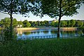
View of the Saar

Outdoor stage
.jpg)
.jpg)
.jpg)
.jpg)
.jpg)
.jpg)
.jpg)
.jpg)
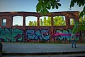
The park is criss-crossed by a network of paths and trails. There is a parking lot under the western bar, which was separated from the park by bush hedge walkways. In the eastern part of the park there are mainly meadows, avenues and tree groves. A large area of water through which a footbridge leads serves as a connection between the eastern and western parts. In the water, foundations were indicated with red bricks. The focus is on an artificial ruin : a wall of water that is supposed to remind of a Roman aqueduct as well as (because of the use of red clinker bricks ) of the ruins of an industrial plant. In the eastern part a forest and smaller gardens are predominant. In the center of the facility is a roundabout with a water surface, which is also used for concerts and performances. A skate park with a half pipe is located under the western clasp . Small works of art and relics from the Montan era and the early development of the site can be found everywhere in the park. The vegetation formed on the rubble has many rare species, which is why care and management are geared towards protecting them.
There is a landing stage for river cruise ships on the banks of the Saar .
literature
- Claus Reisinger : The harbor island in Saarbrücken . In: Die Gartenkunst 3 (1/1991), pp. 73–101.
- Christine Rupp: Adderhead and roses. Spontaneous and planted vegetation on the harbor island in Saarbrücken . In: Die Gartenkunst 3 (1/1991), pp. 102–110.
Web links
- Bürgerpark Hafeninsel on the website of the state capital Saarbrücken
- Bürgerpark Hafeninsel, Saarbrücken , landscape architecture portal today of the BDLA
- Literature on the Saarbrücken Bürgerpark in the Saarland Bibliography
Individual evidence
- ↑ A space for the encounter between the past and the present - Bürgerpark Hafeninsel , Kunstlexikon Saar, Institute for Contemporary Art, Jo Enzweiler and the Department of Culture of the State Capital Saarbrücken, pp. 28–32
- ↑ a b c Bürgerpark Hafeninsel, Saarbrücken . 1989 in the online exhibition 100 Years of Landscape Architecture of the BDLA. Retrieved May 2, 2014.
- ^ Saarbrücken harbor island, DE. In: Latz und Partner. Retrieved April 7, 2019 .
- ↑ Andreas Heiske on the Saarbrücken Bürgerpark ( memento from March 28, 2010 in the Internet Archive ), accessed on October 20, 2011
- ^ Website of the Bürgerpark Initiative
- ↑ Silvia Buss: The attraction of ruins in the Bürgerpark . In: Saarbrücker Zeitung . October 13, 2017 ( saarbruecker-zeitung.de [accessed May 5, 2019]).
Coordinates: 49 ° 14 '15.8 " N , 6 ° 59' 0.6" E