Bundesstrasse 41
| Bundesstrasse 41 in Germany | ||||||||||||||||||||||||||||||||||||||||||||||||||||||||||||||||||||||||||||||||||||||||||||||||||||||||||||||||||||||||||||||||||||||||||||||||||||||||||||||||||||||||||||||||||||||||||||||||||||||||||||||||||||||||||||||||||||||||||||||||||||||||||||||||||||||||||||||||||||||||||||||||||||||||||||||||||||||||||||||||||||||||||||||

|
||||||||||||||||||||||||||||||||||||||||||||||||||||||||||||||||||||||||||||||||||||||||||||||||||||||||||||||||||||||||||||||||||||||||||||||||||||||||||||||||||||||||||||||||||||||||||||||||||||||||||||||||||||||||||||||||||||||||||||||||||||||||||||||||||||||||||||||||||||||||||||||||||||||||||||||||||||||||||||||||||||||||||||||
| map | ||||||||||||||||||||||||||||||||||||||||||||||||||||||||||||||||||||||||||||||||||||||||||||||||||||||||||||||||||||||||||||||||||||||||||||||||||||||||||||||||||||||||||||||||||||||||||||||||||||||||||||||||||||||||||||||||||||||||||||||||||||||||||||||||||||||||||||||||||||||||||||||||||||||||||||||||||||||||||||||||||||||||||||||
| Basic data | ||||||||||||||||||||||||||||||||||||||||||||||||||||||||||||||||||||||||||||||||||||||||||||||||||||||||||||||||||||||||||||||||||||||||||||||||||||||||||||||||||||||||||||||||||||||||||||||||||||||||||||||||||||||||||||||||||||||||||||||||||||||||||||||||||||||||||||||||||||||||||||||||||||||||||||||||||||||||||||||||||||||||||||||
| Operator: |
|
|||||||||||||||||||||||||||||||||||||||||||||||||||||||||||||||||||||||||||||||||||||||||||||||||||||||||||||||||||||||||||||||||||||||||||||||||||||||||||||||||||||||||||||||||||||||||||||||||||||||||||||||||||||||||||||||||||||||||||||||||||||||||||||||||||||||||||||||||||||||||||||||||||||||||||||||||||||||||||||||||||||||||||||
| Start of the street: |
Saarbrücken ( 49 ° 12 ′ N , 6 ° 57 ′ E ) |
|||||||||||||||||||||||||||||||||||||||||||||||||||||||||||||||||||||||||||||||||||||||||||||||||||||||||||||||||||||||||||||||||||||||||||||||||||||||||||||||||||||||||||||||||||||||||||||||||||||||||||||||||||||||||||||||||||||||||||||||||||||||||||||||||||||||||||||||||||||||||||||||||||||||||||||||||||||||||||||||||||||||||||||
| End of street: |
Bad Kreuznach ( 49 ° 59 ′ N , 8 ° 2 ′ E ) |
|||||||||||||||||||||||||||||||||||||||||||||||||||||||||||||||||||||||||||||||||||||||||||||||||||||||||||||||||||||||||||||||||||||||||||||||||||||||||||||||||||||||||||||||||||||||||||||||||||||||||||||||||||||||||||||||||||||||||||||||||||||||||||||||||||||||||||||||||||||||||||||||||||||||||||||||||||||||||||||||||||||||||||||
| Overall length: | approx. 130 km | |||||||||||||||||||||||||||||||||||||||||||||||||||||||||||||||||||||||||||||||||||||||||||||||||||||||||||||||||||||||||||||||||||||||||||||||||||||||||||||||||||||||||||||||||||||||||||||||||||||||||||||||||||||||||||||||||||||||||||||||||||||||||||||||||||||||||||||||||||||||||||||||||||||||||||||||||||||||||||||||||||||||||||||
|
State : |
||||||||||||||||||||||||||||||||||||||||||||||||||||||||||||||||||||||||||||||||||||||||||||||||||||||||||||||||||||||||||||||||||||||||||||||||||||||||||||||||||||||||||||||||||||||||||||||||||||||||||||||||||||||||||||||||||||||||||||||||||||||||||||||||||||||||||||||||||||||||||||||||||||||||||||||||||||||||||||||||||||||||||||||
| Development condition: | see below | |||||||||||||||||||||||||||||||||||||||||||||||||||||||||||||||||||||||||||||||||||||||||||||||||||||||||||||||||||||||||||||||||||||||||||||||||||||||||||||||||||||||||||||||||||||||||||||||||||||||||||||||||||||||||||||||||||||||||||||||||||||||||||||||||||||||||||||||||||||||||||||||||||||||||||||||||||||||||||||||||||||||||||||
| Bundesstrasse 41 near Bad Kreuznach | ||||||||||||||||||||||||||||||||||||||||||||||||||||||||||||||||||||||||||||||||||||||||||||||||||||||||||||||||||||||||||||||||||||||||||||||||||||||||||||||||||||||||||||||||||||||||||||||||||||||||||||||||||||||||||||||||||||||||||||||||||||||||||||||||||||||||||||||||||||||||||||||||||||||||||||||||||||||||||||||||||||||||||||||
|
Course of the road
|
||||||||||||||||||||||||||||||||||||||||||||||||||||||||||||||||||||||||||||||||||||||||||||||||||||||||||||||||||||||||||||||||||||||||||||||||||||||||||||||||||||||||||||||||||||||||||||||||||||||||||||||||||||||||||||||||||||||||||||||||||||||||||||||||||||||||||||||||||||||||||||||||||||||||||||||||||||||||||||||||||||||||||||||
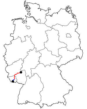
The federal highway 41 (abbreviation: B 41 ) is a federal highway in Saarland and Rhineland-Palatinate with a total length of about 140 kilometers. It connects Saarbrücken with the federal motorway 61 near Bad Kreuznach .
The federal road 41 can be seen as an extension of the French Route nationale 3 . At the Goldene Bremm border crossing , it changes from Rue du Roussillon (Gem. Stiring-Wendel ) to Saarbrücken city area and becomes Metzer Straße (road to Metz) there. The memorial for those persecuted by the National Socialists is located directly on the border .
State of development
The B 41 has two lanes, partly three in Saarland and three or four lanes between the A 62 and A 61 .
Sections developed as a motorway-like road
- Between the St. Wendel - Niederlinxweiler and Pinsweiler junction . The original plan was to continue this expansion with a bypass of Pinsweiler, Hirstein, Wolfersweiler and Nohfelden to the A 62 ( Birkenfeld junction ). Some of the further construction has already begun, as can be seen from a functionless bridge west of Wolfersweiler . After parts of the Rosenwald in the Hoppstädten-Weiersbach district were declared a nature reserve, construction work could no longer be continued. The Wolfersweiler and Ottweiler bypasses and the section between Wolfersweiler and the A 62 are in the federal traffic route plan , classified as an urgent requirement. In Ottweiler, however, resistance has formed against the planned project, which intends to let the route continue to run through the city and founded a citizens' initiative that advocates a new, more western bypass of the city. Between Birkenfeld and the St. Wendel-Winterbach junction, it runs together with federal highway 269 .
- At 700 m between Bad Sobernheim Ost and Steinhardt, it has four lanes with a seven percent gradient.
- The 20 km long section between Waldböckelheim and the A 61 .
- In the area of the nearby Waldböckelheim route, the State Office for Mobility (LBM) Rhineland-Palatinate carried out a traffic study on the plan-free expansion of the accident-prone exit Waldböckelheim-West and merging of the exit Mitte and West. Later on, the B 41 will eventually be expanded to four lanes on this nearby route. In the village, however, resistance to the planned project has arisen and a citizens' initiative has been founded to promote a new, more northerly four-lane route further away from the village, which is already in the further requirements of the Federal Transport Infrastructure Plan. The first construction phase has now been completed and connects Waldböckelheim in the north to the B 41 via roundabouts. The renovation in the west of Waldböckelheim is currently still in the planning stage.
- In addition, a traffic survey for the two-lane construction of the bypasses Hochstetten and Martinstein was carried out by the Landesbetrieb Mobility Rlp. Both projects are urgently required by the Federal Transport Infrastructure Plan.
- In addition to the four-lane expansion of the Neunkirchen bypass, the two-lane new construction of the Niederbrombach, Oberbrombach and Rötsweiler bypasses are also needed in the federal transport route plan.
Replaced by highways
- between Saarbrücken-Ludwigspark and AD Friedrichsthal ( A 623 ) and on to junction Neunkirchen-Spiesen ( A 8 )
Truck toll
On August 1, 2012, the truck toll was introduced on the section between Bad Kreuznach and the A 61.
Nahe development
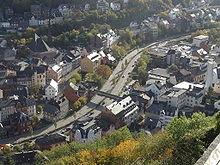
One of the most striking (and best-known) sections of the road is the Nahe overbuilding (Nahe high road) ⊙ in Idar-Oberstein , which began in 1980 and opened on September 24, 1986.
Fire in the Blücher seam
After the near-day coal seams of the Blücher seam were cut during the construction of the B 41 as a bypass road west of Neunkirchen, the coal-bearing layer ignited due to the ingress of oxygen. The fire started in the 1990s to the west of the intersection of the B 41 and L 124 (Westspange). It has been deleted since the end of October 2012.
Renovation and gradation to the country road
The former eastern part of the B 41 in Rheinhessen from Bad Kreuznach to Ingelheim am Rhein , which has had no direct connection to the new section of the B 41 leading around Gensingen to the A 61, was redeveloped from October to December 2014 State road graded. The background to the gradation is a longstanding demand by the federal government because of the parallel A 60.
See also
Web links
Individual evidence
- ↑ Internet presence of the “Bürgerinitiative B 41 -So nicht!” (No longer available online.) Archived from the original on August 22, 2011 ; Retrieved December 12, 2011 .
- ↑ K. Kohm, W. Kieren, G. Böckling: Traffic investigation B 41 / L 234 / L 108 Waldböckelheim 2005 . Ed .: VERTEC engineers. Koblenz April 2006 ( lbm.rlp.de [PDF; accessed on December 12, 2011] Study commissioned by the Rhineland-Palatinate State Mobility Office). PDF at lbm.rlp.de ( Memento from November 16, 2016 in the Internet Archive )
- ↑ Internet presence of the citizens' initiative BI-B41 Yes! Retrieved on December 12, 2011 (for the new construction of a remote route of the B 41).
- ^ K. Kohm, W. Kieren, G. Böckling: Verkehrsuntersprüfung B 41 Hochstetten - Martinstein update 2005 . Ed .: VERTEC engineers. Koblenz April 2006 ( online at lbm.rlp.de [PDF; 3.6 MB ; Retrieved on December 12, 2011] Study commissioned by the Rhineland-Palatinate State Mobility Office). Online at lbm.rlp.de ( Memento from March 7, 2016 in the Internet Archive )
- ↑ Truck tolls on five federal highways in Rhineland-Palatinate should start in August ( Memento from November 11, 2012 in the Internet Archive ); in Rhein Main Presse on February 15, 2012
- ↑ http://www.volksfreund.de/nachrichten/region/rheinlandpfalz/rheinlandpfalz/Heute-im-Trierischen-Volksfreund-Betonsarg-auf-dem-Fluss;art806,1052289
- ↑ Announcement by the Rhineland-Palatinate State Mobility Office from October 2014 ( memento from January 29, 2015 in the Internet Archive )


