
Birkenfeld district
| coat of arms | Germany map |
|---|---|

|

Coordinates: 49 ° 43 ' N , 7 ° 17' E |
| Basic data | |
| State : | Rhineland-Palatinate |
| Administrative headquarters : | Birch field |
| Area : | 776.58 km 2 |
| Residents: | 80,951 (Dec 31, 2019) |
| Population density : | 104 inhabitants per km 2 |
| License plate : | BIR |
| Circle key : | 07 1 34 |
| NUTS : | DEB15 |
| Circle structure: | 96 parishes |
| Address of the district administration: |
Schneewiesenstrasse 25 55765 Birkenfeld |
| Website : | |
| District Administrator : | Matthias Schneider ( CDU ) |
| Location of the district of Birkenfeld in Rhineland-Palatinate | |
  |
|
The Birkenfeld district is a regional authority in Rhineland-Palatinate . The seat of the district administration is the city of Birkenfeld . The most populous municipality is the association-free city of Idar-Oberstein , where most of the public institutions are based, such as the district court , the tax office, the health department, the job center and the district savings bank . Since 2015 the corporation has been entitled National Park District.
geography
location
The Nahe flows from west to east through the southern part of the Birkenfeld district. The area north of the river is determined by the Hunsrück low mountain range , the highest point of which is the Erbeskopf at 816 m above sea level. NHN is. In the southern district area, Westrich , is the Baumholder military training area , where 14 communities with around 4,000 inhabitants had to be relocated.
Neighboring areas
The district borders in a clockwise direction in the west, beginning with the districts of Trier-Saarburg , Bernkastel-Wittlich , Rhein-Hunsrück-Kreis , Bad Kreuznach and Kusel (all in Rhineland-Palatinate). In the south it borders on the district of St. Wendel (in Saarland ).
history

Historically, the Nahe is the borderline between two regions: Birkenfeld north of the Nahe and Lichtenberg south of the river. The region belonged to different dominions until the end of the 18th century, then to France . After the Congress of Vienna in 1815, the mayor's offices on the left of the Nahe became a Principality of Birkenfeld , which belonged to the Grand Duchy of Oldenburg ; Lichtenberg, on the other hand, became the Duchy of Saxe-Coburg-Saalfeld , from 1826 Saxe-Coburg-Gotha . Both states thus had an exclave west of the Rhine. In 1834 this principality of Lichtenberg was sold to Prussia , which made the area into the district of Sankt Wendel . The Principality of Birkenfeld, which was formally dissolved with the end of the monarchy and the resignation of the Oldenburg Grand Duke, initially remained a part of the now Free State of Oldenburg .
After the First World War , the southern part of the Sankt Wendel district was added to the Saar area , and the part remaining with Prussia was henceforth called the Sankt Wendel-Baumholder district . As part of the Greater Hamburg Act , the Oldenburg region of Birkenfeld was transferred to the State of Prussia on April 1, 1937, which incorporated it into the Rhine Province under the name of “District Birkenfeld” and united it with the remainder of the Sankt Wendel-Baumholder district.
On July 18, 1946, the French military government took over the communities of Bosen , Eckelhausen , Eisen , Eiweiler , Gehweiler , Gonnesweiler , Grügelborn , Hirstein , Leitersweiler , Mosberg-Richweiler , Neunkirchen , Reitscheid , Schwarzenbach , Selbach , Sötern , Steinberg -deckehardt , Türkismühle and Walhausen reclassified from the Birkenfeld district to the St. Wendel district in Saarland . On June 7, 1947, the communities Asweiler-Eitzweiler , Freisen , Haupersweiler , Nohfelden , Oberkirchen , Schwarzerden and Wolfersweiler were reclassified from the Birkenfeld district to the St. Wendel district.
On June 7, 1969, the Birkenfeld district joined the communities of Pfeffelbach , Reichweiler , Ruthweiler , Thallichtenberg , Buborn , Deimberg , Grumbach , Hausweiler , Herren-Sulzbach , Homberg , Kappeln , Kirrweiler , Langweiler , Merzweiler , Niederalben , Niedereisenbach , Offenbach am Glan , Unterjeckenbach and Wiesweiler to the district of Kusel and the community of Kirnsulzbach to the district of Bad Kreuznach. At the same time he received the communities Allenbach , Asbach , Bollenbach , Bruchweiler , Gösenroth , Hausen , Hellertshausen , Horbruch , Hottenbach , Kempfeld , Krummenau , Oberkirn , Rhaunen , Schauren , Schwerbach , Sensweiler , Stipshausen , Sulzbach , Weitersbach and Wirschweiler-Langweiler of the dissolved district of Bernkastel and the community of Börfink-Muhl of the dissolved district of Trier . The latter gave the district Muhl to the community Neuhütten in the district of Trier-Saarburg on November 7, 1970 .
In 1994, by the Rhineland-Palatinate "State Law on the Dissolution of the Gutsbezirks Baumholder and its municipal reorganization" of November 2, 1993 (GVBl. P. 518), parts of the Baumholder military training area , including the former districts of Ilgesheim and Oberjeckenbach , were removed from the Birkenfeld district reclassified to the district of Kusel.
Population development
| year | Residents | source |
|---|---|---|
| 1939 | 90.397 | |
| 1950 | 77,633 | |
| 1960 | 93,000 | |
| 1970 | 93,600 | |
| 1980 | 87,300 | |
| 1990 | 86,900 | |
| 2000 | 90,300 | |
| 2010 | 83,243 | |
| 2016 | 80,799 |
politics
District administrators
- Herbert Wild , NSDAP (1937 to 1945)
- Valentin Eibes , NSDAP (1945, from March 12th to 17th)
- Karl Nieten (1945 to 1946)
- Jakob Heep , SPD (1946 to 1956)
- Walter Beyer , SPD (1957 to 1982)
- Ernst Theilen , SPD (1982 to 1994)
- Wolfgang Hey , SPD (1995 to 2003)
- Axel Redmer , SPD (2003 to 2011)
- Matthias Schneider , CDU (from 2011)
In the direct election on August 26, 2018, Matthias Schneider was confirmed in his office for a further eight years with a share of the vote of 59.25%.
District council
The district council of the Birkenfeld district consists of 42 elected members and the district administrator as chairman. After the last district election on May 26, 2019 , the following distribution of seats results:
| Parties and constituencies |
% 2019 |
Seats 2019 |
% 2014 |
Seats 2014 |
% 2009 |
Seats 2009 |
% 2004 |
Seats 2004 |
|
| CDU | Christian Democratic Union of Germany | 30.3 | 12 | 34.6 | 14th | 30.5 | 13 | 41.8 | 18th |
| SPD | Social Democratic Party of Germany | 29.9 | 12 | 35.9 | 15th | 37.1 | 16 | 37.3 | 16 |
| GREEN | Alliance 90 / The Greens | 10.9 | 5 | 5.0 | 2 | - | - | - | - |
| FLKB | Free list of the district of Birkenfeld | 9.2 | 4th | 6.6 | 3 | 8.6 | 3 | 4.8 | 2 |
| FDP | Free Democratic Party | 9.1 | 4th | 6.3 | 3 | 13.8 | 6th | 9.3 | 4th |
| LUB | List of independent citizens of the Birkenfeld district association | 6.3 | 3 | 5.2 | 2 | 4.3 | 2 | 4.2 | 2 |
| THE LEFT. | The left | 4.3 | 2 | 4.6 | 2 | 5.7 | 2 | - | - |
| AfD | Alternative for Germany | - | - | 1.7 | 1 | - | - | - | - |
| Other | Other | - | - | - | - | - | - | 2.5 | 0 |
| total | 100.0 | 42 | 100.0 | 42 | 100.0 | 42 | 100.0 | 42 | |
| Voter turnout in% | 56.8 | 52.8 | 50.5 | 53.6 | |||||
badges and flags

The Birkenfeld district has a coat of arms and a flag.
|
|
Blazon : “ Box of red and silver; topped with a red tongued, gold crowned and gold armored blue lion. "
The coat of arms was awarded on July 28, 1949. |
| Reasons for the coat of arms: The chess pattern refers to the rear county of Sponheim , the lion to the county of Veldenz . The coat of arms of the district only contains elements of the medieval territorial structure, with no insignia of the rulers of the Wild and Rhine Counties. There is no reference to the over 150-year membership of the majority of the district of Oldenburg in modern times. |
Economy and Transport
In the Future Atlas 2016 , the district of Birkenfeld was ranked 337 out of 402 districts and urban districts in Germany, making it one of the districts with "future risks".
traffic
The federal motorway 62 touches the south of the district area . Several federal, state and district roads run through the district, including the B 41 and the B 422 .

In the Nahe Valley, the Rhein-Nahe Railway Company opened a railway line from Bad Kreuznach to Idar-Oberstein in 1859, which was continued in the direction of Saarbrücken in the following year. The Birkenfelder Lokalbahn GmbH established the connection to the district town from the Neubrücke station in 1880 . A railway connection (branch line / branch line) from Heimbach (railway station: near and outside the actual local community Heimbach) to Baumholder with its military training area was built in 1912 by the Prussian State Railways. Passenger traffic on both routes was discontinued in 1962 (Birkenfeld Local Railway) and 1981 (the railway connection to Baumholder). The route to Baumholder was reactivated in 2014 when the timetable changed.
The so-called Hunsrückquerbahn runs through the Horbruch district , and can no longer be operated for the time being due to high investment requirements.
The municipality of Rhaunen is in the immediate vicinity of Hahn Airport .
cities and communes
(Residents on December 31, 2019)
- Idar-Oberstein , large district town (28,520)
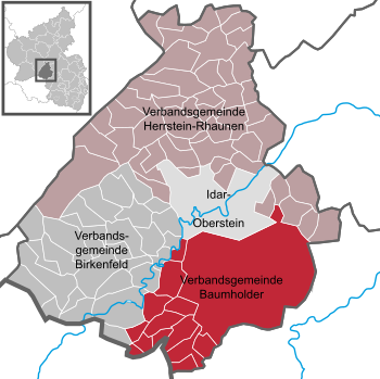
Association municipalities with their association members:

- Former parishes
- The municipalities of Aulenbach , Ausweiler , Breungenborn , Ehlenbach , Erzweiler , Frohnhausen , Grünbach , Ilgesheim , Kefersheim , Mambächel , Oberjeckenbach , Ronnenberg , Wickenhof and Wieselbach were dissolved at the end of the 1930s for the construction of the Baumholder military training area; on January 1, 1978 also the municipality of Zaubach .
- The parish Sienerhöfe was incorporated into the parish of Sien on April 1, 1939.
- The community of Gollenberg-Ellenberg was split into its two components on May 1, 1952.
- The municipality of Elchweiler-Schmißberg was split into its two components in 1962.
- The communities Enzweiler , Göttschied , Hammerstein and Regulshausen were incorporated into the city of Idar-Oberstein on June 7, 1969.
- The communities Georg-Weierbach , Kirchenbollenbach , Mittelbollenbach , Nahbollenbach and Weierbach were incorporated into the town of Idar-Oberstein on November 7, 1970.
For lists of the term "area changes" see area reforms in Rhineland-Palatinate
License Plate
On July 1, 1956, the district was assigned the distinctive sign BIR when the vehicle registration number that is still valid today was introduced . It is still issued today.
literature
- Ulrike Weber-Karge, Maria Wenzel (edit.): District of Birkenfeld (= cultural monuments in Rhineland-Palatinate. Monument topography Federal Republic of Germany . Volume 11 ). Wernersche Verlagsgesellschaft, Worms 1993, ISBN 3-88462-099-1 .
Web links
|
Further content in the sister projects of Wikipedia:
|
||
|
|
Commons | - multimedia content |
- Website of the district of Birkenfeld
- Statistical data for the district of Birkenfeld from the State Statistical Office of Rhineland-Palatinate
- Literature from and about the Birkenfeld district in the catalog of the German National Library
- Literature on the Birkenfeld district in the Rhineland-Palatinate state bibliography
Individual evidence
- ↑ State Statistical Office of Rhineland-Palatinate - population status 2019, districts, communities, association communities ( help on this ).
- ↑ - ( Memento of the original from January 6, 2017 in the Internet Archive ) Info: The archive link was inserted automatically and has not yet been checked. Please check the original and archive link according to the instructions and then remove this notice.
- ^ First implementing ordinance to the law on Greater Hamburg and other territorial consolidations (Greater Hamburg Act) of February 15, 1937
- ↑ Official Gazette of the Saar Regional Council , year 1946, No. 32, p. 131: "Connection of municipalities to the Délégation Supérieure de la Sarre" of July 18, 1946 ( Saarland University )
- ^ Official Journal of the French High Command in Germany , year 1947, edition 77, p. 768. Order No. 215 of June 7, 1947: “Connection of communities to the Merzig-Wadern and St. Wendel districts” ( German National Library ( Memento des Originals from February 15, 2015 in the Internet Archive ) Info: The archive link was automatically inserted and not yet checked. Please check the original and archive link according to the instructions and then remove this note. )
- ↑ Official municipality directory (= State Statistical Office of Rhineland-Palatinate [Hrsg.]: Statistical volumes . Volume 407 ). Bad Ems February 2016, p. 155 (PDF; 2.8 MB).
- ↑ for comparison of maps: old community boundary map: Walther Hubatsch (ed.): Outline of German administrative history 1815–1945, Volume 7, Marburg / Lahn, 1978, map annex 8; New community boundary map: Landesvermessungsamt Rhineland-Palatinate, Rhineland-Palatinate (ed.): Overview map with community boundaries, edition B, ISBN 3-89637-316-1
- ^ A b c Michael Rademacher: German administrative history from the unification of the empire in 1871 to the reunification in 1990. birkenfeld.html. (Online material for the dissertation, Osnabrück 2006).
- ↑ Statistical Yearbook for the Federal Republic of Germany 1972
- ↑ Statistical Yearbook for the Federal Republic of Germany 1981
- ↑ Statistical Yearbook for the Federal Republic of Germany 1992
- ↑ Statistical Yearbook for the Federal Republic of Germany 2002
- ^ Süddeutsche Zeitung: Schneider wins district election in Birkenfeld. August 26, 2018, accessed December 2, 2019 .
- ↑ https://www.wahlen.rlp.de/de/kw/wahlen//kk/verbindungen/1340000000.html
- ^ The Regional Returning Officer RLP: District Birkenfeld. Final result of the 2019 district council election. Accessed August 10, 2019 .
- ↑ Future Atlas 2016. (No longer available online.) Archived from the original on October 2, 2017 ; accessed on March 23, 2018 . Info: The archive link was inserted automatically and has not yet been checked. Please check the original and archive link according to the instructions and then remove this notice.
- ↑ Local rail transport south, reactivation of the Baumholder-Heimbach line is coming in 2014 ( memento of the original from April 7, 2012 in the Internet Archive ) Info: The archive link was automatically inserted and not yet checked. Please check the original and archive link according to the instructions and then remove this notice.
- ↑ State Statistical Office of Rhineland-Palatinate - population status 2019, districts, communities, association communities ( help on this ).
Districts:
Ahrweiler |
Altenkirchen (Westerwald) |
Alzey-Worms |
Bad Dürkheim |
Bad Kreuznach |
Bernkastel-Wittlich |
Birkenfeld |
Cochem cell |
Donnersbergkreis |
Eifelkreis Bitburg-Prüm |
Germersheim |
Kaiserslautern |
Kusel |
Mainz-Bingen |
Mayen-Koblenz |
Neuwied |
Rhine-Hunsrück District |
Rhein-Lahn district |
Rhine-Palatinate District |
Southern Wine Route |
Southwest Palatinate |
Trier-Saarburg |
Vulkaneifel |
Westerwaldkreis
Independent cities:
Frankenthal (Pfalz) |
Kaiserslautern |
Koblenz |
Landau in the Palatinate |
Ludwigshafen am Rhein |
Mainz |
Neustadt an der Weinstrasse |
Pirmasens |
Speyer |
Trier |
Worms |
Zweibrücken