
Berschweiler at Baumholder
| coat of arms | Germany map | |
|---|---|---|

|
Coordinates: 49 ° 35 ' N , 7 ° 18' E |
|
| Basic data | ||
| State : | Rhineland-Palatinate | |
| County : | Birch field | |
| Association municipality : | Baumholder | |
| Height : | 435 m above sea level NHN | |
| Area : | 6.64 km 2 | |
| Residents: | 524 (Dec. 31, 2019) | |
| Population density : | 79 inhabitants per km 2 | |
| Postal code : | 55777 | |
| Area code : | 06783 | |
| License plate : | BIR | |
| Community key : | 07 1 34 008 | |
| LOCODE : | DE B7Z | |
| Association administration address: | Am Weiherdamm 1 55774 Baumholder |
|
| Website : | ||
| Local Mayor : | Rouven lever | |
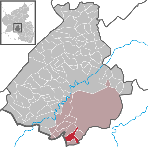
| Location of the local community of Berschweiler near Baumholder in the Birkenfeld district | ||
  |
||

Berschweiler bei Baumholder is a municipality in the Birkenfeld district in Rhineland-Palatinate . It belongs to the Baumholder community .
geography
Berschweiler belongs to the Westrich . To the north is Fohren-Linden , east Mettweiler , south Eckersweiler and west is Rohrbach .
Berschweiler also includes the residential areas Im Hahn, Hof Am Forst and Zollhaus.
history
Until the end of the 18th century, the place belonged to the part of the Duchy of Palatinate-Zweibrücken, which originated in the county of Veldenz , and was the main place of a mayor's workshop , which was subordinate to the Oberamt Lichtenberg . In addition to Berschweiler, the Berschweiler Schultheisserei included the villages of Berglangenbach , Bleiderdingen , Eckersweiler , Fohren , Freisen , Heimbach , Hoppstädten , Leitzweiler , Linden , Mettweiler , Rohrbach , Rückweiler and Weiersbach as well as the "Haus Werdenstein". In 1790 44 families lived in the village. The district of Berschweiler comprised 663 hectares .
In 1794 the Left Bank of the Rhine was taken by French revolutionary troops. From 1798 to 1814 Berschweiler belonged to the canton Baumholder in the Saardepartement . Due to the agreements reached at the Congress of Vienna (1815), the region came to the Saxon-Coburg principality of Lichtenberg in 1816 , to which it belonged until 1834. Berschweiler was temporarily the seat of a mayor's office, from 1823 the community belonged to the mayor's office of Burglichtenberg. After the sale to Prussia and the dissolution of the Principality of Lichtenberg, Berschweiler came to the newly established St. Wendel district in the Rhine province . Berschweiler has been part of the Birkenfeld district since 1937 and part of the state of Rhineland-Palatinate since 1946 .
- Population development
The development of the population of Berschweiler bei Baumholder, the values from 1871 to 1987 are based on censuses:
|
|
politics
Municipal council
The council in Berschweiler in Baumholder consists of twelve council members, who in the local elections on May 26, 2019 in a majority vote were elected, and the honorary mayor as chairman.
coat of arms
The blue lion refers to the former belonging to the county of Veldenz .
Culture and sights
Buildings
see list of cultural monuments in Berschweiler near Baumholder
societies
In addition to the gymnastics and sports club (SG Unnertal) and the volunteer fire brigade, there is also a shooting club that can already boast some successes on a national level. Many other associations and clubs offer the opportunity to get active together with other residents.
Economy and Infrastructure
traffic
Due to its location on the motorway slip road to the A 62, the place has very good transport links. Both Kaiserslautern , Trier and Saarbrücken can be reached in less than an hour.
education
In addition to a primary school, there is also a kindergarten in Berschweiler. Both are right next to the sports facilities, so that the football field and multi-purpose hall can be used.
Other public institutions
There is also a village community center near the sports facilities, which also houses the local fire brigade. There is also a Protestant community house.
Leisure and sports facilities
The local community has two soccer fields. A Rote-Erde-Platz on the Bornberg is located just outside the village and a lawn in the Berggrube district.
There is also a multi-purpose hall with a small-bore shooting range.
Web links
- Local community Berschweiler near Baumholder
- Local community Berschweiler bei Baumholder on the website of the Baumholder community
- In this country: main street in Berschweiler. State show Rhineland-Palatinate, SWR television, July 11, 2014
- Literature about Berschweiler at Baumholder in the Rhineland-Palatinate state bibliography
Individual evidence
- ↑ State Statistical Office of Rhineland-Palatinate - population status 2019, districts, communities, association communities ( help on this ).
- ↑ State Statistical Office Rhineland-Palatinate (ed.): Official directory of the municipalities and parts of the municipality. Status: January 2019 [ Version 2020 is available. ] . S. 28 (PDF; 3 MB).
- ^ Wilhelm Fabricius : Explanations for the Historical Atlas of the Rhine Province. The map from 1789. (2nd volume). Bonn 1898. p. 400.
- ↑ State Statistical Office Rhineland-Palatinate: My village, my city. Retrieved September 9, 2019 .
- ^ The Regional Returning Officer Rhineland-Palatinate: Local elections 2019, city and municipal council elections. Retrieved September 9, 2019 .

Adventure | Achtelsbach | Allenbach | Asbach | Baumholder | Mountains | Berglangenbach | Berschweiler at Baumholder | Berschweiler near Kirn | Birkenfeld | Bollenbach | Börfink | Breitenthal | Bruchweiler | Bridges | Buhlenberg | Bundenbach | Dambach | Dickesbach | Dienstweiler | Eckersweiler | Elkweiler | Ellenberg | Ellweiler | Fischbach | Fohren-Linden | Frauenberg | Gerach | Gimbweiler | Gollenberg | Gösenroth | Griebelschied | Hahnweiler | Hattgenstein | Hausen | Heimbach | Hellertshausen | Herborn | Herrstein | Hettenrodt | Hintertiefenbach | Hoppstädten-Weiersbach | Horbruch | Hottenbach | Idar-Oberstein | Kempfeld | Kirschweiler | Kronweiler | Krummenau | Boring | Leisel | Leitzweiler | Mackenrodt | Meckenbach | Mettweiler | Mittelreidenbach | Mörschied | Niederbrombach | Niederhambach | Niederhosenbach | Niederwörresbach | Nohen | Oberbrombach | Oberhambach | Oberhosenbach | Upper brain | Oberreidenbach | Oberwörresbach | Reichenbach | Rhaunen | Rimsberg | Rinzenberg | Rohrbach | Rötsweiler-Nockenthal | Rückweiler | Ruschberg | Showers | Schmidthachenbach | Schmissberg | Schwerbach | Swelling | Sensweiler | Sien | Sienhachenbach | Siesbach | Sonnenberg-Winnenberg | Sonnschied | Stipshausen | Sulzbach | Veitsrodt | Vollmersbach | Pastures | Weitersbach | Wickenrodt | Wilzenberg-Hussweiler | Wirschweiler