
Wirschweiler
| coat of arms | Germany map | |
|---|---|---|

|
Coordinates: 49 ° 46 ' N , 7 ° 10' E |
|
| Basic data | ||
| State : | Rhineland-Palatinate | |
| County : | Birch field | |
| Association municipality : | Herrstein-Rhaunen | |
| Height : | 550 m above sea level NHN | |
| Area : | 10.26 km 2 | |
| Residents: | 295 (Dec. 31, 2019) | |
| Population density : | 29 inhabitants per km 2 | |
| Postal code : | 55758 | |
| Area code : | 06786 | |
| License plate : | BIR | |
| Community key : | 07 1 34 095 | |
| Association administration address: | Brühlstrasse 16 55756 Herrstein |
|
| Website : | ||
| Local Mayor : | Erich Paulus | |
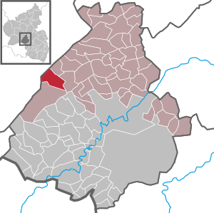
| Location of the local community Wirschweiler in the Birkenfeld district | ||
  |
||

Wirschweiler is a municipality in the Birkenfeld district in Rhineland-Palatinate . It belongs to the Herrstein-Rhaunen community .

geography
Wirschweiler is located in the Saar-Hunsrück Nature Park between Allenbach and Sensweiler . 69 percent of the district area is forested. The Klarebacherhof and Wirschweiler Mühle residential areas also belong to Wirschweiler. Wirschweiler is a national park municipality in the Hunsrück-Hochwald National Park .
history
The place was certainly mentioned in 1148 as "Wernzvilre". A document from the year 975, which calls a "Werriswillero", the authenticity is questioned. In the Middle Ages the community belonged to the Hinteren Grafschaft Sponheim . After the French Revolution it was part of the Saar department . In 1815 Wirschweiler was added to Prussia .
On June 7, 1969, the municipality of Wirschweiler-Langweiler was transformed into the district of Langweiler with 325 inhabitants to Sensweiler , from which an independent municipality was formed in 1992. On May 1, 1970, the community of Wirschweiler-Langweiler was renamed Wirschweiler.
Population development
The development of the population of Wirschweiler, the values from 1871 to 1987 are based on censuses:
|
|
politics
Municipal council
The local council in Wirschweiler consists of six council members, who were elected by a majority vote in the local elections on May 26, 2019 , and the honorary local mayor as chairman.
mayor
Erich Paulus is the local mayor of Wirschweiler. Since there were no applicants in the direct election on May 26, 2019, the election of the mayor was incumbent on the council in accordance with the municipal regulations. He confirmed Paul in his office on July 16, 2019.
coat of arms
|
|
Blazon : "Shield divided by half a golden oblique left-hand shaft bar, a blue-tongued golden lion's body to the left in red, behind red-silver shaft." |
| Foundation of the coat of arms: The wavy bar indicates the Grenzbach (Gladenbach) between Wirschweiler and Sensweiler (rear county of Sponheim and Wild and Rhine county). The lion's trunk symbolizes the property of the Wild and Rhine Graef on the other side of the Gladenbach. The rear part of the shield refers to the former belonging to the Hinteren Grafschaft Sponheim . |
Attractions
Web links
- Local community Wirschweiler on the website of the Herrstein-Rhaunen community
- Literature about Wirschweiler in the Rhineland-Palatinate state bibliography
Individual evidence
- ↑ a b State Statistical Office of Rhineland-Palatinate - population status 2019, districts, municipalities, association communities ( help on this ).
- ↑ State Statistical Office Rhineland-Palatinate (ed.): Official directory of the municipalities and parts of the municipality. Status: January 2020. S. 30 (PDF; 1 MB).
- ↑ Official municipality directory 2006 ( Memento from December 22, 2017 in the Internet Archive ) (= State Statistical Office Rhineland-Palatinate [Hrsg.]: Statistical volumes . Volume 393 ). Bad Ems March 2006, p. 196, 205 (PDF; 2.6 MB). Info: An up-to-date directory ( 2016 ) is available, but in the section "Territorial changes - Territorial administrative reform" it does not give any population figures.
- ↑ State Statistical Office Rhineland-Palatinate - regional data
- ^ The Regional Returning Officer Rhineland-Palatinate: Local elections 2019, city and municipal council elections
- ^ The Regional Returning Officer Rhineland-Palatinate: direct elections 2019. see Herrstein-Rhaunen, Verbandsgemeinde, penultimate line of results. Retrieved August 27, 2020 .

Adventure | Achtelsbach | Allenbach | Asbach | Baumholder | Mountains | Berglangenbach | Berschweiler at Baumholder | Berschweiler near Kirn | Birkenfeld | Bollenbach | Börfink | Breitenthal | Bruchweiler | Bridges | Buhlenberg | Bundenbach | Dambach | Dickesbach | Dienstweiler | Eckersweiler | Elkweiler | Ellenberg | Ellweiler | Fischbach | Fohren-Linden | Frauenberg | Gerach | Gimbweiler | Gollenberg | Gösenroth | Griebelschied | Hahnweiler | Hattgenstein | Hausen | Heimbach | Hellertshausen | Herborn | Herrstein | Hettenrodt | Hintertiefenbach | Hoppstädten-Weiersbach | Horbruch | Hottenbach | Idar-Oberstein | Kempfeld | Kirschweiler | Kronweiler | Krummenau | Boring | Leisel | Leitzweiler | Mackenrodt | Meckenbach | Mettweiler | Mittelreidenbach | Mörschied | Niederbrombach | Niederhambach | Niederhosenbach | Niederwörresbach | Nohen | Oberbrombach | Oberhambach | Oberhosenbach | Upper brain | Oberreidenbach | Oberwörresbach | Reichenbach | Rhaunen | Rimsberg | Rinzenberg | Rohrbach | Rötsweiler-Nockenthal | Rückweiler | Ruschberg | Showers | Schmidthachenbach | Schmissberg | Schwerbach | Swelling | Sensweiler | Sien | Sienhachenbach | Siesbach | Sonnenberg-Winnenberg | Sonnschied | Stipshausen | Sulzbach | Veitsrodt | Vollmersbach | Pastures | Weitersbach | Wickenrodt | Wilzenberg-Hussweiler | Wirschweiler