
Oberwörresbach
| coat of arms | Germany map | |
|---|---|---|

|
Coordinates: 49 ° 47 ' N , 7 ° 19' E |
|
| Basic data | ||
| State : | Rhineland-Palatinate | |
| County : | Birch field | |
| Association municipality : | Herrstein-Rhaunen | |
| Height : | 346 m above sea level NHN | |
| Area : | 1.4 km 2 | |
| Residents: | 116 (December 31, 2019) | |
| Population density : | 83 inhabitants per km 2 | |
| Postal code : | 55758 | |
| Area code : | 06785 | |
| License plate : | BIR | |
| Community key : | 07 1 34 067 | |
| Association administration address: | Brühlstrasse 16 55756 Herrstein |
|
| Website : | ||
| Local Mayor : | Olaf Crummenauer | |
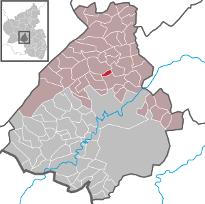
| Location of the local community of Oberwörresbach in the Birkenfeld district | ||
  |
||

Oberwörresbach is a municipality in the Birkenfeld district in Rhineland-Palatinate . It belongs to the Herrstein-Rhaunen community .
geography
The village is located on the Wörresbach between the southern edge of the Hunsrück and the volcanic mountains of the upper Nahe . In the east, Oberwörresbach borders on Herrstein . Niederwörresbach is located in the south-east, Herborn in the south-west and Mörschied in the north-west .
The Gutenbacher Hof and Maierhof residential areas also belong to Oberwörresbach .
Population development
The development of the population of Oberwörresbach, the values from 1871 to 1987 are based on censuses:
|
|
politics
Municipal council
The council in Oberwörresbach consists of six council members, who in the local elections on May 26, 2019 in a majority vote were elected, and the honorary mayor as chairman.
mayor
Olaf Crummenauer became the local mayor of Oberwörresbach on July 10, 2019. Since there was no candidate in the direct election on May 26, 2019, the new election of the mayor was incumbent on the council, which opted for Crummenauer, in accordance with the municipal regulations.
Crummenauer's predecessor as local mayor was Heidemarie Juchum.
coat of arms
The coat of arms, approved by decree of the Ministry of the Interior of April 4, 1963, shows three (2: 1) red, square stones in front in gold, in front of a shield divided to the left, red and silver chess, topped with black three-mountain.
The front part of the shield refers to the court of this family in the community with the colors and stones taken from the coat of arms of the Bailiffs of Hunolstein . The rear part of the shield refers to the former affiliation to the rear county of Sponheim in the Herrstein office.
Economy and Infrastructure
Bundesstraße 41 runs in the southeast . In Fischbach there is a train station on the Bingen – Saarbrücken line . Two bus routes stop in Oberwörresbach. The journeys primarily serve school traffic. A bus runs daily on line 349 to Nahbollenbach , line 351 goes to the school center Vollmersbachstraße in Idar-Oberstein and on to the grammar school on Heinzenwies . The two opposite buses only stop to get out.
Events
- Brämerekirb
Web links
- Local community Oberwörresbach
- Local community Oberwörresbach on the website of the Herrstein-Rhaunen community community
- Literature about Oberwörresbach in the Rhineland-Palatinate state bibliography
Individual evidence
- ↑ a b State Statistical Office of Rhineland-Palatinate - population status 2019, districts, municipalities, association communities ( help on this ).
- ↑ State Statistical Office Rhineland-Palatinate (ed.): Official directory of the municipalities and parts of the municipality. Status: January 2020. S. 29 f . (PDF; 1 MB).
- ↑ State Statistical Office Rhineland-Palatinate - regional data
- ^ The Regional Returning Officer Rhineland-Palatinate: Local elections 2019, city and municipal council elections
- ^ The Regional Returning Officer Rhineland-Palatinate: direct elections 2019. see Herrstein-Rhaunen, Verbandsgemeinde, 34th line of results. Retrieved August 23, 2020 .
- ^ Andreas Nitsch: Local elections in Herrstein. Heidemarie Juchum. In: Nahe newspaper. Mittelrhein-Verlag GmbH, Koblenz, April 10, 2019, accessed on August 23, 2020 .
- ↑ Description of the coat of arms at www.oberwoerresbach.de

Adventure | Achtelsbach | Allenbach | Asbach | Baumholder | Mountains | Berglangenbach | Berschweiler at Baumholder | Berschweiler near Kirn | Birkenfeld | Bollenbach | Börfink | Breitenthal | Bruchweiler | Bridges | Buhlenberg | Bundenbach | Dambach | Dickesbach | Dienstweiler | Eckersweiler | Elkweiler | Ellenberg | Ellweiler | Fischbach | Fohren-Linden | Frauenberg | Gerach | Gimbweiler | Gollenberg | Gösenroth | Griebelschied | Hahnweiler | Hattgenstein | Hausen | Heimbach | Hellertshausen | Herborn | Herrstein | Hettenrodt | Hintertiefenbach | Hoppstädten-Weiersbach | Horbruch | Hottenbach | Idar-Oberstein | Kempfeld | Kirschweiler | Kronweiler | Krummenau | Boring | Leisel | Leitzweiler | Mackenrodt | Meckenbach | Mettweiler | Mittelreidenbach | Mörschied | Niederbrombach | Niederhambach | Niederhosenbach | Niederwörresbach | Nohen | Oberbrombach | Oberhambach | Oberhosenbach | Upper brain | Oberreidenbach | Oberwörresbach | Reichenbach | Rhaunen | Rimsberg | Rinzenberg | Rohrbach | Rötsweiler-Nockenthal | Rückweiler | Ruschberg | Showers | Schmidthachenbach | Schmissberg | Schwerbach | Swelling | Sensweiler | Sien | Sienhachenbach | Siesbach | Sonnenberg-Winnenberg | Sonnschied | Stipshausen | Sulzbach | Veitsrodt | Vollmersbach | Pastures | Weitersbach | Wickenrodt | Wilzenberg-Hussweiler | Wirschweiler