
Ellweiler
| coat of arms | Germany map | |
|---|---|---|

|
Coordinates: 49 ° 37 ' N , 7 ° 9' E |
|
| Basic data | ||
| State : | Rhineland-Palatinate | |
| County : | Birch field | |
| Association municipality : | Birch field | |
| Height : | 358 m above sea level NHN | |
| Area : | 7.46 km 2 | |
| Residents: | 298 (Dec. 31, 2019) | |
| Population density : | 40 inhabitants per km 2 | |
| Postal code : | 55765 | |
| Area code : | 06782 | |
| License plate : | BIR | |
| Community key : | 07 1 34 024 | |
| Association administration address: | Schneewiesenstrasse 21 55765 Birkenfeld |
|
| Website : | ||
| Mayoress : | Ellen Breuer | |
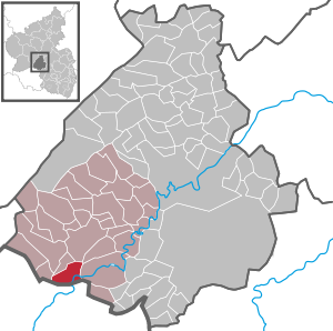
| Location of the local community Ellweiler in the Birkenfeld district | ||
  |
||

Ellweiler is a municipality in the Birkenfeld district in Rhineland-Palatinate . It belongs to the Birkenfeld community .
geography
The place is on the Traunbach in the Black Forest high forest in the Hunsrück near the border with Saarland . 67.6 percent of the district area is forested. To the north is Dambach , in the east Neubrücke and south Nohfelden .
The Haumbach, Neubrücker Mühle and Steinautal residential areas also belong to Ellweiler .
history
Ellweiler was first mentioned in a document in the 12th century. After it had initially belonged to a fiefdom of Kurtrier , it came to the Duchy of Pfalz-Zweibrücken in 1480 .
Population development
The development of the population of Ellweiler, the values from 1871 to 1987 are based on censuses:
|
|
politics
Municipal council
The local council in Ellweiler consists of eight council members, who were elected in the local elections on May 26, 2019 in a majority vote, and the honorary local mayor as chairman. In 2014–2019 there were six council members on the municipal council.
coat of arms
|
|
Blazon : "In a split shield above a red elk shovel in gold, below a red armored, tongued and crowned growing golden lion in black." |
| Justification of the coat of arms: The elk shovel symbolizes the place name and the lion comes from the coat of arms of Pfalz-Zweibrücken. The coat of arms was approved by the Rhineland-Palatinate Ministry of the Interior in 1963 . |
Economy and Infrastructure
The federal highway 41 and the federal highway 62 run in the southeast . In Neubrücke there is a train station on the Bingen – Saarbrücken line .
Uranium ore processing plant in Ellweiler
From 1958 to 1967, uranium ores were extracted from the “Bühlskopf” north of Ellweiler ( ⊙ ) by the “ Brunhilde Union ” in open-cast mining. Smaller uranium deposits were also found 650 m northwest of the Bühlkopf on the northeast slope of "Der Stein", also west of Nohfelden and at Nohfeld Castle. The processing took place in the uranium ore processing plant in Ellweiler .
See also
Web links
- Local community Ellweiler on the website of the Verbandsgemeinde Birkenfeld
- Natrouranospinite (ellweilerite) . In: Mineralienatlas
- Literature about Ellweiler in the Rhineland-Palatinate state bibliography
Individual evidence
- ↑ a b State Statistical Office of Rhineland-Palatinate - population status 2019, districts, municipalities, association communities ( help on this ).
- ↑ State Statistical Office Rhineland-Palatinate (ed.): Official directory of the municipalities and parts of the municipality. Status: January 2018 [ Version 2020 is available. ] . S. 19 (PDF; 2.2 MB).
- ↑ State Statistical Office Rhineland-Palatinate - regional data
- ^ The Regional Returning Officer Rhineland-Palatinate: Local elections 2019, city and municipal council elections
- ↑ H. Schmeltzer: Mineral Fundstellen. Volume 6: Rhineland-Palatinate and Saarland , Ch.Weiss Verlag, Munich 1977

Adventure | Achtelsbach | Allenbach | Asbach | Baumholder | Mountains | Berglangenbach | Berschweiler at Baumholder | Berschweiler near Kirn | Birkenfeld | Bollenbach | Börfink | Breitenthal | Bruchweiler | Bridges | Buhlenberg | Bundenbach | Dambach | Dickesbach | Dienstweiler | Eckersweiler | Elkweiler | Ellenberg | Ellweiler | Fischbach | Fohren-Linden | Frauenberg | Gerach | Gimbweiler | Gollenberg | Gösenroth | Griebelschied | Hahnweiler | Hattgenstein | Hausen | Heimbach | Hellertshausen | Herborn | Herrstein | Hettenrodt | Hintertiefenbach | Hoppstädten-Weiersbach | Horbruch | Hottenbach | Idar-Oberstein | Kempfeld | Kirschweiler | Kronweiler | Krummenau | Boring | Leisel | Leitzweiler | Mackenrodt | Meckenbach | Mettweiler | Mittelreidenbach | Mörschied | Niederbrombach | Niederhambach | Niederhosenbach | Niederwörresbach | Nohen | Oberbrombach | Oberhambach | Oberhosenbach | Upper brain | Oberreidenbach | Oberwörresbach | Reichenbach | Rhaunen | Rimsberg | Rinzenberg | Rohrbach | Rötsweiler-Nockenthal | Rückweiler | Ruschberg | Showers | Schmidthachenbach | Schmissberg | Schwerbach | Swelling | Sensweiler | Sien | Sienhachenbach | Siesbach | Sonnenberg-Winnenberg | Sonnschied | Stipshausen | Sulzbach | Veitsrodt | Vollmersbach | Pastures | Weitersbach | Wickenrodt | Wilzenberg-Hussweiler | Wirschweiler