
Schmissberg
| coat of arms | Germany map | |
|---|---|---|

|
Coordinates: 49 ° 40 ′ N , 7 ° 12 ′ E |
|
| Basic data | ||
| State : | Rhineland-Palatinate | |
| County : | Birch field | |
| Association municipality : | Birch field | |
| Height : | 428 m above sea level NHN | |
| Area : | 1.68 km 2 | |
| Residents: | 216 (Dec. 31, 2019) | |
| Population density : | 129 inhabitants per km 2 | |
| Postal code : | 55765 | |
| Area code : | 06782 | |
| License plate : | BIR | |
| Community key : | 07 1 34 078 | |
| Association administration address: | Schneewiesenstrasse 21 55765 Birkenfeld |
|
| Website : | ||
| Local Mayor : | Thomas Marx | |
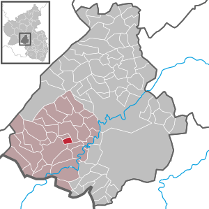
| Location of the Schmißberg community in the Birkenfeld district | ||
  |
||

Schmißberg is a municipality in the Birkenfeld district in Rhineland-Palatinate . It belongs to the Birkenfeld community . In 1969 and 1982 the local community Schmißberg won the silver medal in the village beautification competition "Our village should be more beautiful" (today: "Our village has a future") .
geography
Schmißberg is located in the Hunsrück. The next larger town is the district town of Birkenfeld, about three kilometers to the southwest . Elchweiler is in the north and Rimsberg in the south .
history
Schmißberg was first mentioned in a document in 1438. It was part of the rear county of Sponheim . From 1934 to 1962 Schmißberg and the neighboring Elchweiler were united in the municipality of Elchweiler-Schmißberg .
- Population development
The development of the population of Schmißberg, the values up to 1987 are based on censuses:
|
|
Municipal council
The local council in Schmißberg consists of six council members, who were elected by a majority vote in the local elections on May 26, 2019 , and the honorary local mayor as chairman.
Culture and sights
Hiking trails offer the possibility of a view up to the Erbeskopf ( 816 m above sea level, the highest mountain in Rhineland-Palatinate).
Economy and Infrastructure
In the west runs the federal highway 41 , which leads to the federal highway 62 in the south . The next train stations are in Nohen and Neubrücke / Nahe. The stops are on the railway line from Saarbrücken, Mainz, Wiesbaden to Frankfurt am Main. The nearest airports are Hahn Airport in about 50 kilometers north in the Hunsrück and Frankfurt am Main Airport in around 180 kilometers to the northeast.
See also
Web links
- Internet presence of the local community Schmißberg
- Local community Schmißberg on the website of the Verbandsgemeinde Birkenfeld
- Literature about Schmißberg in the Rhineland-Palatinate state bibliography
Individual evidence
- ↑ a b State Statistical Office of Rhineland-Palatinate - population status 2019, districts, municipalities, association communities ( help on this ).
- ↑ State Statistical Office Rhineland-Palatinate - regional data
- ^ The Regional Returning Officer Rhineland-Palatinate: Local elections 2019, city and municipal council elections

Adventure | Achtelsbach | Allenbach | Asbach | Baumholder | Mountains | Berglangenbach | Berschweiler at Baumholder | Berschweiler near Kirn | Birkenfeld | Bollenbach | Börfink | Breitenthal | Bruchweiler | Bridges | Buhlenberg | Bundenbach | Dambach | Dickesbach | Dienstweiler | Eckersweiler | Elkweiler | Ellenberg | Ellweiler | Fischbach | Fohren-Linden | Frauenberg | Gerach | Gimbweiler | Gollenberg | Gösenroth | Griebelschied | Hahnweiler | Hattgenstein | Hausen | Heimbach | Hellertshausen | Herborn | Herrstein | Hettenrodt | Hintertiefenbach | Hoppstädten-Weiersbach | Horbruch | Hottenbach | Idar-Oberstein | Kempfeld | Kirschweiler | Kronweiler | Krummenau | Boring | Leisel | Leitzweiler | Mackenrodt | Meckenbach | Mettweiler | Mittelreidenbach | Mörschied | Niederbrombach | Niederhambach | Niederhosenbach | Niederwörresbach | Nohen | Oberbrombach | Oberhambach | Oberhosenbach | Upper brain | Oberreidenbach | Oberwörresbach | Reichenbach | Rhaunen | Rimsberg | Rinzenberg | Rohrbach | Rötsweiler-Nockenthal | Rückweiler | Ruschberg | Showers | Schmidthachenbach | Schmissberg | Schwerbach | Swelling | Sensweiler | Sien | Sienhachenbach | Siesbach | Sonnenberg-Winnenberg | Sonnschied | Stipshausen | Sulzbach | Veitsrodt | Vollmersbach | Pastures | Weitersbach | Wickenrodt | Wilzenberg-Hussweiler | Wirschweiler