
Oberbrombach
| coat of arms | Germany map | |
|---|---|---|

|
Coordinates: 49 ° 42 ' N , 7 ° 16' E |
|
| Basic data | ||
| State : | Rhineland-Palatinate | |
| County : | Birch field | |
| Association municipality : | Birch field | |
| Height : | 478 m above sea level NHN | |
| Area : | 6.56 km 2 | |
| Residents: | 394 (Dec. 31, 2019) | |
| Population density : | 60 inhabitants per km 2 | |
| Postal code : | 55767 | |
| Area code : | 06787 | |
| License plate : | BIR | |
| Community key : | 07 1 34 062 | |
| Association administration address: | Schneewiesenstrasse 21 55765 Birkenfeld |
|
| Website : | ||
| Local Mayor : | Rudiger Scherer | |
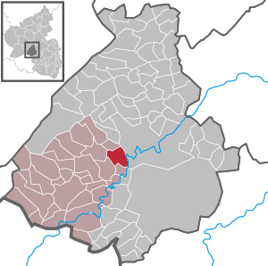
| Location of the local community Oberbrombach in the Birkenfeld district | ||
  |
||

Oberbrombach is a municipality in the Birkenfeld district in Rhineland-Palatinate . It belongs to the Birkenfeld community .
history
Oberbrombach was first mentioned in a document in 1324.
In 1817, Oberbrombach came to the Grand Duchy of Oldenburg as part of the Principality of Birkenfeld . After the First World War, the first gemstone cutters appeared in the village, but their economic prosperity was over by the 1960s. In 1937 Oberbrombach came to the Prussian district of Birkenfeld. After the Second World War, the place belonged to the French zone of occupation and since 1946 to the state of Rhineland-Palatinate . Oberbrombach has been part of the Birkenfeld community since 1973 .
- Population development
The development of the population of Oberbrombach, the values from 1871 to 1987 are based on censuses:
|
|
politics
Municipal council
The council in Oberbrombach consists of eight council members, who in the local elections on May 26, 2019 in a majority vote were elected, and the honorary mayor as chairman. In 2009–2014 the municipality council had twelve council members.
mayor
Local mayor is Rüdiger Scherer.
Economy and Infrastructure
Today the gainfully employed are practically exclusively employed outside of the country. Of the formerly more than 40 full and part-time farms, only two still exist.
The federal road 41 leads through the village . In Idar-Oberstein there is a train station on the Mainz / Bingen – Saarbrücken line .
literature
- Freimut Heiderich: Oberbrombach - history of the place. Published as special issue 55 of the communications of the Association for Local Studies in the Birkenfeld district, ISSN 0341-6992 , Birkenfeld 1989.
See also
Web links
- Local community Oberbrombach on the website of the Verbandsgemeinde Birkenfeld
- Local portrait of SWR television
- Literature about Oberbrombach in the Rhineland-Palatinate state bibliography
Individual evidence
- ↑ a b State Statistical Office of Rhineland-Palatinate - population status 2019, districts, municipalities, association communities ( help on this ).
- ↑ State Statistical Office Rhineland-Palatinate - regional data
- ^ The Regional Returning Officer Rhineland-Palatinate: Local elections 2019, city and municipal council elections

Adventure | Achtelsbach | Allenbach | Asbach | Baumholder | Mountains | Berglangenbach | Berschweiler at Baumholder | Berschweiler near Kirn | Birkenfeld | Bollenbach | Börfink | Breitenthal | Bruchweiler | Bridges | Buhlenberg | Bundenbach | Dambach | Dickesbach | Dienstweiler | Eckersweiler | Elkweiler | Ellenberg | Ellweiler | Fischbach | Fohren-Linden | Frauenberg | Gerach | Gimbweiler | Gollenberg | Gösenroth | Griebelschied | Hahnweiler | Hattgenstein | Hausen | Heimbach | Hellertshausen | Herborn | Herrstein | Hettenrodt | Hintertiefenbach | Hoppstädten-Weiersbach | Horbruch | Hottenbach | Idar-Oberstein | Kempfeld | Kirschweiler | Kronweiler | Krummenau | Boring | Leisel | Leitzweiler | Mackenrodt | Meckenbach | Mettweiler | Mittelreidenbach | Mörschied | Niederbrombach | Niederhambach | Niederhosenbach | Niederwörresbach | Nohen | Oberbrombach | Oberhambach | Oberhosenbach | Upper brain | Oberreidenbach | Oberwörresbach | Reichenbach | Rhaunen | Rimsberg | Rinzenberg | Rohrbach | Rötsweiler-Nockenthal | Rückweiler | Ruschberg | Showers | Schmidthachenbach | Schmissberg | Schwerbach | Swelling | Sensweiler | Sien | Sienhachenbach | Siesbach | Sonnenberg-Winnenberg | Sonnschied | Stipshausen | Sulzbach | Veitsrodt | Vollmersbach | Pastures | Weitersbach | Wickenrodt | Wilzenberg-Hussweiler | Wirschweiler