
Sensweiler
| coat of arms | Germany map | |
|---|---|---|

|
Coordinates: 49 ° 46 ' N , 7 ° 12' E |
|
| Basic data | ||
| State : | Rhineland-Palatinate | |
| County : | Birch field | |
| Association municipality : | Herrstein-Rhaunen | |
| Height : | 517 m above sea level NHN | |
| Area : | 8.43 km 2 | |
| Residents: | 422 (Dec. 31, 2019) | |
| Population density : | 50 inhabitants per km 2 | |
| Postal code : | 55758 | |
| Area code : | 06786 | |
| License plate : | BIR | |
| Community key : | 07 1 34 081 | |
| Association administration address: | Brühlstrasse 16 55756 Herrstein |
|
| Website : | ||
| Local Mayor : | Manfred Werling | |
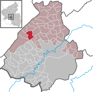
| Location of the local community Sensweiler in the district of Birkenfeld | ||
  |
||

Sensweiler is a municipality in the Birkenfeld district in Rhineland-Palatinate . It belongs to the Herrstein-Rhaunen community . Sensweiler is a state-approved resort .

geography
Sensweiler is located in the upper Idar valley in the Hunsrück . 61.4 percent of the district area is forested. The Sensweiler Mühlen and Waldhof residential areas also belong to Sensweiler. Sensweiler is a national park community in the Hunsrück-Hochwald National Park .
history
Until the end of the 18th century to the Wild and Rhine County and was assigned to the Wildenburg office. The border with the Hinteren Grafschaft Sponheim and the Grafschaft Nassau-Saarbrücken ran south of the village . Even today, the "Dreiherrenstein" reminds of this, which stands at the point where the boundaries of today's local communities of Sensweiler, Hettenrodt , Siesbach and Allenbach meet.
In 1794 the Left Bank of the Rhine was taken by French revolutionary troops. From 1798 to 1814 Sensweiler belonged to the canton of Rhaunen in the Saardepartement . Due to the agreements reached at the Congress of Vienna (1815), the northern part of the previous Saar department, to which Sensweiler also belonged, became part of the Kingdom of Prussia in 1815 . The municipality of Sensweiler belonged to the mayor's office of Wirschweiler in the Bernkastel district, which was newly established in 1816, and from 1822 to the Rhine province . Sensweiler has been part of the state of Rhineland-Palatinate since 1946 .
On June 7, 1969, a part of the municipality Wirschweiler with 325 inhabitants was umgemeindet to Sensweiler. On January 1, 1992, the district of Langweiler with 290 inhabitants was spun off from the community of Sensweiler and an independent local community was formed from it.
Population development
The development of the population of Sensweiler in relation to today's municipal area; the values from 1871 to 1987 are based on censuses:
|
|
politics
Municipal council
The council in Sensweiler consists of eight council members, who in the local elections on May 26, 2019 in a majority vote were elected, and the directly elected honorary mayor as chairman.
mayor
Manfred Werling became the local mayor of Sensweiler on July 22, 2019. In the direct election on May 26, 2019, he was elected for five years with 79.92% of the vote.
Werling's predecessors were Günter Gros, elected in May 2017, who did not run again in 2019, and Horst Schmidt, who resigned in 2016.
Attractions
leisure
- Art workshop and painting school, creative cradle of the WEIBER-ART group
- Campsite Upper Idar Valley
- Campsite Sensweiler Mühle
- Geological open-air museum in the Krahlochwald: natural rock formations, boulders, broken and hewn rocks that were created in all geological ages (some up to 550 million years old). These sample stones are lined up along an approx. 1.5 km long walk and are provided with detailed information boards.
- Fishing pond in the Krahlochwald in the immediate vicinity of the campsites and the Geological Open Museum (see above).
- Celtic stone walls and a reconstructed Celtic village (tribe of the Treveri ): There are numerous testimonies of settlement as far back as 400 BC within a short distance of the center of the municipality of Sensweiler. Chr. ( Ring head )
Sons and daughters of the church
- Wilhelm Levy (1894–1944), German doctor (murdered in Auschwitz )
- Wanda Icus-Rothe (1875–1947), local writer
- Gerd Edinger (* 1951), German artist
Web links
- Local community Sensweiler on the website of the Herrstein-Rhaunen community
- Literature about Sensweiler in the Rhineland-Palatinate state bibliography
Individual evidence
- ↑ State Statistical Office of Rhineland-Palatinate - population status 2019, districts, communities, association communities ( help on this ).
- ^ A b c State Statistical Office Rhineland-Palatinate - regional data
- ↑ State Statistical Office Rhineland-Palatinate (ed.): Official directory of the municipalities and parts of the municipality. Status: January 2020. S. 20 (PDF; 1 MB).
- ↑ Hochwald- and Hunsrückführer , ed. from the association for the Moselle, Hochwald and Hunsrück, Kreuznach: Voigtländer, 1899, p. 134 ( dilibri.de )
- ↑ Official municipality directory 2006 ( Memento from December 22, 2017 in the Internet Archive ) (= State Statistical Office Rhineland-Palatinate [Hrsg.]: Statistical volumes . Volume 393 ). Bad Ems March 2006, p. 184 and 196 (PDF; 2.6 MB). Info: An up-to-date directory ( 2016 ) is available, but in the section "Territorial changes - Territorial administrative reform" it does not give any population figures.
- ^ The Regional Returning Officer Rhineland-Palatinate: Local elections 2019, city and municipal council elections
- ^ Günter Gros: Invitation and announcement of the local parish council meeting of the local parish of Sensweiler. In: Our home. Linus Wittich Medien GmbH, edition 28/2019, accessed on August 24, 2020 .
- ^ The Regional Returning Officer Rhineland-Palatinate: direct elections 2019. see Herrstein-Rhaunen, Verbandsgemeinde, 39th line of results. Retrieved August 24, 2020 .
- ↑ Andreas Nitsch: Four mayors give up their office: Sixth part of the survey among the local chiefs. Günter Gros. In: Nahe newspaper. Mittelrhein-Verlag GmbH, Koblenz, March 14, 2019, accessed on August 24, 2020 .

Adventure | Achtelsbach | Allenbach | Asbach | Baumholder | Mountains | Berglangenbach | Berschweiler at Baumholder | Berschweiler near Kirn | Birkenfeld | Bollenbach | Börfink | Breitenthal | Bruchweiler | Bridges | Buhlenberg | Bundenbach | Dambach | Dickesbach | Dienstweiler | Eckersweiler | Elkweiler | Ellenberg | Ellweiler | Fischbach | Fohren-Linden | Frauenberg | Gerach | Gimbweiler | Gollenberg | Gösenroth | Griebelschied | Hahnweiler | Hattgenstein | Hausen | Heimbach | Hellertshausen | Herborn | Herrstein | Hettenrodt | Hintertiefenbach | Hoppstädten-Weiersbach | Horbruch | Hottenbach | Idar-Oberstein | Kempfeld | Kirschweiler | Kronweiler | Krummenau | Boring | Leisel | Leitzweiler | Mackenrodt | Meckenbach | Mettweiler | Mittelreidenbach | Mörschied | Niederbrombach | Niederhambach | Niederhosenbach | Niederwörresbach | Nohen | Oberbrombach | Oberhambach | Oberhosenbach | Upper brain | Oberreidenbach | Oberwörresbach | Reichenbach | Rhaunen | Rimsberg | Rinzenberg | Rohrbach | Rötsweiler-Nockenthal | Rückweiler | Ruschberg | Showers | Schmidthachenbach | Schmissberg | Schwerbach | Swelling | Sensweiler | Sien | Sienhachenbach | Siesbach | Sonnenberg-Winnenberg | Sonnschied | Stipshausen | Sulzbach | Veitsrodt | Vollmersbach | Pastures | Weitersbach | Wickenrodt | Wilzenberg-Hussweiler | Wirschweiler