
Quiet
| coat of arms | Germany map | |
|---|---|---|

|
Coordinates: 49 ° 43 ' N , 7 ° 12' E |
|
| Basic data | ||
| State : | Rhineland-Palatinate | |
| County : | Birch field | |
| Association municipality : | Birch field | |
| Height : | 420 m above sea level NHN | |
| Area : | 8.82 km 2 | |
| Residents: | 534 (Dec. 31, 2019) | |
| Population density : | 61 inhabitants per km 2 | |
| Postal code : | 55767 | |
| Area code : | 06787 | |
| License plate : | BIR | |
| Community key : | 07 1 34 050 | |
| Association administration address: | Schneewiesenstrasse 21 55765 Birkenfeld | |
| Website : | ||
| Local Mayor : | Karlheinz Bittig | |
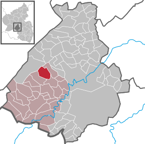
| Location of the local community Leisel in the Birkenfeld district | ||
  |
||

Leisel is a municipality in the Birkenfeld district in Rhineland-Palatinate . It belongs to the Birkenfeld community .
geography
The place is on the Leiselbach in the Idarwald in the Hunsrück . 65 percent of the municipal area is forested. In the north-east is Siesbach , southeast Wilzenberg-Hußweiler and southwest is Schwollen . Leisel is a national park community in the Hunsrück-Hochwald National Park .
history
Leisel was first mentioned in 1180 as Lucei when it belonged to the Archbishopric of Trier . In 1328 it came to the County of Sponheim . In 1437 it became a condominium from Pfalz-Zweibrücken and Baden until it came to Baden entirely in 1776.
During the French period in 1801, Leisel became the seat of a Mairie , a mayor's office that continued until 1840. It included the places Siesbach , Leisel, Schwollen , Hattgenstein , Rinzenberg , Hambach , Böschweiler and Heupweiler .
The municipality of Leisel gained national fame because in 1929 one of two well-known citizens' petitions was made in the Birkenfeld part of the Oldenburg region . However, unlike a similar procedure in Kirn-Sulzbach, the referendum in Leisel was probably inadmissible.
- Population development
The development of the population of Leisel, the values from 1871 to 1987 are based on censuses:
|
|
politics
Municipal council
The municipal council in Leisel consists of twelve council members, who were elected by a majority vote in the local elections on May 26, 2019 , and the honorary local mayor as chairman.
Local mayor
Local mayor since 1945:
- 1945–1969: Emil Hey
- 1969–1976: Walter Schüßler
- 1976–1988: Werner Jung
- 1988–2004: Karlheinz Bittig
- 2004–2009: Klaus Bohrer
- 2009–2019: Wolfgang Schüßler
- 2019– : Karlheinz Bittig
coat of arms
|
|
Blazon : "A silver deer antler with grind, inside a golden crown, over a red-silver shield base in green."
It was approved by the Rhineland-Palatinate Ministry of the Interior in 1965. |
Culture and sights
traffic
The federal highway 422 runs in the northeast . In Kronweiler there is a train station on the Bingen – Saarbrücken line .
Personalities
- Karl Heyl (1812–1893), member of the Reichstag and Landtag, born in Leisel
Web links
- Website of the local community Leisel
- Local community Leisel on the website of the Verbandsgemeinde Birkenfeld
- Literature about Leisel in the Rhineland-Palatinate State Bibliography
Individual evidence
- ↑ a b State Statistical Office of Rhineland-Palatinate - population status 2019, districts, municipalities, association communities ( help on this ).
- ↑ Christopher Schmidt: Immediate community democracy in central and southern Germany during the Weimar Republic . Baden-Baden 2007, ISBN 978-3-8329-2607-6 , pp. 103 .
- ↑ State Statistical Office Rhineland-Palatinate: My village, my city. Retrieved February 12, 2020 .
- ^ The Regional Returning Officer Rhineland-Palatinate: Local elections 2019, city and municipal council elections.

Adventure | Achtelsbach | Allenbach | Asbach | Baumholder | Mountains | Berglangenbach | Berschweiler at Baumholder | Berschweiler near Kirn | Birkenfeld | Bollenbach | Börfink | Breitenthal | Bruchweiler | Bridges | Buhlenberg | Bundenbach | Dambach | Dickesbach | Dienstweiler | Eckersweiler | Elkweiler | Ellenberg | Ellweiler | Fischbach | Fohren-Linden | Frauenberg | Gerach | Gimbweiler | Gollenberg | Gösenroth | Griebelschied | Hahnweiler | Hattgenstein | Hausen | Heimbach | Hellertshausen | Herborn | Herrstein | Hettenrodt | Hintertiefenbach | Hoppstädten-Weiersbach | Horbruch | Hottenbach | Idar-Oberstein | Kempfeld | Kirschweiler | Kronweiler | Krummenau | Boring | Leisel | Leitzweiler | Mackenrodt | Meckenbach | Mettweiler | Mittelreidenbach | Mörschied | Niederbrombach | Niederhambach | Niederhosenbach | Niederwörresbach | Nohen | Oberbrombach | Oberhambach | Oberhosenbach | Upper brain | Oberreidenbach | Oberwörresbach | Reichenbach | Rhaunen | Rimsberg | Rinzenberg | Rohrbach | Rötsweiler-Nockenthal | Rückweiler | Ruschberg | Showers | Schmidthachenbach | Schmissberg | Schwerbach | Swelling | Sensweiler | Sien | Sienhachenbach | Siesbach | Sonnenberg-Winnenberg | Sonnschied | Stipshausen | Sulzbach | Veitsrodt | Vollmersbach | Pastures | Weitersbach | Wickenrodt | Wilzenberg-Hussweiler | Wirschweiler