
Gimbweiler
| coat of arms | Germany map | |
|---|---|---|

|
Coordinates: 49 ° 35 ' N , 7 ° 11' E |
|
| Basic data | ||
| State : | Rhineland-Palatinate | |
| County : | Birch field | |
| Association municipality : | Birch field | |
| Height : | 480 m above sea level NHN | |
| Area : | 5.53 km 2 | |
| Residents: | 388 (Dec. 31, 2019) | |
| Population density : | 70 inhabitants per km 2 | |
| Postal code : | 55767 | |
| Area code : | 06782 | |
| License plate : | BIR | |
| Community key : | 07 1 34 029 | |
| Association administration address: | Schneewiesenstrasse 21 55765 Birkenfeld |
|
| Website : | ||
| Local Mayor : | Martin Samson | |
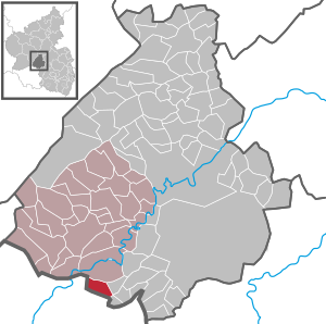
| Location of the local community of Gimbweiler in the Birkenfeld district | ||
  |
||

Gimbweiler is a municipality in the Birkenfeld district in Rhineland-Palatinate . It belongs to the Birkenfeld community .
Geographical location
The place is on the Mörschbach in the Black Forest high forest in the Hunsrück on the border with Saarland .
The Heidehof residential area also belongs to Gimbweiler .
history
The oldest forms of Gimbweiler's name are: Gumbweiler (1397), Gompwiler (1480), Gympwiler (1480). The Roman origin of Gimbweiler and the submerged Frudesweiler located on its boundary has not been proven.
Gimbweiler generally shared the fate of the neighboring Wolfersweiler . Gimbweiler always belonged to his high court and parish, the overlords were alternately: Bishops of Verdun , the Counts of Veldenz , the Dukes of Zweibrücken .
In the 13th century, the Lords of Oberstein tried to gain a firm foothold in the place between Wolfersweiler and Baumholder . Attempts which they renewed in the following centuries, based on their Lorraine feudal reverse .
They had always owned real estate in Gimbweiler, but the other gentlemen were also wealthy there. But the people of Veldenz and Zweibrücken have vigorously preserved and increased their sovereignty and possessions. In 1397 Count Friedrich von Veldenz bought a farm and poor people in Gumpwiler from the Lords of Broich, in addition to goods, interest and rights to Eckelnhusen, Hanwiler and Moysberg.
Gimbweiler and Frudesweiler, as well as the neighboring towns of Freisen and Hoppstädten, Hahnweiler and Reitscheid , now belong to the great Lorraine fiefdom of the Obersteiners, following the Lehnsrevers first issued in 1432 and constantly renewed until 1667. The Lorraine, as well as their Oberstein feudal bearers, always kept their demands on Gimbweiler alive. So the von Oberstein-Falkenstein gave the place in 1599 to the Lord von Schillards, those von Feigniss, as a Lorraine fief . In reality, however, the sovereignty of the two bridges over Gimbweiler has not been touched. Wolfersweiler's fate was also his.
In the French era, Gimbweiler belonged with this to Mairie Nohfelden, which was affiliated to the canton of Baumholder .
The submerged Frudesweiler was only 10 minutes north of Gimbweiler on the right side of the path to Weiersbach. Its location is determined by the districts Hofgärten, Dorfwies in corridor 3 and Mauer in corridor 6. In the Lorraine fiefdoms mentioned under Gimbweiler, Frudesweiler and Hahnweiler are claimed together by Oberstein as a Lorraine fief.
According to Fabricius , part of the Frudesweiler trade belonged to the Rohrbacher care , whose border after a wisdom of 1581 against the high court Wolfersweiler from the Krämelsmäuerchen near Hahnweiler with the road Lichtenberg - Wolfersweiler to the Gimbweiler Langwiese, the brook that rises there to Frudesweiler and from there with a valley coming from the north to the Langenstein. But the Wolfersweiler contradicts this. In addition to the Frudesweiler ban , the ban from Leitzweiler, Rückweiler and Hahnweiler are included in the Wolfersweiler judicial district, and among the lay judges who pointed the border in 1507 there is also one from Frudesweiler. In any case, Frudesweiler was always Veldenzisch or Zweibrückisch.
In 1640 Frudesweiler is said to have stood still, in 1740 it is mentioned as derelict. Later, the residents of Gimbweiler and Weiersbach exercised the right to graze on the lands. The resulting disputes dragged on into the 19th century. They were ended by a settlement. Weiersbach received two-fifths, mostly forests, Gimbweiler three-fifths, mainly arable and meadow land.
( after Prof. H. Baldes )
Population development
The development of the population of Gimbweiler, the values from 1871 to 1987 are based on censuses:
|
|
religion
Most of the residents belong to the Evangelical Church Community of Wolfersweiler.
politics
Municipal council
The municipal council in Gimbweiler consists of eight council members, who were elected in a majority vote in the local elections on May 26, 2019 , and the honorary local mayor as chairman.
Local mayor
- 1947–1961 Emil Schweig
- 1961–1970 Willy Jungblut
- 1971–1990 Manfred Wommer (SPD)
- 1990-2004 Walter Kreulich (SPD)
- 2004– Martin Samson
Walter Kreulich was the first local mayor to be elected in a direct election by the Gimbweiler citizens.
coat of arms
|
|
Blazon : "In a divided shield above in gold five rooted green trees, of which the second and fourth tower over the others, below a red-armored, tongued and crowned growing golden lion in black."
It was approved by the Rhineland-Palatinate Ministry of the Interior in 1965 |
Economy and Infrastructure
Up until the 1960s, the municipality's economy was shaped by farms.
traffic
Road network
Gimbweiler is well connected to the trunk road network by the federal highways 41 (east-west connection: Mainz - Saarbrücken ) and the 269 ( Bernkastel-Kues - Saarlouis ), as well as the federal motorway 62 . This motorway is also the most important north-south connection and provides the connection to Trier and Kaiserslautern . Furthermore, the Hunsrückhöhenstraße ( B 327 ) and thus Hahn Airport can be reached quickly via the B 269 (50 km). There is a bus connection five times a day between Hahn Airport and Birkenfeld.
Rail network
Birkenfeld is connected to the Saarbrücken – Frankfurt am Main line through the Neubrücke (Nahe) train station, 6 km away . It takes 45 minutes to get to Saarbrücken and less than 2 hours to Frankfurt am Main.
Educational institutions
Since 1996, a university of applied sciences has been established on the site of a former US military hospital in the neighboring community of Hoppstädten-Weiersbach . The Environmental Campus Birkenfeld carries, as the location of Fachhochschule Trier , strengthened the economic development of the region Birkenfeld at.
Leisure and sports facilities
At leisure and sports facilities there are u. a. a grass pitch of the local sports club.
Arts and Culture
The punk band Pascow , founded in 1998, comes partly from Gimbweiler. The band still has their rehearsal room on the nearby Heidehof. The song " This is Gimbweiler and not LA " was released in 2010 on the album "Alles muss sein" .
Personalities
- Alex Pascow (Alexander Thomé), musician
- Ollo Pascow (Oliver Thomé), musician
See also
Web links
- Local community Gimbweiler on the website of the Verbandsgemeinde Birkenfeld
- Literature about Gimbweiler in the Rhineland-Palatinate state bibliography
Individual evidence
- ↑ a b State Statistical Office of Rhineland-Palatinate - population status 2019, districts, municipalities, association communities ( help on this ).
- ↑ State Statistical Office Rhineland-Palatinate (ed.): Official directory of the municipalities and parts of the municipality. Status: January 2019 [ Version 2020 is available. ] . S. 29 (PDF; 3 MB).
- ↑ State Statistical Office Rhineland-Palatinate: My village, my city. Retrieved November 23, 2019 .
- ^ The Regional Returning Officer Rhineland-Palatinate: Local elections 2019, city and municipal council elections .

Adventure | Achtelsbach | Allenbach | Asbach | Baumholder | Mountains | Berglangenbach | Berschweiler at Baumholder | Berschweiler near Kirn | Birkenfeld | Bollenbach | Börfink | Breitenthal | Bruchweiler | Bridges | Buhlenberg | Bundenbach | Dambach | Dickesbach | Dienstweiler | Eckersweiler | Elkweiler | Ellenberg | Ellweiler | Fischbach | Fohren-Linden | Frauenberg | Gerach | Gimbweiler | Gollenberg | Gösenroth | Griebelschied | Hahnweiler | Hattgenstein | Hausen | Heimbach | Hellertshausen | Herborn | Herrstein | Hettenrodt | Hintertiefenbach | Hoppstädten-Weiersbach | Horbruch | Hottenbach | Idar-Oberstein | Kempfeld | Kirschweiler | Kronweiler | Krummenau | Boring | Leisel | Leitzweiler | Mackenrodt | Meckenbach | Mettweiler | Mittelreidenbach | Mörschied | Niederbrombach | Niederhambach | Niederhosenbach | Niederwörresbach | Nohen | Oberbrombach | Oberhambach | Oberhosenbach | Upper brain | Oberreidenbach | Oberwörresbach | Reichenbach | Rhaunen | Rimsberg | Rinzenberg | Rohrbach | Rötsweiler-Nockenthal | Rückweiler | Ruschberg | Showers | Schmidthachenbach | Schmissberg | Schwerbach | Swelling | Sensweiler | Sien | Sienhachenbach | Siesbach | Sonnenberg-Winnenberg | Sonnschied | Stipshausen | Sulzbach | Veitsrodt | Vollmersbach | Pastures | Weitersbach | Wickenrodt | Wilzenberg-Hussweiler | Wirschweiler