
Krummenau (Hunsrück)
| coat of arms | Germany map | |
|---|---|---|
_COA.svg)
|
Coordinates: 49 ° 54 ' N , 7 ° 17' E |
|
| Basic data | ||
| State : | Rhineland-Palatinate | |
| County : | Birch field | |
| Association municipality : | Herrstein-Rhaunen | |
| Height : | 400 m above sea level NHN | |
| Area : | 4.32 km 2 | |
| Residents: | 165 (Dec. 31, 2019) | |
| Population density : | 38 inhabitants per km 2 | |
| Postal code : | 55483 | |
| Area code : | 06543 | |
| License plate : | BIR | |
| Community key : | 07 1 34 049 | |
| Association administration address: | Brühlstrasse 16 55756 Herrstein |
|
| Website : | ||
| Local Mayor : | Gerd Böhnke | |
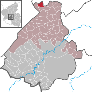
| Location of the local community Krummenau in the Birkenfeld district | ||
  |
||


Krummenau is a municipality in the Birkenfeld district in Rhineland-Palatinate . It belongs to the Herrstein-Rhaunen community .
geography
Krummenau is located in the Hunsrück north of the 746 meter high Idarkopf in the Idarwald . 61.6 percent of the district area is forested. The Idarbach flows through the village. To the west is Horbruch , in the north Niederweiler and east is Laufersweiler .
The Weylandsmühle residential area also belongs to Krummenau .
history
Krummenau was first mentioned on November 20, 1086. A manuscript from the end of the 18th century - kept in the archive of the Museum Wasserburg Anholt of Prince Salm-Salm in Isselburg-Anhold in Westphalia - is the only evidence.
Population development
The development of the population of Krummenau, the values from 1871 to 1987 are based on censuses:
|
|
|
politics
Municipal council
The council in Krummenau consists of six council members, who in the local elections on May 26, 2019 in a majority vote were elected, and the honorary mayor as chairman.
mayor
Gerd Böhnke became local mayor of Krummenau again on June 11, 2019, after having held this office from 1992 to 2014. In the direct election on May 26, 2019, he was elected for five years with a share of the vote of 76.34%.
Böhnke's successor and predecessor Martin Klein had held the office since 2014, but did not take office again in 2019.
Culture and sights
Cultural monuments
- The Protestant church dates from 1747.
- The middle of the three bridges over the Idarbach is a slate arch bridge to which the dial with the golden numerals of the old church tower clock is attached.
Natural monuments
- The approximately 400 year old imperial oak stands about 500 m southeast of the village.
Economy and Infrastructure
There is a village community center in Krummenau . In Idar-Oberstein there is a train station on the Bingen – Saarbrücken line . In the north are the federal highway 50 and the Frankfurt-Hahn airport .
Web links
- Local community Krummenau on the website of the Herrstein-Rhaunen community
- Krummenau at hunsrueck-nahereise.de
- History of Krummenau at regionalgeschichte.net
- Literature about Krummenau in the Rhineland-Palatinate state bibliography
Individual evidence
- ↑ a b State Statistical Office of Rhineland-Palatinate - population status 2019, districts, municipalities, association communities ( help on this ).
- ↑ State Statistical Office Rhineland-Palatinate (ed.): Official directory of the municipalities and parts of the municipality. Status: January 2020. S. 29 (PDF; 1 MB).
- ↑ State Statistical Office Rhineland-Palatinate: My village, my city. Retrieved February 28, 2020 .
- ^ The Regional Returning Officer Rhineland-Palatinate: Local elections 2019, city and municipal council elections.
- ↑ a b Constituent meeting of the local council Krummenau. In: Our home. Linus Wittich Medien GmbH, edition 30/2019, accessed on August 22, 2020 .
- ↑ a b Landesstraße divides Krummenau - community life can clearly be increased. Interview with Gerd Böhnke, conducted by Andreas Nitsch. In: Nahe newspaper. Mittelrhein-Verlag GmbH, Koblenz, October 11, 2019, accessed on August 22, 2020 .
- ^ The Regional Returning Officer Rhineland-Palatinate: direct elections 2019. see Herrstein-Rhaunen, Verbandsgemeinde, 25th line of results. Retrieved August 22, 2020 .

Adventure | Achtelsbach | Allenbach | Asbach | Baumholder | Mountains | Berglangenbach | Berschweiler at Baumholder | Berschweiler near Kirn | Birkenfeld | Bollenbach | Börfink | Breitenthal | Bruchweiler | Bridges | Buhlenberg | Bundenbach | Dambach | Dickesbach | Dienstweiler | Eckersweiler | Elkweiler | Ellenberg | Ellweiler | Fischbach | Fohren-Linden | Frauenberg | Gerach | Gimbweiler | Gollenberg | Gösenroth | Griebelschied | Hahnweiler | Hattgenstein | Hausen | Heimbach | Hellertshausen | Herborn | Herrstein | Hettenrodt | Hintertiefenbach | Hoppstädten-Weiersbach | Horbruch | Hottenbach | Idar-Oberstein | Kempfeld | Kirschweiler | Kronweiler | Krummenau | Boring | Leisel | Leitzweiler | Mackenrodt | Meckenbach | Mettweiler | Mittelreidenbach | Mörschied | Niederbrombach | Niederhambach | Niederhosenbach | Niederwörresbach | Nohen | Oberbrombach | Oberhambach | Oberhosenbach | Upper brain | Oberreidenbach | Oberwörresbach | Reichenbach | Rhaunen | Rimsberg | Rinzenberg | Rohrbach | Rötsweiler-Nockenthal | Rückweiler | Ruschberg | Showers | Schmidthachenbach | Schmissberg | Schwerbach | Swelling | Sensweiler | Sien | Sienhachenbach | Siesbach | Sonnenberg-Winnenberg | Sonnschied | Stipshausen | Sulzbach | Veitsrodt | Vollmersbach | Pastures | Weitersbach | Wickenrodt | Wilzenberg-Hussweiler | Wirschweiler