
Niederweiler (Hunsrück)
| coat of arms | Germany map | |
|---|---|---|
.png)
|
Coordinates: 49 ° 55 ' N , 7 ° 17' E |
|
| Basic data | ||
| State : | Rhineland-Palatinate | |
| County : | Rhein-Hunsrück district | |
| Association municipality : | Kirchberg (Hunsrück) | |
| Height : | 420 m above sea level NHN | |
| Area : | 4.8 km 2 | |
| Residents: | 393 (Dec. 31, 2019) | |
| Population density : | 82 inhabitants per km 2 | |
| Postal code : | 55491 | |
| Area code : | 06543 | |
| License plate : | SIM, GOA | |
| Community key : | 07 1 40 109 | |
| Association administration address: | Marktplatz 5 55481 Kirchberg (Hunsrück) |
|
| Website : | ||
| Local Mayor : | Harry Gutenberger | |
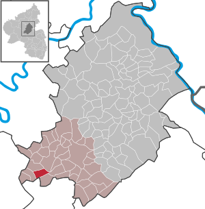
| Location of the local community Niederweiler in the Rhein-Hunsrück district | ||
  |
||

Niederweiler is a municipality in the Rhein-Hunsrück district in Rhineland-Palatinate . It belongs to the Kirchberg (Hunsrück) community .

geography
The agricultural community is located in the Hunsrück . The district covers an area of 4.81 km², of which 1.45 km² is forest.
history
Roman settlement on the site is proven. A first exact documentary mention is not known. With the occupation of the left bank of the Rhine in 1794 by French revolutionary troops , the place became French, in 1815 it was assigned to the Kingdom of Prussia at the Congress of Vienna . After the First World War temporarily occupied by the French, the place has been part of the then newly formed state of Rhineland-Palatinate since 1946.
politics
Municipal council
The council in Niederweiler consists of eight council members, who in the local elections on May 26, 2019 in a majority vote were elected, and the honorary mayor as chairman.
mayor
Local mayor of Niederweiler is Harry Gutenberger. In the local elections on May 26, 2019, no candidate ran, he was elected by the local council on June 18, 2019 and is the successor to Volker Mähringer-Kunz.
coat of arms
Blazon : “In red, a curled point made of blue and gold; on the right a silver urn, on the left two diagonally crossed golden ears. "
The chess of blue and gold points to the former affiliation of the place to the Vorderen Grafschaft Sponheim . The silver urn is reminiscent of Celtic excavation finds in the Niederweiler district. The golden ears of wheat represent the predominantly agricultural structure of the local community.
Buildings
- Roman grave monument from the 2nd century with balustrade framing, uncovered in 1926
- Catholic chapel, new building from 1914 to 1919
See also: List of cultural monuments in Niederweiler
Web links
- Literature about Niederweiler in the Rhineland-Palatinate state bibliography
Individual evidence
- ↑ State Statistical Office of Rhineland-Palatinate - population status 2019, districts, communities, association communities ( help on this ).
- ^ The regional returning officer RLP: City council election 2019 Niederweiler. Retrieved October 8, 2019 .
- ^ The Regional Returning Officer RLP: direct elections 2019. see Kirchberg, Verbandsgemeinde, 24th line of results. Retrieved October 8, 2019 .
- ^ Niederweiler local community: minutes of meetings. Local council. June 18, 2019, accessed October 8, 2019 .
- ↑ Niederweiler coat of arms description ( Memento of the original from July 19, 2011 in the Internet Archive ) Info: The archive link was inserted automatically and has not yet been checked. Please check the original and archive link according to the instructions and then remove this notice.

Alterkülz | Altweidelbach | Argenthal | Badenhard | Bärenbach | Belg | Belgweiler | Bell (Hunsrück) | Beltheim | Benzweiler | Bergenhausen | Bulging | Bickenbach | Beavers | Birkheim | Boppard | Braunshorn | Bubach | Book | Büchenbeuren | Budenbach | Damscheid | Dichtelbach | Dickenschied | Dill | Dillendorf | Dommershausen | Dörth | Ellern (Hunsrück) | Emmelshausen | Erbach | Fronhofen | Gehlweiler | Gemünden | Gödenroth | Gondershausen | Rooster | Halsenbach | Hasselbach | House Bay | Hedges | Heinzenbach | Henau | Hirschfeld | Hollnich | Holzbach | Horn | Hungenroth | Kappel | Karbach | Kastellaun | Keidelheim | Kirchberg (Hunsrück) | Kisselbach | Klosterkumbd | Kludenbach | Korweiler | Kratzenburg | Külz (Hunsrück) | Kümbdchen | Lahr | Laubach | Laudert | Laufersweiler | Lautzenhausen | Leiningen | Liebshausen | Lindenschied | Linger Hahn | Maisborn | Maitzborn | Mastershausen | Mengiffer | Mermuth | Metzenhausen | Michelbach | Mörschbach | Mörsdorf | Morshausen | Mill path | Mother difference | Nannhausen | Neuerkirch | Ney | Low cost | Niederburg | Niederkumbd | Low ears | Niedert | Niederweiler | Norath | Upper cost | Oberwesel | Ohlweiler | Oppertshausen | Perscheid | Pfalzfeld | Pleizenhausen | Ravengiersburg | Raversbeuren | Rayanders | Reckershausen | Empire | Rheinböllen | Riegenroth | Riesweiler | Rödelhausen | Rödern | Rohrbach | Roth | Sankt Goar | Sargenroth | Conclusion | Schnorbach | Schönborn | Torrent | Blacks | Simmern / Hunsrück | Sohren | Sohrschied | Expense red | Steinbach | Thörlingen | Tiefenbach | Death Red | Uhler | Unzenberg | Urbar | Utzenhain | Wahlbach | Wahlenau | Wiebelsheim | Womrath | Woppenroth | Würrich | Wüschheim | Zilshausen

Bärenbach | Belg | Büchenbeuren | Dickenschied | Dill | Dillendorf | Gehlweiler | Gemünden | Rooster | Hedges | Heinzenbach | Henau | Hirschfeld (Hunsrück) | Kappel | Kirchberg (Hunsrück) | Kludenbach | Laufersweiler | Lautzenhausen | Lindenschied | Maitzborn | Metzenhausen | Low cost | Low ears | Niederweiler | Upper cost | Raversbeuren | Reckershausen | Rödelhausen | Rödern | Rohrbach | Conclusion | Blacks | Sohren | Sohrschied | Death Red | Unzenberg | Wahlenau | Womrath | Woppenroth | Würrich