
Dillendorf
| coat of arms | Germany map | |
|---|---|---|

|
Coordinates: 49 ° 56 ' N , 7 ° 23' E |
|
| Basic data | ||
| State : | Rhineland-Palatinate | |
| County : | Rhein-Hunsrück district | |
| Association municipality : | Kirchberg (Hunsrück) | |
| Height : | 416 m above sea level NHN | |
| Area : | 6.5 km 2 | |
| Residents: | 566 (Dec. 31, 2019) | |
| Population density : | 87 inhabitants per km 2 | |
| Postal code : | 55481 | |
| Area code : | 06763 | |
| License plate : | SIM, GOA | |
| Community key : | 07 1 40 030 | |
| Community structure: | 2 districts | |
| Association administration address: | Marktplatz 5 55481 Kirchberg (Hunsrück) |
|
| Website : | ||
| Mayoress : | Renate Paschke | |
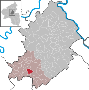
| Location of the local community Dillendorf in the Rhein-Hunsrück district | ||
  |
||

Dillendorf is a municipality in the Rhein-Hunsrück district in Rhineland-Palatinate . It belongs to the Kirchberg (Hunsrück) community .
geography
Geographical location

The place is located in the Kyrbachtal , in the middle of the Hunsrück , at an average altitude of 340 m above sea level. NHN . The historic Ausoniusstraße runs through Dillendorf.
Community structure
The districts of Liederbach and Dillendorf and the Forsthaus Brauschied and Weißensteiner Hof residential areas belong to the local community .
Neighboring places
| Low ears | Lower cost and upper cost | |
| dill |
.svg)
|
Kirchberg |
| Sohrschied | Lindenschied | Hedges |
history
The first documentary mention was made on September 19, 1338 by a loan document from the Count of Sponheim - Starkenburg and his wife Mechthild to the Archbishop Balduin of Trier for shown goodwill. In 1434, Dillendorf is mentioned again in a confirmation document from the Margraves of Baden and Veldenz as Counts of Sponheim over their Trier fiefdoms. With the occupation of the Left Bank of the Rhine in 1794 by French revolutionary troops , the place became French, in 1815 it was assigned to the Kingdom of Prussia at the Congress of Vienna . Since 1946 the place has been part of the state of Rhineland-Palatinate.
politics
Municipal council
The municipal council in Dillendorf consists of twelve council members who were elected in a personalized proportional representation in the local elections on May 26, 2019 , and the honorary local mayor as chairman.
The distribution of seats in the municipal council:
| choice | WGP | FWG | total |
|---|---|---|---|
| 2019 | 7th | 5 | 12 seats |
| 2014 | 7th | 5 | 12 seats |
| 2009 | 7th | 5 | 12 seats |
- WGP = Paschke voter group
- FWG = Free Voting Group Dillendorf
mayor
Renate Paschke is the local mayor of Dillendorf. In the local elections on May 26, 2019, she was confirmed in her office with a share of 62.87% of the votes.
coat of arms
|
|
Blazon : “Divided by green oblique beams; on top of gold and blue, below of silver and red. " |
| Justification of the coat of arms: The two nested fields gold-blue and silver-red represent the coats of arms of the front and rear counties of Sponheim , to whose rule the municipality of Dillendorf formerly belonged. The border between the two territories was formed by the Kyrbach flowing through the village , which therefore divides the coat of arms diagonally. |
literature
- Sabine Bollhorst: Dillendorf in the Hunsrück. History and everyday life. Dillendorf 2001 (local chronicle).
See also
Web links
- Literature about Dillendorf in the Rhineland-Palatinate state bibliography
Individual evidence
- ↑ State Statistical Office of Rhineland-Palatinate - population status 2019, districts, communities, association communities ( help on this ).
- ↑ State Statistical Office Rhineland-Palatinate (ed.): Official directory of the municipalities and parts of the municipality. Status: January 2018 [ Version 2020 is available. ] . S. 37 (PDF; 2.2 MB).
- ^ The Regional Returning Officer RLP: City Council Election 2019 Dillendorf. Retrieved October 8, 2019 .
- ^ The Regional Returning Officer Rhineland-Palatinate: Municipal elections 2014, city and municipal council elections
- ^ The Regional Returning Officer RLP: direct elections 2019. see Kirchberg, Verbandsgemeinde, sixth result line. Retrieved October 8, 2019 .
- ^ Verbandsgemeinde Kirchberg in the Hunsrück

Bärenbach | Belg | Büchenbeuren | Dickenschied | Dill | Dillendorf | Gehlweiler | Gemünden | Rooster | Hedges | Heinzenbach | Henau | Hirschfeld (Hunsrück) | Kappel | Kirchberg (Hunsrück) | Kludenbach | Laufersweiler | Lautzenhausen | Lindenschied | Maitzborn | Metzenhausen | Low cost | Low ears | Niederweiler | Upper cost | Raversbeuren | Reckershausen | Rödelhausen | Rödern | Rohrbach | Conclusion | Blacks | Sohren | Sohrschied | Death Red | Unzenberg | Wahlenau | Womrath | Woppenroth | Würrich

Alterkülz | Altweidelbach | Argenthal | Badenhard | Bärenbach | Belg | Belgweiler | Bell (Hunsrück) | Beltheim | Benzweiler | Bergenhausen | Bulging | Bickenbach | Beavers | Birkheim | Boppard | Braunshorn | Bubach | Book | Büchenbeuren | Budenbach | Damscheid | Dichtelbach | Dickenschied | Dill | Dillendorf | Dommershausen | Dörth | Ellern (Hunsrück) | Emmelshausen | Erbach | Fronhofen | Gehlweiler | Gemünden | Gödenroth | Gondershausen | Rooster | Halsenbach | Hasselbach | House Bay | Hedges | Heinzenbach | Henau | Hirschfeld | Hollnich | Holzbach | Horn | Hungenroth | Kappel | Karbach | Kastellaun | Keidelheim | Kirchberg (Hunsrück) | Kisselbach | Klosterkumbd | Kludenbach | Korweiler | Kratzenburg | Külz (Hunsrück) | Kümbdchen | Lahr | Laubach | Laudert | Laufersweiler | Lautzenhausen | Leiningen | Liebshausen | Lindenschied | Linger Hahn | Maisborn | Maitzborn | Mastershausen | Mengiffer | Mermuth | Metzenhausen | Michelbach | Mörschbach | Mörsdorf | Morshausen | Mill path | Mother difference | Nannhausen | Neuerkirch | Ney | Low cost | Niederburg | Niederkumbd | Low ears | Niedert | Niederweiler | Norath | Upper cost | Oberwesel | Ohlweiler | Oppertshausen | Perscheid | Pfalzfeld | Pleizenhausen | Ravengiersburg | Raversbeuren | Rayanders | Reckershausen | Empire | Rheinböllen | Riegenroth | Riesweiler | Rödelhausen | Rödern | Rohrbach | Roth | Sankt Goar | Sargenroth | Conclusion | Schnorbach | Schönborn | Torrent | Blacks | Simmern / Hunsrück | Sohren | Sohrschied | Expense red | Steinbach | Thörlingen | Tiefenbach | Death Red | Uhler | Unzenberg | Urbar | Utzenhain | Wahlbach | Wahlenau | Wiebelsheim | Womrath | Woppenroth | Würrich | Wüschheim | Zilshausen