
Fronhofen
| coat of arms | Germany map | |
|---|---|---|

|
Coordinates: 49 ° 59 ' N , 7 ° 28' E |
|
| Basic data | ||
| State : | Rhineland-Palatinate | |
| County : | Rhein-Hunsrück district | |
| Association municipality : | Simmern-Rheinböllen | |
| Height : | 375 m above sea level NHN | |
| Area : | 3.71 km 2 | |
| Residents: | 225 (Dec. 31, 2019) | |
| Population density : | 61 inhabitants per km 2 | |
| Postal code : | 55471 | |
| Area code : | 06761 | |
| License plate : | SIM, GOA | |
| Community key : | 07 1 40 039 | |
| Association administration address: | Brühlstrasse 2 55469 Simmern / Hunsrück |
|
| Website : | ||
| Local Mayor : | Dirk Kloeckner | |
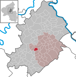
| Location of the local community Fronhofen in the Rhein-Hunsrück district | ||
  |
||


Fronhofen is a municipality in the Rhein-Hunsrück district in Rhineland-Palatinate . It belongs to the Simmern-Rheinböllen community .
geography
The place is in the Biebertal in the middle of the Hunsrück between the federal highway 50 and the Hunsrückhöhenstraße . The village itself is on a slope, at an altitude of 370 to 408 m above sea level. NHN .
Neighboring communities are Külz , Keidelheim , Nannhausen , Unzenberg , Biebern .
history
It was first mentioned in a document in 1285.
Fronhofen originally consisted of a monastery courtyard and a mill. Through a donation of Count Berthold in 1074 it was owned by the monastery Ravengiersburg and belonged to 1408 to the provost Ravengiersburg, since the upper office Simmern, the country delightful to Pfalz-Simmern belonged and Schultheißerei Reich was assigned.
After the Left Bank of the Rhine was occupied by French revolutionary troops in 1794 , the place became French and from 1798 to 1814 belonged to the canton of Simmern in the Rhine-Mosel department . Due to the agreements made at the Congress of Vienna , he was assigned to the Kingdom of Prussia in 1815. Since 1946 the place has been part of the then newly formed state of Rhineland-Palatinate.
politics
Municipal council
The municipal council in Fronhofen consists of six council members, who were elected by a majority vote in the local elections on May 26, 2019 , and the honorary local mayor as chairman.
mayor
Local mayor is Dirk Klöckner. No candidate ran in the local elections on May 26, 2019; he was re-elected by the local council on July 1, 2019.
coat of arms
On December 29, 1980, the municipal council decided to introduce a municipal coat of arms. The draft and final drawings were made by Willi Wagner. The district government Koblenz issued on 15 March 1981, the granting of the coat of arms presented.
|
|
Blazon : "In black on a silver three-mountain , a blue crook growing in it, a red-armored and tongued golden lion to the left." |
| Justification of the coat of arms: Dreiberg and Löwe are taken from the Fronhofener Schultheissereisiegel from 1773 ( Landeshauptarchiv Koblenz , Best. 4, Nr. 2156). The lion refers to the former sovereigns, the Count Palatine von Simmern and the Electors of the Palatinate , the crook refers to the Fronhof of the Augustinian Canons of Ravengiersburg, from which the place name is derived. |
Sons and daughters of the church
- Paul Heckmann (1909–1980), administrative lawyer, District Administrator of the Biberach district
Web links
- Fronhofen in the SWR television program Hierzuland
- Literature about Fronhofen in the Rhineland-Palatinate state bibliography
Individual evidence
- ↑ State Statistical Office of Rhineland-Palatinate - population status 2019, districts, communities, association communities ( help on this ).
- ^ The Regional Returning Officer RLP: City Council Election 2019 Fronhofen. Retrieved October 4, 2019 .
- ↑ The regional returning officer RLP: direct elections 2019. see Simmern-Rheinböllen, Verbandsgemeinde, 13th line of results. Retrieved October 4, 2019 .
- ↑ Heimat Aktuell - Mitteilungsblatt: Election of the local mayor and the aldermen. Edition 29/2019, official notices from the municipalities of Simmern and Rheinböllen. Retrieved October 4, 2019 .

Alterkülz | Altweidelbach | Argenthal | Badenhard | Bärenbach | Belg | Belgweiler | Bell (Hunsrück) | Beltheim | Benzweiler | Bergenhausen | Bulging | Bickenbach | Beavers | Birkheim | Boppard | Braunshorn | Bubach | Book | Büchenbeuren | Budenbach | Damscheid | Dichtelbach | Dickenschied | Dill | Dillendorf | Dommershausen | Dörth | Ellern (Hunsrück) | Emmelshausen | Erbach | Fronhofen | Gehlweiler | Gemünden | Gödenroth | Gondershausen | Rooster | Halsenbach | Hasselbach | House Bay | Hedges | Heinzenbach | Henau | Hirschfeld | Hollnich | Holzbach | Horn | Hungenroth | Kappel | Karbach | Kastellaun | Keidelheim | Kirchberg (Hunsrück) | Kisselbach | Klosterkumbd | Kludenbach | Korweiler | Kratzenburg | Külz (Hunsrück) | Kümbdchen | Lahr | Laubach | Laudert | Laufersweiler | Lautzenhausen | Leiningen | Liebshausen | Lindenschied | Linger Hahn | Maisborn | Maitzborn | Mastershausen | Mengiffer | Mermuth | Metzenhausen | Michelbach | Mörschbach | Mörsdorf | Morshausen | Mill path | Mother difference | Nannhausen | Neuerkirch | Ney | Low cost | Niederburg | Niederkumbd | Low ears | Niedert | Niederweiler | Norath | Upper cost | Oberwesel | Ohlweiler | Oppertshausen | Perscheid | Pfalzfeld | Pleizenhausen | Ravengiersburg | Raversbeuren | Rayanders | Reckershausen | Empire | Rheinböllen | Riegenroth | Riesweiler | Rödelhausen | Rödern | Rohrbach | Roth | Sankt Goar | Sargenroth | Conclusion | Schnorbach | Schönborn | Torrent | Blacks | Simmern / Hunsrück | Sohren | Sohrschied | Expense red | Steinbach | Thörlingen | Tiefenbach | Death Red | Uhler | Unzenberg | Urbar | Utzenhain | Wahlbach | Wahlenau | Wiebelsheim | Womrath | Woppenroth | Würrich | Wüschheim | Zilshausen