
Perscheid
| coat of arms | Germany map | |
|---|---|---|

|
Coordinates: 50 ° 4 ′ N , 7 ° 42 ′ E |
|
| Basic data | ||
| State : | Rhineland-Palatinate | |
| County : | Rhein-Hunsrück district | |
| Association municipality : | Hunsrück-Middle Rhine | |
| Height : | 430 m above sea level NHN | |
| Area : | 18.51 km 2 | |
| Residents: | 347 (Dec. 31, 2019) | |
| Population density : | 19 inhabitants per km 2 | |
| Postal code : | 55430 | |
| Area code : | 06744 | |
| License plate : | SIM, GOA | |
| Community key : | 07 1 40 116 | |
| Association administration address: | Rathausstrasse 6 55430 Oberwesel |
|
| Website : | ||
| Local Mayor : | Kurt Mueller | |
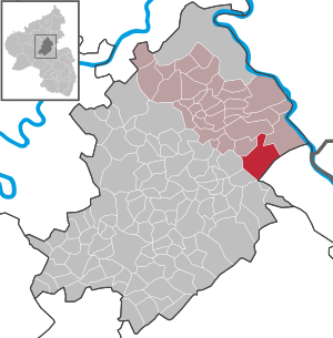
| Location of the local community Perscheid in the Rhein-Hunsrück district | ||
  |
||

The Rheinhöhenort Perscheid is a municipality in the Rhein-Hunsrück district in Rhineland-Palatinate . It belongs to the Hunsrück-Mittelrhein community .
geography
Perscheid is located on the eastern edge of the Hunsrück on a ridge between the Rhine Valley and the A 61 .
history
Excavations and grave finds around Perscheid indicate settlements during the Hallstatt period (~ 1500–1200 BC). Finds (coins, foundations, temple fragments) from Roman times indicate a settlement from this time. The place was first mentioned in 1248 as the village of Perrischeit . The Archbishopric of Trier exercised the state sovereignty . After the occupation of the left bank of the Rhine by French revolutionary troops (1794), the place became French and from 1798 to 1814 belonged to the canton of Bacharach in the Rhine-Moselle department . In 1815 the region was assigned to the Kingdom of Prussia at the Congress of Vienna . After the First World War temporarily occupied by the French, the place has been part of the then newly formed state of Rhineland-Palatinate since 1946.
politics
Municipal council
The municipal council in Perscheid consists of eight council members, who were elected by a majority vote in the local elections on May 26, 2019 , and the honorary local mayor as chairman.
mayor
Michael Jäckel has been the local mayor of the community since November 14, 2007, and after 18 ½ years replaced Hugo Hübel, who resigned on May 20, 2007. Jäckel was last re-elected in the 2014 local elections with 73 percent of the vote. After the death of Michael Jäckel in spring 2019, Kurt Müller was elected as the new local mayor.
coat of arms
|
|
Blazon : "In silver shields split over red, a red cross in front, behind an aligned silver four-ended stag pole." |
Attractions
- The Rheinböllen wildlife sanctuary is not far from the village .
- One of the largest nature reserves in Rhineland-Palatinate is adjacent to the southwest of the town. The emerging high moor is home to many rare plant species such as orchids, daphne and arnica. Here you can also find settlement remains from the submerged town of Volkenbach, as well as traces of Roman settlement on the Hellenpütz and Celtic graves. The area around the village is interspersed with the Bacharach slate mine and former copper mines from the north.
panorama

See also
Web links
- Homepage of the local community Perscheid
- Local community Perscheid on the website of the association community St. Goar-Oberwesel
- Historical information about Perscheid at regionalgeschichte.net
- Literature about Perscheid in the Rhineland-Palatinate state bibliography
Individual evidence
- ↑ State Statistical Office of Rhineland-Palatinate - population status 2019, districts, communities, association communities ( help on this ).
- ^ The Regional Returning Officer Rhineland-Palatinate: Local elections 2019, city and municipal council elections. Retrieved August 20, 2019 .
- ^ The State Returning Officer Rhineland-Palatinate: Local elections 2019, individual results. Retrieved August 20, 2019 .

Alterkülz | Altweidelbach | Argenthal | Badenhard | Bärenbach | Belg | Belgweiler | Bell (Hunsrück) | Beltheim | Benzweiler | Bergenhausen | Bulging | Bickenbach | Beavers | Birkheim | Boppard | Braunshorn | Bubach | Book | Büchenbeuren | Budenbach | Damscheid | Dichtelbach | Dickenschied | Dill | Dillendorf | Dommershausen | Dörth | Ellern (Hunsrück) | Emmelshausen | Erbach | Fronhofen | Gehlweiler | Gemünden | Gödenroth | Gondershausen | Rooster | Halsenbach | Hasselbach | House Bay | Hedges | Heinzenbach | Henau | Hirschfeld | Hollnich | Holzbach | Horn | Hungenroth | Kappel | Karbach | Kastellaun | Keidelheim | Kirchberg (Hunsrück) | Kisselbach | Klosterkumbd | Kludenbach | Korweiler | Kratzenburg | Külz (Hunsrück) | Kümbdchen | Lahr | Laubach | Laudert | Laufersweiler | Lautzenhausen | Leiningen | Liebshausen | Lindenschied | Linger Hahn | Maisborn | Maitzborn | Mastershausen | Mengiffer | Mermuth | Metzenhausen | Michelbach | Mörschbach | Mörsdorf | Morshausen | Mill path | Mother difference | Nannhausen | Neuerkirch | Ney | Low cost | Niederburg | Niederkumbd | Low ears | Niedert | Niederweiler | Norath | Upper cost | Oberwesel | Ohlweiler | Oppertshausen | Perscheid | Pfalzfeld | Pleizenhausen | Ravengiersburg | Raversbeuren | Rayanders | Reckershausen | Empire | Rheinböllen | Riegenroth | Riesweiler | Rödelhausen | Rödern | Rohrbach | Roth | Sankt Goar | Sargenroth | Conclusion | Schnorbach | Schönborn | Torrent | Blacks | Simmern / Hunsrück | Sohren | Sohrschied | Expense red | Steinbach | Thörlingen | Tiefenbach | Death Red | Uhler | Unzenberg | Urbar | Utzenhain | Wahlbach | Wahlenau | Wiebelsheim | Womrath | Woppenroth | Würrich | Wüschheim | Zilshausen