
Keidelheim
| coat of arms | Germany map | |
|---|---|---|

|
Coordinates: 49 ° 59 ′ N , 7 ° 30 ′ E |
|
| Basic data | ||
| State : | Rhineland-Palatinate | |
| County : | Rhein-Hunsrück district | |
| Association municipality : | Simmern-Rheinböllen | |
| Height : | 320 m above sea level NHN | |
| Area : | 2.72 km 2 | |
| Residents: | 333 (Dec. 31, 2019) | |
| Population density : | 122 inhabitants per km 2 | |
| Postal code : | 55471 | |
| Area code : | 06761 | |
| License plate : | SIM, GOA | |
| Community key : | 07 1 40 065 | |
| Association administration address: | Brühlstrasse 2 55469 Simmern / Hunsrück |
|
| Website : | ||
| Local Mayor : | Karsten Krämer | |
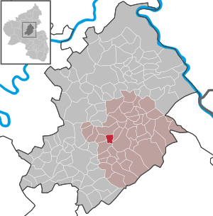
| Location of the local community Keidelheim in the Rhein-Hunsrück district | ||
  |
||

Keidelheim is a municipality in the Rhein-Hunsrück district in Rhineland-Palatinate . It belongs to the Simmern-Rheinböllen community .
geography

Keidelheim is centrally located in the Hunsrück between Simmern and Kastellaun , directly on the Schinderhannes cycle path at an average altitude of 320 m above sea level . The Külzbach separates the villages Keidelheim and Kümbdchen .
history
The place name with -heim suggests that it was formed at the time of the Franconian conquest . Keidel is derived from wedge and means that a rough person was the eponymous person here. If a coarse wedge belongs to a coarse block, then this could have been a first lumberjack.
Around 1310 (1350) it was first mentioned in writing in the interest register of the Counts of Sponheim .
In 1410 the entire Propsteig area , with the Ravengiersburg monastery and the district courts of Nunkirch and Biebern , was transferred to the newly created Duchy of Palatinate-Simmern-Zweibrücken , later Palatinate-Simmern . Keidelheim belonged to Biebern with the villages on the Moselle side.
The Palatine rule ended after taking the left bank of the Rhine by French revolutionary troops (1794). From 1798 to 1814 Keidelheim belonged to the canton of Simmern in the Département de Rhin-et-Moselle with Koblenz as the capital.
In 1815 Prussia took over the area. The responsible mayor's office in the district of Simmern was in Simmern .
The Simmern – Kastellaun section of the Hunsrück Railway, on which Keidelheim is located, was opened on October 28, 1901. The station Keidelheim ( kilometer 3.5) went with some delay in February 1902 in operation.
On March 16, 1945 the Second World War came to an end for Keidelheim with the invasion of the 3rd US Army under George S. Patton . On July 10, 1945, the French replaced the Americans and the French occupation zone was created .
With the administrative reform of June 7, 1969, Keidelheim became part of the new Rhein-Hunsrück district . Then the place expanded with sizable new building areas.
Population development
| year | Residents |
|---|---|
| 1815 | 103 |
| 1835 | 168 |
| 1871 | 150 |
| 1905 | 181 |
| 1939 | 172 |
| 1950 | 180 |
| 1961 | 161 |
| 1970 | 152 |
| 1987 | 208 |
| 2002 | 328 |
| 2004 | 335 |
politics
Municipal council
The local council in Keidelheim consists of eight council members, who were elected by a majority vote in the local elections on May 26, 2019 , and the honorary local mayor as chairman.
mayor
Karsten Krämer is the local mayor. In the local elections on May 26, 2019, no candidate ran, he was elected by the local council on July 3, 2019 and is the successor of the previous mayor Friedhelm Kurz.
coat of arms
|
|
Blazon : "Raised divided by black and silver (white), above a golden (yellow) crown decorated with a cross and covered with three black balls, below a green oak growing out of a green shield base."
The coat of arms was approved on March 21, 1980 by the Koblenz district government . |
| Crest Reason: There is a crown above a under nature conservation standing old oak tree in the district Keidelheim. The crown indicates that Keidelheim is said to be one of the first Franconian settlements on the Hunsrück. |
leisure
Cyclists , hikers and skaters can use the Schinderhannes cycle path without having to take the public roads . The cycle path leads over the railway line of the former Hunsrück Railway through the Schmiedeltunnel below the Schmiedelanstalten to Simmern (to the former train station). In the region, the song is often sung in the Hunsrück dialect : "Between Siemere and Käillem do is en Tunell, when we drive in, it gets dark, when we drive out, it gets light. Holladihi, Holladiho, Holladihoppsassa Holladiho!"
See also
Personalities
- Hans Augustin (* approx. 1570, ⚭ 1595 Keidelheim, † approx. 1656) one of the oldest in Keidelheim
- Karl Kaul, expressionist painter with a studio in Keidelheim since 2000
- Herbert Wagner (* 1930 in Keidelheim), chronicler, painter and type designer
literature
- Willi Wagner: Keidelheim - history of a village in the Külztal ; ed. from the local community Keidelheim. Keidelheim 1993, DNB 940323591 .
- Mades and Wilhelm, law firm in Simmern: The region, Hunsrück judicial history .
Web links
- Keidelheim - On the history of the village ( Memento from March 20, 2012 in the Internet Archive )
- Verbandsgemeindeverwaltung Simmern, Tourist Information ( Memento from December 30, 2011 in the Internet Archive )
- Literature about Keidelheim in the Rhineland-Palatinate State Bibliography
Individual evidence
- ↑ State Statistical Office of Rhineland-Palatinate - population status 2019, districts, communities, association communities ( help on this ).
- ↑ Eisenbahndirektion Mainz (Ed.): Collection of the published official gazettes of October 26, 1901. Volume 5, No. 51, Announcement No. 478, p. 356f and ibid. Of November 2, 1901, No. 52, Announcement No. 494, p. 365.
- ^ Eisenbahndirektion Mainz (Ed.): Collection of the published official gazettes from February 1, 1902. Volume 6, No. 6. Announcement No. 54, p. 33.
- ↑ State Statistical Office RLP
- ^ The regional returning officer RLP: Local council election 2019 Keidelheim. Retrieved October 4, 2019 .
- ^ The Regional Returning Officer RLP: direct elections 2019. see Simmern-Rheinböllen, Verbandsgemeinde, 16th line of results. Retrieved October 4, 2019 .
- ↑ Heimat Aktuell - Mitteilungsblatt: Election of the local mayor and the aldermen. Edition 29/2019, official notices from the municipalities of Simmern and Rheinböllen. Retrieved October 4, 2019 .
- ↑ http://www.augustin-koblenz.de/ahn_list.htm - ancestor no. 2144

Alterkülz | Altweidelbach | Argenthal | Badenhard | Bärenbach | Belg | Belgweiler | Bell (Hunsrück) | Beltheim | Benzweiler | Bergenhausen | Bulging | Bickenbach | Beavers | Birkheim | Boppard | Braunshorn | Bubach | Book | Büchenbeuren | Budenbach | Damscheid | Dichtelbach | Dickenschied | Dill | Dillendorf | Dommershausen | Dörth | Ellern (Hunsrück) | Emmelshausen | Erbach | Fronhofen | Gehlweiler | Gemünden | Gödenroth | Gondershausen | Rooster | Halsenbach | Hasselbach | House Bay | Hedges | Heinzenbach | Henau | Hirschfeld | Hollnich | Holzbach | Horn | Hungenroth | Kappel | Karbach | Kastellaun | Keidelheim | Kirchberg (Hunsrück) | Kisselbach | Klosterkumbd | Kludenbach | Korweiler | Kratzenburg | Külz (Hunsrück) | Kümbdchen | Lahr | Laubach | Laudert | Laufersweiler | Lautzenhausen | Leiningen | Liebshausen | Lindenschied | Linger Hahn | Maisborn | Maitzborn | Mastershausen | Mengiffer | Mermuth | Metzenhausen | Michelbach | Mörschbach | Mörsdorf | Morshausen | Mill path | Mother difference | Nannhausen | Neuerkirch | Ney | Low cost | Niederburg | Niederkumbd | Low ears | Niedert | Niederweiler | Norath | Upper cost | Oberwesel | Ohlweiler | Oppertshausen | Perscheid | Pfalzfeld | Pleizenhausen | Ravengiersburg | Raversbeuren | Rayanders | Reckershausen | Empire | Rheinböllen | Riegenroth | Riesweiler | Rödelhausen | Rödern | Rohrbach | Roth | Sankt Goar | Sargenroth | Conclusion | Schnorbach | Schönborn | Torrent | Blacks | Simmern / Hunsrück | Sohren | Sohrschied | Expense red | Steinbach | Thörlingen | Tiefenbach | Death Red | Uhler | Unzenberg | Urbar | Utzenhain | Wahlbach | Wahlenau | Wiebelsheim | Womrath | Woppenroth | Würrich | Wüschheim | Zilshausen