
Nannhausen
| coat of arms | Germany map | |
|---|---|---|

|
Coordinates: 49 ° 59 ' N , 7 ° 29' E |
|
| Basic data | ||
| State : | Rhineland-Palatinate | |
| County : | Rhein-Hunsrück district | |
| Association municipality : | Simmern-Rheinböllen | |
| Height : | 355 m above sea level NHN | |
| Area : | 6.05 km 2 | |
| Residents: | 618 (Dec. 31, 2019) | |
| Population density : | 102 inhabitants per km 2 | |
| Postal code : | 55469 | |
| Area code : | 06761 | |
| License plate : | SIM, GOA | |
| Community key : | 07 1 40 100 | |
| Community structure: | 3 districts | |
| Association administration address: | Brühlstrasse 2 55469 Simmern / Hunsrück |
|
| Website : | ||
| Local Mayor : | Manuel fear | |
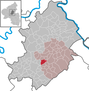
| Location of the local community Nannhausen in the Rhein-Hunsrück district | ||
  |
||

Nannhausen is a municipality in the Rhein-Hunsrück district in Rhineland-Palatinate . It belongs to the Simmern-Rheinböllen community .
geography
Nannhausen is at the end of the Biebertal in the middle of the Hunsrück .
The Nickweiler district with the Kauerhof and the Kauermühle to the west of the village and the hamlet of Schmiedel to the east of the village belong to Nannhausen .
history
The village of Nannhausen was mentioned for the first time in a document from Count Johann IV von Sponheim from 1399. Nannhausen belonged to the Ravengiersburg monastery and became part of the Duchy of Palatinate-Simmern in 1557 as a result of the Reformation and secularization . At first the place was Lutheran , then Reformed . With the end of the line from Pfalz-Simmern in 1674, the place became part of the Electoral Palatinate and in 1686 the Catholic religion was re-admitted. With the occupation of the Left Bank of the Rhine in 1794 by French revolutionary troops , the place became French, in 1815 it was assigned to the Kingdom of Prussia at the Congress of Vienna . After the First and Second World War, temporarily occupied by the French again, the place has been part of the then newly formed state of Rhineland-Palatinate since 1946. Today's community was created on March 17, 1974 through the merger of the communities of Nannhausen (451 inhabitants at the time) and Nickweiler (121 inhabitants).
Nickweiler district
Nickweiler is first mentioned in a document from the landlord of Ravengiersburg Abbey in 1285. Nickweiler has been part of the Nannhausen community since the 1974 administrative reform.
Schmiedel district
The Protestant pastor Julius Reuss from Simmern founded a rescue house for children from neglected backgrounds "on the Schmiedel" in 1851, from which the Schmiedel e. V. emerged .
politics
Municipal council
The council in Nannhausen consists of twelve council members, who in the local elections on May 26, 2019 in a majority vote were elected, and the honorary mayor as chairman.
mayor
The local mayor is Manuel Bange. At the meeting of the Nannhausen local council on January 29, 2020, the previous 1st alderman, Mr Manuel Bange (new election) was elected mayor. Following the election, he was appointed, sworn in and put into office by the local mayor, Mr. Achim Wolf.
Culture and sights
Buildings
see list of cultural monuments in Nannhausen
Parks
On May 17, 2002, the first part of the Schmiedelpark was opened as an adventure park on the extensive, formerly agricultural site of the Schmiedelanstalten , with playgrounds for small and school children, an animal enclosure as a petting zoo, a biotope, a sensory path, a riding facility, a mountain bike Practice area, a barbecue hut and a supply pavilion.
Economy and Infrastructure
traffic
Nannhausen and Nickweiler are located directly on the Hunsrückquerbahn, which is no longer in operation, between Langenlonsheim and Hermeskeil. Nannhausen had a breakpoint here since February 1902 .
There is also a sports airfield for small aircraft in Nannhausen. The ICAO identification is EDRN.
leisure
The Biebertaler circular route with a total length of 26.5 km connects the villages of the Biebertal.
Social facilities
The Schmiedel district is the main site of the Schmiedel children's and youth home ( Association of Schmiedelanstalten eV ), a diaconal youth welfare institution. There is also a short-term nursing home on the site, which is a branch of the Evangelical Dr. Theodor-Fricke retirement and nursing home in Simmern, and the social pediatric center of the kreuznacher diakonie .
literature
- Walter Göhl (ed.): A farmer in the Hunsrück, memories and thoughts of the Hunsrück farmer Heinrich Weirich [from Nannhausen], Pandion Verlag, Simmern 2000 (³2009), ISBN 978-3-922929-88-8
Web links
- Internet presence of the local community Nannhausen
- TV report about Nannhausen in the SWR Hierzuland
- Literature about Nannhausen in the Rhineland-Palatinate state bibliography
Individual evidence
- ↑ State Statistical Office of Rhineland-Palatinate - population status 2019, districts, communities, association communities ( help on this ).
- ↑ Official municipality directory 2006 ( Memento from December 22, 2017 in the Internet Archive ) (= State Statistical Office Rhineland-Palatinate [Hrsg.]: Statistical volumes . Volume 393 ). Bad Ems March 2006, p. 188 (PDF; 2.6 MB). Info: An up-to-date directory ( 2016 ) is available, but in the section "Territorial changes - Territorial administrative reform" it does not give any population figures.
- ^ The regional returning officer RLP: Municipal council election 2019 Nannhausen. Retrieved October 4, 2019 .
- ^ The regional returning officer RLP: direct elections 2019. see Simmern-Rheinböllen, Verbandsgemeinde, 26th line of results. Retrieved October 4, 2019 .
- ^ Local community Nannhausen: Local council. Constituent municipal council meeting on July 17, 2019 and municipal council meeting on January 29, 2020. Retrieved on March 13, 2020 .
- ^ Eisenbahndirektion Mainz (Ed.): Collection of the published official gazettes from February 1, 1902. Volume 6, No. 6. Announcement No. 54, p. 33.
- ^ Pilot in the network airfield Nannhausen

Alterkülz | Altweidelbach | Argenthal | Badenhard | Bärenbach | Belg | Belgweiler | Bell (Hunsrück) | Beltheim | Benzweiler | Bergenhausen | Bulging | Bickenbach | Beavers | Birkheim | Boppard | Braunshorn | Bubach | Book | Büchenbeuren | Budenbach | Damscheid | Dichtelbach | Dickenschied | Dill | Dillendorf | Dommershausen | Dörth | Ellern (Hunsrück) | Emmelshausen | Erbach | Fronhofen | Gehlweiler | Gemünden | Gödenroth | Gondershausen | Rooster | Halsenbach | Hasselbach | House Bay | Hedges | Heinzenbach | Henau | Hirschfeld | Hollnich | Holzbach | Horn | Hungenroth | Kappel | Karbach | Kastellaun | Keidelheim | Kirchberg (Hunsrück) | Kisselbach | Klosterkumbd | Kludenbach | Korweiler | Kratzenburg | Külz (Hunsrück) | Kümbdchen | Lahr | Laubach | Laudert | Laufersweiler | Lautzenhausen | Leiningen | Liebshausen | Lindenschied | Linger Hahn | Maisborn | Maitzborn | Mastershausen | Mengiffer | Mermuth | Metzenhausen | Michelbach | Mörschbach | Mörsdorf | Morshausen | Mill path | Mother difference | Nannhausen | Neuerkirch | Ney | Low cost | Niederburg | Niederkumbd | Low ears | Niedert | Niederweiler | Norath | Upper cost | Oberwesel | Ohlweiler | Oppertshausen | Perscheid | Pfalzfeld | Pleizenhausen | Ravengiersburg | Raversbeuren | Rayanders | Reckershausen | Empire | Rheinböllen | Riegenroth | Riesweiler | Rödelhausen | Rödern | Rohrbach | Roth | Sankt Goar | Sargenroth | Conclusion | Schnorbach | Schönborn | Torrent | Blacks | Simmern / Hunsrück | Sohren | Sohrschied | Expense red | Steinbach | Thörlingen | Tiefenbach | Death Red | Uhler | Unzenberg | Urbar | Utzenhain | Wahlbach | Wahlenau | Wiebelsheim | Womrath | Woppenroth | Würrich | Wüschheim | Zilshausen