
Bubach
| coat of arms | Germany map | |
|---|---|---|

|
Coordinates: 50 ° 4 ′ N , 7 ° 33 ′ E |
|
| Basic data | ||
| State : | Rhineland-Palatinate | |
| County : | Rhein-Hunsrück district | |
| Association municipality : | Simmern-Rheinböllen | |
| Height : | 450 m above sea level NHN | |
| Area : | 7.1 km 2 | |
| Residents: | 257 (Dec. 31, 2019) | |
| Population density : | 36 inhabitants per km 2 | |
| Postal code : | 56288 | |
| Area code : | 06766 | |
| License plate : | SIM, GOA | |
| Community key : | 07 1 40 020 | |
| Association administration address: | Brühlstrasse 2 55469 Simmern / Hunsrück |
|
| Website : | ||
| Mayoress : | Elke Härter | |
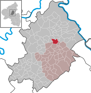
| Location of the local community Bubach in the Rhein-Hunsrück district | ||
  |
||

Bubach is a municipality in the low mountain range of the Hunsrück in the Rhine-Hunsrück district , Rhineland-Palatinate . It belongs to the Simmern-Rheinböllen community .
Location and description of the place

Bubach lies on a small ridge (an elongated ridge) between the Bubacherbach or Grundbach (Simmerbach) and the Maisborner Bach or the Flößchen , which flow together below Bubach (protective layer). The third brook, coming from Laubach and the Bubacher Burg , a barely recognizable medieval moth in a swamp, makes the brook so strong that it could drive a mill, which is therefore about a kilometer away from the village. At the top of the Riedel is the small Protestant church with a Stumm organ from 1852 (Bubach is parochial connected to Horn , Catholics were only a small minority until 1945), including the former stately schoolhouse (from 1910). Bubach is essentially formed by two streets, the "Vorderdorf", facing south-west, and the "Hinterdorf". In 1933 the village bought an open-air swimming pool on the Bubacher Bach above the village (now a fish pond). The first and at that time the only swimmer in the village was the village schoolteacher's son and theology student Hermann Michel, who at the inauguration with many associations and guests from the neighborhood also gave the festive sermon as a candidate for theology in the church.
The village includes the Ammerich weekend settlement in a southeastern direction. on the road to Riegenroth .
history
Prehistoric times
The name of the place arose from Buochbach and thus indicates its foundation or name in the first Franconian settlement period in the 6th to 8th centuries. Its favorable location on the dry spur close to the two streams also speaks for an early settlement. In 1940 a stone ax found in the district appeared, which suggests that the corridor was already settled in the Neolithic Age . It is now in the Hunsrück Museum in Simmern.
middle Ages
Bubach (Buochbach) was first mentioned on July 10, 1002 in a document from King and later Emperor Henry II , with which he donated six royal hooves from his property to a knight Gezo from Nahegau. These king hooves also speak for the old age of the settlement. The "millennial" was celebrated with a large publication. In 1135 Bubach is mentioned as Bubpach in a donation from Gertrud von Honrein (Horn) to the Ravengiersburg monastery , which was confirmed by Emperor Friedrich Barbarossa in 1166 . In the more recent literature these two documents were referred to as forgeries of the archivist Georg Friedrich Schott . However, they are listed as regest in the Ravengiersburger camp book from 1600. Bubach is also mentioned in this regest. On June 13, 1302, imperial property and rights in Bubach and other places were pledged by King Albrecht to the Counts of Sponheim for 500 Cologne marks . The Laubacher Schöffen -gericht with Bubach belonged to the Electoral Palatinate from the middle of the 14th century . In 1410 the place and the whole surrounding area came to the newly created Duchy of Palatinate-Simmern . The first church was a chapel dedicated to Saints Philip and Jacob , which is mentioned in 1493 with a procession approved by Archbishop Johann of Trier , but the location of which has not been recorded.
Modern times
Before the Thirty Years War (1498), Bubach had 79 adults (a total of around 200) residents, in around (1599) 16 households (fireplaces). After the war, only 5 fathers were taxable (estimate from 1656). In 1698, two generations later, there were only 44 inhabitants. Between 1767 and 1894, 29 Bubachers emigrated, mostly to Brazil. After the occupation of the left bank of the Rhine (1794) by French revolutionary troops , the place became French . For 1809 209 and 1840 270 inhabitants are counted. In 1815 the region was assigned to the Kingdom of Prussia at the Congress of Vienna . Since 1946 the place has been part of the state of Rhineland-Palatinate . For 1965 a differentiation is made according to denominations: 209 Protestants and 88 Catholics. The numbers haven't changed much up to the present.
The Reformation was introduced in the Electoral Palatinate in 1557, but in 1626 many Protestant pastors were expelled in the Counter Reformation . It was not until the Electoral Palatinate or Kauber church division of 1706 that clear conditions were created and the churches were divided. Bubach remained Protestant with Horn and Riegenroth. The Catholics went to the church in Laubach. But they had their own corner in the churchyard around the church. In 1764, after a dilapidated previous building was demolished, today's village church was built and consecrated on June 16, 1765. An organ was purchased in 1852 for 700 thalers. It came from the Stumm workshop .
In 1844 the Great Bridge below Bubach was built at the cost of the community, the stone bridge above the town towards Lingerhahn was built in 1850. So things were looking up in the new Prussian times . A new cemetery was created on Riegenrother Weg in 1873. The first schoolhouse was built in 1826. Like the last school, it was at the entrance to the village in the Vorderdorf. Before that, teaching was in private homes. The building was paid for by the Protestants, and the Catholics went to school in Laubach. The school from 1910, which also had only one classroom, but a spacious teacher's apartment, and a modern hot-water bathtub facility in the school basement, was only for the Protestants until the politically decreed establishment of the unified school in 1937. After the war, the old state was changed restored. From 1956 until it was closed in 1971, the school was again run as a community school. Today it is used as a private house.
In 1887 a post office was set up in Gasthof Ries (from 1871) (until 1975), which in 1903 was given a public telephone. Between 1900 and 1908 the Hunsrück Railway was built, at the Dudenroth stop. A central water supply was built in 1905/06. Since the associated springs are located above the village, it works without pumps. In 1922 electricity came to Bubach.
Bubacher Castle

To the southwest of Bubach in a swampy area at a tributary of the Grundbach from Laubach are the remains of a medieval low castle ( Motte ). More precise historical information about the facility is not available. It is about 30 by 30 meters large, almost square castle hill, which is surrounded by a circular wall. Access is at the bridge on Horner Strasse.
Wars
In the First World War the community had 14 deaths. Many men were deployed as soldiers and were missing in the village, including the forester and the teacher, who came back seriously injured with a paralyzed right hand, but was able to resume his school and organist duties.
The Second World War took a far greater toll in blood. 25 names had to be added to the 14 names on the war memorial on the church from 1922. In 1916, during World War I, around 29 Russian prisoners of war were used on the farms. From 1941, during World War II, 14 French, 6 Polish and 12 Soviet prisoners of war were used for forced labor . When the Americans marched in on March 18, 1945, there was no damage, except that the entrance sign from the Adolf Hitler Bad (bad = bad !!) was taken away as a trophy.
Change after the Second World War
Between 1954 and 1956 the parish hall was built in place of the old "Bakkes" bakery. In 1955 the restaurateur Ries installed the first television set. From 1955 to 1976 there was a general store in town .
In 1961 there were already five combine harvesters . The 1961 census counted 56 buildings with 55 households, 6 workplaces (1 blacksmith, 1 shop, 1 restaurant with overnight stay and post office as well as 3 farmers who employed staff) and 269 inhabitants in Bubach. The Cologne geographer Reinhard Zschocke also writes that the majority of the remaining farms (37 in 1964, around a third already given up) are full-time, although mostly run by the grandparents' generation, with some of the farmers working seasonally as forest workers. There are still employment opportunities in road construction and in the sawmill in Maisborn . The number of businesses doing business part-time or after work is relatively low. The number of establishments had decreased to 30 by 1967. Today there are very few farms left.
The weekend house settlement "Im Ammerich" is located 950 m south of Bubach on the road 219 in the direction of Riegenroth. In 1961 the site was designated. It was fully built up until 1975. From the initial wooden house settlement of 18 houses with water, electricity, sewer and telephone connections, the area changed over the years to a settlement with buildings, some of which are now permanently inhabited. The area is partly in the forest on the slope of the Grundbach and the former mill ditch of the lump mill belonging to the municipality of Riegenroth. From 1980 21 pure residential houses were built in the Obergarten . The young generation wanted to live in a contemporary way. The number of residents has not increased significantly as a result. Another new building area was built above the cemetery in 2000. The place was also heavily adapted to modern times through renovations and new buildings. Not only have the dung heaps in front of the doors disappeared. Recently, a comfortable log cabin with a barbecue area was built on the tree in front of the Maisborner Forest.
As part of the municipal reorganization, Bubach joined the former community of Simmern (and not Kastellaun ) at his own request (resolution of December 4, 1969) .
politics
Municipal council
The municipal council in Bubach consists of six council members who were elected by a majority vote in the local elections on May 26, 2019 , and the honorary local mayor as chairman.
mayor
Local mayor is Elke Härter. In the local elections on May 26, 2019, she was confirmed in her office with 79.31% of the votes.
Municipal coat of arms
In 1979 the local council decided to create a coat of arms. It shows a green beech leaf in the cross-sectioned shield on the left (heraldic right) in the white field, the blue meandering Grundbach and the bridge that characterizes the town in black . In the other black field, the yellow, red-armored, striding Electoral Palatinate lion is shown.
Dialect saying about the place
"Would you know where Bobach leads? Bobach leads in the ground, where the beese bucks are, stink like the Hunn. Where the pretty girls are, shine like the sun!" (Do you know where Bubach is? Bubach is in the ground, where the bad boys are, stink like dogs. Where the beautiful girls are, they shine like the sun!)
See also
literature
- Jürgen Real: Bubach. From the history of a Hunsrück village , Verlag Dr. Eike Pies, Research Center Vorderhunsrück e. V., Sprockhövel / Bubach August 2001
Web links
- https://www.bubach-hunsrueck.de
- Local community Bubach on the website of the Simmern / Hunsrück community
- Literature about Bubach in the Rhineland-Palatinate State Bibliography
Individual evidence
- ↑ State Statistical Office of Rhineland-Palatinate - population status 2019, districts, communities, association communities ( help on this ).
- ^ Jürgen Real: Bubach. From the history of a Hunsrück village , Verlag Dr. Eike Pies, Research Center Vorderhunsrück e. V., Sprockhövel / Bubach August 2001, pp. 98-100
- ^ Heinrich Beyer : Document book on the history of the Middle Rhine territories now forming the Prussian administrative districts of Coblenz and Trier . tape 1 : From the oldest times to the year 1169. Koblenz 1874, p. 333 f. Reg. 280 ( full text in the Google book search).
- ^ Heinrich Beyer: Document book on the history of the Middle Rhine territories now forming the Prussian administrative districts of Coblenz and Trier . tape 1 : From the oldest times to the year 1169. Koblenz 1874, p. 535 f. Reg. 480 ( full text in the Google book search).
- ^ Heinrich Beyer: Document book on the history of the Middle Rhine territories now forming the Prussian administrative districts of Coblenz and Trier . tape 1 : From the oldest times to the year 1169. Koblenz 1874, p. 703 f. Reg. 646 ( full text in Google Book Search).
- ↑ Monumenta Germaniae Historica . Friedrich I .: 1181-1190, Appendix II, p. 511 No. 20 ( link ).
- ↑ Best 4, No. 2417, fol. 42 in the state main archive Koblenz
- ↑ Real, p. 18, certificate in Bayr. Main State Archives (Kaiserselekt 1151)
- ^ Real, p. 66, based on a list by Walter Diener, typescript v. 1956 District Administrator Simmer
- ↑ Real, pp. 23 + 241 with reference to sources
- ^ Bubacher Burg at regionalgeschichte.net
- ↑ Real, p. 106
- ↑ Reinhard Zschocke: The cultural landscape of the Hunsrück and its peripheral landscapes in the present and in their historical development , Kölner Geographische Arbeit Heft 24, Wiesbaden 1970, page 47 (quoted by Real, p. 119)
- ^ The Regional Returning Officer RLP: City Council Election 2019 Bubach. Retrieved October 5, 2019 .
- ↑ The regional returning officer RLP: direct elections 2019. see Simmern-Rheinböllen, Verbandsgemeinde, eighth line of results. Retrieved October 5, 2019 .

Alterkülz | Altweidelbach | Argenthal | Badenhard | Bärenbach | Belg | Belgweiler | Bell (Hunsrück) | Beltheim | Benzweiler | Bergenhausen | Bulging | Bickenbach | Beavers | Birkheim | Boppard | Braunshorn | Bubach | Book | Büchenbeuren | Budenbach | Damscheid | Dichtelbach | Dickenschied | Dill | Dillendorf | Dommershausen | Dörth | Ellern (Hunsrück) | Emmelshausen | Erbach | Fronhofen | Gehlweiler | Gemünden | Gödenroth | Gondershausen | Rooster | Halsenbach | Hasselbach | House Bay | Hedges | Heinzenbach | Henau | Hirschfeld | Hollnich | Holzbach | Horn | Hungenroth | Kappel | Karbach | Kastellaun | Keidelheim | Kirchberg (Hunsrück) | Kisselbach | Klosterkumbd | Kludenbach | Korweiler | Kratzenburg | Külz (Hunsrück) | Kümbdchen | Lahr | Laubach | Laudert | Laufersweiler | Lautzenhausen | Leiningen | Liebshausen | Lindenschied | Linger Hahn | Maisborn | Maitzborn | Mastershausen | Mengiffer | Mermuth | Metzenhausen | Michelbach | Mörschbach | Mörsdorf | Morshausen | Mill path | Mother difference | Nannhausen | Neuerkirch | Ney | Low cost | Niederburg | Niederkumbd | Low ears | Niedert | Niederweiler | Norath | Upper cost | Oberwesel | Ohlweiler | Oppertshausen | Perscheid | Pfalzfeld | Pleizenhausen | Ravengiersburg | Raversbeuren | Rayanders | Reckershausen | Empire | Rheinböllen | Riegenroth | Riesweiler | Rödelhausen | Rödern | Rohrbach | Roth | Sankt Goar | Sargenroth | Conclusion | Schnorbach | Schönborn | Torrent | Blacks | Simmern / Hunsrück | Sohren | Sohrschied | Expense red | Steinbach | Thörlingen | Tiefenbach | Death Red | Uhler | Unzenberg | Urbar | Utzenhain | Wahlbach | Wahlenau | Wiebelsheim | Womrath | Woppenroth | Würrich | Wüschheim | Zilshausen