
Hattgenstein
| coat of arms | Germany map | |
|---|---|---|

|
Coordinates: 49 ° 42 ' N , 7 ° 10' E |
|
| Basic data | ||
| State : | Rhineland-Palatinate | |
| County : | Birch field | |
| Association municipality : | Birch field | |
| Height : | 534 m above sea level NHN | |
| Area : | 8.21 km 2 | |
| Residents: | 252 (Dec. 31, 2019) | |
| Population density : | 31 inhabitants per km 2 | |
| Postal code : | 55767 | |
| Area code : | 06782 | |
| License plate : | BIR | |
| Community key : | 07 1 34 034 | |
| Association administration address: | Schneewiesenstrasse 21 55765 Birkenfeld |
|
| Website : | ||
| Local Mayor : | Udo Laube | |
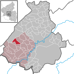
| Location of the local community of Hattgenstein in the Birkenfeld district | ||
  |
||

Hattgenstein is a municipality in the Birkenfeld district in Rhineland-Palatinate . It belongs to the Birkenfeld community .
geography

The village is on the edge of the Black Forest high forest in the Hunsrück . 72.2 percent of the district area is forested. Schwollen is in the northeast and Oberhambach in the south . Hattgenstein is a national park municipality in the Hunsrück-Hochwald National Park .
The living spaces Helmhof, Waldfriede and Zur Carpentry also belong to Hattgenstein .
history
Wonderfully country belonged to the village by the end of the 18th century to the Rear County of Sponheim and shelter as part of the care Hambach managing the Oberamt Birkenfeld . In 1607 Hattgenstein had 21 families and in 1699 seven families, in 1790 the place had 177 inhabitants.
In 1794 the left bank of the Rhine was taken by French revolutionary troops. From 1798 to 1814 Hattgenstein belonged to the canton of Birkenfeld in the Saardepartement . As a result of the agreements made at the Congress of Vienna (1815), the region became part of the Oldenburg Principality of Birkenfeld in 1817 . The community was assigned to the mayor's office Leisel in the Birkenfeld office. From 1918 on Hattgenstein belonged to the Oldenburg "Landesteil Birkenfeld" and in 1937 it came to the Prussian district of Birkenfeld . Hattgenstein has been part of the state of Rhineland-Palatinate since 1946 .
- Population development
The development of the population of Hattgenstein, the values from 1871 to 1987 are based on censuses:
|
|
politics
Municipal council
The council in Hattgenstein consists of six council members, who in the local elections on May 26, 2019 in a majority vote were elected, and the honorary mayor as chairman.
Local mayor
| 1984-2014 | Rudi Gordner |
| 2014-2015 | Udo fair weather |
| 2015– | Udo Laube |
Culture and sights

- The landmark of Hattgenstein is the bell house built in 1762 as a school building and residence of the community servant
- Two anthills on the main road at the entrance to the village were u. a. a reason for silver in the competition “ Our village should become more beautiful ” at the state level.
- Hattgensteiner Fels (presumably namesake of the village)
- Lookout tower on the Rothenburg mountain . The 29 meter high wooden tower was built in 2006 from four Douglas fir trees and offers a good view of the Hunsrück landscape from its 21 meter high viewing platform .
See also
Economy and Infrastructure
The federal highway 269 runs in the west and the federal highway 62 in the south . In Neubrücke there is a train station on the Bingen – Saarbrücken line .
Web links
- Internet presence of the local community Hattgenstein
- Local community Hattgenstein on the website of the Verbandsgemeinde Birkenfeld
- Literature on Hattgenstein in the Rhineland-Palatinate State Bibliography
Individual evidence
- ↑ a b State Statistical Office of Rhineland-Palatinate - population status 2019, districts, municipalities, association communities ( help on this ).
- ↑ State Statistical Office Rhineland-Palatinate (ed.): Official directory of the municipalities and parts of the municipality. Status: January 2019 [ Version 2020 is available. ] . S. 29 (PDF; 3 MB).
- ^ Wilhelm Fabricius : Explanations of the historical atlas of the Rhine province, 2nd volume: The map of 1789. Bonn 1898, p. 443, 455.
- ↑ State Statistical Office Rhineland-Palatinate: My village, my city. Retrieved January 13, 2020 .
- ^ The Regional Returning Officer Rhineland-Palatinate: Local elections 2019, city and municipal council elections.
- ↑ Hattgenstein, observation tower. In: Paths to Wood. Landesforsten Rheinland-Pfalz, accessed on January 13, 2020 .

Adventure | Achtelsbach | Allenbach | Asbach | Baumholder | Mountains | Berglangenbach | Berschweiler at Baumholder | Berschweiler near Kirn | Birkenfeld | Bollenbach | Börfink | Breitenthal | Bruchweiler | Bridges | Buhlenberg | Bundenbach | Dambach | Dickesbach | Dienstweiler | Eckersweiler | Elkweiler | Ellenberg | Ellweiler | Fischbach | Fohren-Linden | Frauenberg | Gerach | Gimbweiler | Gollenberg | Gösenroth | Griebelschied | Hahnweiler | Hattgenstein | Hausen | Heimbach | Hellertshausen | Herborn | Herrstein | Hettenrodt | Hintertiefenbach | Hoppstädten-Weiersbach | Horbruch | Hottenbach | Idar-Oberstein | Kempfeld | Kirschweiler | Kronweiler | Krummenau | Boring | Leisel | Leitzweiler | Mackenrodt | Meckenbach | Mettweiler | Mittelreidenbach | Mörschied | Niederbrombach | Niederhambach | Niederhosenbach | Niederwörresbach | Nohen | Oberbrombach | Oberhambach | Oberhosenbach | Upper brain | Oberreidenbach | Oberwörresbach | Reichenbach | Rhaunen | Rimsberg | Rinzenberg | Rohrbach | Rötsweiler-Nockenthal | Rückweiler | Ruschberg | Showers | Schmidthachenbach | Schmissberg | Schwerbach | Swelling | Sensweiler | Sien | Sienhachenbach | Siesbach | Sonnenberg-Winnenberg | Sonnschied | Stipshausen | Sulzbach | Veitsrodt | Vollmersbach | Pastures | Weitersbach | Wickenrodt | Wilzenberg-Hussweiler | Wirschweiler