Rothenburg (Hattgenstein)
| Rothenburg
Rothenburgberg
|
||
|---|---|---|
|
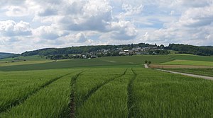
Rothenburgberg from the east, in front of that Hattgenstein |
||
| height | 592.6 m above sea level NHN | |
| location | near Hattgenstein , Birkenfeld district , Rhineland-Palatinate ( Germany ) | |
| Mountains | Hunsrück | |
| Coordinates | 49 ° 41 '52 " N , 7 ° 9' 15" E | |
|
|
||
| particularities | Observation tower | |
The Rothenburg (also Rothenburgberg ) is 592.6 m above sea level. NHN high mountain in the Hunsrück near Hattgenstein in the Rhineland-Palatinate district of Birkenfeld . The managed Rothenburghütte is located in the summit area. In 2006 a 29 m high and freely accessible observation tower was built near it. It allows wide views to the east and south over the northern Palatinate mountains and to the west and north of the forests in the nearby Hunsrück-Hochwald National Park .
Individual evidence
- ↑ a b Map service of the landscape information system of the Rhineland-Palatinate Nature Conservation Administration (LANIS map) ( notes ) Scale 1: 1,000
- ↑ Topographic map 1: 50,000 Saar-Hunsrück Nature Park Blatt Ost, published by the State Office for Surveying and Geographic Base Information Rhineland-Palatinate and the State Office for Cadastral and Mapping Saarland 2007
- ↑ Rothenburghütte on hattgenstein.com, accessed on November 17, 2017
- ↑ Hattgenstein, observation tower on the Landesforsten Rheinland-Pfalz website, accessed on November 17, 2017


