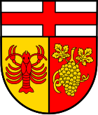
Bernkastel district
| coat of arms | Germany map | |
|---|---|---|

|
Coordinates: 49 ° 55 ' N , 7 ° 4' E |
|
| Basic data (as of 1969) | ||
| Existing period: | 1816-1969 | |
| State : | Rhineland-Palatinate | |
| Administrative region : | trier | |
| Administrative headquarters : | Bernkastel | |
| Area : | 667.73 km 2 | |
| Residents: | 56,300 (June 30, 1968) | |
| Population density : | 84 inhabitants per km 2 | |
| License plate : | UCS | |
| Circle key : | 07 2 31 | |
| Circle structure: | 93 parishes | |
The district of Bernkastel was until 1969 a county in the Prussian Rhine province and Rheinland-Pfalz .
geography
structure
The district of Bernkastel had a size of 668 km² and was divided into the nine mayor's offices (from 1927 offices) Bernkastel-Land, Kempfeld, Lieser, Morbach , Mülheim, Neumagen, Zeltingen, Thalfang and Rhaunen (today to the district of Birkenfeld and in the case of Lindenschied and Woppenroth to the Rhein-Hunsrück district ). Then there was the municipality of Bernkastel-Kues.
The district comprised 92 communities in 1908 and 93 communities in 1967.
Neighboring areas
Beginning in 1969, the district bordered clockwise in the northwest on the districts of Wittlich , Zell (Mosel) , Simmern , Kreuznach , Birkenfeld and Trier .
history
The district founded in 1816, spelled with c in the word Berncastel until the beginning of the 20th century, was called "District Bernkastel" until 1938 and belonged to Prussia until 1945 . It got its name from the town of Bernkastel , part of today's town of Bernkastel-Kues . The district also kept its name when, on April 1, 1905, the town of Kues , then Cues, on the opposite side of the Moselle , was incorporated. The name of the district town changed to Bernkastel-Kues. During the district reform in Rhineland-Palatinate , which came into force on June 7, 1969, the district was dissolved:
- The communities Allenbach , Asbach , Bollenbach , Bruchweiler , Gösenroth , Hausen , Hellertshausen , Horbruch , Hottenbach , Kempfeld , Krummenau , Oberkirn , Rhaunen , Schauren , Schwerbach , Sensweiler , Stipshausen , Sulzbach , Weitersbach and Wirschweiler-Langweiler came to the Birkenfeld district.
- The communities Lindenschied and Woppenroth came to the new Rhein-Hunsrück district .
- All other communities came to the new district of Bernkastel-Wittlich with seat in Wittlich .
Population development
| year | Residents | source |
|---|---|---|
| 1816 | 32,555 | |
| 1847 | 42,886 | |
| 1871 | 44,138 | |
| 1885 | 44,433 | |
| 1900 | 46.282 | |
| 1910 | 49.110 | |
| 1925 | 50,453 | |
| 1939 | 51,353 | |
| 1950 | 54,553 | |
| 1960 | 55,100 | |
| 1968 | 56,300 |
Almost two thirds of the workforce were employed in agriculture , viticulture and forestry .
District administrators
- 1816–1832 Jakob Liessem
- 1832–1844 Konstantin von Gaertner
- 1845–1846 Wilhelm von Arnim (substitute)
- 1846–1848 Moritz von Bardeleben
- 1848–1852 Franz von Steinäcker (acting)
- 1852–1863 Julius Wiethaus
- 1861 Ludwig Ferdinand Timme (represented during Wiethaus's illness)
- 1863–1864 Gustav von Puttkamer
- 1864–1881 Friedrich von Kühlwetter
- 1881–1903 Ferdinand Rintelen
- 1903–1910 Adolf Freiherr von Hammerstein-Loxten
- 1910–1923 Ernst von Nasse
- 1924–1933 Friedrich Gorius
- 1933–1945 Hermann Middendorf
- 1945 Hans-Georg Alexander Kremmler
- 1945–1952 Walter Hummelsheim
- 1952–1959 Klemens Schlueter
- 1959–1966 Hermann Krämer
- 1966–1969 Helmut Gestrich
cities and communes
At the end of its existence in 1969, the district had a city and 92 other parishes:
License Plate
On July 1, 1956, the district was assigned the distinctive sign BKS when the vehicle registration number that is still valid today was introduced . It was issued until June 6, 1969. It has been available in the Bernkastel-Wittlich district since November 26, 2012 ( license plate liberalization ).
literature
- Hans Vogts : The art monuments of the Bernkastel district. (= The Art Monuments of the Rhine Province , Vol. 15, Section I) Düsseldorf 1935
Individual evidence
- ↑ Historical information on territorial.de
- ^ Contributions to the statistics of the Königl. Prussian Rhineland. 1829, p. 20 , accessed November 11, 2017 .
- ^ Description of the administrative district of Trier. 1849, p. 282 , accessed November 11, 2017 .
- ↑ a b Community encyclopedia for the Kingdom of Prussia 1885
- ↑ a b c d e f Michael Rademacher: German administrative history from the unification of the empire in 1871 to the reunification in 1990. bernkastel.html. (Online material for the dissertation, Osnabrück 2006).
