
Mülheim on the Moselle
| coat of arms | Germany map | |
|---|---|---|

|
Coordinates: 49 ° 55 ' N , 7 ° 1' E |
|
| Basic data | ||
| State : | Rhineland-Palatinate | |
| County : | Bernkastel-Wittlich | |
| Association municipality : | Bernkastel-Kues | |
| Height : | 119 m above sea level NHN | |
| Area : | 4.92 km 2 | |
| Residents: | 1027 (Dec. 31, 2019) | |
| Population density : | 209 inhabitants per km 2 | |
| Postal code : | 54486 | |
| Area code : | 06534 | |
| License plate : | WIL, BKS | |
| Community key : | 07 2 31 090 | |
| Association administration address: | Gestade 18 54470 Bernkastel-Kues |
|
| Website : | ||
| Local Mayor : | Friedhelm Leimbrock | |
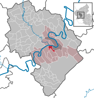
| Location of the local community Mülheim on the Moselle in the district of Bernkastel-Wittlich | ||
 _in_WIL.svg) |
||


Mülheim an der Mosel is a municipality in the district of Bernkastel-Wittlich in Rhineland-Palatinate . It belongs to the community of Bernkastel-Kues .
geography
Geographical location
Mülheim is surrounded by vineyards, meadows and forests in the natural and cultural landscape of the Moselle valley near Bernkastel-Kues, not far from the university town of Trier . Mülheim is located on the right bank of the river, where the valley begins to widen into a landscape that is determined by flat bank slopes and former Moselle loops. The place lies at the foot of a small, narrow circulating mountain, which is surrounded by a cut-off glacial valley of the Moselle, planted all around with vines and is supposedly the only mountain in Europe completely cultivated with vines .
Spatial planning
Neighboring communities include Brauneberg and Lieser . The closest medium- sized center is the town of Bernkastel-Kues , about four kilometers away, and the district town of Wittlich , about twelve kilometers away. Trier is about 33 kilometers away.
climate
Mülheim lies in the transition zone from the temperate maritime climate to the continental climate ; Compared to other regions in Germany, the climate is very warm and sunny - on August 11, 1998, the record temperature of 41.2 ° C in the shade, the highest air temperature ever recorded in the Federal Republic , was found in the immediately neighboring Brauneberg . Due to the Eifel Barrier , Mülheim is protected and protected from rain by westerly winds, which can also have a blow-dry effect. At the same time, air warming is favored by low air exchange with the surrounding area. Associated with this, due to the constant evaporation of the Moselle water, is a regularly high level of humidity , which, especially in summer, causes sometimes stressful, humid weather and numerous thunderstorms.
history
In the vicinity one found settlement remains from the Bronze Age as well as the ruins of a refuge, the Heidenmauer , which is a few kilometers away from Mülheim behind the Veldenz Castle . Already around 500 BC It was settled by the Treveri , a Celtic-Germanic mixed people, from whom the Latin name of the city of Trier Augusta Treverorum is derived. Around 50 BC The Romans finally followed until 500 AD . After the collapse of Roman rule, the Salian Franks took over the area around Mülheim, which their king Childebert II finally gave to Bishop Agericus of Verdun . Princes from the Nahegau who were appointed bishop became more and more independent and from 1129 bore the title of count . From then on, Mülheim was part of the County of Veldenz , which, however, after the first and second counts died out, first fell to the new principality of Pfalz-Zweibrücken and finally in 1694 to the Electoral Palatinate . In the year 1752 the nationally known robber Johann Peter Petri , called Schwarzer Peter , was born in the not far distant castle . Until the end of the 18th century, Mülheim belonged to the County of Veldenz. From 1798 to 1814 Mülheim belonged to the French canton of Bernkastel and was the seat of a Mairie . After the Congress of Vienna (1815), Mülheim became part of Prussia . Since 1946 the community has been part of the then newly formed state of Rhineland-Palatinate .
On June 1, 2013, the community name of Mülheim (Mosel) was changed back to the original spelling Mülheim an der Mosel , which still existed in 1909 .
politics
Municipal council
The local council in Mülheim consists of 16 council members, who were elected in a personalized proportional representation in the local elections on May 26, 2019 , and the honorary local mayor as chairman. The 16 seats in the council are divided between three groups of voters .
coat of arms
|
|
Blazon : "The coat of arms of Mülheim contains the blue Veldenz lion with a red tongue and gold-reinforced claws as well as its special characteristic, the yellow mill wheel ." |
| Justification for the coat of arms: The colors red and gold or yellow were taken from the crest of the coat of arms of the County of Veldenz . In 1835, the lion in Mülheim's coat of arms was adopted by the King of Bavaria as the Bavarian lion in the state coat of arms there, where he was the last Bavarian King Ludwig III until the end of the First World War . had to abdicate in the course of the November Revolution, remained. |
Culture and sights
Buildings

Regular events
Local and wine festivals take place regularly in Mülheim. The highlight of the annual calendar is the Mülheimer Markt , a market and court day set up by the counts in 1555, which is celebrated today as a wine festival with a pageant, market stalls and fairground. The Mülheimer Markt does not take place on a weekend, but every year between the first Tuesday and Thursday in August. Despite this fact, it is in no way inferior to the other wine festivals in the municipality of Bernkastel-Kues and is always well attended. In addition, other, smaller events take place every year, such as the parasol festival or the St. Nicholas family evening.
Economy and Infrastructure
Viticulture and tourism also play an important role. A local supply of food is guaranteed. The wine-growing village also has a ship landing stage from which tours are possible. Furthermore, several first-class hotels for high demands have been built in Mülheim since the mid-1990s . The municipality belongs to the Verkehrsverbund Region Trier (VRT) , which includes the districts of Bernkastel-Wittlich , Bitburg-Prüm , Vulkaneifel and Trier-Saarburg in addition to the independent city of Trier .
Sons of the place
- Karlheinz Boujong (1931–2004), judge at the Federal Court of Justice
- Wolfram F. Richter (* 1948), economist
Trivia
The wine from the Mülheim Sonnenlay vineyard is also known as Zeppelin wine. This is due to the fact that it was very often drunk on zeppelins in the 20th century. Every year in the village a certain wine is designated as a Zeppelin wine.
Web links
- Official website of the local community Mülheim an der Mosel
- To search for cultural assets of the local community Mülheim an der Mosel in the database of cultural assets in the Trier region .
- Link catalog on the subject of Mülheim / Mosel at curlie.org (formerly DMOZ )
Individual evidence
- ↑ State Statistical Office of Rhineland-Palatinate - population status 2019, districts, communities, association communities ( help on this ).
- ↑ From now on it is called: Mülheim an der Mosel. In: volksfreund.de. July 19, 2013, accessed February 2, 2018 .
- ^ The Regional Returning Officer Rhineland-Palatinate: Local elections 2019, city and municipal council elections
Bernkastel-Kues | Brauneberg | Castles | Earth | Gornhausen | Graach an der Mosel | Hochscheid | Kesten | Kleinich | Coming | Readers | Losnich | Longkamp | Maring-Noviand | Minheim | Monzelfeld | Mülheim an der Mosel | Neumagen-Dhron | Piesport | Ürzig | Veldenz | Wintrich | Zeltingen-Rachtig

Altrich | Arenrath | Bausendorf | Brat | Mountain light | Mountain hamlet | Bernkastel-Kues | Bettenfeld | Binsfeld | Brauneberg | Wide | Break | Büdlich | Castle (Mosel) | Castles | Burtscheid | Deuselbach | Throne corners | Diefenbach | Dierfeld | Dierscheid | Dodenburg | Three | Corner field | Eisenschmitt | Enkirch | Earth | Esch | Etgert | River stream | Gielert | Gipperath | Gladbach | Gornhausen | Graach an der Mosel | Gräfendhron | Greimerath | Großlittgen | Hasborn | Heckenmünster | Heidenburg | Heidweiler | Hetzerath | Hilscheid | Hochscheid | Hontheim | Horath | Hupperath | Immert | Irmenach | Karl | Kesten | Kinderbeuern | Kinheim | Klausen | Kleinich | Coming | Kröv | Landscheid | Laufeld | Readers | Longkamp | Losnich | Lötzbeuren | Lückenburg | Malborn | Manderscheid | Maring-Noviand | Meerfeld | Merschbach | Minority | Minheim | Monzelfeld | Morbach | Mülheim an der Mosel | Musweiler | Neumagen-Dhron | Neunkirchen | Niederöfflingen | Niederscheidweiler | Niersbach | Oberöfflingen | Oberscheidweiler | Osann-Monzel | Pantenburg | Piesport | Plates | Plein | Reil | Rivenich | Rorodt | Salmtal | Schladt | Schoenberg | Schwarzenborn | Sehlem | Starkenburg | Talling | Thalfang | Traben-Trarbach | Ürzig | Veldenz | Wallscheid | Willwerscheid | Wintrich | Wittlich | Zeltingen-Rachtig