
Büdlich
| coat of arms | Germany map | |
|---|---|---|

|
Coordinates: 49 ° 47 ' N , 6 ° 54' E |
|
| Basic data | ||
| State : | Rhineland-Palatinate | |
| County : | Bernkastel-Wittlich | |
| Association municipality : | Thalfang at the Erbeskopf | |
| Height : | 290 m above sea level NHN | |
| Area : | 4.02 km 2 | |
| Residents: | 210 (Dec. 31, 2019) | |
| Population density : | 52 inhabitants per km 2 | |
| Postal code : | 54426 | |
| Area code : | 06509 | |
| License plate : | WIL, BKS | |
| Community key : | 07 2 31 203 | |
| LOCODE : | DE UDI | |
| Association administration address: | Saarstrasse 7 54424 Thalfang |
|
| Website : | ||
| Local Mayor : | Jörg Schönenberger | |
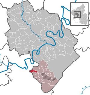
| Location of the local community Büdlich in the district of Bernkastel-Wittlich | ||
  |
||

Büdlich is a municipality in the district of Bernkastel-Wittlich in Rhineland-Palatinate . It belongs to the Verbandsgemeinde Thalfang am Erbeskopf .
geography
Büdlich is located in the Hunsrück, about five kilometers south of Trittenheim and eight kilometers northwest of Thalfang . The Kleine Dhron flows west of the village . The Büdlicher Bach flows through the village and flows into the small Dhron about 850 m west of the village. The community also includes the Bohnsmühle, Büdlicherbrück (part), Büdlichermühle and Schneidemühle residential areas .
history
Until the end of the 18th century, Büdlich belonged to the Electoral Trier office of Maximin . After the French Revolution , the Left Bank of the Rhine, and thus Büdlich, was taken over by France in 1794 . From 1798 to 1814 Büdlich was the capital of the canton of the same name in the Saar department and seat of a peace court . Due to a law of March 26, 1798, the French repealed feudal rights in the region. After the end of French rule, the place came to the Kingdom of Prussia in 1815 . The Dhrontalsperre was built north of Büdlich in 1911 . Since 1946 the place has been part of the then newly formed state of Rhineland-Palatinate.
- Population development
The development of the population of Büdlich, the values from 1871 are based on censuses:
|
|
politics
Municipal council
The council in Büdlich consists of six council members, who in the local elections on May 26, 2019 in a majority vote were elected, and the honorary mayor as chairman.
coat of arms
|
|
Blazon : "Field split from silver and gold, below covered with a green angular shield base, which is covered with golden oak leaf and from the top of which a green castle tower grows, in front a red bar cross, behind a black plow knife." |
| Justification of the coat of arms: The red cross on a silver background indicates the former rule of Kurtrier ; the ploughshare is reminiscent of agriculture as the village's main source of income in the past, the color green and the oak leaf symbolize the abundance of forests, the castle tower stands for the mountain cone that defines the landscape in the immediate vicinity of the village. |
economy
Büdlich is a rural residential community . There are small businesses for local needs.
Attractions
- Menhir von Büdlich ("Hinkelstein") between Büdlich and Heidenburg
- Burgkopf, between Büdlich and Büdlicherbrück with Joseph's Chapel, Burgkopfkapelle and Dhrontalkapelle
- Catholic parish church of St. Agatha with pulpit from the 15th century
- Dhrontalsperre
See also: List of cultural monuments in Büdlich
Web links
- To search for cultural assets of the local community Büdlich in the database of cultural assets in the Trier region .
- Link catalog on the topic Büdlich at curlie.org (formerly DMOZ )
Individual evidence
- ↑ State Statistical Office of Rhineland-Palatinate - population status 2019, districts, communities, association communities ( help on this ).
- ↑ State Statistical Office Rhineland-Palatinate (ed.): Official directory of the municipalities and parts of the municipality. Status: January 2018 [ Version 2020 is available. ] . S. 56 (PDF; 2.2 MB).
- ↑ State Statistical Office Rhineland-Palatinate - regional data
- ^ The Regional Returning Officer Rhineland-Palatinate: Local elections 2019, city and municipal council elections
Mountain light | Wide | Büdlich | Burtscheid | Deuselbach | Throne corners | Etgert | Gielert | Gräfendhron | Heidenburg | Hilscheid | Horath | Immert | Lückenburg | Malborn | Merschbach | Neunkirchen | Rorodt | Schoenberg | Talling | Thalfang

Altrich | Arenrath | Bausendorf | Brat | Mountain light | Mountain hamlet | Bernkastel-Kues | Bettenfeld | Binsfeld | Brauneberg | Wide | Break | Büdlich | Castle (Mosel) | Castles | Burtscheid | Deuselbach | Throne corners | Diefenbach | Dierfeld | Dierscheid | Dodenburg | Three | Corner field | Eisenschmitt | Enkirch | Earth | Esch | Etgert | River stream | Gielert | Gipperath | Gladbach | Gornhausen | Graach an der Mosel | Gräfendhron | Greimerath | Großlittgen | Hasborn | Heckenmünster | Heidenburg | Heidweiler | Hetzerath | Hilscheid | Hochscheid | Hontheim | Horath | Hupperath | Immert | Irmenach | Karl | Kesten | Kinderbeuern | Kinheim | Klausen | Kleinich | Coming | Kröv | Landscheid | Laufeld | Readers | Longkamp | Losnich | Lötzbeuren | Lückenburg | Malborn | Manderscheid | Maring-Noviand | Meerfeld | Merschbach | Minority | Minheim | Monzelfeld | Morbach | Mülheim an der Mosel | Musweiler | Neumagen-Dhron | Neunkirchen | Niederöfflingen | Niederscheidweiler | Niersbach | Oberöfflingen | Oberscheidweiler | Osann-Monzel | Pantenburg | Piesport | Plates | Plein | Reil | Rivenich | Rorodt | Salmtal | Schladt | Schoenberg | Schwarzenborn | Sehlem | Starkenburg | Talling | Thalfang | Traben-Trarbach | Ürzig | Veldenz | Wallscheid | Willwerscheid | Wintrich | Wittlich | Zeltingen-Rachtig