
Castle (mosel)
| coat of arms | Germany map | |
|---|---|---|
_COA.svg)
|
Coordinates: 50 ° 0 ' N , 7 ° 7' E |
|
| Basic data | ||
| State : | Rhineland-Palatinate | |
| County : | Bernkastel-Wittlich | |
| Association municipality : | Traben-Trarbach | |
| Height : | 110 m above sea level NHN | |
| Area : | 3.37 km 2 | |
| Residents: | 370 (Dec. 31, 2019) | |
| Population density : | 110 inhabitants per km 2 | |
| Postal code : | 56843 | |
| Area code : | 06541 | |
| License plate : | WIL, BKS | |
| Community key : | 07 2 31 014 | |
| Association administration address: | Am Markt 3 56841 Traben-Trarbach |
|
| Website : | ||
| Local Mayor : | Rudolf Bucher | |
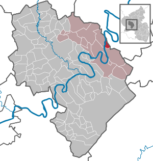
| Location of the municipality of Burg (Mosel) in the Bernkastel-Wittlich district | ||
 _in_WIL.svg) |
||

Burg (Mosel) is a wine-growing town on the Moselle in the Bernkastel-Wittlich district in Rhineland-Palatinate . The local community belongs to the Traben-Trarbach community .
geography
location

Burg is located on the right bank of the Moselle between Koblenz and Trier near Traben-Trarbach and Zell .
Land use
The size of the entire district is 361.83 hectares, of which 111.94 hectares are in the vineyards , 70 percent with Riesling and 30 percent with Müller-Thurgau grape varieties, 102.88 hectares in the forest, 83.32 hectares on land - mostly owned by the municipality - and 63.69 ha on other areas. The development of new building land enabled the village to expand to the border of Enkirch and, with the construction of 25 new repatriate farms, was given a completely new look.
Neighboring places
| Reil | Pünderich | Briedel |
.svg)
|
Cell | |
| Kröv | Enkirch |
history

The name Burg seems to be based on the existence of a Roman fort . The place is first mentioned in 928, when Duke Giselbert von Lothringen bequeathed Burg to Archbishop Rutger of Trier as a gift. The Archbishopric Trier was sovereign until 1794. Due to the turmoil of the French Revolution, Burg came under French rule and became part of the Kingdom of Prussia in 1815 after the defeat of Napoleon . Burg has been part of the state of Rhineland-Palatinate since 1946. The community has had the addition of "(Mosel)" to its name since May 1, 1970.
Municipal council
The municipal council in Burg consists of eight council members, who were elected by a majority vote in the local elections on May 26, 2019 , and the honorary local mayor as chairman.
Personalities
- Gustav von Stein , Prussian district administrator in the district of Zell (Mosel) from (1910–1935), builder of the mansion "Castle Castle" built from 1910 onwards.
See also
Web links
- Website of the local community Burg (Mosel)
- To search for cultural assets of the local community Burg (Mosel) in the database of cultural assets in the Trier region .
- Brief portrait of Burg bei Hierzuland , SWR television
- Link catalog on the topic of Burg / Moselle at curlie.org (formerly DMOZ )
Individual evidence
- ↑ State Statistical Office of Rhineland-Palatinate - population status 2019, districts, communities, association communities ( help on this ).
- ↑ Official municipality directory (= State Statistical Office of Rhineland-Palatinate [Hrsg.]: Statistical volumes . Volume 407 ). Bad Ems February 2016, p. 186 (PDF; 2.8 MB).
- ^ The Regional Returning Officer Rhineland-Palatinate: Local elections 2019, city and municipal council elections
Bausendorf | Brat | Castle | Diefenbach | Enkirch | River stream | Hontheim | Irmenach | Kinderbeuern | Kinheim | Kröv | Lötzbeuren | Reil | Starkenburg | Traben-Trarbach | Willwerscheid

Altrich | Arenrath | Bausendorf | Brat | Mountain light | Mountain hamlet | Bernkastel-Kues | Bettenfeld | Binsfeld | Brauneberg | Wide | Break | Büdlich | Castle (Mosel) | Castles | Burtscheid | Deuselbach | Throne corners | Diefenbach | Dierfeld | Dierscheid | Dodenburg | Three | Corner field | Eisenschmitt | Enkirch | Earth | Esch | Etgert | River stream | Gielert | Gipperath | Gladbach | Gornhausen | Graach an der Mosel | Gräfendhron | Greimerath | Großlittgen | Hasborn | Heckenmünster | Heidenburg | Heidweiler | Hetzerath | Hilscheid | Hochscheid | Hontheim | Horath | Hupperath | Immert | Irmenach | Karl | Kesten | Kinderbeuern | Kinheim | Klausen | Kleinich | Coming | Kröv | Landscheid | Laufeld | Readers | Longkamp | Losnich | Lötzbeuren | Lückenburg | Malborn | Manderscheid | Maring-Noviand | Meerfeld | Merschbach | Minority | Minheim | Monzelfeld | Morbach | Mülheim an der Mosel | Musweiler | Neumagen-Dhron | Neunkirchen | Niederöfflingen | Niederscheidweiler | Niersbach | Oberöfflingen | Oberscheidweiler | Osann-Monzel | Pantenburg | Piesport | Plates | Plein | Reil | Rivenich | Rorodt | Salmtal | Schladt | Schoenberg | Schwarzenborn | Sehlem | Starkenburg | Talling | Thalfang | Traben-Trarbach | Ürzig | Veldenz | Wallscheid | Willwerscheid | Wintrich | Wittlich | Zeltingen-Rachtig