
Hasborn (Eifel)
| coat of arms | Germany map | |
|---|---|---|

|
Coordinates: 50 ° 3 ' N , 6 ° 55' E |
|
| Basic data | ||
| State : | Rhineland-Palatinate | |
| County : | Bernkastel-Wittlich | |
| Association municipality : | Wittlich-Land | |
| Height : | 375 m above sea level NHN | |
| Area : | 6.18 km 2 | |
| Residents: | 617 (Dec. 31, 2019) | |
| Population density : | 100 inhabitants per km 2 | |
| Postal code : | 54533 | |
| Area code : | 06574 | |
| License plate : | WIL, BKS | |
| Community key : | 07 2 31 049 | |
| Association administration address: | Kurfürstenstrasse 1 54516 Wittlich |
|
| Website : | ||
| Local Mayor : | Hermann Leister | |
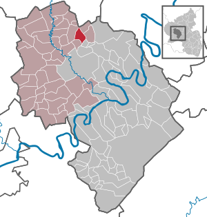
| Location of the local community Hasborn in the Bernkastel-Wittlich district | ||
  |
||


Hasborn in the Eifel is a municipality in the district of Bernkastel-Wittlich in Rhineland-Palatinate . It belongs to the Verbandsgemeinde Wittlich-Land .
history
Hasborn was first mentioned in 1341 in a document from Elector Baldwin . The place name probably results from "Havekesbrunno", which means hawk well. This is referred to in the legend book of the Wittlich district. Another interpretation of the name refers to a Franconian named Hasso who built a courtyard at a well ("Born"). At this fountain an old Roman road led past, traces of which can still be seen in the deeply cut ravine , the "Holg" means.
Hasborn probably originated in the submerged village of Ritzeroth, which was last mentioned in 1357 and was located in a side valley of the Sammetbach on today's road to Oberscheidweiler . Like many other villages in the area, Ritzeroth must have died out due to the plague. The field name “Reizat” is reminiscent of this lost village. As an imperial knighthood village, Hasborn was not subject to the local sovereigns, but to an imperial knight. From 1726 Hasborn was a station on the Trier - Koblenz stagecoach line. This line operated until 1879.
From 1794 Hasborn was under French rule, in 1815 the place was assigned to the Kingdom of Prussia at the Congress of Vienna . Since 1946 it has been part of the then newly formed state of Rhineland-Palatinate.
Municipal council
The council in Hasborn consists of twelve council members, who in the local elections on May 26, 2019 in a majority vote were elected, and the honorary mayor as chairman.
Culture and sights
Natural monuments
Hasborner Sauerbrunnen
In the Sammetbachtal between Hasborn and Oberscheidweiler, directly on the banks of the Sammetbach, the Hasborner Sauerbrunnen is located , a spring emerging from Devonian rocks. The spring water is brown in color and has a sour taste. Dissolved iron is responsible for the color and carbon dioxide of volcanic origin is responsible for the taste .
Oak grove
According to tradition, the oak grove, almost 400 year old oak trees in the center of Hasborn, was created during the Thirty Years War , when marauding gangs made it impossible for the farmers to drive the pigs to pasture in the surrounding oak forests. Instead, the villagers gathered the acorns in the forest and then gave them to the animals on the outskirts as food. Some fruits are said to have been worked into the soil by the four-legged friends so that germs and saplings could develop.
Schanzley
The Schanzley is a steep rock high above the Sammetbachtal, deep in the forest and therefore difficult to find.
Buildings
Old Chapel of Saint Roch

- High altar around 1700 (Dehio)
- Former parish church from 1775 with stations of the cross
- 1967 profaned, 1997/98 interior and exterior renovation (German Foundation for Monument Protection)
- today a cultural center used for events: exhibitions, concerts, readings and theater
New Church of Saint Roch
- new, modern church with tent roof in the old oak grove
- inaugurated in 1968
- Architect Böhr from Trier
- Führer organ , which originally stood in Bergkamen
Hasborner Mill
The Hasborner Mühle, located on the Sammetbach stream and used as a grain mill until 1957, has been empty for several years.
Neuglück copper mine
The decommissioned Neuglück copper mine is located on the border with Willwerscheid . Access is blocked by a lattice door in the mountain, but the tunnel is visible.
Sports
In the DJK Hasborn eV (more than 500 members) the sports soccer, tennis, gymnastics and volleyball are practiced. In Hasborn there is a grass soccer field, a training field, three tennis courts, a large multi-purpose sports hall and a bowling alley in the Hotel Thomas. In addition, the Maare-Mosel cycle path leads through the village on the route of the disused Eifelbahn .
Economy and Infrastructure
traffic
There is a direct connection to Federal Motorway 1 via the Hasborn junction . Landesstraße 52, the old connection between Trier and Koblenz, runs through Hasborn. Buses run to Wittlich and Daun.
education
- Hasborn-Greimerath kindergarten
- six-class primary school attended by children from all the surrounding villages.
Valuable wood storage area
The valuable wood storage area of the Rhineland-Palatinate State Forests is located in Hasborn. All valuable wood from the wide area is stored on a large area for viewing and auctioning. The path to the valuable wood storage area branches off from the road to Niederöfflingen or the Maare-Mosel cycle path and is signposted.
Photovoltaic system
Hasborn has the largest intermunicipal photovoltaic system in Rhineland-Palatinate. The capacity is 12 megawatts. The solar park consists of two sub-systems with an area of 40 hectares, which are divided between the Hasborn and Niederöfflingen districts. The facility was inaugurated on April 12, 2010 in the presence of ministers Margit Conrad and Malu Dreyer .
Hasborn's sons and daughters
- Edeltrud Bayer (* 1957), Ltd. Director, State Office for Mobility, Trier
- Hermann Simon (* 1947), economics professor, management consultant and entrepreneur
Web links
- Link catalog on Hasborn at curlie.org (formerly DMOZ )
Individual evidence
- ↑ State Statistical Office of Rhineland-Palatinate - population status 2019, districts, communities, association communities ( help on this ).
- ^ The Regional Returning Officer Rhineland-Palatinate: Local elections 2019, city and municipal council elections

Altrich | Arenrath | Bausendorf | Brat | Mountain light | Mountain hamlet | Bernkastel-Kues | Bettenfeld | Binsfeld | Brauneberg | Wide | Break | Büdlich | Castle (Mosel) | Castles | Burtscheid | Deuselbach | Throne corners | Diefenbach | Dierfeld | Dierscheid | Dodenburg | Three | Corner field | Eisenschmitt | Enkirch | Earth | Esch | Etgert | River stream | Gielert | Gipperath | Gladbach | Gornhausen | Graach an der Mosel | Gräfendhron | Greimerath | Großlittgen | Hasborn | Heckenmünster | Heidenburg | Heidweiler | Hetzerath | Hilscheid | Hochscheid | Hontheim | Horath | Hupperath | Immert | Irmenach | Karl | Kesten | Kinderbeuern | Kinheim | Klausen | Kleinich | Coming | Kröv | Landscheid | Laufeld | Readers | Longkamp | Losnich | Lötzbeuren | Lückenburg | Malborn | Manderscheid | Maring-Noviand | Meerfeld | Merschbach | Minority | Minheim | Monzelfeld | Morbach | Mülheim an der Mosel | Musweiler | Neumagen-Dhron | Neunkirchen | Niederöfflingen | Niederscheidweiler | Niersbach | Oberöfflingen | Oberscheidweiler | Osann-Monzel | Pantenburg | Piesport | Plates | Plein | Reil | Rivenich | Rorodt | Salmtal | Schladt | Schoenberg | Schwarzenborn | Sehlem | Starkenburg | Talling | Thalfang | Traben-Trarbach | Ürzig | Veldenz | Wallscheid | Willwerscheid | Wintrich | Wittlich | Zeltingen-Rachtig