
Kinheim
| coat of arms | Germany map | |
|---|---|---|

|
Coordinates: 49 ° 58 ' N , 7 ° 3' E |
|
| Basic data | ||
| State : | Rhineland-Palatinate | |
| County : | Bernkastel-Wittlich | |
| Association municipality : | Traben-Trarbach | |
| Height : | 110 m above sea level NHN | |
| Area : | 9.07 km 2 | |
| Residents: | 803 (Dec. 31, 2019) | |
| Population density : | 89 inhabitants per km 2 | |
| Postal code : | 54538 | |
| Area code : | 06532 | |
| License plate : | WIL, BKS | |
| Community key : | 07 2 31 068 | |
| LOCODE : | DE EI9 | |
| Community structure: | 3 districts | |
| Association administration address: | Am Markt 3 56841 Traben-Trarbach |
|
| Website : | ||
| Local Mayor : | Walter Klink | |
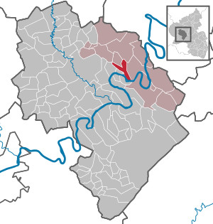
| Location of the local community Kinheim in the district of Bernkastel-Wittlich | ||
  |
||


Kinheim is a municipality in the district of Bernkastel-Wittlich in Rhineland-Palatinate . It belongs to the Traben-Trarbach community . Kinheim is a state-approved health resort .
geography
The place Kinheim is on the left side of the Middle Moselle at the height of the Moselle river kilometer 116. The district Kindel on the right side of the Moselle. The two districts are connected by a Moselle bridge. The district of Sengwald is embedded in the Alftal between the village of Kinderbeuern and the Ürziger Bahnhof settlement . Around half of the district area is forested.
climate
The annual precipitation is 706 mm. The precipitation is in the middle third of the values recorded in Germany. Lower values are registered at 41% of the measuring stations of the German Weather Service . The driest month is February, with the most rainfall in June. In June there is 1.6 times more rainfall than in February. Precipitation varies only minimally and is extremely evenly distributed over the year. Lower seasonal fluctuations are recorded at only 3% of the measuring stations .
Neighboring communities
| Bausendorf | Kinderbeuern | Brat |
| Urzig |
.svg)
|
Kröv |
| Losnich | Kindel | Traben-Trarbach |
history
The first written mention of the place name Kinheim took place in 1161. The meaning of the name is uncertain. Presumably the determiner Ken is of pre-Roman origin. The basic word home indicates that Kinheim is an early Franconian settlement. The Kindel opposite Kinheim is already mentioned as a Kennelle in 1069 and is later called Kinelle (1304) or Kinnel (1404). Kindel is certainly a daughter settlement of Kinheim, because Kennelle means "little Kinheim". In addition, Kinheim owned an outlying settlement in the Alftal , today's Kinderbeuern (1296: Kynheymerbüren ), which was incorporated into the Kinheim community until 1740.
From 1794 Kinheim was under French rule , in 1815 the place was assigned to the Kingdom of Prussia at the Congress of Vienna . Since 1946 it has been part of the state of Rhineland-Palatinate .
In the Kindel district, the remains of a Celtic-Roman court from the 3rd century were excavated. A high relief of the flail god Sucellus was discovered. This archaeological find is the oldest evidence of viticulture on the Moselle. The original relief figure is now in the Rheinisches Landesmuseum Trier .
- Population development
The development of the population of the municipality Kinheim, the values from 1871 to 1987 are based on censuses:
|
|
politics
Municipal council
The council in Kinheim consists of twelve council members, who in the local elections on May 26, 2019 in a majority vote were elected, and the honorary mayor as chairman.
Partnerships
The municipality is linked through a partnership with the Belgian city of Harelbeke ( West Flanders ) and with the French municipality of Ambonnay ( Champagne ).
Economy and Infrastructure

- The community is characterized by viticulture and tourism . Wines thrive in the individual layers of Rosenberg , Hubertuslay and Römerhang on around 120 hectares of vineyards . All three vineyards belong to the large Schwarzlay site and the Bernkastel area of the Moselle growing region .
- The federal highway 53 leads through the village . Federal motorway 1 runs to the west . This is followed by the Wittlich-Mitte exit about 15 km away . Since the completion of the Hochmosel crossing , the four-lane federal highway 50 has been accessible via the Erden-Lösnich junction about four kilometers away. This shortened the travel time to the Autobahn 61 at the Rheinböllen junction from around 50 minutes to around 40 minutes.
- In nearby Ürzig there is a train station on the Moselle line .
societies
In Kinheim-Kindel there are the clubs gymnastics and sports club, winemaker Chapel Volunteer Fire Department, village youth Kinheim-Kindel and the carnival club. Throughout the year, these associations also organize and carry out some events in the village.
Sons and daughters of the church
- Helmut Mathy (1934–2008), German historian and politician
- Alfred Beth (* 1940), German politician and administrative lawyer; State Minister for Environment and Health of the State of Rhineland-Palatinate (1988–1991)
See also

Catholic parish church of St. Martin

Echternacher Hof

Grafenhof

Old Town Hall

War memorial 1914/18


Web links
- To search for cultural assets of the local community Kinheim in the database of cultural assets in the Trier region .
- Short portrait of Kinheim bei Hierzuland , SWR television
- Video of the Sucellus remains in Kinheim-Kindel
Individual evidence
- ↑ State Statistical Office of Rhineland-Palatinate - population status 2019, districts, communities, association communities ( help on this ).
- ^ A b c State Statistical Office Rhineland-Palatinate - regional data
- ^ A b c Erwin Schaaf: Verbandsgemeinde Kröv-Bausendorf. Country and people in old photos. Geiger-Verlag, Horb am Neckar 2006, pp. 114–115.
- ^ The Regional Returning Officer Rhineland-Palatinate: Local elections 2019, city and municipal council elections
Bausendorf | Brat | Castle | Diefenbach | Enkirch | River stream | Hontheim | Irmenach | Kinderbeuern | Kinheim | Kröv | Lötzbeuren | Reil | Starkenburg | Traben-Trarbach | Willwerscheid

Altrich | Arenrath | Bausendorf | Brat | Mountain light | Mountain hamlet | Bernkastel-Kues | Bettenfeld | Binsfeld | Brauneberg | Wide | Break | Büdlich | Castle (Mosel) | Castles | Burtscheid | Deuselbach | Throne corners | Diefenbach | Dierfeld | Dierscheid | Dodenburg | Three | Corner field | Eisenschmitt | Enkirch | Earth | Esch | Etgert | River stream | Gielert | Gipperath | Gladbach | Gornhausen | Graach an der Mosel | Gräfendhron | Greimerath | Großlittgen | Hasborn | Heckenmünster | Heidenburg | Heidweiler | Hetzerath | Hilscheid | Hochscheid | Hontheim | Horath | Hupperath | Immert | Irmenach | Karl | Kesten | Kinderbeuern | Kinheim | Klausen | Kleinich | Coming | Kröv | Landscheid | Laufeld | Readers | Longkamp | Losnich | Lötzbeuren | Lückenburg | Malborn | Manderscheid | Maring-Noviand | Meerfeld | Merschbach | Minority | Minheim | Monzelfeld | Morbach | Mülheim an der Mosel | Musweiler | Neumagen-Dhron | Neunkirchen | Niederöfflingen | Niederscheidweiler | Niersbach | Oberöfflingen | Oberscheidweiler | Osann-Monzel | Pantenburg | Piesport | Plates | Plein | Reil | Rivenich | Rorodt | Salmtal | Schladt | Schoenberg | Schwarzenborn | Sehlem | Starkenburg | Talling | Thalfang | Traben-Trarbach | Ürzig | Veldenz | Wallscheid | Willwerscheid | Wintrich | Wittlich | Zeltingen-Rachtig