
Gipperath
| coat of arms | Germany map | |
|---|---|---|

|
Coordinates: 50 ° 2 ′ N , 6 ° 52 ′ E |
|
| Basic data | ||
| State : | Rhineland-Palatinate | |
| County : | Bernkastel-Wittlich | |
| Association municipality : | Wittlich-Land | |
| Height : | 370 m above sea level NHN | |
| Area : | 4.87 km 2 | |
| Residents: | 229 (Dec. 31, 2019) | |
| Population density : | 47 inhabitants per km 2 | |
| Postal code : | 54533 | |
| Area code : | 06574 | |
| License plate : | WIL, BKS | |
| Community key : | 07 2 31 036 | |
| Association administration address: | Kurfürstenstrasse 1 54516 Wittlich |
|
| Website : | ||
| Local Mayor : | Hans-Leo Schäfer | |
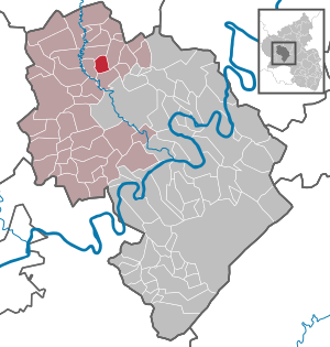
| Location of the local community of Gipperath in the Bernkastel-Wittlich district | ||
  |
||

Gipperath (first mentioned in 1098 as Gevenrothe ) is a municipality in the district of Bernkastel-Wittlich in Rhineland-Palatinate . It has been a member of the Wittlich-Land community since July 1, 2014 .
geography
The place is in the Vulkaneifel . 42 percent of the district area is forested. In the north-east is Niederöfflingen , 3 km away , Plein in the south-east, 4 km away, and Schladt, 3 km away, in the south-west . The nearby forest is called Geisbüch.
history
The place was first mentioned in 1098 as Gevenrothe in St. Simeon's Abbey in Trier . The place already had a church in the 12th century. From 1794 Gipperath was under French rule, in 1815 the place was assigned to the Kingdom of Prussia at the Congress of Vienna . The first telephone system was installed in June 1908, the water pipe went into operation in May 1913 and the power supply went into operation in December 1920. Since 1946 the place has been part of the then newly formed state of Rhineland-Palatinate .
politics
Municipal council
The council in Gipperath consists of six council members, who in the local elections on May 26, 2019 in a majority vote were elected, and the honorary mayor as chairman.
mayor
The local mayor is Hans-Leo Schäfer, who replaced Alfred Oster in 1991.
Parish partnership
There is a partnership with the French municipality of Beuvillers . Every two years the Gipperathers go to France and the French come to Gipperath in turn.
Culture and sights
The oak grove (just before the entrance, can be seen from a great distance), the Gipperather mill, the barrows, the church from the 16th century and the cross with St. Quirinus , to whom the church is consecrated and whose patronage is on, are worth seeing April 30th is celebrated. There is an altar in the church that replaced a simple wooden table in the 1990s. There is an emblem with a cross on the front. This cross represents the 12 tribes of the apostles. Behind this stone slab there are finger bones as a relic .
The music festival "GESAT back to the roots" has been taking place in Gipperath since 2007. Renowned bands from various musical genres perform here once a year .
See also:
Economy and Infrastructure
In the east, which runs Federal Highway 1 , south of the Bundesautobahn 60 . District road 21 leads through the village .
Web links
- Brief portrait of Gipperath bei Hierzuland , SWR television
- To search for cultural assets of the local community Gipperath in the database of cultural assets in the Trier region .
Individual evidence
- ↑ State Statistical Office of Rhineland-Palatinate - population status 2019, districts, communities, association communities ( help on this ).
- ↑ Local election Rhineland-Palatinate 2019, local council

Altrich | Arenrath | Bausendorf | Brat | Mountain light | Mountain hamlet | Bernkastel-Kues | Bettenfeld | Binsfeld | Brauneberg | Wide | Break | Büdlich | Castle (Mosel) | Castles | Burtscheid | Deuselbach | Throne corners | Diefenbach | Dierfeld | Dierscheid | Dodenburg | Three | Corner field | Eisenschmitt | Enkirch | Earth | Esch | Etgert | River stream | Gielert | Gipperath | Gladbach | Gornhausen | Graach an der Mosel | Gräfendhron | Greimerath | Großlittgen | Hasborn | Heckenmünster | Heidenburg | Heidweiler | Hetzerath | Hilscheid | Hochscheid | Hontheim | Horath | Hupperath | Immert | Irmenach | Karl | Kesten | Kinderbeuern | Kinheim | Klausen | Kleinich | Coming | Kröv | Landscheid | Laufeld | Readers | Longkamp | Losnich | Lötzbeuren | Lückenburg | Malborn | Manderscheid | Maring-Noviand | Meerfeld | Merschbach | Minority | Minheim | Monzelfeld | Morbach | Mülheim an der Mosel | Musweiler | Neumagen-Dhron | Neunkirchen | Niederöfflingen | Niederscheidweiler | Niersbach | Oberöfflingen | Oberscheidweiler | Osann-Monzel | Pantenburg | Piesport | Plates | Plein | Reil | Rivenich | Rorodt | Salmtal | Schladt | Schoenberg | Schwarzenborn | Sehlem | Starkenburg | Talling | Thalfang | Traben-Trarbach | Ürzig | Veldenz | Wallscheid | Willwerscheid | Wintrich | Wittlich | Zeltingen-Rachtig