
Etgert
| coat of arms | Germany map | |
|---|---|---|

|
Coordinates: 49 ° 47 ' N , 7 ° 1' E |
|
| Basic data | ||
| State : | Rhineland-Palatinate | |
| County : | Bernkastel-Wittlich | |
| Association municipality : | Thalfang at the Erbeskopf | |
| Height : | 445 m above sea level NHN | |
| Area : | 3.75 km 2 | |
| Residents: | 66 (Dec. 31, 2019) | |
| Population density : | 18 inhabitants per km 2 | |
| Postal code : | 54424 | |
| Area code : | 06504 | |
| License plate : | WIL, BKS | |
| Community key : | 07 2 31 032 | |
| Address of the municipal administration: |
Saarstrasse 7 54424 Thalfang |
|
| Website : | ||
| Local Mayor : | Sabrina Kirch | |
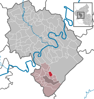
| Location of the local community Etgert in the district of Bernkastel-Wittlich | ||
  |
||

Etgert im Hunsrück is a municipality in the district of Bernkastel-Wittlich in Rhineland-Palatinate . It belongs to the Verbandsgemeinde Thalfang am Erbeskopf .
history
There is evidence that Etgert belonged to the Thalfang region from 1112 onwards . From 1800 the community was then part of the Mairie Thalfang. Due to the turmoil of the French Revolution , it came under French rule after 1794 and became part of the Kingdom of Prussia in 1815 . Since 1946 the place has been part of the then newly formed state of Rhineland-Palatinate. Until the municipal administration reform of Rhineland-Palatinate in 1969, the Hunsrück town was part of the Bernkastel district .
- Population development
The development of the population of Etgert, the values from 1871 to 1987 are based on censuses:
|
|
politics
Municipal council
The local council in Etgert consists of six council members, who were elected in the local elections on May 26, 2019 in a majority election, and the honorary local mayor as chairman.
coat of arms
|
|
Blazon : "In gold, a blue-armored and tongued red lion, accompanied by ten green oak leaves." |
| Reasons for the coat of arms: The lion on the golden background is the symbol of the Wild and Rhine Counts. The oak leaves stand for an old oak at the entrance to the village, as well as the oak forests that surround the field marrow |
economy
Etgert is a rural residential community with small businesses for local needs.
See also
Web links
- Portrait and video of Etgert in the show Hierzuland on SWR television
Individual evidence
- ↑ State Statistical Office of Rhineland-Palatinate - population status 2019, districts, communities, association communities ( help on this ).
- ^ Etgert - Hunsrück-Nahe trip. Retrieved June 14, 2018 .
- ↑ regional data . State Statistical Office of Rhineland-Palatinate
- ↑ Local elections 2019, city and municipal council elections. The State Returning Officer Rhineland-Palatinate
- ↑ Local communities - Etgert - coat of arms. Verbandsgemeinde Thalfang, accessed on June 14, 2018 .
Mountain light | Wide | Büdlich | Burtscheid | Deuselbach | Throne corners | Etgert | Gielert | Gräfendhron | Heidenburg | Hilscheid | Horath | Immert | Lückenburg | Malborn | Merschbach | Neunkirchen | Rorodt | Schoenberg | Talling | Thalfang

Altrich | Arenrath | Bausendorf | Brat | Mountain light | Mountain hamlet | Bernkastel-Kues | Bettenfeld | Binsfeld | Brauneberg | Wide | Break | Büdlich | Castle (Mosel) | Castles | Burtscheid | Deuselbach | Throne corners | Diefenbach | Dierfeld | Dierscheid | Dodenburg | Three | Corner field | Eisenschmitt | Enkirch | Earth | Esch | Etgert | River stream | Gielert | Gipperath | Gladbach | Gornhausen | Graach an der Mosel | Gräfendhron | Greimerath | Großlittgen | Hasborn | Heckenmünster | Heidenburg | Heidweiler | Hetzerath | Hilscheid | Hochscheid | Hontheim | Horath | Hupperath | Immert | Irmenach | Karl | Kesten | Kinderbeuern | Kinheim | Klausen | Kleinich | Coming | Kröv | Landscheid | Laufeld | Readers | Longkamp | Losnich | Lötzbeuren | Lückenburg | Malborn | Manderscheid | Maring-Noviand | Meerfeld | Merschbach | Minority | Minheim | Monzelfeld | Morbach | Mülheim an der Mosel | Musweiler | Neumagen-Dhron | Neunkirchen | Niederöfflingen | Niederscheidweiler | Niersbach | Oberöfflingen | Oberscheidweiler | Osann-Monzel | Pantenburg | Piesport | Plates | Plein | Reil | Rivenich | Rorodt | Salmtal | Schladt | Schoenberg | Schwarzenborn | Sehlem | Starkenburg | Talling | Thalfang | Traben-Trarbach | Ürzig | Veldenz | Wallscheid | Willwerscheid | Wintrich | Wittlich | Zeltingen-Rachtig