
Manderscheid
| coat of arms | Germany map | |
|---|---|---|

|
Coordinates: 50 ° 6 ′ N , 6 ° 49 ′ E |
|
| Basic data | ||
| State : | Rhineland-Palatinate | |
| County : | Bernkastel-Wittlich | |
| Association municipality : | Wittlich-Land | |
| Height : | 388 m above sea level NHN | |
| Area : | 10.06 km 2 | |
| Residents: | 1402 (Dec. 31, 2019) | |
| Population density : | 139 inhabitants per km 2 | |
| Postal code : | 54531 | |
| Area code : | 06572 | |
| License plate : | WIL, BKS | |
| Community key : | 07 2 31 080 | |
| Association administration address: | Kurfürstenstrasse 1 54516 Wittlich |
|
| Website : | ||
| City Mayor : | Günter Krämer | |
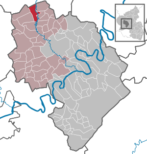
| Location of the city of Manderscheid in the district of Bernkastel-Wittlich | ||
  |
||

.jpg)

Manderscheid is a Rhineland-Palatinate town in the Bernkastel-Wittlich district . It has been a member of the Wittlich-Land community since July 1, 2014 . Until then, Manderscheid was the administrative seat of the disbanded Verbandsgemeinde Manderscheid , to which 21 municipalities belonged. Manderscheid is a climatic health resort and Kneipp health resort and is designated as a basic center according to state planning .
geography
location
The city is located in the southern Eifel between the rivers Lieser in the east and Kleine Kyll in the west . North-east of Manderscheid lies the Bleckhausen juniper protection area , the largest of its kind in the entire Eifel .
structure
Manderscheid also includes the Niedermanderscheid district and the Birkenhof, Dombachhof, Drei-Tannenhof, Heidsmühle, Kapellenhof, Lindenhof and Sonnenhof residential areas .
climate
The annual precipitation is 908 mm. The rainfall is high. They are in the upper quarter of the values recorded in Germany. Lower values are registered at 78% of the measuring stations of the German Weather Service . The driest month is April, with the most rainfall in December. In December there is 1.5 times more rainfall than in April. The rainfall varies moderately. Lower seasonal fluctuations are recorded at 52% of the measuring stations .
history
Pre-Roman and Roman times
If, as one can guess, the first part of the name Manderscheid is derived from the Celtic word “mantara” = pine , then this should be taken as proof that the Manderscheid area was inhabited very early. Several Stone Age settlements have been found near Schwarzenborn . It is also known that on the road from Steineberg to Demerath (near Mehren) a large number of graves from the Hallstatt period with many decorative objects and devices have been discovered, so that one speaks of a Mehren culture . In Wallscheid also graves were La Tene period and Hallstatt period found as well (1916) in Laufeld . At Wallscheid there were two iron arrowheads from this period and a bronze vessel.
The finds from the Roman period are more numerous . In addition to the Villa von Manderscheid , which was discovered in 1863 at the foot of the Mosenberg, Roman finds come to light in almost all the localities in the area. In Dierfeld and Wallscheid remains of such villas , graves and urns were found in Laufeld, Manderscheid, Openlingen, Pantenburg, Wallscheid, Großlittgen, Oberkail and Karl, and occasionally coins. In addition to the Viergötterstein from Großlittgen, two altars that were found in Pantenburg in 1920 deserve special attention . They were dedicated to the god Voroius and the goddesses Boudina and Alauna and probably belonged to a Gallo-Roman spring shrine. This may make it clear that in Roman times there were already a large number of settlements in the area around Manderscheid.
middle Ages


Finds from the Franconian period are rarer - as almost everywhere. A lance, a spear and a shield were found in Pantenburg, a sword and a visor plate in Eckfeld .
In spite of these sparse finds, we can assume a considerable density of settlement for this time, and the majority of today's localities will have arisen at that time, as the place names with the endings -scheid, -feld, -ingen indicate. So in 794 and 895 "Officinus Villa" (today's Openlingen) is mentioned, 973 Manderscheid and "Eckiveld" (Eckfeld), 1161 "Louvenvelt" (Laufeld).
Manderscheid was first mentioned in 973 in a document from Emperor Otto II as "Mandreschreit". Since the middle of the 12th century it belonged to Kurtrier . Manderscheid received city rights in 1332. At that time, Bishop Balduin of Luxembourg from Emperor Ludwig the Bavarian had a collective privilege for a total of 30 places in his diocese, including Manderscheid, confirm old city rights and transfer new ones. Manderscheid was the capital of an Electoral Trier office and seat of the imperial counts of Manderscheid .
The history of the Luziakirche
The Luziakirche , also called Luciakapelle (probably the first church in the village) was located in the Middle Ages on the northern outskirts of Manderscheid. In 1386 Lucia von Manderscheid , wife of Heinrich von Manderscheid , was buried there. Around 1794 the chapel was burned down by French troops. The former location is now deserted , which means that no remains of the chapel are visible. Only a street name reminds of it. The portrait of Our Lady of Sorrows, which is now in the parish church of St. Hubertus, comes from the Luzia Chapel. The Pietà dates from around 1600; traces of fire were discovered during the restoration in the 1960s.
Modern times

From 1794 the whole of Manderscheid was under French rule, in 1815 the place was assigned to the Kingdom of Prussia at the Congress of Vienna . Since 1946 it has been part of the then newly formed state of Rhineland-Palatinate . The building of the former electoral winery housed the seat of the Manderscheid municipal administration until 2014 .
On June 7, 1969, the previously independent community of Niedermanderscheid was incorporated. Manderscheid has been a town since January 16, 1998 .
The Verbandsgemeinde Manderscheid , which was dissolved on July 1, 2014, consisted of almost the same individual communities as the former County of Manderscheid .
Population development
In 1852 74 people lived in 8 households in Manderscheid.
The development of the population of Manderscheid in relation to today's urban area, the values from 1871 to 1987 are based on censuses:
|
|
politics
City council
The City Council in Manderscheid consists of 16 council members, who in the local elections on May 26, 2019 in a majority vote were elected, and the volunteer city mayor as chairman. In the previous elections, personalized proportional representation took place.
The distribution of seats in the city council:
| choice | SPD | CDU | Forum | total |
|---|---|---|---|---|
| 2019 | by majority vote | 16 seats | ||
| 2014 | by majority vote | 16 seats | ||
| 2009 | - | 7th | 9 | 16 seats |
| 2004 | 2 | 9 | 5 | 16 seats |
mayor
City Mayor is Günter Krämer (Forum).
Culture and sights
The two castles of Manderscheid , the Upper and Lower Castle , are well known. The gemstone cutting shop , the local museum and the maar museum are also interesting for tourists . Manderscheid is located on the Lieser , which you can follow on the Lieser path of the Eifelverein to Daun or Wittlich . In addition, the 330 km long Eifelsteig leads through Manderscheid from Aachen to Trier. Manderscheid is the venue for the Eifel Culture Days.
Manderscheid is also known nationwide for the Manderscheider Castle Festival.
Manderscheider Platt

The traditional Manderscheider dialect (in Eifel dialect : Maanischder Platt ) is one of the Moselle-Franconian dialects. In addition to words that do not exist in Standard German, it has the following peculiarities:
- A ch as in milk there is not. It is replaced by sch .
- Some voiced sounds are replaced by voiceless ones: blood becomes ploot , faith becomes clown .
- The a is pronounced openly and broadly like Wääsch and Frääsch .
- ei is pronounced like ai .
- The consonant combination rt is pronounced like in French cht : place becomes ocht .
Economy, infrastructure and transport
The Manderscheider measure called until the mid 19th century in the flour mills to Lieser , Salm and Kleine Kyll the size of Malters (1 Malter corresponded to 221.15 liters ). The Malter measure was not the same everywhere, but very different from region to region. The Manderscheider Measure was issued in a mill order from October 20, 1736 by Elector Franz-Georg and applied to the entire Electorate of Trier .
In 1963 Manderscheid was recognized as a "health resort with a healthy climate", and health tourism is still an important economic factor today.
Manderscheid is on the A1 motorway . The Manderscheid-Pantenburg train station was located near Manderscheid until the Maare-Mosel Railway was shut down .
Personalities
- Wilhelm Meyer (1835–1900), Mayor of Malstatt-Burbach (1866–1900)
- Josef Simon (1868–1945), plant physiologist in Dresden
- Alfred Winkler (1872–1945), entrepreneur, had a holiday home in Manderscheid
- Wolfgang Leonhard (1921–2014), writer, publicist and historian, lived in Manderscheid
- Rainer Laupichler (* 1957), actor and manager of the Eifel-Kulturtage
- Sabine Röhl (1957–2012), politician (SPD) and district administrator for the Bad Dürkheim district
- Michael Siefener (* 1961), writer and translator, lives in Manderscheid
Web links
- Link catalog on Manderscheid at curlie.org (formerly DMOZ )
Individual evidence
- ↑ State Statistical Office of Rhineland-Palatinate - population status 2019, districts, communities, association communities ( help on this ).
- ↑ a b State Statistical Office Rhineland-Palatinate - regional data
- ↑ State Statistical Office Rhineland-Palatinate (ed.): Official directory of the municipalities and parts of the municipality. Status: January 2019 [ Version 2020 is available. ] . S. 91 (PDF; 3 MB).
- ↑ Heinrich Beyer : Document book on the history of the Middle Rhine territories now forming the Prussian administrative districts of Coblenz and Trier . Volume 1: From the oldest times to the year 1169 . J. Hölscher Koblenz 1860, p. 294, certificate no.238.
- ↑ Ernst Wackenroder (arrangement): The art monuments of the Wittlich district . Schwann, Düsseldorf 1934, p. 1006.
- ↑ Erich Keyser (Ed.): City Book of Rhineland-Palatinate and Saarland (= German City Book. Handbook of Urban History , Part 4: Southwest Germany , Vol. 3). Kohlhammer, Stuttgart 1964, p. 29.
- ↑ a b Official municipality directory (= State Statistical Office of Rhineland-Palatinate [Hrsg.]: Statistical volumes . Volume 407 ). Bad Ems February 2016, p. 171, 187 (PDF; 2.8 MB).
- ↑ Johann Friedrich Schanat: Eiflia Illustrata or geographical and historical description of the Eifel . Jacob Anton Mayer , Aachen & Leipzig 1854, p. 411 .
- ^ The Regional Returning Officer Rhineland-Palatinate: Local elections 2019, city and municipal council elections.
- ^ Manderscheid local history museum. Bauer + Kirch GmbH, accessed on July 6, 2020 .
- ↑ Carlo Padilla; Sou prattles Maanischd , 2008
- ↑ Manderscheid. In: Guest Landscapes Rhineland-Palatinate. Rheinland-Pfalz Tourismus GmbH, accessed on July 6, 2020 .
- ↑ Starting shot for the healthy land. In: Trierischer Volksfreund , January 14, 2014. Accessed December 20, 2014.

Altrich | Arenrath | Bausendorf | Brat | Mountain light | Mountain hamlet | Bernkastel-Kues | Bettenfeld | Binsfeld | Brauneberg | Wide | Break | Büdlich | Castle (Mosel) | Castles | Burtscheid | Deuselbach | Throne corners | Diefenbach | Dierfeld | Dierscheid | Dodenburg | Three | Corner field | Eisenschmitt | Enkirch | Earth | Esch | Etgert | River stream | Gielert | Gipperath | Gladbach | Gornhausen | Graach an der Mosel | Gräfendhron | Greimerath | Großlittgen | Hasborn | Heckenmünster | Heidenburg | Heidweiler | Hetzerath | Hilscheid | Hochscheid | Hontheim | Horath | Hupperath | Immert | Irmenach | Karl | Kesten | Kinderbeuern | Kinheim | Klausen | Kleinich | Coming | Kröv | Landscheid | Laufeld | Readers | Longkamp | Losnich | Lötzbeuren | Lückenburg | Malborn | Manderscheid | Maring-Noviand | Meerfeld | Merschbach | Minority | Minheim | Monzelfeld | Morbach | Mülheim an der Mosel | Musweiler | Neumagen-Dhron | Neunkirchen | Niederöfflingen | Niederscheidweiler | Niersbach | Oberöfflingen | Oberscheidweiler | Osann-Monzel | Pantenburg | Piesport | Plates | Plein | Reil | Rivenich | Rorodt | Salmtal | Schladt | Schoenberg | Schwarzenborn | Sehlem | Starkenburg | Talling | Thalfang | Traben-Trarbach | Ürzig | Veldenz | Wallscheid | Willwerscheid | Wintrich | Wittlich | Zeltingen-Rachtig