Alf (river)
|
Alf Alfbach |
||
|
Course of the Alf ( interactive map ) |
||
| Data | ||
| Water code | EN : 268 | |
| location |
Eifel
|
|
| River system | Rhine | |
| Drain over | Moselle → Rhine → North Sea | |
| source | north of Hörscheid 50 ° 13 ′ 41 ″ N , 6 ° 53 ′ 8 ″ E |
|
| Source height | 549 m above sea level NHN | |
| muzzle | at Alf in the Moselle Coordinates: 50 ° 3 '26 " N , 7 ° 7' 43" E 50 ° 3 '26 " N , 7 ° 7' 43" E |
|
| Mouth height | 95 m above sea level NHN | |
| Height difference | 454 m | |
| Bottom slope | 8.8 ‰ | |
| length | 51.9 km | |
| Catchment area | 358.146 km² | |
| Left tributaries | Laubach, Diefenbach, Holzbach, Salzbach, Olkenbach, Ewesbach, Kammerbach, Udelsbach, Saalsbach, Üßbach | |
| Right tributaries | Irlenbach, Sammetbach, Demichbach, Elterbach, Hoegbach, Ilbach, Erbach, Scherbach, | |
| Communities | Darscheid , Gillenfeld , Strohn , Bausendorf , Kinderbeuern , Bengel , Alf | |
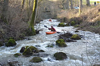
The Alf (also: "Alfbach") is a 52 km long, orographically left tributary of the Moselle in Rhineland-Palatinate , Germany .
geography
course
The Alf rises about 1 km northeast of Hörscheid in the Vulkaneifel . From its source at 549 m above sea level. From NHN the Alf flows first in a southerly direction. The first village on your way is Darscheid , on the eastern edge of which it flows past. The next places on their course are Gillenfeld and Strohn . In the following section to Bausendorf the course of the Alf is quite winding. Up until that point, the direction of the river was mainly south, but now it turns east and flows through the villages of Kinderbeuern and Bengel south of the Kondelwald . About 3.5 km down from Bengel it swings abruptly to the north, because a ridge blocks the further way to the east to the Moselle, which is only 500 m away. After breaking through the Moselle mountains , the Alf flows into Alf in the district of Cochem-Zell at 95 m above sea level. NHN in the Moselle.
After a 52 km run with an average bed gradient of 8.6 ‰, the Alf flows 454 meters below its source.
Tributaries
| Left tributaries | Right tributaries |
|---|---|
|
|
See also
Web links
proof
- ↑ a b Topographic map 1: 25,000
- ↑ a b GeoExplorer of the Rhineland-Palatinate Water Management Authority ( information ) (query on November 15, 2010)

