
Strohn
| coat of arms | Germany map | |
|---|---|---|

|
Coordinates: 50 ° 7 ' N , 6 ° 55' E |
|
| Basic data | ||
| State : | Rhineland-Palatinate | |
| County : | Vulkaneifel | |
| Association municipality : | Down | |
| Height : | 390 m above sea level NHN | |
| Area : | 8.6 km 2 | |
| Residents: | 484 (Dec. 31, 2019) | |
| Population density : | 56 inhabitants per km 2 | |
| Postal code : | 54558 | |
| Area code : | 06573 | |
| License plate : | DAU | |
| Community key : | 07 2 33 070 | |
| Community structure: | 8 districts | |
| Association administration address: | Leopoldstrasse 29 54550 Daun |
|
| Website : | ||
| Local Mayor : | Heinz Martin | |
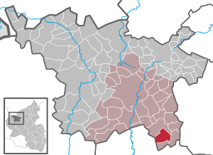
| Location of the local community Strohn in the Vulkaneifel district | ||
  |
||

Strohn is a municipality in the Vulkaneifel district in Rhineland-Palatinate . She belongs to the community of Daun .
geography
location
Strohn is located in the Vulkaneifel , south of Gillenfeld and the Pulvermaar , the Alfbach flows through Strohn.
Districts
The hamlets and residential areas Altheck, Buchholz, Dornheck, Herrenbüsch, Sprink, Tannenhof and Trautzberg belong to the municipality of Strohn .
Volcanism
The area around the village is shaped by the volcanism of the Eifel. Particularly noteworthy are the Strohner Märchen , a small maar that is about to be silted up . It was created around 8100 years ago during a lateral eruption of the Römerberg, a slag volcano . Together with the Pulvermaar and the Römerberg it forms a nature reserve (placed under protection in 1984). The Trautzberger Maar has also been filled with water again since 2014 after it was drained for agricultural use in the 1950s.

In the village itself there is a lava bomb , a basalt ball formed by volcanic activity . It has a diameter of about five meters and a weight of over 120 tons. It did not arise from a single ejection, but from being thrown up and back into the crater several times, absorbing lava and slag pieces until it got stuck in the crater rim and finally cooled off. They broke up in 1969 at the quarry - blasts from the volcano and was in the winter 1980/81 by means of an iron plate over the solid snowpack with a bulldozer moved into the town center.
history
Strohn is a very old place. In 1193 the place was first mentioned under the name "Struna" when Emperor Heinrich VI. confirms the possession of fields and meadows in Strohn to Abbot Absalon von Springiersbach . High court was held in Strohn .
politics
Municipal council
The local council in Strohn consists of eight council members, who were elected in the local elections on May 26, 2019 in a majority vote, and the honorary local mayor as chairman. In 2014 there were twelve council members on the municipal council.
coat of arms
|
|
Blazon : "Shield, split by an inserted silver tip, inside a red scales, in front a red-tongued cut golden lion head in green, behind in green a silver millstone covered with three golden ears." |
| Reasons for the coat of arms: The lion was the badge of the abbots of the Springiersbach monastery , the scales indicate the place of the court. Millstone and ear of wheat indicate the importance of agriculture and Strohn mills, one of which still exists today. |
Parish partnership
Strohn has had a partnership with the Irish community of Bunmahon for years.
tourism
The Vulkanhaus adventure museum is of supra-local importance. There are seven signposted hiking trails with a total length of 60 km. There are also many designated Nordic walking routes around Strohn. As a supplement to the Vulkanhaus in Strohn, the new volcano adventure trail with a tour of approx. 4.5 km in a scenic valley, the "Strohn Switzerland", was completed at the end of September 2007.
Born in Strohn
- Bernwarda Rodenkirch (1883–1979), religious
See also
Web links
- To search for cultural assets of the local community Strohn in the database of cultural assets in the Trier region .
- Strohn volcano house with lava bomb
Individual evidence
- ↑ State Statistical Office of Rhineland-Palatinate - population status 2019, districts, communities, association communities ( help on this ).
- ↑ State Statistical Office Rhineland-Palatinate (ed.): Official directory of the municipalities and parts of the municipality. Status: January 2018. S. 71 (PDF; 2.2 MB; municipality is missing in the 2019 directory!).
- ^ The Regional Returning Officer Rhineland-Palatinate: Local elections 2019, city and municipal council elections.

Arbach | Basberg | Beinhausen | Bereborn | Berenbach | Berlingen | Berndorf | Betteldorf | Birgel | Birresborn | Bleckhausen | Bodenbach | Bongard | Borler | Boxberg | Brockscheid | Brückal | Darscheid | Down | Demerath | Densborn | Deudesfeld | Dockweiler | Dohm-Lammersdorf | Drees | Dreis-Brück | Duppach | Ellscheid | Esch | Feusdorf | Gefell | Gelenberg | Gerolstein | Gillenfeld | Gönnersdorf | Gunderath | Reverberation | Hillesheim | Hinterweiler | Höchstberg | Hohenfels-Essingen | Horperath | Hörscheid | Hörschhausen | Immerath | Jünkerath | Kalenborn scrubbing | Caperich | Katzwinkel | Kelberg | Kerpen (Eifel) | Kerschenbach | Kirchweiler | Kirsbach | Kolverath | Kopp | Kötterichen | Kradenbach | Lirstal | Lissendorf | Mannebach | More | Meisburg | Mosbruch | Mosquitoes | Mürlenbach | Neichen | Nerd | Neroth | Niederstadtfeld | Nitz | Nohn | Oberbettingen | Oberehe-Stroheich | Oberelz | Oberstadtfeld | Ormont | Pelm | Reimerath | Retterath | Reuth | Rockeskyll | Salm | Sarmersbach | Sassen | Saxler | Schalkenmehren | Scheid | Schönbach | Schüller | Protection | Stadtkyll | Steffeln | Steineberg | Steiningen | Strohn | Strotzbüsch | Üdersdorf | Udler | Uersfeld | Ueß | Utzerath | Üxheim | Wallenborn | Walsdorf | Weidenbach | Which council | Wiesbaum | Winkel (Eifel)