
Steiningen
| coat of arms | Germany map | |
|---|---|---|

|
Coordinates: 50 ° 11 ′ N , 6 ° 55 ′ E |
|
| Basic data | ||
| State : | Rhineland-Palatinate | |
| County : | Vulkaneifel | |
| Association municipality : | Down | |
| Height : | 450 m above sea level NHN | |
| Area : | 7.6 km 2 | |
| Residents: | 192 (Dec. 31, 2019) | |
| Population density : | 25 inhabitants per km 2 | |
| Postal code : | 54552 | |
| Area code : | 06573 | |
| License plate : | DAU | |
| Community key : | 07 2 33 068 | |
| LOCODE : | DE IIS | |
| Association administration address: | Leopoldstrasse 29 54550 Daun |
|
| Website : | ||
| Local Mayor : | Reinhold Schäfer | |
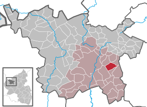
| Location of the local community Steiningen in the Vulkaneifel district | ||
  |
||

Steiningen is a municipality in the Vulkaneifel district in Rhineland-Palatinate . She belongs to the community of Daun .
geography
The community lies in the Vulkaneifel Nature Park and the conservation area "between Ueß and Kyll ". The Lehnwaldhof residential area also belongs to Steiningen . The Vulkaneifel motorway triangle is located in the municipality .
history
The place was first mentioned in a document dated August 28, 1193, in which Emperor Heinrich VI. the monastery Springiersbach confirmed its ownership in Steiningen.
Up until the end of the 18th century, Steiningen belonged to the Electorate of Daun .
The " Wüstung Allscheid" is located northwest of Steiningen . The village belonged to the community association of Steiningen. In 1852 the residents sold their 21 properties for 21,000 Thaler to the Steiningen community and emigrated to America. After the residents left the village, the buildings were demolished. The village last had 80 inhabitants who lived in 18 houses.
- Statistics on population development
The development of the population of Steiningen, the values from 1871 to 1987 are based on censuses :
|
|
Old house names
Many older houses in Steiningen have names that no longer have anything to do with the current owners . Some of the names come from the names and professions of previous residents. But also through the use of the respective building . The names also came about through various events.
politics
Municipal council
The municipal council in Steiningen consists of six council members, who were elected by a majority vote in the local elections on May 26, 2019 , and the honorary local mayor as chairman.
coat of arms
The description of the coat of arms reads: “Divided in green by silver, oblique left wavy bars; in front a silver chapel, behind a silver horseshoe, accompanied by two silver, five-pointed stars. "
See also
Web links
- Internet presence of the local community Steiningen
- To search for cultural assets of the local community Steiningen in the database of cultural assets in the Trier region .
Individual evidence
- ↑ State Statistical Office of Rhineland-Palatinate - population status 2019, districts, communities, association communities ( help on this ).
- ↑ Tiergartenstraße in Steiningen from the SWR Landesschau Rheinland-Pfalz online on the Internet: June 6, 2014
- ↑ State Statistical Office Rhineland-Palatinate (ed.): Official directory of the municipalities and parts of the municipality. Status: January 2018. S. 71 (PDF; 2.2 MB; municipality is missing in the 2019 directory!).
- ↑ Adolf Molitor: 130 years ago there was a village here. In: 1983 homeland yearbook of the Daun district. Retrieved March 10, 2017 .
- ↑ State Statistical Office Rhineland-Palatinate - regional data
- ^ The Regional Returning Officer Rhineland-Palatinate: Local elections 2019, city and municipal council elections

Arbach | Basberg | Beinhausen | Bereborn | Berenbach | Berlingen | Berndorf | Betteldorf | Birgel | Birresborn | Bleckhausen | Bodenbach | Bongard | Borler | Boxberg | Brockscheid | Brückal | Darscheid | Down | Demerath | Densborn | Deudesfeld | Dockweiler | Dohm-Lammersdorf | Drees | Dreis-Brück | Duppach | Ellscheid | Esch | Feusdorf | Gefell | Gelenberg | Gerolstein | Gillenfeld | Gönnersdorf | Gunderath | Reverberation | Hillesheim | Hinterweiler | Höchstberg | Hohenfels-Essingen | Horperath | Hörscheid | Hörschhausen | Immerath | Jünkerath | Kalenborn scrubbing | Caperich | Katzwinkel | Kelberg | Kerpen (Eifel) | Kerschenbach | Kirchweiler | Kirsbach | Kolverath | Kopp | Kötterichen | Kradenbach | Lirstal | Lissendorf | Mannebach | More | Meisburg | Mosbruch | Mosquitoes | Mürlenbach | Neichen | Nerd | Neroth | Niederstadtfeld | Nitz | Nohn | Oberbettingen | Oberehe-Stroheich | Oberelz | Oberstadtfeld | Ormont | Pelm | Reimerath | Retterath | Reuth | Rockeskyll | Salm | Sarmersbach | Sassen | Saxler | Schalkenmehren | Scheid | Schönbach | Schüller | Protection | Stadtkyll | Steffeln | Steineberg | Steiningen | Strohn | Strotzbüsch | Üdersdorf | Udler | Uersfeld | Ueß | Utzerath | Üxheim | Wallenborn | Walsdorf | Weidenbach | Which council | Wiesbaum | Winkel (Eifel)