
Kerpen (Eifel)
| coat of arms | Germany map | |
|---|---|---|

|
Coordinates: 50 ° 19 ′ N , 6 ° 44 ′ E |
|
| Basic data | ||
| State : | Rhineland-Palatinate | |
| County : | Vulkaneifel | |
| Association municipality : | Gerolstein | |
| Height : | 450 m above sea level NHN | |
| Area : | 8.22 km 2 | |
| Residents: | 473 (Dec. 31, 2019) | |
| Population density : | 58 inhabitants per km 2 | |
| Postal code : | 54578 | |
| Area code : | 06593 | |
| License plate : | DAU | |
| Community key : | 07 2 33 038 | |
| Community structure: | 2 districts | |
| Association administration address: | Kyllweg 1 54568 Gerolstein |
|
| Website : | ||
| Local Mayor : | Rudolf Raetz | |
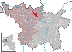
| Location of the local community Kerpen (Eifel) in the Vulkaneifel district | ||
 _in_DAU.svg) |
||

Kerpen (Eifel) is a municipality in the Vulkaneifel district in Rhineland-Palatinate . It belongs to the Gerolstein community . Kerpen is a state-approved resort .
geography
The districts of Kerpen with the Bernardyshof and Loogh with the Looghermühle belong to the municipality of Kerpen (Eifel). The Kerpen district is located at approx. 430 m above sea level. NHN in the Vulkaneifel nature park in the eastern part of the Hillesheimer Kalkmulde in the valley of the Rudersbach , on the dolomite spur of the Höhenberg ( ⊙ 511.1 m ). Loogh lies at approx. 470 m above sea level. NHN in a brook valley between the Zapechlei and the Hönselberg ( ⊙ 570.4 m ). The district also includes the vineyard ( ⊙ 553.9 m ), where you can find the reddish Kerpen marble , which u. a. was used for the construction of Bonn Central Station and the Catholic parish church in Gey . Viticulture was practiced on its southern slope.
The landscape is characterized by the mixed forests on the mountains. The northeast slope of the Hönselberg is covered by a heather area.
history
_002x_Strumpffabrik.jpg)
_Gedenktafel_Bombenopfer_vom_3._Februar_1945.jpg)
_006x.jpg)


In 1893 Johann Heinrich Dün took over the castle complex and saved it from further deterioration. From 1907 to 1911 it was owned by Clemens Manstein, it was bought by the Eifel painter Fritz von Wille in 1911 and had urgent security and repair work carried out.
In the 1930s, the National Socialists founded a school for training housemaids on Adenauer Strasse. After the war, a Nuremberg entrepreneur set up a stocking factory in the facility. Then a Dutch couple turned it into an old stocking factory and turned it into an event venue, and the community opened a registry office. In 2020 it will serve as the Kerpen seminar house .
In February 1945 an aerial bomb fell into a house on “Im Kapelleneck”.
The municipality of Kerpen (Eifel) was re-formed by the municipal reform in Rhineland-Palatinate on June 7, 1969 from the dissolved municipalities of Kerpen and Loogh.
In 1993, Kerpen was awarded the gold prize as the national winner in the competition “ Our village should become more beautiful ”. In the competition “ Our village has a future ” it was awarded bronze in the 2013 federal decision.
- Statistics on population development
The development of the population of Kerpen in relation to today's municipality area; the values from 1871 to 1987 are based on censuses:
|
|
.svg)
politics
Municipal council
The local council in Kerpen consists of eight council members, who in the local elections on May 26, 2019 in a majority vote were elected, and the honorary mayor as chairman. Until 2014, the municipality council had twelve council members.
coat of arms
|
|
Blazon : "In silver on a golden three-mountain, a black pinnacle tower, covered with a silver plate, inside a red zigzag bar." |
| Justification of the coat of arms: The coat of arms represents Kerpen Castle , which is symbolized by the tower on the Dreiberg. Kerpen Castle was the seat of the Kerpen Empire , which included the Kerpen community. Therefore the tower was covered with the coat of arms of the imperial rule Kerpen. |
Buildings
- Kerpen Castle dates from the 12th century. The Eifel painter Fritz von Wille bought the castle and prepared it for himself. His grave with a memorial stone is on the ridge behind the castle.
- Catholic branch church St. Sebastian : The former castle chapel , a single-pillar room , dates from the 16th century.
See also: List of natural monuments in Kerpen (Eifel)
Economy and Infrastructure
With its rural character, the municipality of Kerpen has farms, a cheese dairy and slaughterhouse, as well as a gardening, bakery, car dealership and several restaurants and bars.
The castle and the Kerpen stocking factory have made Kerpen famous.
traffic
The Kerpen district is located directly on state road 70 , which connects the Ahr valley near Ahrdorf with federal road 421 .
The place is connected to the local public transport (ÖPNV) . The tariffs of the Verkehrsverbund Region Trier (VRT) , the Verkehrsverbund Rhein-Sieg and the NRW tariff apply across all tariff areas .
A rail connection has not existed since 1973. The station Kerpen lay on the 1912 opened Middle Ahrtalbahn Dümpelfeld-Abzw Insul-Ahrdorf-Hillesheim Lissendorf-Jünkerath. The line was connected to the Lower Ahr Valley Railway and the Eifel line from Cologne to Trier. After the end of passenger and freight traffic (1973), the railway tracks were dismantled a short time later. Street names and the station building were retained.
Established businesses
Resident in the place are u. a. the Kloep car dealership, the Mörsch window construction company, the Edmondts wholemeal bakery and the Eifeler Hofkäserei and Gröner Hof slaughterhouse .
tourism
Kerpen is primarily a destination for tourists who come from the urban areas of North Rhine-Westphalia and the Netherlands . In addition to the medieval town center including the church and the castle complex, the place has a recreational facility on the small Rudersbach reservoir, tennis courts, roller skating rink, mini golf and a children's playground. The Neuss district in the Felschbachtal has a youth campground near the former train station.
With the restaurants Das kleine LANDCAFE and Die Einkehr, Kerpen is a stop on the Eifelsteig and the “ Eifel-Krimi-Wanderweg ”. The latter is based on books by crime writers Jacques Berndorf and Ralf Kramp .
Numerous information boards provide details about the place and the surrounding area.
It is a starting point for the geological teaching and hiking trail of the Hillesheim community. Numerous stations in the area explain the geology of the Eifel and the evidence of volcanism in the Vulkaneifel .
The circular hiking trail enjoyment on foot connects viewpoints, sights and refreshment stops in Kerpen, Loogh and Niederehe .
On the former embankment, a cycle path towards Niederehe and Hillesheim largely follows the old route.
In years with even years a village festival is held in Loogh on the penultimate weekend of July, in uneven years in Kerpen in December there is a large craft and Christmas market with fireworks at the end.
The keeping of kangaroos and bison is accessible in Loogh.
literature
- Herbert Wagner: Kerpen (High Eifel) . Ed .: Rheinischer Verein für Denkmalpflege und Landschaftsschutz (= Rheinische Kunststätten . Issue 233). Society for book printing, Neuss 1980, ISBN 3-88094-318-4 .
Web links
- Website of the local community Kerpen (Eifel)
- Kerpen (Eifel) on the website of the Verbandsgemeinde Hillesheim
- To search for cultural assets of the local community Kerpen (Eifel) in the database of cultural assets in the Trier region .
Individual evidence
- ↑ State Statistical Office of Rhineland-Palatinate - population status 2019, districts, communities, association communities ( help on this ).
- ↑ a b State Statistical Office Rhineland-Palatinate - regional data
- ↑ State Statistical Office Rhineland-Palatinate (ed.): Official directory of the municipalities and parts of the municipality. Status: January 2019 [ Version 2020 is available. ] . S. 115 (PDF; 3 MB).
- ↑ a b c Map service of the landscape information system of the Rhineland-Palatinate Nature Conservation Administration (LANIS map) ( information ) (altitude information from DTK 1: 25,000)
- ↑ SWR report on, among others, the old stocking factory
- ↑ Official municipality directory (= State Statistical Office of Rhineland-Palatinate [Hrsg.]: Statistical volumes . Volume 407 ). Bad Ems February 2016, p. 167 (PDF; 2.8 MB).
- ↑ Bronze for Kerpen
- ^ The Regional Returning Officer Rhineland-Palatinate: Local elections 2019, city and municipal council elections
- ↑ Description of the coat of arms on the website of the Hillesheim Association
- ↑ Burgkapelle Kerpen ( Memento of the original from September 18, 2016 in the Internet Archive ) Info: The archive link was inserted automatically and has not yet been checked. Please check the original and archive link according to the instructions and then remove this notice.
- ^ Business in Kerpen
- ↑ The small country cafe
- ↑ Die Einkehr ( Memento of the original from May 20, 2015 in the Internet Archive ) Info: The archive link was inserted automatically and has not yet been checked. Please check the original and archive link according to the instructions and then remove this notice.
- ^ Website of the Eifelsteig
- ↑ Geopath ( Memento of the original from February 7, 2016 in the Internet Archive ) Info: The archive link was inserted automatically and has not yet been checked. Please check the original and archive link according to the instructions and then remove this notice.
- ↑ Hiking trail "Enjoyment on foot"

Arbach | Basberg | Beinhausen | Bereborn | Berenbach | Berlingen | Berndorf | Betteldorf | Birgel | Birresborn | Bleckhausen | Bodenbach | Bongard | Borler | Boxberg | Brockscheid | Brückal | Darscheid | Down | Demerath | Densborn | Deudesfeld | Dockweiler | Dohm-Lammersdorf | Drees | Dreis-Brück | Duppach | Ellscheid | Esch | Feusdorf | Gefell | Gelenberg | Gerolstein | Gillenfeld | Gönnersdorf | Gunderath | Reverberation | Hillesheim | Hinterweiler | Höchstberg | Hohenfels-Essingen | Horperath | Hörscheid | Hörschhausen | Immerath | Jünkerath | Kalenborn scrubbing | Caperich | Katzwinkel | Kelberg | Kerpen (Eifel) | Kerschenbach | Kirchweiler | Kirsbach | Kolverath | Kopp | Kötterichen | Kradenbach | Lirstal | Lissendorf | Mannebach | More | Meisburg | Mosbruch | Mosquitoes | Mürlenbach | Neichen | Nerd | Neroth | Niederstadtfeld | Nitz | Nohn | Oberbettingen | Oberehe-Stroheich | Oberelz | Oberstadtfeld | Ormont | Pelm | Reimerath | Retterath | Reuth | Rockeskyll | Salm | Sarmersbach | Sassen | Saxler | Schalkenmehren | Scheid | Schönbach | Schüller | Protection | Stadtkyll | Steffeln | Steineberg | Steiningen | Strohn | Strotzbüsch | Üdersdorf | Udler | Uersfeld | Ueß | Utzerath | Üxheim | Wallenborn | Walsdorf | Weidenbach | Which council | Wiesbaum | Winkel (Eifel)