Meisburg
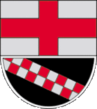
| coat of arms | Germany map | |
|---|---|---|

|
Coordinates: 50 ° 7 ' N , 6 ° 42' E |
|
| Basic data | ||
| State : | Rhineland-Palatinate | |
| County : | Vulkaneifel | |
| Association municipality : | Down | |
| Height : | 475 m above sea level NHN | |
| Area : | 7.05 km 2 | |
| Residents: | 241 (Dec. 31, 2019) | |
| Population density : | 34 inhabitants per km 2 | |
| Postal code : | 54570 | |
| Area code : | 06599 | |
| License plate : | DAU | |
| Community key : | 07 2 33 043 | |
| Association administration address: | Leopoldstrasse 29 54550 Daun |
|
| Website : | ||
| Mayoress : | Anja Rieker | |
| Location of the local community Meisburg in the Vulkaneifel district | ||
Meisburg ( phonetic spelling in Eifler dialect : " Mesbuasch ") is a municipality in the Vulkaneifel district in Rhineland-Palatinate . She belongs to the community of Daun . A Moselle-Franconian dialect is spoken in Meisburg .
geography
Meisburg is located in the middle of the Vulkaneifel on the B 257 between Daun (19 km) and Bitburg (24 km). Since opening in September 2006, the German Volcano Road has passed the site.
The village is in the valley of the Dümpelbach at an average altitude of 480 m above sea level. NHN settled. The highest peaks in the area are the Daxelberg at 589 m above sea level. NHN and Rackenbach at 522 m above sea level. NHN . The Schafbach, which flows into the Lohsalm, rises in the Salmwald, a water-rich area with a waterworks. Large parts of the Bernkastel-Wittlich district are supplied with drinking water from here.
Meisburg also includes the Schafbrück, Schneidemühle, Rackenbach and Rascheid residential areas .
Neighboring communities
The following communities are in close proximity to Meisburg:
history
In 1979 the community celebrated its 750th anniversary. According to more recent findings, Meisburg was first mentioned in a document on May 6, 1140 (as "Meisbreth"). In a document signed by Pope Innocent II, the village is confirmed as the property of the St. Maximin Monastery in front of Trier . Meisburg probably already existed around the year 1116, when it is mentioned as "Meisbrath" in numerous forged documents by the St. Maximin Monastery .
According to recent research, it is likely that the original meaning of the place name can be translated as "cleared, penned area of the Megin".
Up until the end of the 18th century, Meisburg belonged to the Electorate of Trier and was under the administration and jurisdiction of the Kyllburg Office .
In 1794 the Left Bank of the Rhine was occupied by French revolutionary troops in the First Coalition War. From 1798 to 1814 Meisburg belonged to the canton of Kyllburg in the Saar department .
At the Congress of Vienna (1815), the region came to the Kingdom of Prussia , Meisburg was assigned to the newly established Daun district in the Trier administrative district in 1816 and administered by the Weidenbach mayor .
After the Second World War , the municipality of Meisburg within the French occupation zone became part of the then newly formed state of Rhineland-Palatinate.
- Population development
The development of the population of Meisburg, the values from 1871 to 1987 are based on censuses:
|
|
Municipal council
The municipal council in Meisburg consists of six council members, who were elected by a majority vote in the local elections on May 26, 2019 , and the honorary local mayor as chairman.
Attractions
Meisburg has an old cutting mechanism that is driven by an overshot mill wheel with a diameter of seven meters. The “cutting mill”, as it is called by the inhabitants, is the last remaining cutting machine in the Rhineland and Eifel. The necessary operating energy is obtained from a 350 meter long ditch.
See also: List of cultural monuments in Meisburg
Web links
- Internet presence of the local community Meisburg
- History of the community
- New chronicle of the community of Meisburg
- To search for cultural assets of the local community Meisburg in the database of cultural assets in the Trier region .
Individual evidence
- ↑ a b State Statistical Office of Rhineland-Palatinate - population status 2019, districts, municipalities, association communities ( help on this ).
- ↑ State Statistical Office Rhineland-Palatinate (ed.): Official directory of the municipalities and parts of the municipality. Status: January 2018 [ Version 2020 is available. ] . S. 70 (PDF; 2.2 MB).
- ↑ Helmut Atzor (Red.): New chronicle of the municipality of Meisburg . Ed .: Local community Meisburg. Meisburg 2014, ISBN 978-3-00-047669-3 .
- ^ Theodor Baums, Tim Becker: Meisburg – Meispelt – Meyemburg. Part 1. In: Hémecht. Revue d'Histoire luxembourgeoise. 65 (1) 2013, pp. 22-25.
- ↑ State Statistical Office Rhineland-Palatinate - regional data
- ^ The Regional Returning Officer Rhineland-Palatinate: Local elections 2019, city and municipal council elections
- ^ The cutting mill from Meisburg. Sawing boards with water power , documentary film by the Institute for Regional Studies and Regional History of the Rhineland Regional Council from 1989, YouTube video


