
Betteldorf
| coat of arms | Germany map | |
|---|---|---|

|
Coordinates: 50 ° 15 ' N , 6 ° 45' E |
|
| Basic data | ||
| State : | Rhineland-Palatinate | |
| County : | Vulkaneifel | |
| Association municipality : | Down | |
| Height : | 540 m above sea level NHN | |
| Area : | 3.31 km 2 | |
| Residents: | 255 (Dec. 31, 2019) | |
| Population density : | 77 inhabitants per km 2 | |
| Postal code : | 54570 | |
| Area code : | 06595 | |
| License plate : | DAU | |
| Community key : | 07 2 33 006 | |
| LOCODE : | DE 9BB | |
| Association administration address: | Leopoldstrasse 29 54550 Daun |
|
| Website : | ||
| Local Mayor : | Frank Spies | |
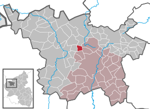
| Location of the local community of Betteldorf in the Vulkaneifel district | ||
  |
||

_01.jpg)
Betteldorf is a municipality in the Vulkaneifel district in Rhineland-Palatinate . She belongs to the community of Daun .
Geographical location
The place is located in the High Eifel at the foot of the Döhmberg, about eleven kilometers northwest of the district town of Daun . In the south, the B 410 runs past the village.
The Kahlenberghof and Kleewiesenhof residential areas also belong to Betteldorf .
The source of the Ahr tributary Ahbach is located southeast of the village .
history
The place name goes back to a Roman named Betilo who operated a horse changing station on the Maas - Mosel - Roman road around 475 in what is now the municipality .
- Statistics on population development
The development of the population of Betteldorf, the values from 1871 to 1987 are based on censuses:
|
|
politics
Municipal council
The municipal council in Betteldorf consists of six council members who were elected by a majority vote in the local elections on May 26, 2019 , and the honorary local mayor as chairman.
coat of arms
|
|
Blazon : "Under the red head of the shield, in it gold pliers, in gold a green band collar, topped with a red medlar with a golden lug." |
| Justification of the coat of arms: The patron saint is St. Apollonia , whose symbol, the pincers, is depicted in the head of the shield . The green inclined cross ( strip slant ) indicates the Roman roads that crossed southwest of the "Döhmberg". The early Roman settlement is also documented by important coin treasures. The red medlar with a golden clasp is taken from the coat of arms of the Duke of Arenberg . Betteldorf came to the Duchy of Arenberg after the death of the last Manderscheid count . The colors red and gold are borrowed from the coat of arms of the Counts of Manderscheid. |
Culture and sights
One of the sights of the municipality is the chapel of St. Apolloniae from the 18th century.
At the instigation of the local bachelor club, a memorial was erected in the summer of 1922 to commemorate the fallen of the First World War . A figure of the Archangel Michael stands on a cuboid made of red sandstone .
About 750 meters north of the village there is a Hunnenstein, which has been protected as a natural monument since 1938 .
See also: List of cultural monuments in Betteldorf
See also: List of natural monuments in Betteldorf
literature
- Literature about Betteldorf in the Rhineland-Palatinate state bibliography
Web links
- Internet presence of the local community of Betteldorf
- To search for cultural assets of the local community Betteldorf in the database of cultural assets in the Trier region .
- Brief portrait of Betteldorf on SWR television
Individual evidence
- ↑ State Statistical Office of Rhineland-Palatinate - population status 2019, districts, communities, association communities ( help on this ).
- ↑ State Statistical Office Rhineland-Palatinate (ed.): Official directory of the municipalities and parts of the municipality. Status: January 2018 [ Version 2020 is available. ] . S. 69 f . (PDF; 2.2 MB).
- ↑ State Statistical Office Rhineland-Palatinate - regional data
- ^ The Regional Returning Officer Rhineland-Palatinate: Local elections 2019, city and municipal council elections
- ↑ Description of coat of arms / justification. Local community Betteldorf, accessed on July 11, 2017 .

Arbach | Basberg | Beinhausen | Bereborn | Berenbach | Berlingen | Berndorf | Betteldorf | Birgel | Birresborn | Bleckhausen | Bodenbach | Bongard | Borler | Boxberg | Brockscheid | Brückal | Darscheid | Down | Demerath | Densborn | Deudesfeld | Dockweiler | Dohm-Lammersdorf | Drees | Dreis-Brück | Duppach | Ellscheid | Esch | Feusdorf | Gefell | Gelenberg | Gerolstein | Gillenfeld | Gönnersdorf | Gunderath | Reverberation | Hillesheim | Hinterweiler | Höchstberg | Hohenfels-Essingen | Horperath | Hörscheid | Hörschhausen | Immerath | Jünkerath | Kalenborn scrubbing | Caperich | Katzwinkel | Kelberg | Kerpen (Eifel) | Kerschenbach | Kirchweiler | Kirsbach | Kolverath | Kopp | Kötterichen | Kradenbach | Lirstal | Lissendorf | Mannebach | More | Meisburg | Mosbruch | Mosquitoes | Mürlenbach | Neichen | Nerd | Neroth | Niederstadtfeld | Nitz | Nohn | Oberbettingen | Oberehe-Stroheich | Oberelz | Oberstadtfeld | Ormont | Pelm | Reimerath | Retterath | Reuth | Rockeskyll | Salm | Sarmersbach | Sassen | Saxler | Schalkenmehren | Scheid | Schönbach | Schüller | Protection | Stadtkyll | Steffeln | Steineberg | Steiningen | Strohn | Strotzbüsch | Üdersdorf | Udler | Uersfeld | Ueß | Utzerath | Üxheim | Wallenborn | Walsdorf | Weidenbach | Which council | Wiesbaum | Winkel (Eifel)