
Rockeskyll
| coat of arms | Germany map | |
|---|---|---|

|
Coordinates: 50 ° 15 ' N , 6 ° 42' E |
|
| Basic data | ||
| State : | Rhineland-Palatinate | |
| County : | Vulkaneifel | |
| Association municipality : | Gerolstein | |
| Height : | 400 m above sea level NHN | |
| Area : | 5.88 km 2 | |
| Residents: | 226 (Dec. 31, 2019) | |
| Population density : | 38 inhabitants per km 2 | |
| Postal code : | 54570 | |
| Area code : | 06591 | |
| License plate : | DAU | |
| Community key : | 07 2 33 058 | |
| Association administration address: | Kyllweg 1 54568 Gerolstein |
|
| Website : | ||
| Local Mayor : | Volker Oos | |
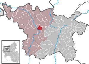
| Location of the local community Rockeskyll in the Vulkaneifel district | ||
  |
||


;_kath._Kirche_St._Bartholom%C3%A4us_c.jpg)
Rockeskyll in the Eifel is a municipality in the Vulkaneifel district in Rhineland-Palatinate . It belongs to the Gerolstein community .
Geographical location
Rockeskyll is located in the Eastern Eifel in the Vulkaneifel Nature Park . About 4.5 kilometers south-south-west is the core town of Gerolstein , 4 km north-north-west that of Hillesheim and 11.5 km (as the crow flies ) southeast of the district town of Daun . To the west of the village rises the 554.6 m high Rockeskyller Kopf , an extinct stratovolcano or stratovolcano . The Kaulbach flows through the village as the right source brook of the Hangelsbach , which flows into the Kyll , which runs to the southwest . To the west of the district of Rockeskyll part are the protected landscape Gerolstein and the surrounding area .
history
There were Stone Age traces of settlement on the “Kuhweide” corridor on the Kyller Höhe.
The area around Rockeskyll was evidently inhabited by finds as early as Roman and Celtic times.
A certificate from Emperor Heinrich IV from 1098, in which he confirmed his possessions to the St. Simeon Abbey in Trier , was also mentioned as 'kila' among other localities. This 'kila', as well as a 'kila' mentioned in a document as early as 1084, is, according to regional local researchers, very likely to be today's Rockeskyll. The historian Heinrich Beyer assigned the document from 1098 to the town of Stadtkyll .
Rockeskyll had market rights since the 15th century . The last cattle and junk markets were held in the 1920s. The market square is still reminiscent of two oaks, designated as natural monuments, which are located in the south of the village.
Until the end of the 18th century Rockeskyll belonged to the Daun office in the Electorate of Trier .
After the annexation of the Left Bank of the Rhine in the First Coalition War (1794), Rockeskyll belonged from 1798 to the canton of Gerolstein in the arrondissement de Prüm , which belonged to the Saar department . Rockeskyll became the seat of a mairie . The towns of Rockeskyll, Berlingen , Betteldorf , Bewingen , Essingen , Gees , Hinterweiler , Hohenfels , Pelm and Roth belonged to Mairie Rockeskyll . Because of the agreements made at the Congress of Vienna (1815), a. the Eifel part of the Saar department to the Kingdom of Prussia . Under the Prussian administration, Rockeskyll became the seat of a mayor's office , which had the same scope as the previous Mairie in terms of the assigned communities. The mayor Rockeskyll belonged to the circle down in Trier and from 1822 to the Rhine province . Since 1946 Rockeskyll has belonged to the then newly formed state of Rhineland-Palatinate and since November 7, 1970 to the community of Gerolstein .
- Population development
The development of the population of Rockeskyll, the values from 1871 to 1987 are based on censuses:
|
|
politics
Municipal council
The local council in Rockeskyll consists of six council members, who were elected in the local elections on May 26, 2019 in a majority vote, and the honorary local mayor as chairman.
coat of arms
|
|
Blazon : "Divided by blue over silver, above a golden scale , below a lattice cross formed from three red threads." |
| Justification of the coat of arms: The scales refer to the old market law of the municipality. The lattice cross symbolizes a striking architectural detail from the church built in 1728. The colors red and silver indicate that the place was part of Kurtrier . |
Culture and sights
Buildings
;_Pfarrhof_1826_b.jpg)
- Roman Catholic parish church of St. Bartholomew from 1511
- Stations of the Cross from 1750 on the churchyard wall
- Former rectory from 1826 location
- Wayside shrine Antoniushäuschen from 1774, on the edge of a wooded hilltop location
- There are some - some very old - crossroads spread across the municipality .
- Path chapel from the 18th or 19th century, on the outskirts in the direction of Hohenfels-Essingen
See also: List of cultural monuments in Rockeskyll
Green spaces and recreation

- The Rockeskyller Kopf is an extinct volcanic complex from the Quaternary period and around 360,000 years old.
- Two of the original three old oaks that germinated around 1700 at Dorfstrasse 3
- The oak at the castle fountain was planted around 1840. location
- Hiking trails in and around Rockeskyll
See also: List of natural monuments in Rockeskyll
Regular events
- Annual fair or parish fair
- Traditional rattling or rattling on Good Friday and Holy Saturday
- Schewe-Sonnisch on the first weekend after Ash Wednesday (so-called Disc Sunday )
- Thanksgiving on the 3rd weekend in September
Economy and Transport
Rockeskyll is located directly on the B 410 . The state road L 27 leads through the village.
literature
- Hartwig Löhr (arrangement and gesture): The Eifel village Rockeskyll . Ed .: Rockeskyll parish. Rockeskyll 1993, p. 36–43 (The Rockeskyll settlement area in prehistoric times).
- Gesine Weber: The Urnfield Age Grave Field of Rockeskyll, Gerolstein Association, District of Daun / Eifel. In: Trier magazine for the history and art of the Trier region and its neighboring areas . Trier 1993, p. 7-27 .
Web links
- Internet presence of the local church Rockeskyll
- To search for cultural assets of the local community Rockeskyll in the database of cultural assets in the Trier region .
Individual evidence
- ↑ State Statistical Office of Rhineland-Palatinate - population status 2019, districts, communities, association communities ( help on this ).
- ↑ State Statistical Office Rhineland-Palatinate (ed.): Official directory of the municipalities and parts of the municipality. Status: January 2019 [ Version 2020 is available. ] . S. 115 (PDF; 3 MB).
- ↑ D. Krausse: Roman-Germanic research. ( Memento from June 24, 2018 in the Internet Archive ) Vol. 63.
- ^ Heinrich Beyer : Mittelrheinisches Urkundenbuch , Volume I, Coblenz: Hölscher, 1860, Certificate 397
- ↑ a b Wilhelm Tarter: From kila to Rockeskyll. In: Heimatjahrbuch 1999. Vulkaneifel district, accessed on April 6, 2019 .
- ↑ Erwin Schaefer: The Prussian administrative division in the early years of the Daun district. In: Heimatjahrbuch 1980. Vulkaneifel district, accessed on April 6, 2019 .
- ↑ State Statistical Office Rhineland-Palatinate - regional data
- ^ The Regional Returning Officer Rhineland-Palatinate: Local elections 2019, city and municipal council elections
- ↑ Hillesheim - Kerpen - Stroheich - Rockeskyll hiking trail. Retrieved July 14, 2018 .
- ↑ Lavagrube Rockesykyll Loop from Rockeskyll. Retrieved July 14, 2018 .
- ↑ Hüttenbrennen in the Eifel. Retrieved May 1, 2016 .
- ↑ Hut Sunday in the Eifel. Retrieved August 10, 2017 .

Arbach | Basberg | Beinhausen | Bereborn | Berenbach | Berlingen | Berndorf | Betteldorf | Birgel | Birresborn | Bleckhausen | Bodenbach | Bongard | Borler | Boxberg | Brockscheid | Brückal | Darscheid | Down | Demerath | Densborn | Deudesfeld | Dockweiler | Dohm-Lammersdorf | Drees | Dreis-Brück | Duppach | Ellscheid | Esch | Feusdorf | Gefell | Gelenberg | Gerolstein | Gillenfeld | Gönnersdorf | Gunderath | Reverberation | Hillesheim | Hinterweiler | Höchstberg | Hohenfels-Essingen | Horperath | Hörscheid | Hörschhausen | Immerath | Jünkerath | Kalenborn scrubbing | Caperich | Katzwinkel | Kelberg | Kerpen (Eifel) | Kerschenbach | Kirchweiler | Kirsbach | Kolverath | Kopp | Kötterichen | Kradenbach | Lirstal | Lissendorf | Mannebach | More | Meisburg | Mosbruch | Mosquitoes | Mürlenbach | Neichen | Nerd | Neroth | Niederstadtfeld | Nitz | Nohn | Oberbettingen | Oberehe-Stroheich | Oberelz | Oberstadtfeld | Ormont | Pelm | Reimerath | Retterath | Reuth | Rockeskyll | Salm | Sarmersbach | Sassen | Saxler | Schalkenmehren | Scheid | Schönbach | Schüller | Protection | Stadtkyll | Steffeln | Steineberg | Steiningen | Strohn | Strotzbüsch | Üdersdorf | Udler | Uersfeld | Ueß | Utzerath | Üxheim | Wallenborn | Walsdorf | Weidenbach | Which council | Wiesbaum | Winkel (Eifel)