
Ormont
| coat of arms | Germany map | |
|---|---|---|

|
Coordinates: 50 ° 20 ' N , 6 ° 27' E |
|
| Basic data | ||
| State : | Rhineland-Palatinate | |
| County : | Vulkaneifel | |
| Association municipality : | Gerolstein | |
| Height : | 530 m above sea level NHN | |
| Area : | 12.44 km 2 | |
| Residents: | 346 (Dec. 31, 2019) | |
| Population density : | 28 inhabitants per km 2 | |
| Postal code : | 54597 | |
| Area code : | 06557 | |
| License plate : | DAU | |
| Community key : | 07 2 33 232 | |
| LOCODE : | DE O6M | |
| Association administration address: | Kyllweg 1 54568 Gerolstein |
|
| Website : | ||
| Local Mayor : | Andreas mouse | |
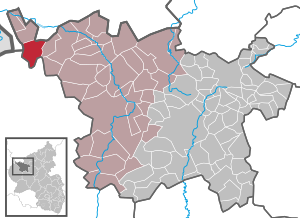
| Location of the local community Ormont in the Vulkaneifel district | ||
  |
||

;_Panoramablick_b.jpg)
;_katholische_Pfarrkirche_St._Margaretha_a.jpg)
Ormont is a municipality in the Vulkaneifel district in Rhineland-Palatinate . It belongs to the Gerolstein community .
geography
The community is located in the Eifel at the foot of the Schneifel . The Neuenstein and Erlenphenn residential areas also belong to Ormont .
history
Ormont was first mentioned in a document in the Prümer Urbar in 893 .
In a goods classification of 1222 which is investiture of the counts of Vianden with the farm to Oremunte by the Prüm Abbey überliefert.1320 was Frederick II. Of Blankenheim of King John of Bohemia , the same Count of Luxembourg was with the village Oyrmunde invested. Friedrich's wife was Else, Frau von Neuenstein. In 1329 the brothers Arnold I and Gerhard V. von Blankenheim bought the Neuenstein farm. In 1361, Ormont and Neuenstein came to Johann I. von Schleiden and his brother Konrad von Schleiden, who was provost of St. Gereon in Cologne . Konrad von Schleiden built Neuenstein Castle around 1365 on a cone hill high above the left Prümufer . In 1450 Ormont came to the Counts of Manderscheid-Schleiden and was owned by Manderscheid-Gerolstein from 1613 to 1719, then by Manderscheid-Blankenheim-Gerolstein.
Wonderfully country the place belonged to the late 18th century to the Duchy of Luxembourg , which is part of the Austrian Netherlands was. After the region was captured by French revolutionary troops (1794), Ormont belonged to the French canton of Kronenburg in the Ourthe department from 1795 to 1814 and was subordinate to Mairie Hallschlag . During the First Coalition War , French revolutionary troops burned Neuenstein Castle down in 1794 and sold it as a quarry.
As a result of the agreements made at the Congress of Vienna, the three municipalities of Hallschlag , Ormont and Scheid came from the Ourthe department to the Kingdom of Prussia . The three communities were assigned to the Hallschlag mayor's office in the Prüm district, newly established in 1816, in the Trier administrative district .
During the Second World War , Ormont was severely destroyed during the so-called Ardennes offensive (company "Wacht am Rhein").
As part of the Rhineland-Palatinate functional and territorial reform , Ormont was reclassified together with 14 other communities on November 7, 1970 from the district of Prüm, which was dissolved at the same time, to the district of Daun (since 2007 district Vulkaneifel).
- Population development
The development of the population of Ormont, the values from 1871 to 1987 are based on censuses:
|
|
politics
Municipal council
The municipal council in Ormont consists of eight council members, who were elected by a majority vote in the local elections on May 26, 2019 , and the honorary local mayor as chairman.
coat of arms
;_Hochmoor_Bragphenn_g.jpg)
|
|
Blazon : “Under a golden serrated shield head and above a golden arched foot (mountain), inside a red dragon head, which is covered with a red cross staff, in red five (2: 1: 2) silver balls, accompanied on the right and left by a golden glaive. " |
| Foundation of the coat of arms: Ormont and the district of Neuenstein belonged to the County of Manderscheid, which is represented by the golden zigzag head . Konrad von Schleiden , the builder of Neuenstein Castle in Ormont, had the golden glaives (lance tips) in his coat of arms . The five balls are taken from the seal of Johann von Neuenstein . The golden mountain in the lower part of the coat of arms symbolizes the former volcano Goldberg near the municipality and at the same time the place name, which originated from the Latin “ad aureum montem”. Cross staff and dragon stand as attributes of the church and local patroness for Saint Margaretha . |
The municipality of Ormont has had the coat of arms since 1992.
Culture and sights
;_H%C3%B6ckerlinie_Westwall_f.jpg)
;_Pr%C3%BCmquelle_a.jpg)
- Catholic parish church of St. Margareta (Ormont) from 1850
- Marienkapelle from 1952 with honorary cemetery
- The annual fair or parish fair is celebrated on the Sunday after July 20th (Margareta v. A.)
- Burning castles on the first Sunday of Lent (so-called Scheef Sunday)
- Neuenstein Castle used to stand in the Neuenstein district, of which only small remains are today ( ⊙ ).
- Several very well-preserved sections of the cusp line of the west wall ( ⊙ )
- "Bragphenn" high moor - a natural area for z. B. cotton grass, fever clover or mother-of-pearl butterfly ( ⊙ )
- "Prümquelle" - a pond spring in the Arenberg Forest ( ⊙ )
- "Ormonter Drees" in the Dreiswies. The Sauerbrunnen is not built and is difficult to reach on foot. ( ⊙ )
- Numerous hiking trails in and around Ormont
- Way of St. James through Ormont to Santiago de Compostela (Spain); Ormont is on the way from Cologne / Bonn via Trier to Schengen .
See also: List of cultural monuments in Ormont
See also: List of natural monuments in Ormont
Economy and Infrastructure
A family business has been producing wood pellets in Ormont since 2002.
Since 1991 there has been the first wind farm in inland Germany on the Goldberg northeast of the municipality. The Ormont-Goldberg wind farm ( ⊙ ) has seven Enercon-33 wind turbines and nine Südwind S70 wind turbines. The total output of the 16 wind turbines is 15.46 MW per year.
The Ormont-Erlenphenn wind farm ( ⊙ ) has an Enercon E-40 / 5.40 wind turbine and an Enercon E-58 wind turbine. The total output of the two wind turbines is 1.5 MW.
See also: List of wind turbines in Rhineland-Palatinate
Born in Ormont
- Walter Krämer (* 1948), economist, university professor and author
literature
- Herbert Blum: Ormont. Vill passeert between Goldberg and Prümquelle. Prüm 2001, ISBN 3-931478-07-6 .
- Hubert Jenniges: The boundaries of the Ormonter district and the lay judgeship of 1596. In: Der Prümer Landbote 2009. P. 28–33.
- Herbert Blum: Draft of a municipal coat of arms for the local parish of Ormont. In: Der Prümer Landbote 1992, p. 56.
Web links
- Website of the local parish Ormont
- Representation of the local community Ormont on the website of the Verbandsgemeinde Obere Kyll
- To search for cultural assets of the local community Ormont in the database of cultural assets in the Trier region .
Individual evidence
- ↑ a b State Statistical Office of Rhineland-Palatinate - population status 2019, districts, municipalities, association communities ( help on this ).
- ↑ State Statistical Office Rhineland-Palatinate (ed.): Official directory of the municipalities and parts of the municipality. Status: January 2018 [ Version 2020 is available. ] . S. 74 (PDF; 2.2 MB).
- ↑ Official municipality directory (= State Statistical Office of Rhineland-Palatinate [Hrsg.]: Statistical volumes . Volume 407 ). Bad Ems February 2016, p. 156 (PDF; 2.8 MB).
- ^ The Regional Returning Officer Rhineland-Palatinate: Local elections 2019, city and municipal council elections
- ↑ Declaration of the coat of arms. Retrieved on July 5, 2016 (description of the coat of arms on the website of the Verbandsgemeinde Obere Kyll).
- ↑ Hüttenbrennen in the Eifel. Retrieved May 1, 2016 .
- ↑ Neuenstein Castle near Ormont. Retrieved July 27, 2017 .
- ↑ Nettersheim-Ormont hiking trail. Retrieved June 24, 2017 .
- ↑ Ormont-Westwall-Siegfried Line hiking trail with 3 bunkers-Schnee Eifel. Retrieved June 24, 2017 .
- ^ Way of St. James by bike; Ormont-Mettendorf. Retrieved July 11, 2017 .
- ↑ Information on the Camino de Santiago. (PDF) Retrieved July 11, 2017 .
- ^ Economy in Ormont. Retrieved April 30, 2016 .
- ↑ Ormont-Goldberg wind farm. Retrieved July 11, 2017 .
- ↑ Ormont-Erlenphenn wind farm. Retrieved July 11, 2017 .

Arbach | Basberg | Beinhausen | Bereborn | Berenbach | Berlingen | Berndorf | Betteldorf | Birgel | Birresborn | Bleckhausen | Bodenbach | Bongard | Borler | Boxberg | Brockscheid | Brückal | Darscheid | Down | Demerath | Densborn | Deudesfeld | Dockweiler | Dohm-Lammersdorf | Drees | Dreis-Brück | Duppach | Ellscheid | Esch | Feusdorf | Gefell | Gelenberg | Gerolstein | Gillenfeld | Gönnersdorf | Gunderath | Reverberation | Hillesheim | Hinterweiler | Höchstberg | Hohenfels-Essingen | Horperath | Hörscheid | Hörschhausen | Immerath | Jünkerath | Kalenborn scrubbing | Caperich | Katzwinkel | Kelberg | Kerpen (Eifel) | Kerschenbach | Kirchweiler | Kirsbach | Kolverath | Kopp | Kötterichen | Kradenbach | Lirstal | Lissendorf | Mannebach | More | Meisburg | Mosbruch | Mosquitoes | Mürlenbach | Neichen | Nerd | Neroth | Niederstadtfeld | Nitz | Nohn | Oberbettingen | Oberehe-Stroheich | Oberelz | Oberstadtfeld | Ormont | Pelm | Reimerath | Retterath | Reuth | Rockeskyll | Salm | Sarmersbach | Sassen | Saxler | Schalkenmehren | Scheid | Schönbach | Schüller | Protection | Stadtkyll | Steffeln | Steineberg | Steiningen | Strohn | Strotzbüsch | Üdersdorf | Udler | Uersfeld | Ueß | Utzerath | Üxheim | Wallenborn | Walsdorf | Weidenbach | Which council | Wiesbaum | Winkel (Eifel)