
Gunderath
| coat of arms | Germany map | |
|---|---|---|

|
Coordinates: 50 ° 15 ' N , 6 ° 59' E |
|
| Basic data | ||
| State : | Rhineland-Palatinate | |
| County : | Vulkaneifel | |
| Association municipality : | Kelberg | |
| Height : | 450 m above sea level NHN | |
| Area : | 1.29 km 2 | |
| Residents: | 114 (Dec. 31, 2019) | |
| Population density : | 88 inhabitants per km 2 | |
| Postal code : | 56767 | |
| Area code : | 02657 | |
| License plate : | DAU | |
| Community key : | 07 2 33 213 | |
| Association administration address: | Dauner Strasse 22 53539 Kelberg |
|
| Website : | ||
| Local Mayor : | Nick Radermacher | |
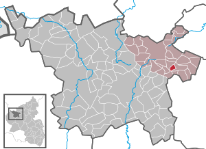
| Location of the local community of Gunderath in the Vulkaneifel district | ||
  |
||

Gunderath is a municipality in the Vulkaneifel district in Rhineland-Palatinate . It belongs to the association community Kelberg .
Geographical location
The place is located in the Eifel , about twelve kilometers from Daun and 20 km from Mayen . The Blumsmühle residential area also belongs to Gunderath .
history
Until the end of the 18th century, Gunderath belonged to the mayor's office Uersfeld of the Electoral Cologne office of Nürburg .
In 1794 French revolutionary troops occupied the left bank of the Rhine . Under the French administration , Gunderath belonged to the canton of Ulmen in the Rhine-Moselle department from 1798 to 1814 . Due to the agreements made at the Congress of Vienna in 1815 , the region became part of the Kingdom of Prussia . Under Prussian administration, the community of Gunderath was assigned to the Adenau district in the Koblenz administrative district and was administered by the Kelberg mayor . This went on in 1927 in the Kelberg office and in 1968 in the Kelberg Association . After the First World War , the area was under French military administration . When the Adenau district was dissolved in 1932, Gunderath joined the Mayen district . The region has been part of the state of Rhineland-Palatinate since 1946 and belonged to the French occupation zone until 1949 and 1955, respectively .
As part of the municipal reorganization of Rhineland-Palatinate, the community came on November 7, 1970 from the district of Mayen , which was dissolved at the same time, to the district of Daun (now the district of Vulkaneifel ).
politics
Municipal council
The municipal council in Gunderath consists of six council members, who were elected in the local elections on May 26, 2019 in a majority vote, and the honorary local mayor as chairman.
coat of arms
|
|
Blazon : "Divided by silver over black, above a black bar cross, below a silver, gold-armored hawk, the right muzzle raised." |
Attractions

The Catholic branch church of St. Quirinus is in the center of the village . It was built in 1785 and has a baroque interior.
The Heilbachsee holiday park is located above the village and is now known as the Center Park Eifel.
Web links
- Internet presence of the local community Gunderath
- Local community Gunderath on the website of the association community Kelberg
- To search for cultural assets of the local community Gunderath in the database of cultural assets in the Trier region .
Individual evidence
- ↑ State Statistical Office of Rhineland-Palatinate - population status 2019, districts, communities, association communities ( help on this ).
- ↑ State Statistical Office Rhineland-Palatinate (ed.): Official directory of the municipalities and parts of the municipality. Status: January 2018 [ Version 2020 is available. ] . S. 73 (PDF; 2.2 MB).
- ↑ Official municipality directory (= State Statistical Office of Rhineland-Palatinate [Hrsg.]: Statistical volumes . Volume 407 ). Bad Ems February 2016, p. 156 (PDF; 2.8 MB).
- ^ The Regional Returning Officer Rhineland-Palatinate: Local elections 2019, city and municipal council elections

Arbach | Basberg | Beinhausen | Bereborn | Berenbach | Berlingen | Berndorf | Betteldorf | Birgel | Birresborn | Bleckhausen | Bodenbach | Bongard | Borler | Boxberg | Brockscheid | Brückal | Darscheid | Down | Demerath | Densborn | Deudesfeld | Dockweiler | Dohm-Lammersdorf | Drees | Dreis-Brück | Duppach | Ellscheid | Esch | Feusdorf | Gefell | Gelenberg | Gerolstein | Gillenfeld | Gönnersdorf | Gunderath | Reverberation | Hillesheim | Hinterweiler | Höchstberg | Hohenfels-Essingen | Horperath | Hörscheid | Hörschhausen | Immerath | Jünkerath | Kalenborn scrubbing | Caperich | Katzwinkel | Kelberg | Kerpen (Eifel) | Kerschenbach | Kirchweiler | Kirsbach | Kolverath | Kopp | Kötterichen | Kradenbach | Lirstal | Lissendorf | Mannebach | More | Meisburg | Mosbruch | Mosquitoes | Mürlenbach | Neichen | Nerd | Neroth | Niederstadtfeld | Nitz | Nohn | Oberbettingen | Oberehe-Stroheich | Oberelz | Oberstadtfeld | Ormont | Pelm | Reimerath | Retterath | Reuth | Rockeskyll | Salm | Sarmersbach | Sassen | Saxler | Schalkenmehren | Scheid | Schönbach | Schüller | Protection | Stadtkyll | Steffeln | Steineberg | Steiningen | Strohn | Strotzbüsch | Üdersdorf | Udler | Uersfeld | Ueß | Utzerath | Üxheim | Wallenborn | Walsdorf | Weidenbach | Which council | Wiesbaum | Winkel (Eifel)