
Borler
| coat of arms | Germany map | |
|---|---|---|

|
Coordinates: 50 ° 19 ′ N , 6 ° 50 ′ E |
|
| Basic data | ||
| State : | Rhineland-Palatinate | |
| County : | Vulkaneifel | |
| Association municipality : | Kelberg | |
| Height : | 440 m above sea level NHN | |
| Area : | 4.54 km 2 | |
| Residents: | 72 (Dec. 31, 2019) | |
| Population density : | 16 inhabitants per km 2 | |
| Postal code : | 53539 | |
| Area code : | 02696 | |
| License plate : | DAU | |
| Community key : | 07 2 33 207 | |
| LOCODE : | DE 85B | |
| Association administration address: | Dauner Strasse 22 53539 Kelberg |
|
| Website : | ||
| Local Mayor : | Franz-Josef Neunkirchen | |
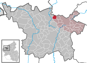
| Location of the borler community in the Vulkaneifel district | ||
  |
||

Borler is a municipality in the Vulkaneifel district in Rhineland-Palatinate . It belongs to the association community Kelberg .
geography
The place is in the Vulkaneifel around 14 kilometers from the Nürburgring .
history
Borler is located at the crossroads of two paths on which traces of settlement can be traced back to Roman times: from the Nürburg to Kerpen or from Barsberg on over the Senscheider Ridge (location of a castle). Both paths use the transition over the Nohner Bach , which runs in the valley between Bodenbach and Nohn .
The first traces of settlement in the region are assigned to the Early Stone Age ( stone axes , found near Üxheim ). Numerous barrows on Barsberg near Bongard , as well as a ring wall there are probably of early Celtic origin (surveyed by the State Office for Monument Preservation , Koblenz 1936/37).
Various Roman military roads passed nearby; B. Caesarstrasse , roughly corresponding to today's B 410 . Various other archaeological finds from Roman times can be found nearby.
A first documentary mention is dated to 1140, whereby the name Budelar used in the document is also assigned to the nearby town of Bauler , in other documents around the same time the spelling is also found as Budeler . In the MGH's writings , Borler is derived from Brunvilare , but from other, even earlier sources, Brunvilare is assigned to Barweiler . Around 1200 the name Burlat appears as the seat of the holder of a ⅔ church tithe , named Gerhard von Wiesbaum. Borler belonged to the private church Üxheim owned by the imperial abbey of St. Maximin in Trier, a Benedictine monastery which, with the abbey of Prüm, had a large share in the colonization of the region beyond the existing places.
Another documentary mention from an undated document is estimated to be 1510–1520, in the Trier fire book of 1563 nine houses with their own fireplace are mentioned. The place was certainly shaped by the Electorate of Cologne and the Electorate of Trier Hof Heyer of the Lords of Heyer, located southeast of the village center. Both groups of buildings no longer exist. A Wilhelm von Heyer appears in 1359 in a list of the castle men of Daun by Archbishop Boemund von Trier .
Until the occupation by French revolutionary troops (1794) Borler belonged to the Electorate of Trier , Office Daun , court Kelberg , centering court Bongard . From 1798 to 1814 it was assigned to the Rhine-Moselle Department , Canton Adenau , Mairie Barweiler . Borler came to the Adenau district during the Prussian period . In connection with the municipal reorganization of Rhineland-Palatinate and the reorganization of the Kelberg Association , the Borler community came on November 7, 1970 from the Mayen district, which was dissolved at the same time, to the Daun district (now the Vulkaneifel district ).
The oldest houses in the village are grouped around Bachgasse, which leads to the bridge over the brook and around the St. Leonard branch church located above Bachgasse. The house "Antünnesse" (Bachgasse 3, demolished in 2006) was built in 1650, the house "Mone" (Hauptstrasse 10) in 1766.

In the course of the construction of a central wastewater treatment facility for Borler and neighboring towns with the construction of a central sewage treatment plant on Borler's municipal area, the streetscape of the village was also extensively renovated between 2002 and 2004 after the sewer pipes were laid. Most of the costs for the road construction were raised by the citizens, as well as the development costs for the sewers. All roads and paths have been rebuilt. Double-sided sidewalks have been replaced by one-sided. Remaining areas have been developed with so-called poor grass . The large playground in the center of the village was rededicated as building land and replaced by a smaller playground behind the fire station.
economy
Agriculture once shaped village life. With funds from the Marshall Plan , a grassland and research institute ( experimental and teaching institute for grassland management and forage production in the high altitude areas of the Eifel, Hunsrück, Westerwald and Taunus ) was set up. In 1970, Borler published a comprehensive analysis of the population and agricultural conditions from the educational establishment. In the course of time, the facility (called "the institute" for short in the village), which was operated by the Rhineland-Nassau Chamber of Agriculture , was abandoned and, after renovation, was now used as a community center. Up until the 1980s, dairy cattle were formative in agriculture. The fodder was obtained from the adjacent meadows and arable land around the village. Today agriculture is only a sideline on some farms (three farms were counted in 2010), predominantly horse breeding and keeping, the pastureland is leased to farmers from neighboring towns.

For some time now, many people from, for example, Belgium, the Netherlands or the Rhineland and the Ruhr area have been living in purchased houses as weekend / holiday homes.
Tourism is gaining importance as a "new" branch of the economy for the village, some of the old houses have been renovated and are being offered as holiday homes for rent.
The following hiking trails lead through Borler:
- Rhein-Kyll-Weg / Hocheifelweg (HWW 14 of the Eifelverein )
- Hochkelberg Panorama Path (partner path of the Eifelsteig )
- Geopath Hillesheim
- History trail " Around the Hochkelberg "
Population development

| 1563 | 1684 | 1817 | 1854 | 1895 | 1925 | 1939 | 1946 | 1950 | 1961 | 1970 | 1980 | 2002 | 2019 | |
|---|---|---|---|---|---|---|---|---|---|---|---|---|---|---|
| Fireplaces / houses | 9 | 10 | 18th | 20th | 23 | |||||||||
| Residents | 104 | 98 | 108 | 107 | 136 | 139 | 140 | 147 | 144 | 103 | 89 | 72 |
(based on Alois Meyer, Erich Mertens: Legends, History, Customs from the Kelberg Association , 1st edition 1986 and the State Statistical Office of Rhineland-Palatinate)
religion
About 90% of the citizens of Borler are Roman Catholic. Borler belongs today to the cath. Bodenbach parish. In the 1990s, the village chapel , built in 1752/53 and consecrated to St. Leonhard , was extensively renovated inside and out with the support of the Trier diocese and the local community.
The neo-Romanesque Heyerberg Chapel, completed in 1875, stands on the wooded Heyerberg about 1200 meters southwest of Borler . It goes back to a castle chapel that existed before 1600. Around the chapel there is a way of the cross with 14 stations created in 1878 .
politics
Municipal council
The council in Borler consists of six council members, who in the local elections on May 26, 2019 in a majority vote were elected, and the honorary mayor as chairman.
coat of arms
|
|
Blazon : "In the divided shield above in gold a growing, double-headed, red armored, black eagle, below in red five (2: 1: 2) silver rings." |
Born in Borler
- Hubert Reuter (* 1927), agricultural scientist and ministerial official
- Ute Bales (* 1961), writer
See also
literature
- Alois Mayer, Erich Mertens: History, culture and literature of the association municipality Kelberg . Verbandsgemeinde Kelberg, Kelberg 1993.
- Alois Mayer, Erich Mertens: Legends, History, Customs of the Kelberg Association . Verbandsgemeinde Kelberg, Kelberg 1986, ISBN 3-926233-00-1 .
- Hubert Reuter: Borler through the ages . Borler parish , Borler 2009, DNB 1006359958 .
Web links
- Website of the Borler parish
- Local community Borler on the website of the association community Kelberg
- To search for cultural assets of the local community Borler in the database of cultural assets in the Trier region .
Individual evidence
- ↑ State Statistical Office of Rhineland-Palatinate - population status 2019, districts, communities, association communities ( help on this ).
- ^ Matthias Reuter: Contributions to the history of the Hocheifel . Self-published, Wimbach 1978, DNB 800861973 , p. 12 .
- ^ Joseph Hagen: Roman roads of the Rhine province . 2nd Edition. K. Schroeder, Bonn 1931, DNB 580070131 .
- ↑ History route "Around the Hochkelberg"
- ^ Heinrich Beyer (ed.): Mittelrheinisches Urkundenbuch (MRUB) . Volume I: From the oldest times to the year 1169 . Hölscher, Koblenz 1860, p. 573 , urn : nbn: de: 0128-1-144 ( dilibri.de - Also under the title: Document book for the history of the Middle Rhine territories or document book for the history of the Middle Rhine territories now forming the Prussian administrative districts of Coblenz and Trier. ).
- ^ Heinrich Beyer (ed.): Mittelrheinisches Urkundenbuch (MRUB) . Volume I: From the oldest times to the year 1169 . Hölscher, Koblenz 1860, p. 517 , urn : nbn: de: 0128-1-144 ( dilibri.de - Also under the title: Document book for the history of the Middle Rhine territories or document book for the history of the Middle Rhine territories now forming the Prussian administrative districts of Coblenz and Trier. ).
- ^ Heinrich Beyer, Leopold Eltester, Adam Goerz: Mittelrheinisches Urkundenbuch (MRUB) . Volume II: From 1169 to 1212 . Hölscher, Koblenz 1865, p. 471 , urn : nbn: de: 0128-1-1371 ( digital-sammlungen.de - Also under the title: Document book for the history of the Middle Rhine territories or document book for the history of the Middle Rhine territories now forming the Prussian administrative districts of Coblenz and Trier. ).
- ↑ Erich Wisplinghoff : Investigations into the early history of the Abbey S. Maximin near Trier from the beginnings to about 1150 . Ges. F. Middle Rhine. Church history, Mainz 1970, DNB 458673420 .
- ^ Matthias Reuter: Contributions to the history of the Hocheifel . Self-published, Wimbach 1978, DNB 800861973 , p. 16 .
- ↑ Feuerbuch of the Archbishopric Trier 1563, sheet 241, State Archives Koblenz
- ↑ Dün: Document book of the von Dune family (Daun) . Cologne 1909.
- ↑ Official municipality directory (= State Statistical Office of Rhineland-Palatinate [Hrsg.]: Statistical volumes . Volume 407 ). Bad Ems February 2016, p. 156 (PDF; 2.8 MB).
- ↑ Location portrait in Hierzuland , SWR television
- ↑ Newspaper article Trierischer Volksfreund from May 24, 2004
- ^ Alfred Heinrich Könekamp, Wolfgang Klöckner: A small farming village in the low mountain range . In: Agriculture - Applied Science . No. 148 . Landwirtschaftsverlag, Hiltrup near Münster 1970, DNB 457248947 .
- ↑ a b State Statistical Office Rhineland-Palatinate - regional data
- ↑ Borler municipal statistics (PDF file; 7 kB), as of June 30, 2008.
- ↑ General Directorate for Cultural Heritage Rhineland-Palatinate (ed.): Informational directory of cultural monuments - Vulkaneifel district. Mainz 2020, p. 7 (PDF; 4.6 MB).
- ^ The Regional Returning Officer Rhineland-Palatinate: Local elections 2019, city and municipal council elections.

Arbach | Basberg | Beinhausen | Bereborn | Berenbach | Berlingen | Berndorf | Betteldorf | Birgel | Birresborn | Bleckhausen | Bodenbach | Bongard | Borler | Boxberg | Brockscheid | Brückal | Darscheid | Down | Demerath | Densborn | Deudesfeld | Dockweiler | Dohm-Lammersdorf | Drees | Dreis-Brück | Duppach | Ellscheid | Esch | Feusdorf | Gefell | Gelenberg | Gerolstein | Gillenfeld | Gönnersdorf | Gunderath | Reverberation | Hillesheim | Hinterweiler | Höchstberg | Hohenfels-Essingen | Horperath | Hörscheid | Hörschhausen | Immerath | Jünkerath | Kalenborn scrubbing | Caperich | Katzwinkel | Kelberg | Kerpen (Eifel) | Kerschenbach | Kirchweiler | Kirsbach | Kolverath | Kopp | Kötterichen | Kradenbach | Lirstal | Lissendorf | Mannebach | More | Meisburg | Mosbruch | Mosquitoes | Mürlenbach | Neichen | Nerd | Neroth | Niederstadtfeld | Nitz | Nohn | Oberbettingen | Oberehe-Stroheich | Oberelz | Oberstadtfeld | Ormont | Pelm | Reimerath | Retterath | Reuth | Rockeskyll | Salm | Sarmersbach | Sassen | Saxler | Schalkenmehren | Scheid | Schönbach | Schüller | Protection | Stadtkyll | Steffeln | Steineberg | Steiningen | Strohn | Strotzbüsch | Üdersdorf | Udler | Uersfeld | Ueß | Utzerath | Üxheim | Wallenborn | Walsdorf | Weidenbach | Which council | Wiesbaum | Winkel (Eifel)