
Drees
| coat of arms | Germany map | |
|---|---|---|

|
Coordinates: 50 ° 20 ' N , 7 ° 0' E |
|
| Basic data | ||
| State : | Rhineland-Palatinate | |
| County : | Vulkaneifel | |
| Association municipality : | Kelberg | |
| Height : | 500 m above sea level NHN | |
| Area : | 4.11 km 2 | |
| Residents: | 161 (Dec. 31, 2019) | |
| Population density : | 39 inhabitants per km 2 | |
| Postal code : | 53520 | |
| Area code : | 02691 | |
| License plate : | DAU | |
| Community key : | 07 2 33 210 | |
| Association administration address: | Dauner Strasse 22 53539 Kelberg |
|
| Website : | ||
| Local Mayor : | Klaus Brachthaus | |
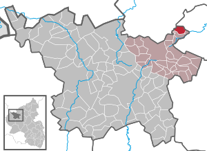
| Location of the local community of Drees in the Vulkaneifel district | ||
  |
||

Drees is a municipality in the Vulkaneifel district in Rhineland-Palatinate . It belongs to the association community Kelberg .
geography
The place is in the Eifel . It is surrounded by the small towns of Balkhausen and Nürburg in the west, Meuspath in the north-west, Döttingen in the north, Herresbach , Baar and Mittelbaar in the north-east, Niederbaar in the east, Nitz in the south-east, Kirsbach in the south and Welcherath in the south-west. Drees also includes the Dreeser Mühle residential area .


history
Drees was first mentioned in a document in 1222 under the name "Dreyse". The word comes from the Celtic name for bubbling spring. This is related to the old Germanic word “Thrais” for sparkling water, bubbling or whirling. The eponymous mineral water spring, bubbling through volcanic activity, no longer exists.
Drees belonged to the late 18th century to the office of mayor Welcherath the Electoral Cologne Office Nürburg .
In 1794 French revolutionary troops occupied the left bank of the Rhine . Under the French administration , Drees belonged to the canton of Adenau in the Rhine-Moselle department from 1798 to 1814 . Due to the agreements made at the Congress of Vienna in 1815 , the region became part of the Kingdom of Prussia . Under Prussian administration, the municipality of Drees was assigned to the Adenau district in the Koblenz administrative district and was administered by the Kelberg mayor . This went on in 1927 in the Kelberg office and in 1968 in the Kelberg Association . After the First World War , the area was under French military administration until 1930 . When the Adenau district was dissolved in 1932, Drees joined the Mayen district . The region has been part of the state of Rhineland-Palatinate since 1946 and belonged to the French occupation zone until 1949 and 1955, respectively .
As part of the municipal reorganization of Rhineland-Palatinate, the community came on November 7, 1970 from the district of Mayen , which was dissolved at the same time, to the district of Daun (now the district of Vulkaneifel ).
- Population development
The development of the population of Drees, the values from 1871 to 1987 are based on censuses:
|
|
politics
Municipal council
The municipal council in Drees consists of six council members, who were elected by a majority vote in the local elections on May 26, 2019 , and the honorary local mayor as chairman.
coat of arms
|
|
Blazon : “Divided by pewter cut of blue and silver. Above is a silver fountain with a split water jet. Below is a red cross of St. Anthony with 2 pilgrim bells. " |
| Justification for the coat of arms: The pewter cut indicates the earlier affiliation to the Electoral Cologne office of Nürburg , the fountain stands for the Celtic word for a bubbling spring from which the place name is derived. The Antonius Cross commemorates the local patron, St. Antony . |
Economy and Infrastructure
traffic
On roads, the district road 93 leads north towards Döttingen and to the federal road 258 , to the east the district road 93 leads via Nitz also to the federal road 258 and to the south-west the district road 92 to Welcherath and to the state road 94 .
Companies
To the north of the village, west of the road to Döttingen, there is an off-road route in an abandoned quarry with the company name Camp 4 Fun , where companies and private individuals can drive off-road vehicles for training and leisure purposes in difficult terrain. Occasionally, sporting events take place there, such as the 2007 German Offroad Masters .
See also
-
List of cultural monuments in Drees

St. Antonius u. Bernhard

Gallery

High altar (19th century)

St. Anthony Altar

Mary with child

Joseph with child
_03.jpg)
_18.jpg)
_04.jpg)
_11.jpg)
_13.jpg)
_16.jpg)
Web links
- Internet presence of the local community Drees
- Local community Drees on the website of the association community Kelberg
- To search for cultural assets of the local community of Drees in the database of cultural assets in the Trier region .
- Brief portrait of Drees on SWR TV
Individual evidence
- ↑ a b State Statistical Office of Rhineland-Palatinate - population status 2019, districts, municipalities, association communities ( help on this ).
- ↑ State Statistical Office Rhineland-Palatinate (ed.): Official directory of the municipalities and parts of the municipality. Status: January 2018 [ Version 2020 is available. ] . S. 73 (PDF; 2.2 MB).
- ↑ Official municipality directory (= State Statistical Office of Rhineland-Palatinate [Hrsg.]: Statistical volumes . Volume 407 ). Bad Ems February 2016, p. 156 (PDF; 2.8 MB).
- ↑ State Statistical Office Rhineland-Palatinate - regional data
- ^ The Regional Returning Officer Rhineland-Palatinate: Local elections 2019, city and municipal council elections

Arbach | Basberg | Beinhausen | Bereborn | Berenbach | Berlingen | Berndorf | Betteldorf | Birgel | Birresborn | Bleckhausen | Bodenbach | Bongard | Borler | Boxberg | Brockscheid | Brückal | Darscheid | Down | Demerath | Densborn | Deudesfeld | Dockweiler | Dohm-Lammersdorf | Drees | Dreis-Brück | Duppach | Ellscheid | Esch | Feusdorf | Gefell | Gelenberg | Gerolstein | Gillenfeld | Gönnersdorf | Gunderath | Reverberation | Hillesheim | Hinterweiler | Höchstberg | Hohenfels-Essingen | Horperath | Hörscheid | Hörschhausen | Immerath | Jünkerath | Kalenborn scrubbing | Caperich | Katzwinkel | Kelberg | Kerpen (Eifel) | Kerschenbach | Kirchweiler | Kirsbach | Kolverath | Kopp | Kötterichen | Kradenbach | Lirstal | Lissendorf | Mannebach | More | Meisburg | Mosbruch | Mosquitoes | Mürlenbach | Neichen | Nerd | Neroth | Niederstadtfeld | Nitz | Nohn | Oberbettingen | Oberehe-Stroheich | Oberelz | Oberstadtfeld | Ormont | Pelm | Reimerath | Retterath | Reuth | Rockeskyll | Salm | Sarmersbach | Sassen | Saxler | Schalkenmehren | Scheid | Schönbach | Schüller | Protection | Stadtkyll | Steffeln | Steineberg | Steiningen | Strohn | Strotzbüsch | Üdersdorf | Udler | Uersfeld | Ueß | Utzerath | Üxheim | Wallenborn | Walsdorf | Weidenbach | Which council | Wiesbaum | Winkel (Eifel)