
Kradenbach
| coat of arms | Germany map | |
|---|---|---|

|
Coordinates: 50 ° 15 ' N , 6 ° 51' E |
|
| Basic data | ||
| State : | Rhineland-Palatinate | |
| County : | Vulkaneifel | |
| Association municipality : | Down | |
| Height : | 485 m above sea level NHN | |
| Area : | 1.73 km 2 | |
| Residents: | 150 (Dec. 31, 2019) | |
| Population density : | 87 inhabitants per km 2 | |
| Postal code : | 54552 | |
| Area code : | 06592 | |
| License plate : | DAU | |
| Community key : | 07 2 33 040 | |
| Association administration address: | Leopoldstrasse 29 54550 Daun |
|
| Website : | ||
| Local Mayor : | Klaus Rödder | |
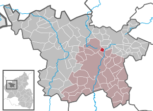
| Location of the local community Kradenbach in the Vulkaneifel district | ||
  |
||

Kradenbach is a municipality in the Vulkaneifel district in Rhineland-Palatinate . She belongs to the community of Daun .
The Auf dem Bur residential area also belongs to Kradenbach .
history
In 1563 Kradenbach included six fireplaces under the name Cradenbach , and in 1684 three . Wonderfully country belonged to the village by the end of the 18th century to the Electorate of Trier and shelter as part of Zents Sarmersbach the high court down the administration of the office down .
- Population development
The development of the population of Kradenbach, the values from 1871 to 1987 are based on censuses:
|
|
politics
Municipal council
The municipal council in Kradenbach consists of six council members, who were elected by a majority vote in the local elections on May 26, 2019 , and the honorary local mayor as chairman.
coat of arms
|
|
Blazon : “In silver; split by a blue wave stick; in front a red bar cross; three red mitres on the back. " |
traffic
Kradenbach is connected to federal highway 1 , junction Kelberg , via state roads 46 and 67 .
Since December 8, 2018, the 520 bus has been running to the district town of Daun and the municipality of Kelberg (with stops in Neichen and Kradenbach and the Rengen industrial area ). In the center there is the Maibaum stop.
See also
Web links
- Website of the local community Kradenbach
- To search for cultural assets of the local community Kradenbach in the database of cultural assets in the Trier region .
Individual evidence
- ↑ State Statistical Office of Rhineland-Palatinate - population status 2019, districts, communities, association communities ( help on this ).
- ↑ State Statistical Office Rhineland-Palatinate (ed.): Official directory of the municipalities and parts of the municipality. Status: January 2019 [ Version 2020 is available. ] . S. 111 (PDF; 3 MB).
- ^ Wilhelm Fabricius : Explanations of the historical atlas of the Rhine province, Volume 2: The map of 1789. Bonn 1898, p. 112, 149.
- ↑ State Statistical Office Rhineland-Palatinate - regional data
- ^ The Regional Returning Officer Rhineland-Palatinate: Local elections 2019, city and municipal council elections

Arbach | Basberg | Beinhausen | Bereborn | Berenbach | Berlingen | Berndorf | Betteldorf | Birgel | Birresborn | Bleckhausen | Bodenbach | Bongard | Borler | Boxberg | Brockscheid | Brückal | Darscheid | Down | Demerath | Densborn | Deudesfeld | Dockweiler | Dohm-Lammersdorf | Drees | Dreis-Brück | Duppach | Ellscheid | Esch | Feusdorf | Gefell | Gelenberg | Gerolstein | Gillenfeld | Gönnersdorf | Gunderath | Reverberation | Hillesheim | Hinterweiler | Höchstberg | Hohenfels-Essingen | Horperath | Hörscheid | Hörschhausen | Immerath | Jünkerath | Kalenborn scrubbing | Caperich | Katzwinkel | Kelberg | Kerpen (Eifel) | Kerschenbach | Kirchweiler | Kirsbach | Kolverath | Kopp | Kötterichen | Kradenbach | Lirstal | Lissendorf | Mannebach | More | Meisburg | Mosbruch | Mosquitoes | Mürlenbach | Neichen | Nerd | Neroth | Niederstadtfeld | Nitz | Nohn | Oberbettingen | Oberehe-Stroheich | Oberelz | Oberstadtfeld | Ormont | Pelm | Reimerath | Retterath | Reuth | Rockeskyll | Salm | Sarmersbach | Sassen | Saxler | Schalkenmehren | Scheid | Schönbach | Schüller | Protection | Stadtkyll | Steffeln | Steineberg | Steiningen | Strohn | Strotzbüsch | Üdersdorf | Udler | Uersfeld | Ueß | Utzerath | Üxheim | Wallenborn | Walsdorf | Weidenbach | Which council | Wiesbaum | Winkel (Eifel)