
Berenbach
| coat of arms | Germany map | |
|---|---|---|

|
Coordinates: 50 ° 14 ' N , 6 ° 57' E |
|
| Basic data | ||
| State : | Rhineland-Palatinate | |
| County : | Vulkaneifel | |
| Association municipality : | Kelberg | |
| Height : | 433 m above sea level NHN | |
| Area : | 3.15 km 2 | |
| Residents: | 165 (Dec. 31, 2019) | |
| Population density : | 52 inhabitants per km 2 | |
| Postal code : | 56766 | |
| Area code : | 02676 | |
| License plate : | DAU | |
| Community key : | 07 2 33 203 | |
| LOCODE : | DE B6P | |
| Association administration address: | Dauner Strasse 22 53539 Kelberg |
|
| Website : | ||
| Mayoress : | Birgit Wirtz | |
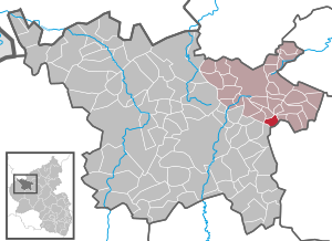
| Location of the local community of Berenbach in the Vulkaneifel district | ||
  |
||

.jpg)
Berenbach is a municipality in the Vulkaneifel district in Rhineland-Palatinate . It belongs to the association community Kelberg .
geography
The place is in the Vulkaneifel Nature Park , in the immediate vicinity of the city of Ulmen .
The Furthermühle and Haus Geisbüsch residential areas also belong to Berenbach .
history
Until the end of the 18th century, Berenbach belonged to the office of Nürburg in the Electorate of Cologne and was subordinate to the Schultheißenamt Uersfeld .
In 1794 French revolutionary troops occupied the left bank of the Rhine . Under the French administration , Berenbach belonged to the canton of Ulmen in the Rhine-Moselle department from 1798 to 1814 . Due to the agreements made at the Congress of Vienna in 1815 , the region became part of the Kingdom of Prussia . Under Prussian administration, the municipality of Berenbach was assigned to the Adenau district in the Koblenz administrative district and was administered by the Kelberg mayor . This went on in 1927 in the Kelberg office and in 1968 in the Kelberg Association.
After the First World War , the area belonged to the French part of the Allied occupation of the Rhineland . When the Adenau district was dissolved in 1932, Berenbach joined the Mayen district . After the Second World War , Berenbach became part of the then newly formed state of Rhineland-Palatinate within the French occupation zone .
As part of the municipal reorganization of Rhineland-Palatinate, the community came on November 7, 1970 from the district of Mayen , which was dissolved at the same time, to the district of Daun (now the district of Vulkaneifel ).
- Population development
The development of the population, the values from 1871 to 1987 are based on censuses:
|
|
politics
Municipal council
The council in Berenbach consists of six council members, who in the local elections on May 26, 2019 in a majority vote were elected, and the volunteer local mayor as chairman.
coat of arms
|
|
Blazon : "In a silver shield a blue wavy bar, above a black bar cross, below a rising red crook." |
Culture and sights
The listed Catholic Church of St. Brigitta is a hall building built in 1933/1940.
Web links
- Local community Berenbach on the website of the association community Kelberg
- Short portrait of Berenbach ( memento from February 12, 2013 in the web archive archive.today ) on SWR television
- To search for cultural assets of the local community Berenbach in the database of cultural assets in the Trier region .
- Literature about Berenbach in the Rhineland-Palatinate State Bibliography
Individual evidence
- ↑ a b State Statistical Office of Rhineland-Palatinate - population status 2019, districts, municipalities, association communities ( help on this ).
- ↑ State Statistical Office Rhineland-Palatinate (ed.): Official directory of the municipalities and parts of the municipality. Status: January 2019 [ Version 2020 is available. ] . S. 112 (PDF; 3 MB).
- ↑ Official municipality directory (= State Statistical Office of Rhineland-Palatinate [Hrsg.]: Statistical volumes . Volume 407 ). Bad Ems February 2016, p. 156 (PDF; 2.8 MB).
- ↑ State Statistical Office Rhineland-Palatinate: My village, my city. Retrieved May 23, 2020 .
- ^ The Regional Returning Officer Rhineland-Palatinate: Local elections 2019, city and municipal council elections.

Arbach | Basberg | Beinhausen | Bereborn | Berenbach | Berlingen | Berndorf | Betteldorf | Birgel | Birresborn | Bleckhausen | Bodenbach | Bongard | Borler | Boxberg | Brockscheid | Brückal | Darscheid | Down | Demerath | Densborn | Deudesfeld | Dockweiler | Dohm-Lammersdorf | Drees | Dreis-Brück | Duppach | Ellscheid | Esch | Feusdorf | Gefell | Gelenberg | Gerolstein | Gillenfeld | Gönnersdorf | Gunderath | Reverberation | Hillesheim | Hinterweiler | Höchstberg | Hohenfels-Essingen | Horperath | Hörscheid | Hörschhausen | Immerath | Jünkerath | Kalenborn scrubbing | Caperich | Katzwinkel | Kelberg | Kerpen (Eifel) | Kerschenbach | Kirchweiler | Kirsbach | Kolverath | Kopp | Kötterichen | Kradenbach | Lirstal | Lissendorf | Mannebach | More | Meisburg | Mosbruch | Mosquitoes | Mürlenbach | Neichen | Nerd | Neroth | Niederstadtfeld | Nitz | Nohn | Oberbettingen | Oberehe-Stroheich | Oberelz | Oberstadtfeld | Ormont | Pelm | Reimerath | Retterath | Reuth | Rockeskyll | Salm | Sarmersbach | Sassen | Saxler | Schalkenmehren | Scheid | Schönbach | Schüller | Protection | Stadtkyll | Steffeln | Steineberg | Steiningen | Strohn | Strotzbüsch | Üdersdorf | Udler | Uersfeld | Ueß | Utzerath | Üxheim | Wallenborn | Walsdorf | Weidenbach | Which council | Wiesbaum | Winkel (Eifel)